

Simonside
Good walks are even better shared.
Overview
Simonside is a 430 m sandstone hill south of Rothbury in Northumberland National Park. Forest tracks lead to a craggy, open ridge with a large summit cairn and views across Coquetdale towards the Cheviots and North Sea. The ridge walk continues towards Old Stell Crag and Dove Crag; higher Tosson Hill lies to the west.
Simonside
Simonside rises to 430 m above Coquetdale, south of Rothbury. Its large summit cairn stands on a sandstone ridge overlooking forest and heather moorland. Tosson Hill, farther west, is a separate, higher summit.
Walking the ridge
The National Park’s published circular route starts at Simonside forest car park (NZ037997). Its 6.9 km itinerary climbs through woodland, visits Little Church Rock and reaches the summit by a steep, stone-pitched path. It continues over Old Stell Crag and Dove Crag before returning through the forest. The guide time is 2 hr 5 min; stops and poor conditions add time. Forestry England separately advertises its moderate, red-waymarked Ridge Walk as 4 miles.
Landscape and heritage
Carboniferous Fell Sandstone forms the crags. The ridge looks towards the Cheviots and North Sea, and summer heather brings colour to the moorland. Prehistoric cairns, nearby Lordenshaws hillfort and local Duergar stories add interest to the landscape.
Planning a visit
The forest car park has a picnic area and is currently listed as free. Arriva X14 serves Rothbury, from which the approach on foot adds distance to the hill walk. Check the timetable and carry a map, water and suitable clothing.
Stone pitching, rocky descents and crag edges need care, particularly when wet or icy. The open ridge is exposed in wind and poor visibility. Follow on-site signs and any forestry diversions.
Explore routes near Simonside
Walks starting near this hill. Open a route to check its map, distance and full itinerary.
Simonside Ridge and Dove Crag
View route
Simonside hills - 50 Rocks of Northumberland inspired
View route
Rothbury Riverside and Town Walk
View route
Rothbury Terraces
View route
Route planning notes
These notes describe possible approaches. Check a route's map and access information when planning your walk.
The Simonside Hills circular (Northumberland National Park)
From Simonside forest car park (NZ037997), follow the National Park circuit through the forest, past Little Church Rock, then climb the stone-pitched path to the summit cairn. Continue over Old Stell Crag and Dove Crag before returning through woodland. The published guide gives 2 hr 5 min; allow extra time for stops and poor conditions.
Make a day of it, together
Find someone to share the walk with, or organise a day out along a route you like.
Photo Gallery
View all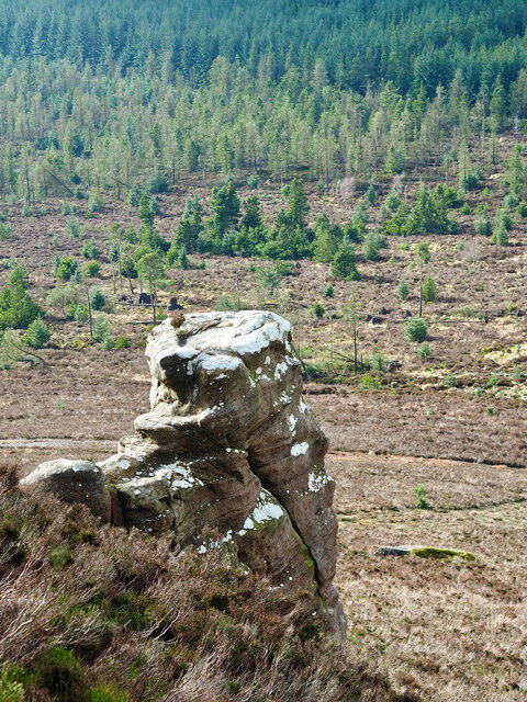 Photo could not load
NZ0298 : Lonely Giant
Mick Garratt
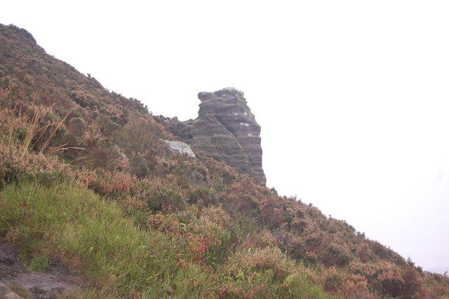 Photo could not load
NZ0298 : Simonside
Trevor Harris
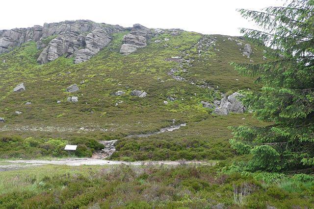 Photo could not load
NZ0298 : Climbing Simonside
Graham Horn
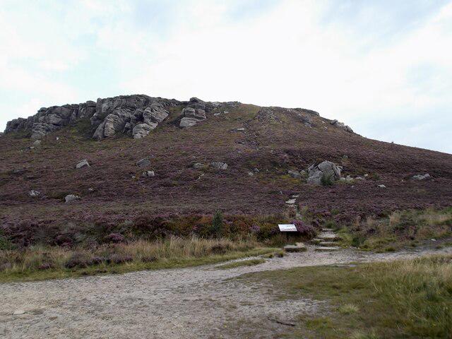 Photo could not load
NZ0298 : West face of Simonside
David Brown
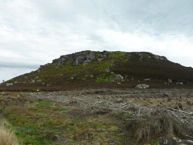 Photo could not load
NZ0298 : Simonside
Anthony Foster
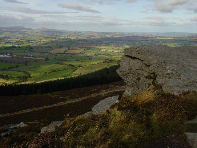 Photo could not load
NZ0298 : Coquetdale from Simonside Crag
Colin Park
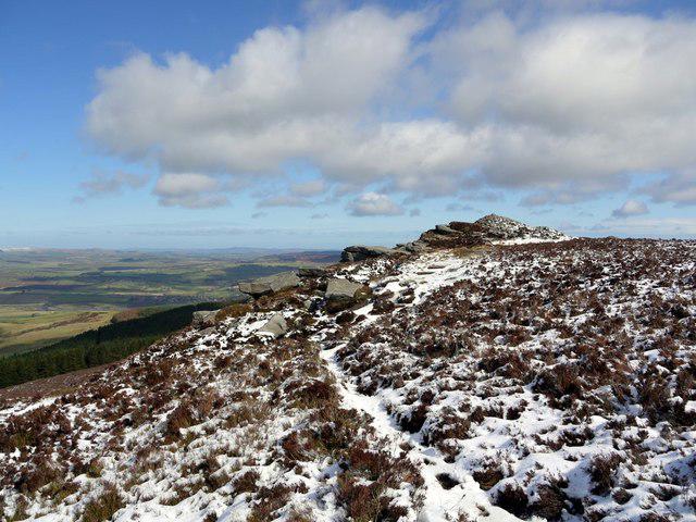 Photo could not load
NZ0298 : Simonside summit cairn
Andrew Curtis
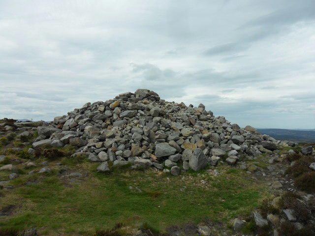 Photo could not load
NZ0298 : Simonside Summit Cairn
Anthony Foster
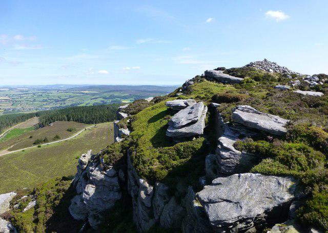 Photo could not load
NZ0298 : The summit cairn on Simonside
Russel Wills
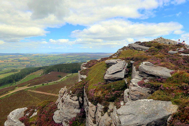
NZ0298 : The summit cairn of Simonside
Andrew Curtis
Hill facts and local notes
Classifications
Elevation
430m
1,411 ft
Prominence
62m
Coordinates
55.2825, -1.9637
NZ024987
OS Map
81
Explorer: OL42E
At the Summit
A large cairn marks the 430 m summit above the sandstone crags.
Terrain & Geology
The crags are formed from the Carboniferous Fell Sandstone Formation. Thick beds of coarse, locally pebbly sandstone create the distinctive escarpment; these sediments were deposited by ancient river systems.
Views & Scenery
Coquetdale and the Cheviot Hills to the north, with the Northumberland coast and North Sea visible in clear weather.
Best Seasons
Summer heather colours the open ridge and the slopes around Dove Crag.
History & Heritage
Name Origin
Recorded as Simundessete in 1279, the name may refer to Sigemund’s seat or settlement. Its origin is uncertain; the National Park also records a suggested connection with seamen seeing the hills from the coast.
Historical Significance
Prehistoric cairns and a Bronze Age cemetery show the long use of this landscape. Nearby Lordenshaws preserves an Iron Age hillfort, while the Simonside beacon served as a Tudor warning signal. The hills also feature in local Duergar folklore.
Getting There & Facilities
Parking
Forestry England Simonside car park, grid reference NZ037997, reached from the minor road signposted off the B6342 south of Rothbury. Forestry England currently lists parking as free. Lordenshaws is a separate starting point farther east, not the forest car park.
Public Transport
Arriva X14 serves Rothbury from Morpeth and Newcastle. The hills require an additional walk: Forestry England describes a 4 km approach from Rothbury via Whitton and Hillhead Lane. Include the return approach in your day and check the current timetable before travelling.
Nearby Facilities
There is a picnic area at the Forestry England car park. Bring drinking water and food for the hill walk.
Safety Information
Known Hazards
- Steep stone-pitched paths and uneven rocky descents
- Crag edges and steep drops beside the ridge
- Slippery rock and flagstones in wet or icy conditions
- Exposed moorland in strong wind or poor visibility
- Unwaymarked forest paths away from the marked trails
Seasonal Hazards
Wet weather can make the rock and flagstones slippery; ice adds difficulty in winter. The open ridge is exposed to wind. In dry conditions, protect the forest and moorland from fire; Forestry England prohibits barbecues, campfires and stoves in the forest.
General Safety Tips
- Check weather conditions before setting out
- Carry appropriate clothing and equipment
- Let someone know your planned route
- Take a map, compass, and GPS device
- Carry emergency supplies: food, water, first aid kit, torch
Hills
Some common questions about the hills answered
Are there group walks up Simonside?
Many walkers use Walkmates to join or organise walks with others. You can check for group walks around Simonside through the maps
Are there other walkers around Simonside?
Activity varies by location and time, but Walkmates lets you see whether others have shared walks or shown interest in this area. Find other people through the walking friends search walking friends for Simonside search or of course create your own walk for Simonside
Can I organise a walk to Simonside?
Yes. If there aren’t any walks listed already, you can create a walk and make it available for others to join.
If you're signed up to Walkmates, you can create a walk to Simonside.
How do I find a walk up this hill?
There are often multiple ways to walk this hill, depending on experience and route preference. Walkmates helps you explore walks and routes that others have shared.
Can I suggest a new route up Simonside?
Yes. You can suggest or create routes to share with others. Walkmates focuses on the social side of walking, so routes are used to help people organise walks and explore areas together, rather than as detailed navigation tools or route libraries.
Other uses really appreciate knowledgeable walkers sharing their routes. Share your favourite route to Simonside here
The is an error or something incorrect about this hill. How do I let you know?
We always strive to keep the information on Walkmates as accurate as possible. If you find an error, please let us know through the contact form and we'll aim to correct it as quickly as possible
Community Discussion
Comments
Location
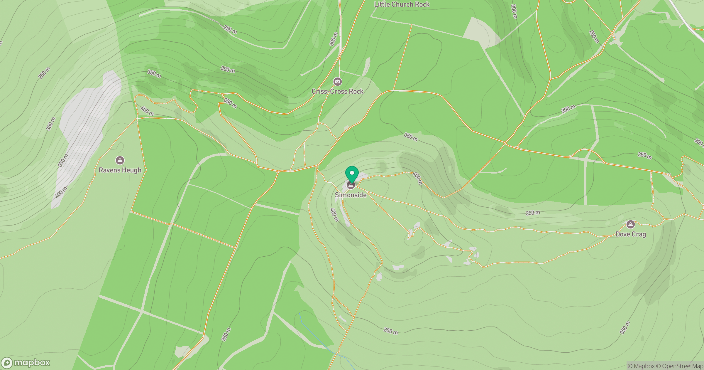
Grid reference: NZ024987
View on OpenStreetMapOpens a map in a new tab, centred on the hill.




No comments yet. Be the first.