
Sgurr nan Coireachan
Good walks are even better shared.
Overview
Sgurr nan Coireachan
Overview
Sgurr nan Coireachan, standing tall at 962 meters, is a prominent Munro in the Scottish Highlands. This peak is not just another mountain; it's a character in the stunning Scottish landscape, offering spectacular views and the thrill of the climb!
Geology
The mountain's rugged features are primarily made up of ancient metamorphic rocks, shaped by glacial activities. There's an unmistakable charm to its steep crags that beckon adventurous souls. Just a reminder – while it has a weathered exterior, it’s more than just a pretty face!
Routes
The most popular route is the South Glen Shiel Ridge, a challenging trek imbued with breathtaking scenery. It spans around 12 km and takes about 5 hours, depending on those pesky legs of yours. The initial ascent might leave you breathless – not just from the climb, but from the awe of your surroundings!
Summit Features
Upon reaching the summit, you’ll be greeted by a sturdy stone cairn – a silent witness to the adventures and stories shared by countless hikers over the years.
Terrain
Expect rocky pathways intertwined with grassy expanses, and don’t be surprised if you wade through some boggy patches along the way. Waterproof boots are not just a recommendation; they might just be a lifesaver.
Views
When you finally make it to the top, the views are nothing short of spectacular. On a clear day, you’ll be treated to vistas of Loch Duich and the impressive Five Sisters of Kintail. It’s as if the landscape is saying, 'Look at me!' – How can you refuse?
Hazards
Be mindful of loose rocks, especially on steeper sections, and remember – weather in the Highlands can turn on a dime. Always keep an eye on the sky!
Access
Finding your way to Sgurr nan Coireachan is straightforward. Use the car park near the A87 to kick off your adventure. Just remember, like good cake, it can get busy when the sun is shining.
Facilities
While you won't find toilets or cafes at the trailhead, Dornie isn't far behind when hunger hits. A lovely cup of tea is just a short drive away.
History
The very name, 'Sgurr nan Coireachan', reflects the mountain's enchanting beauty. Historically, it was a significant landmark for the MacKenzie clan, steeped in rich heritage and tales of yore.
Conclusion
All in all, Sgurr nan Coireachan is a majestic experience that combines stunning geological features, wonderful views, and a bit of Highland history. Whether you're a seasoned climber or just looking to stretch your legs, this Munro won’t disappoint! So lace up those boots, grab your hiking pole – adventure awaits!
Last updated: 2023-10-01
Explore routes near Sgurr nan Coireachan
Walks starting near this hill. Open a route to check its map, distance and full itinerary.
Banavie to Glen Loy Aqueduct: Neptune’s Staircase Canal Towpath
View route
Ben Nevis via Mountain Path
View route
Fort Augustus to Kytra Lock: Caledonian Canal Towpath
View route
Glen Affric: Coire Loch Woodland Trail
View route
Route planning notes
These notes describe possible approaches. Check a route's map and access information when planning your walk.
South Glen Shiel Ridge
A popular route starting from the south side, this path takes you up the ridge with stunning vistas. The trail is well-defined but steep in sections, rewarding you with panoramic views.
Make a day of it, together
Find someone to share the walk with, or organise a day out along a route you like.
Hill facts and local notes
Classifications
Elevation
956m
3,137 ft
Prominence
232m
Coordinates
56.9357, -5.4486
NM902880
OS Map
40
Explorer: 398E
At the Summit
The summit features a stone cairn that provides a marker for weary hikers. On a clear day, the views from the top are absolutely gobsmacking.
Terrain & Geology
Sgurr nan Coireachan is predominantly composed of ancient metamorphic rocks, giving it a rugged appearance. The rocks have been shaped by glacial activity over millennia, offering dramatic cliffs and steep crags.
Views & Scenery
From the summit, you can see the majestic Loch Duich, the rugged peaks of the Five Sisters of Kintail, and the expansive landscape of Glen Shiel.
History & Heritage
Name Origin
The name 'Sgurr nan Coireachan' translates to 'peak of the little corries' in Scottish Gaelic, reflecting the beauty of its landscapes.
Historical Significance
Historically, the area was inhabited by the MacKenzies, and the mountain remains a significant landmark for local cultures.
Getting There & Facilities
Parking
There is a car park located off the A87 at the starting point of the South Glen Shiel Ridge. It's always wise to arrive early, as it can fill up quickly during peak seasons.
Public Transport
Public transport options are limited. The nearest bus stop is a short walk from the car park, with services from Kyle of Lochalsh.
Nearby Facilities
While there are no facilities directly at the trailhead, nearby Dornie offers a few cafes and shops for essential supplies.
Safety Information
Known Hazards
- Loose rocks in the upper reaches can present a trip hazard. Sudden weather changes are common in this region, so it’s wise to be prepared.
General Safety Tips
- Check weather conditions before setting out
- Carry appropriate clothing and equipment
- Let someone know your planned route
- Take a map, compass, and GPS device
- Carry emergency supplies: food, water, first aid kit, torch
Hills
Some common questions about the hills answered
Are there group walks up Sgurr nan Coireachan?
Many walkers use Walkmates to join or organise walks with others. You can check for group walks around Sgurr nan Coireachan through the maps
Are there other walkers around Sgurr nan Coireachan?
Activity varies by location and time, but Walkmates lets you see whether others have shared walks or shown interest in this area. Find other people through the walking friends search walking friends for Sgurr nan Coireachan search or of course create your own walk for Sgurr nan Coireachan
Can I organise a walk to Sgurr nan Coireachan?
Yes. If there aren’t any walks listed already, you can create a walk and make it available for others to join.
If you're signed up to Walkmates, you can create a walk to Sgurr nan Coireachan.
How do I find a walk up this hill?
There are often multiple ways to walk this hill, depending on experience and route preference. Walkmates helps you explore walks and routes that others have shared.
Can I suggest a new route up Sgurr nan Coireachan?
Yes. You can suggest or create routes to share with others. Walkmates focuses on the social side of walking, so routes are used to help people organise walks and explore areas together, rather than as detailed navigation tools or route libraries.
Other uses really appreciate knowledgeable walkers sharing their routes. Share your favourite route to Sgurr nan Coireachan here
The is an error or something incorrect about this hill. How do I let you know?
We always strive to keep the information on Walkmates as accurate as possible. If you find an error, please let us know through the contact form and we'll aim to correct it as quickly as possible
Community Discussion
Comments
Location
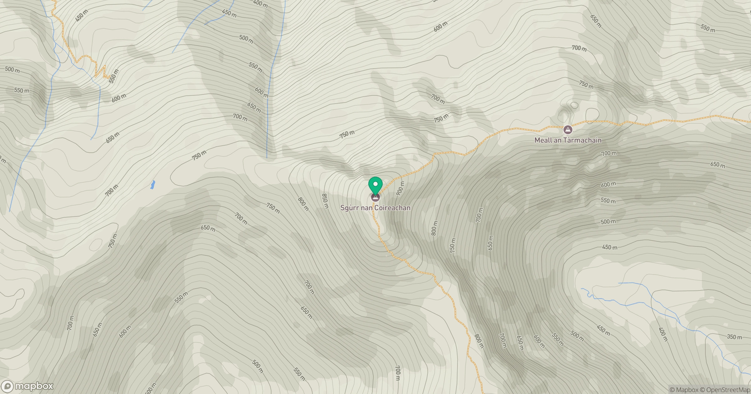
Grid reference: NM902880
View on OpenStreetMapOpens a map in a new tab, centred on the hill.
No comments yet. Be the first.