
Beinn Gharbh
Good walks are even better shared.
Overview
Overview
Beinn Gharbh (880m) stands proud in the Scottish Highlands, offering breathtaking views and a sense of rugged adventure that many crave. The mountain is a classic representation of Scottish mountainous terrain, perfect for both seasoned hikers and enthusiastic novices looking for a challenge.
Geology
The geological makeup of Beinn Gharbh features granite and schist. This combo creates solid terrain and spectacular views of the surrounding landscape as you tread your way upwards.
Route Information
North West Ridge
- Distance: 9.5 km
- Duration: Approx. 4 hours
- Difficulty: Moderate
This route is popular among hikers for its diverse challenges and scenic landscapes. Expect a mix of grassy inclines and rocky challenges, some of which might make you question your life choices (or at least your fitness level). The reward? A brilliant view, a satisfied grin, and perhaps just a few sore muscles.
Summit Features
At the top, you’ll find a traditional stone cairn, perfect for that Instagram snap. Revel in the feeling of achievement as you bask in the stunning views of nearby peaks and valleys.
Views
Notable landmarks visible from the summit include Ben Cruachan, famous for its hydroelectric power station, and the endless expanse of the sprawling Scottish Highlands. Best to visit in late spring to early autumn when it’s less likely to rain on your parade – or hike, as the case may be.
Hazards
While Beinn Gharbh is accessible, don’t let its charm fool you. Be aware of slippery rocks, particularly in wetter weather, and the lovely midges in the summer months. Carry navigational tools as the ‘Scottish Mist’ can appear more suddenly than your mate’s last-minute decision to join the hike.
Access and Facilities
Parking
You can park near the Glen Etive road, where spaces are limited. Show up early to avoid the stress of finding a spot!
Public Transport
Buses run to the village of Dalnacardoch, making your journey easier if you prefer not to drive. Check local timetables to ensure smooth travel.
Nearby Town
Tyndrum is the nearest town and has enough cafes and shops to fuel your adventure. Grab some snacks at the local convenience store or treat yourself to a well-earned meal – you deserve it!
Conclusion
Beinn Gharbh is not just another hill to climb; it’s an experience waiting to unfold. Expect stunning views, exciting terrain, and the kind of beautiful ruggedness that Scotland does best. So lace up those hiking boots, grab your walking sticks, and get ready to conquer Beinn Gharbh. Happy hiking!
Explore routes near Beinn Gharbh
Public walks starting within 80 km of this hill. Nearby does not mean a route reaches the summit; check its map and access before setting out.
Banavie to Glen Loy Aqueduct: Neptune’s Staircase Canal Towpath
View route
Ben Nevis via Mountain Path
View route
Loch Affric full circuit from River Affric
View route
Fort Augustus to Kytra Lock: Caledonian Canal Towpath
View route
Route planning notes
These notes describe possible approaches, not verified navigable routes or permission to cross land. Check current paths, local access rules and conditions before setting out.
North West Ridge
A scenic ascent that provides varied terrain, from grassy slopes to rocky scrambles. Perfect for those who enjoy a bit of a challenge without the full Monty.
Make a day of it, together
Find someone to share the walk with, or organise a day out along a route you like.
Hill facts and local notes
Classifications
Elevation
895m
2,937 ft
Prominence
150m
Coordinates
56.9316, -5.4825
NM882876
OS Map
40
Explorer: 398E
At the Summit
The summit is marked by a traditional stone cairn that offers a perfect photo-op and a place to catch your breath while you recount any tall tales from the ascent.
Terrain & Geology
Beinn Gharbh is primarily composed of granite and schist, giving it a rugged appeal that is typical of this area of the Highlands. The distinctive rock formations contribute to the striking slopes, adorned with numerous boulders and outcrops.
Views & Scenery
From the summit, hikers can enjoy breathtaking views of the surrounding peaks, particularly the mighty Ben Cruachan and the rolling hills of the Highlands.
History & Heritage
Name Origin
The name 'Beinn Gharbh' translates to 'Rough Mountain' in Gaelic, a fitting description for this rugged peak.
Historical Significance
Beinn Gharbh has been a significant landmark for both locals and adventurers alike, symbolising the raw beauty of the Scottish landscape.
Getting There & Facilities
Check current local access restrictions, parking rules and transport timetables before travelling. These notes do not confirm public access to the summit.
Parking
The nearest parking area is at the Glen Etive road, approximately 4 km from the base of Beinn Gharbh. It's best to arrive early to avoid the crowds – or you might find yourself parked behind someone who brought their entire family reunion!
Public Transport
Regular bus services run from nearby towns; check local timetables for the best connections. The closest stop is in the village of Dalnacardoch.
Nearby Facilities
Tyndrum offers several cafes, pubs, and convenience stores for a post-hike snack or to pick up your favourite Scottish treat – haggis, anyone?
Safety Information
Known Hazards
- Slippery rocks in wet conditions, unpredictable weather, and the threat of midges in warmer months. Always carry a map and compass, just in case your sense of direction isn't quite as sharp as your mate's banter.
General Safety Tips
- Check weather conditions before setting out
- Carry appropriate clothing and equipment
- Let someone know your planned route
- Take a map, compass, and GPS device
- Carry emergency supplies: food, water, first aid kit, torch
Hills
Some common questions about the hills answered
Are there group walks up Beinn Gharbh?
Many walkers use Walkmates to join or organise walks with others. You can check for group walks around Beinn Gharbh through the maps
Are there other walkers around Beinn Gharbh?
Activity varies by location and time, but Walkmates lets you see whether others have shared walks or shown interest in this area. Find other people through the walking friends search walking friends for Beinn Gharbh search or of course create your own walk for Beinn Gharbh
Can I organise a walk to Beinn Gharbh?
Yes. If there aren’t any walks listed already, you can create a walk and make it available for others to join.
If you're signed up to Walkmates, you can create a walk to Beinn Gharbh.
How do I find a walk up this hill?
There are often multiple ways to walk this hill, depending on experience and route preference. Walkmates helps you explore walks and routes that others have shared.
Can I suggest a new route up Beinn Gharbh?
Yes. You can suggest or create routes to share with others. Walkmates focuses on the social side of walking, so routes are used to help people organise walks and explore areas together, rather than as detailed navigation tools or route libraries.
Other uses really appreciate knowledgeable walkers sharing their routes. Share your favourite route to Beinn Gharbh here
The is an error or something incorrect about this hill. How do I let you know?
We always strive to keep the information on Walkmates as accurate as possible. If you find an error, please let us know through the contact form and we'll aim to correct it as quickly as possible
Community Discussion
Comments
Location
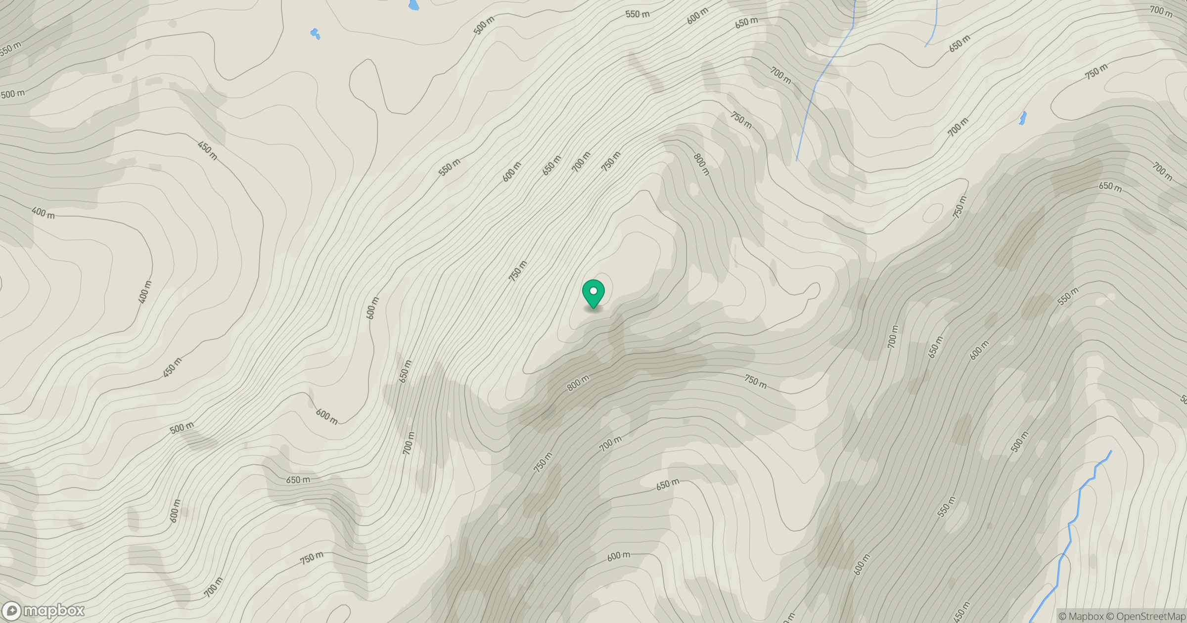
Grid reference: NM882876
View on OpenStreetMapOpens a map in a new tab, centred on the hill.
Hills within 30 km
Straight-line distance, not a walking route or confirmation of access.
An Caisteal
622m
Ladhar Bheinn
1,020m
Sgurr a' Mhaoraich
1,027m
Beinn Sgritheall
974m
Gleouraich
1,035m
No comments yet. Be the first.