

Sgurr na Ciche
Good walks are even better shared.
NM9096 : Mountains in Knoydart from Loch Nevis
Anthony O'Neil Photo source
Overview
Sgurr na Ciche
Overview
Sgurr na Ciche, the majestic Munro located at NM902966, rises to 1040 meters above sea level, offering both a challenge and beauty for eager hikers. The mountain's steep, rocky slopes are decorated with flora and fauna typical of the Scottish Highlands, making this a truly remarkable outing.
Geology
The geology of Sgurr na Ciche primarily consists of gneiss and schist.
These ancient rocks date back millions of years, providing a glimpse into Earth’s tumultuous past.
As you scale the peak, you'll encounter glimpses of the rugged Highland landscape that showcase its geological heritage, providing ample opportunities for geologists and curious sort alike to ponder the forces that shaped this land.
Routes
The most popular route to the summit begins from the West Highland Way, travelling approximately 14.5 km from Inverie.
This approach is ideal for moderate hikers and provides a blend of gentle ascents and challenging scrambles. If you're fortunate, you may even spot a deer or two along your path.
Summit Features
Upon reaching the summit, you will be greeted by a formidable cairn that is an invitation to enjoy the breathtaking views.
The expansive horizon features Loch Nevis's shimmering waters, and on a clear day, you can even spot the distant Ben Nevis, its peak cloaked in a crown of clouds.
A well-deserved picnic here comes highly recommended – but keep your snacks safe from the cheeky crows who might come to investigate!
Terrain
The terrain of Sgurr na Ciche varies, presenting rocky trails with grassy expanses between.
Hikers should be prepared for some scree and muddy patches, which can present an occasional slip hazard. Good hiking boots will serve you well here.
Views
The summit offers some of the finest views in the Highlands. Highlights include:
- Loch Nevis: A stunning sea loch that glimmers in the sunlight.
- The Small Isles: A picturesque sight in the distance.
- Ben Nevis: Always impressive, even from afar.
Best viewed in spring or early autumn, sunrise and sunset offer an almost magical atmosphere, elevating the experience to something unforgettable.
Hazards
Weather conditions can change at the drop of a hat in the Highlands. Check the forecast before you go, and brace yourself for everything from sun to sleet!
Watch out for loose rocks and the potential for boggy ground, particularly as you near the summit.
Access
Accessing Sgurr na Ciche is straightforward, though a bit of a trek from Mallaig. The nearest parking is located at Inverie, a delightful village accessible by ferry. Public transport is limited, so plan accordingly.
Facilities
After your hike, don’t forget to reward yourself! While no facilities are available on the mountain, the village of Inverie features a pub and café where you can quench your thirst and restore your energy.
History
The name Sgurr na Ciche evokes images of folklore and history: 'Peak of the Vampire'. This mountain has seen countless generations, each adding to its legend.
Embrace the stories of the past as you walk its storied terrain.
In conclusion, Sgurr na Ciche is more than just a hike; it’s a journey through time, nature, and perhaps a few ghost stories along the way. Lace up those boots, pack your sense of adventure, and make this Munro part of your itinerary!
Explore routes near Sgurr na Ciche
Walks starting near this hill. Open a route to check its map, distance and full itinerary.
Banavie to Glen Loy Aqueduct: Neptune’s Staircase Canal Towpath
View route
Ben Nevis via Mountain Path
View route
Fort Augustus to Kytra Lock: Caledonian Canal Towpath
View route
Glen Affric: Coire Loch Woodland Trail
View route
Route planning notes
These notes describe possible approaches. Check a route's map and access information when planning your walk.
West Highland Way Approach
Starting from the West Highland Way, this approach offers a gentle slopes interspersed with some steeper sections as you approach the summit.
Make a day of it, together
Find someone to share the walk with, or organise a day out along a route you like.
Photo Gallery
View all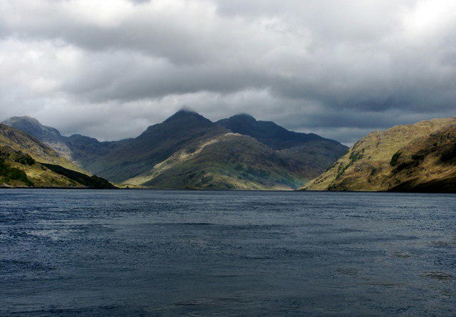 Photo could not load
NM9096 : Mountains in Knoydart from Loch Nevis
Anthony O'Neil
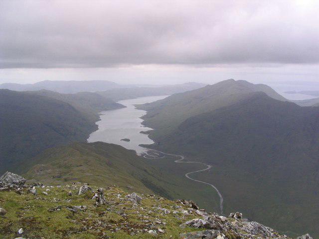 Photo could not load
NM9096 : View from summit of Sgurr na Ciche
Russel Wills
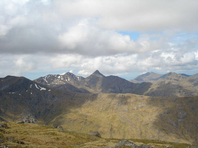 Photo could not load
NM9096 : Sgurr na Ciche
Derek Gray
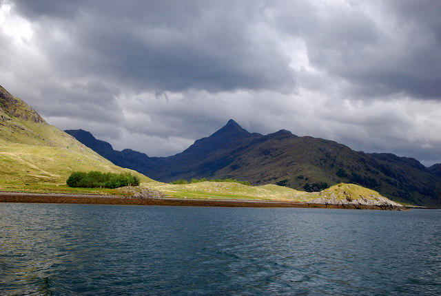 Photo could not load
NM9096 : Sgurr na Ciche
Glen Breaden
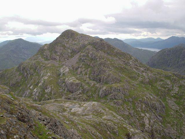 Photo could not load
NM9096 : Sgurr na Ciche from Garbh Cioch Mhor
Eric Gunstensen
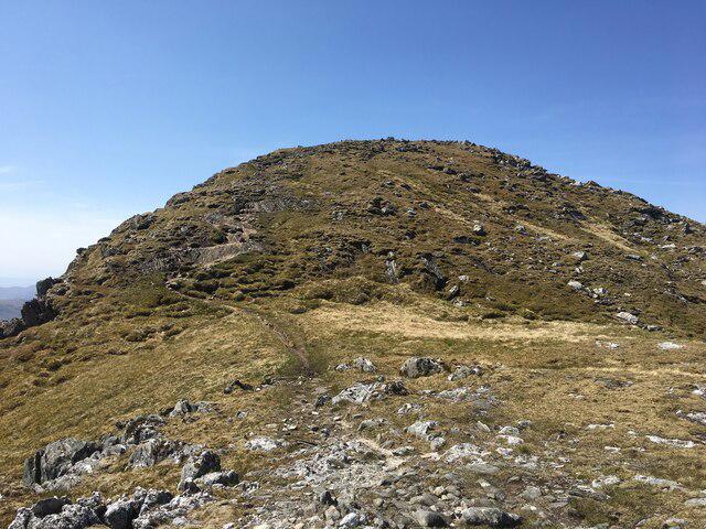 Photo could not load
NM9096 : Towards the summit of Sgurr na Ciche
Steven Brown
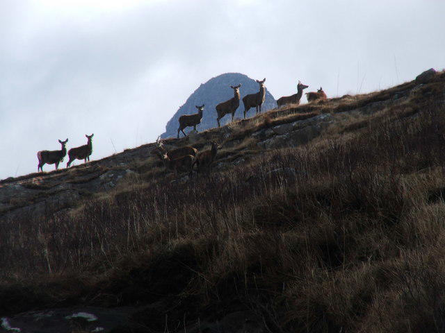 Photo could not load
NM9096 : Sgur na Ciche
tony ferrie
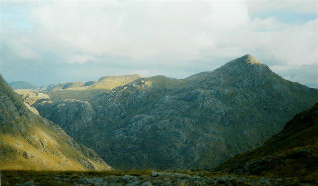 Photo could not load
NM9096 : Sgurr na Ciche
AlastairG
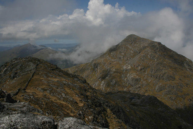 Photo could not load
NM9096 : Garbh Chioch Mhor and Sgurr na Ciche
Nic Bullivant
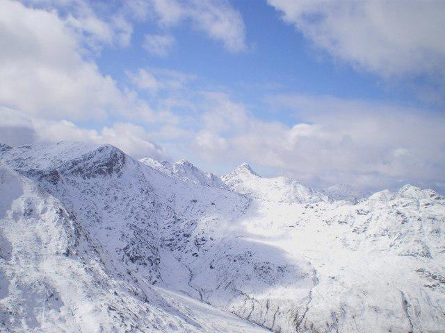
NM9096 : Sgurr na Ciche and the mountains of east Knoydart
Richard Law
Hill facts and local notes
Classifications
Elevation
1,040m
3,413 ft
Prominence
839m
Coordinates
57.0135, -5.4569
NM902966
OS Map
33 40
Explorer: 398E
At the Summit
The summit is marked by a sizeable cairn and offers ample space for a picnic - just be mindful not to feed the crows, or they might pick your sandwich!
Terrain & Geology
Composed chiefly of gneiss and schist, Sgurr na Ciche showcases the ancient geological processes that shaped the Highlands, providing a rocky canvas that hikers can admire.
Views & Scenery
From the summit, admire Loch Nevis, the Small Isles, and the rugged beauty of the surrounding mountains including Ben Nevis in the far distance.
History & Heritage
Name Origin
The name Sgurr na Ciche translates to 'Peak of the Vampire', a nod to the chilling folklore of the region.
Historical Significance
Sgurr na Ciche holds place in local folklore and tradition, linking the landscape with stories of ancestral importance.
Getting There & Facilities
Parking
There is a small car park at the start of the West Highland Way in the village of Inverie, offering a convenient jump-off point for the hike.
Public Transport
Access is primarily by ferry to Mallaig from the mainland, with local buses operating to Inverie.
Nearby Facilities
While no facilities exist at the summit, Inverie has a pub and café for post-hike refreshments and a toilet facility.
Safety Information
Known Hazards
- Beware of sudden weather changes, as conditions can shift quickly in the Highlands. Also watch out for loose rocks and boggy sections.
General Safety Tips
- Check weather conditions before setting out
- Carry appropriate clothing and equipment
- Let someone know your planned route
- Take a map, compass, and GPS device
- Carry emergency supplies: food, water, first aid kit, torch
Hills
Some common questions about the hills answered
Are there group walks up Sgurr na Ciche?
Many walkers use Walkmates to join or organise walks with others. You can check for group walks around Sgurr na Ciche through the maps
Are there other walkers around Sgurr na Ciche?
Activity varies by location and time, but Walkmates lets you see whether others have shared walks or shown interest in this area. Find other people through the walking friends search walking friends for Sgurr na Ciche search or of course create your own walk for Sgurr na Ciche
Can I organise a walk to Sgurr na Ciche?
Yes. If there aren’t any walks listed already, you can create a walk and make it available for others to join.
If you're signed up to Walkmates, you can create a walk to Sgurr na Ciche.
How do I find a walk up this hill?
There are often multiple ways to walk this hill, depending on experience and route preference. Walkmates helps you explore walks and routes that others have shared.
Can I suggest a new route up Sgurr na Ciche?
Yes. You can suggest or create routes to share with others. Walkmates focuses on the social side of walking, so routes are used to help people organise walks and explore areas together, rather than as detailed navigation tools or route libraries.
Other uses really appreciate knowledgeable walkers sharing their routes. Share your favourite route to Sgurr na Ciche here
The is an error or something incorrect about this hill. How do I let you know?
We always strive to keep the information on Walkmates as accurate as possible. If you find an error, please let us know through the contact form and we'll aim to correct it as quickly as possible
Community Discussion
Comments
Location
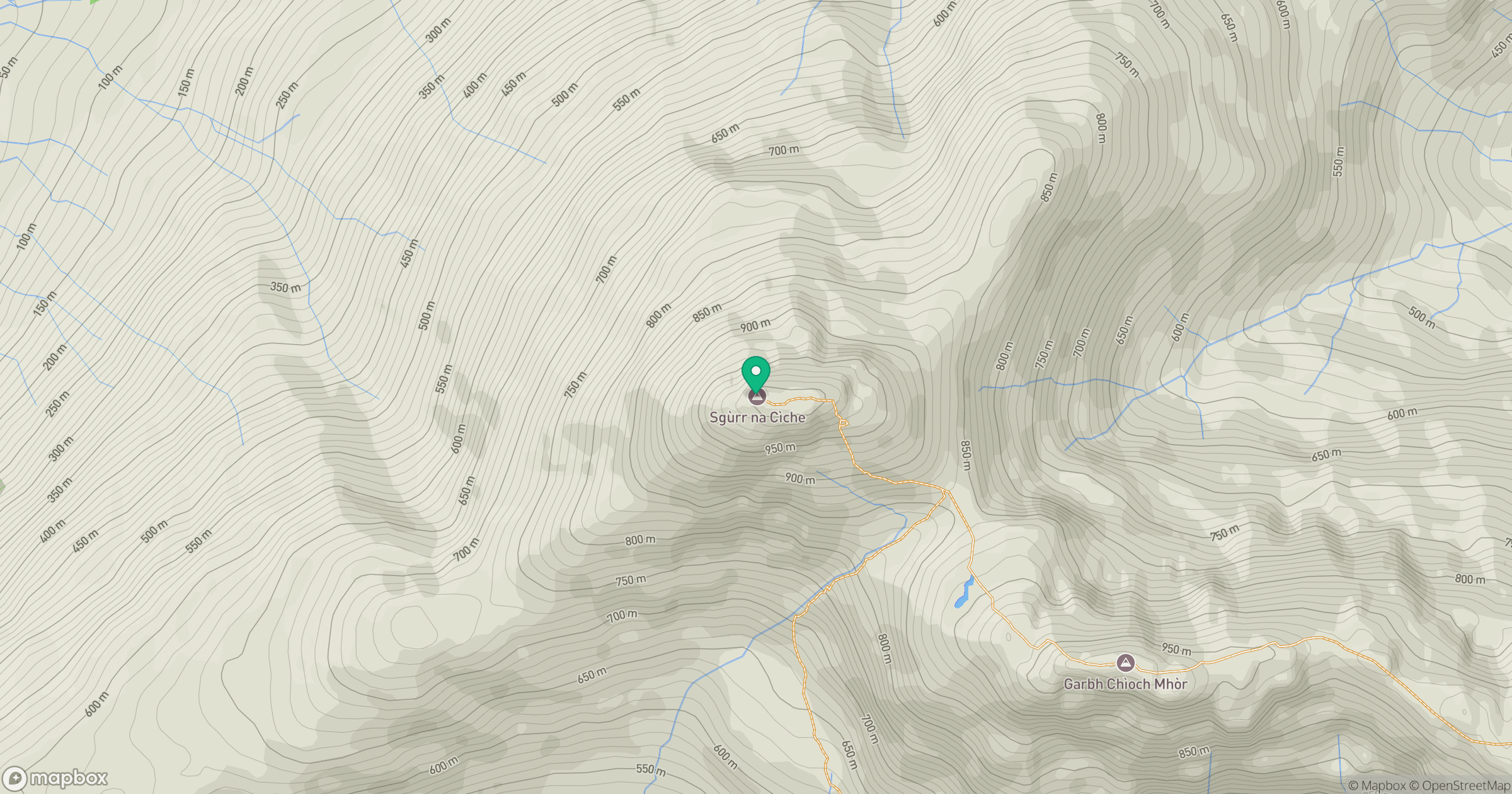
Grid reference: NM902966
View on OpenStreetMapOpens a map in a new tab, centred on the hill.
Nearby Hills
An Caisteal
622m
Ladhar Bheinn
1,020m
Sgurr a' Mhaoraich
1,027m
Beinn Sgritheall
974m
Sgurr Fhuaran
1,069m
No comments yet. Be the first.