

Meall a' Choire Dhuibh
Good walks are even better shared.
Overview
Meall a' Choire Dhuibh
Nestled in the heart of the Scottish Highlands, Meall a' Choire Dhuibh is a charming Corbett that draws outdoor enthusiasts with its rugged beauty and inviting trails. Standing tall at 744 meters, this mountain is beloved by hikers for its relatively moderate ascent and spectacular views.
Geology
The mountain flaunts a fascinating geological history, consisting primarily of Lewisian gneiss, one of the oldest rock types in Europe, interspersed with granite intrusions that create a rugged terrain. The variety of rocks not only adds to its visual appeal but also offers insight into the Earth's ancient past.
Routes
From Inverliever
This route starts at the village of Inverliever. Wander through a stunning woodland path that meanders alongside babbling brooks before leading you steeply upwards. It treats hikers to a delightful diversity of flora and fauna.
- Distance: 6.5 km
- Estimated Time: 3 hours
- Difficulty: Moderate
From Achnacarry
An alternative route begins at Achnacarry, offering a slightly longer but equally rewarding walk. This path provides exhilarating views of Loch Awe and its surroundings, with ample opportunities for photographs along the way.
- Distance: 7 km
- Estimated Time: 3.5 hours
- Difficulty: Moderate
Summit Features
The summit is crowned with a large cairn that not only offers excellent photo ops but makes for a perfect picnic spot to celebrate the achievement of reaching the top. With grassy knolls surrounding it, the summit invites you to linger a while and soak in the tranquil atmosphere.
Terrain Type
Be prepared for a varied terrain; expect rocky outcrops that challenge your footing, soft grassy slopes that invite you to roll down (if you dare), and the occasional boggy patch that can be tricky. Sturdy footwear is recommended!
Views
From the summit, you can feast your eyes on stunning vistas that stretch beyond the horizon. Notable features include Ben Cruachan towering to the north and the beautiful Loch Awe to the south. The best time to enjoy these spectacular views is during the spring and autumn months when the air is crisp, and the sky is usually clear.
Hazards
As with any Highland trek, take note of the potential hazards, including loose rocks on ascents, sudden changes in weather, and those sneaky boggy patches that catch the unwary!
Nearby Summits
Adventurers can also explore nearby peaks such as Ben Cruachan (1126 m) and Sgurr na h-Ulaidh (900 m), both offering additional adventures for those eager to wander.
Access
Nearest Parking
Parking is readily available near Inverliever, often in informal laybys, but do arrive early to secure a spot during peak hiking seasons.
Public Transport
The infrastructure for public transport is somewhat limited, but buses do operate to Inverliever from nearby towns. Having a car is the best option if you want to make the most of your adventure.
Nearest Town
The lovely village of Taynuilt is the closest town, just about 10 miles away, where you can find all your needs met, from snacks to supplies.
Facilities
After a day on the mountain, why not treat yourself to a cup of tea or coffee? Taynuilt offers several charming cafes and shops, plus public toilets for when nature calls.
History
The name 'Meall a' Choire Dhuibh' reveals its allure; it translates to 'hill of the black corrie,' a fitting description for its dark, shady slopes. It holds significance in local folklore, being a landmark entwined with tales of ancient clans and Highland tradition.
With its captivating scenery and inviting trails, Meall a' Choire Dhuibh is a must-visit for anyone looking to bask in the beauty of the Scottish Highlands. Lace up your boots, pack a lunch, and off you go! Safe travels!
Explore routes near Meall a' Choire Dhuibh
Public walks starting within 80 km of this hill. Nearby does not mean a route reaches the summit; check its map and access before setting out.
Banavie to Glen Loy Aqueduct: Neptune’s Staircase Canal Towpath
View route
Ben Nevis via Mountain Path
View route
Loch Affric full circuit from River Affric
View route
Fort Augustus to Kytra Lock: Caledonian Canal Towpath
View route
Route planning notes
These notes describe possible approaches, not verified navigable routes or permission to cross land. Check current paths, local access rules and conditions before setting out.
From Inverliever
A well-trodden path starting from Inverliever leading through scenic woodland before ascending to the summit.
From Achnacarry
An alternative route offering stunning views of Loch Awe and the surrounding hills.
Make a day of it, together
Find someone to share the walk with, or organise a day out along a route you like.
Photo Gallery
View all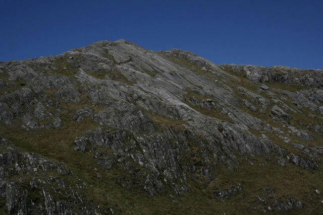 Photo could not load
NM9197 : Meall a'Choire Dhuibh
Nic Bullivant
 Photo could not load
NM9197 : Meall a' Choire Dhuibh
Richard Webb
 Photo could not load
NM9197 : Meall a' Choire Dhuibh
Richard Webb
 Photo could not load
NM9198 : Rainbow, Loch Quoich
Richard Webb
 Photo could not load
NM9198 : Pool, Meall a' Choire Dhuibh
Richard Webb
 Photo could not load
NM9198 : Meall a' Choire Dhuibh
Richard Webb
Hill facts and local notes
Classifications
Elevation
741m
2,430 ft
Prominence
103m
Coordinates
57.0267, -5.4307
NM918980
OS Map
33 40
Explorer: 398E 413S
At the Summit
The summit is marked by a prominent cairn that serves as a perfect vantage point, with grassy areas for a well-deserved rest.
Terrain & Geology
The mountain is predominantly composed of ancient Lewisian gneiss, with intriguing granite intrusions that add to its rugged charm.
Views & Scenery
Breathtaking panoramic views of the neighbouring Ben Cruachan and Loch Awe, with the distant peaks of the Argyll and Bute region visible on clear days.
History & Heritage
Name Origin
The name 'Meall a' Choire Dhuibh' translates to 'hill of the black corrie,' referencing the distinctive shape of the mountain and its darker, sheltered slopes.
Historical Significance
This mountain is a part of the local folklore, often associated with tales of ancient clans that ruled the Highlands.
Getting There & Facilities
Check current local access restrictions, parking rules and transport timetables before travelling. These notes do not confirm public access to the summit.
Parking
Parking is available near the village of Inverliever, where there is an informal layby suitable for a few vehicles.
Public Transport
The closest public transport options are buses to Inverliever from nearby towns, although a car is recommended for ease of access.
Nearby Facilities
In Taynuilt, there are cafes and shops that provide refreshments and supplies, as well as public toilets.
Safety Information
Known Hazards
- Loose rocks on ascent, potential for sudden weather changes, and boggy terrain in certain sections.
General Safety Tips
- Check weather conditions before setting out
- Carry appropriate clothing and equipment
- Let someone know your planned route
- Take a map, compass, and GPS device
- Carry emergency supplies: food, water, first aid kit, torch
Hills
Some common questions about the hills answered
Are there group walks up Meall a' Choire Dhuibh?
Many walkers use Walkmates to join or organise walks with others. You can check for group walks around Meall a' Choire Dhuibh through the maps
Are there other walkers around Meall a' Choire Dhuibh?
Activity varies by location and time, but Walkmates lets you see whether others have shared walks or shown interest in this area. Find other people through the walking friends search walking friends for Meall a' Choire Dhuibh search or of course create your own walk for Meall a' Choire Dhuibh
Can I organise a walk to Meall a' Choire Dhuibh?
Yes. If there aren’t any walks listed already, you can create a walk and make it available for others to join.
If you're signed up to Walkmates, you can create a walk to Meall a' Choire Dhuibh.
How do I find a walk up this hill?
There are often multiple ways to walk this hill, depending on experience and route preference. Walkmates helps you explore walks and routes that others have shared.
Can I suggest a new route up Meall a' Choire Dhuibh?
Yes. You can suggest or create routes to share with others. Walkmates focuses on the social side of walking, so routes are used to help people organise walks and explore areas together, rather than as detailed navigation tools or route libraries.
Other uses really appreciate knowledgeable walkers sharing their routes. Share your favourite route to Meall a' Choire Dhuibh here
The is an error or something incorrect about this hill. How do I let you know?
We always strive to keep the information on Walkmates as accurate as possible. If you find an error, please let us know through the contact form and we'll aim to correct it as quickly as possible
Community Discussion
Comments
Location
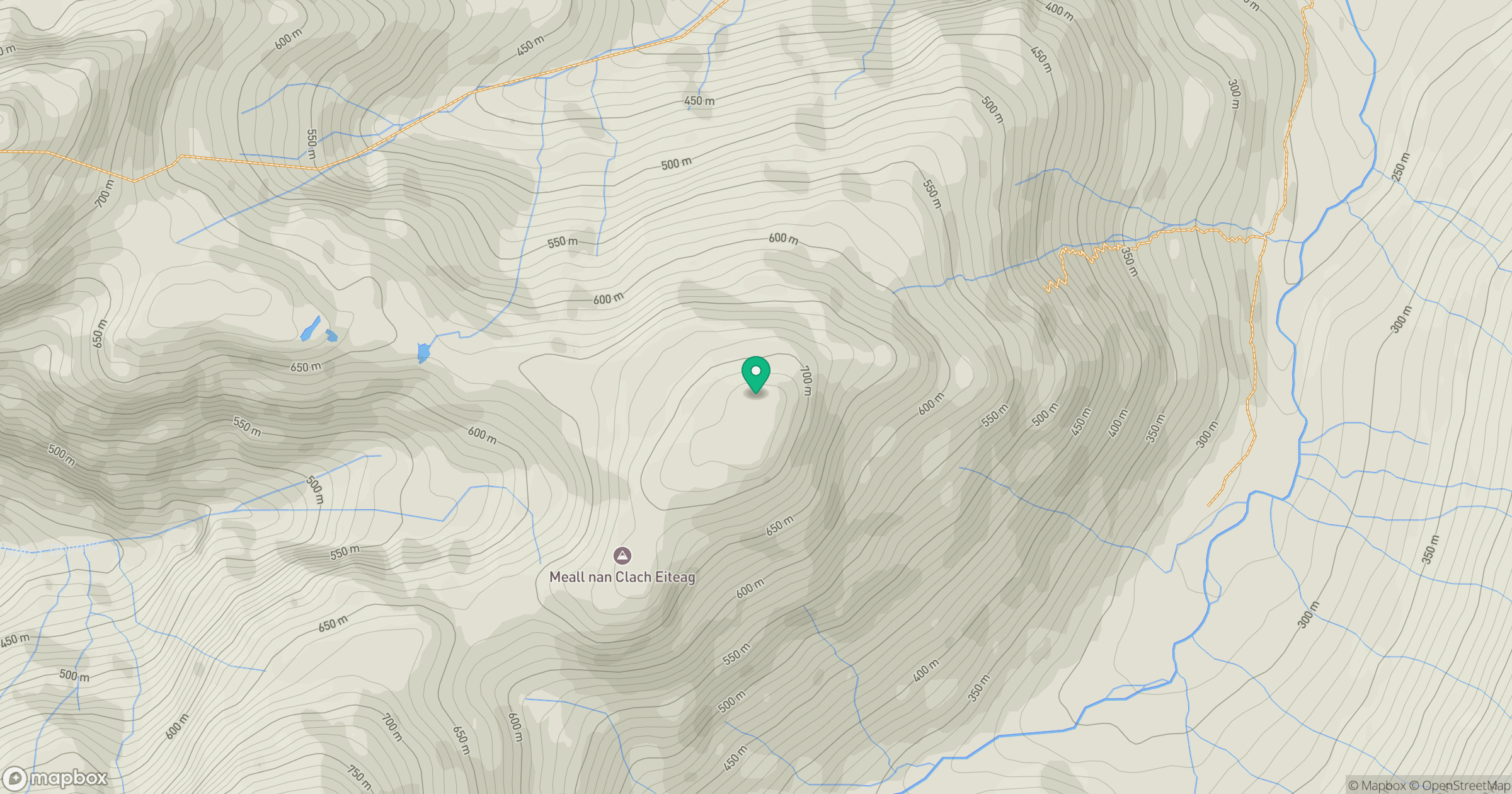
Grid reference: NM918980
View on OpenStreetMapOpens a map in a new tab, centred on the hill.
Hills within 30 km
Straight-line distance, not a walking route or confirmation of access.
An Caisteal
622m
Sgurr a' Mhaoraich
1,027m
Ladhar Bheinn
1,020m
Sgurr Fhuaran
1,069m
Beinn Sgritheall
974m
No comments yet. Be the first.