

Sgurr Choinnich Mor
Good walks are even better shared.
NN2271 : Ridge north-east from summit of Sgùrr Choinnich Mòr
Trevor Littlewood Photo source
Overview
Sgurr Choinnich Mor
Nestled in the enchanting Scottish Highlands, Sgurr Choinnich Mor stands proudly at an elevation of 1,050 meters. Classified as a Munro, this mountain offers not just a robust challenge but also breathtaking views that make every step worthwhile.
Geology
Sgurr Choinnich Mor is primarily composed of ancient gneiss, shaped and sculpted by relentless glacial and weathering processes over millions of years. The exposed rock surfaces, with their rugged contours, capture the imagination of both geologists and casual explorers alike.
The Route
Starting at the B863, the ascent takes you through a variety of terrains—beginning with gentle grassy slopes before transitioning into more challenging rocky outcroppings. A distance of approximately 10.5 km makes for a rewarding trek, often completed in around four hours. Don't forget to pack your favourite snack; nothing beats a well-deserved break atop a Munro!
Summit Features
Upon reaching the summit, hikers are welcomed by a modest cairn. It's the ideal spot for a photo op—just be sure not to knock over other people's carefully constructed stone piles! The summit provides perfect views to accompany a well-earned sandwich (or a choccy biscuit, we won’t judge).
Terrain
The terrain varies, featuring rocky patches and grassy slopes closer to the base. Be sure to tread carefully in boggy areas—no one wants to end their hike with muddy boots (or worse, wet socks!).
Stunning Views
The views from Sgurr Choinnich Mor are truly remarkable, showcasing the dramatic Glencoe valley and the reflective waters of Loch Leven. The best time to enjoy panoramic views is in early autumn when the landscape is set ablaze with fall colours.
Hazards
Hiking this majestic peak is not without its perils. The weather can change as quickly as a Scottish mood, so be prepared for rain—and possibly snow—regardless of the season. The rocky outcrops can also be slippery, especially after rain, so awareness is key. Remember, it's all part of the adventure!
Access and Facilities
The easiest access point is via the B863 road where ample parking is available. Public transport is a bit sparse, so planning ahead is advisable. The nearest town, Ballachulish, is just a short drive away and offers cafes where one can refuel after a long trek.
Historical Significance
The name Sgurr Choinnich Mor pays tribute to an ancient Gaelic chieftain, adding a layer of cultural significance to this natural beauty. For those who appreciate a bit of history alongside their hikes, this mountain does not disappoint.
So, lace up those boots, pack your waterproofs, and get ready to conquer Sgurr Choinnich Mor. It may be tough, but the reward is a memory that will last a lifetime!
Explore routes near Sgurr Choinnich Mor
Walks starting near this hill. Open a route to check its map, distance and full itinerary.
Ben Nevis via Mountain Path
View route
Banavie to Glen Loy Aqueduct: Neptune’s Staircase Canal Towpath
View route
Fort Augustus to Kytra Lock: Caledonian Canal Towpath
View route
Killin: Falls of Dochart, Finlarig and Moirlanich Longhouse
View route
Route planning notes
These notes describe possible approaches. Check a route's map and access information when planning your walk.
B863 to Sgurr Choinnich Mor
A scenic route starting from the B863, winding its way up through grassy slopes and rocky outcrops.
Make a day of it, together
Find someone to share the walk with, or organise a day out along a route you like.
Photo Gallery
View all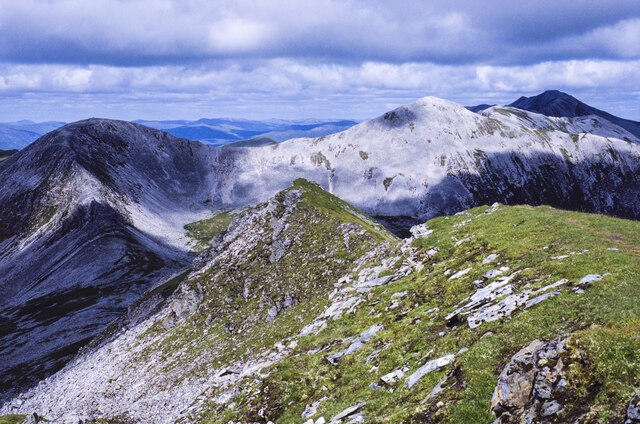 Photo could not load
NN2271 : Ridge north-east from summit of Sgùrr Choinnich Mòr
Trevor Littlewood
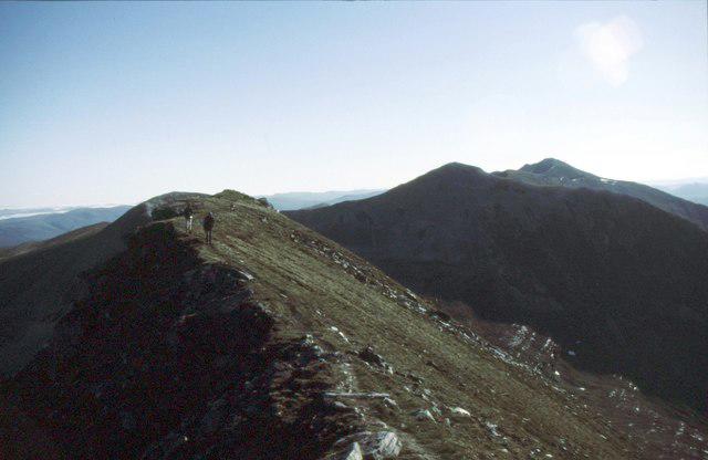 Photo could not load
NN2271 : On Sgurr Chòinnich Mòr
Russel Wills
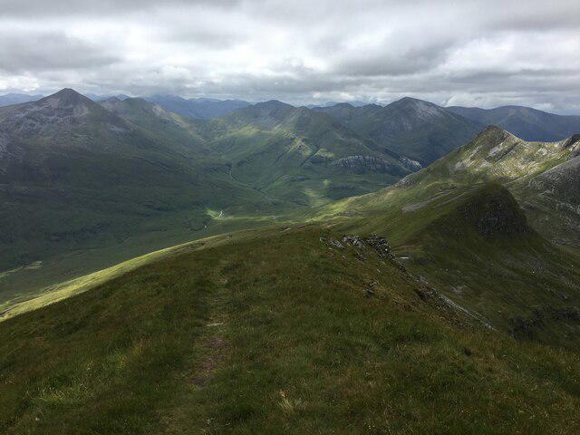 Photo could not load
NN2271 : Looking south west from the summit of Sgurr Choinnich Mor
Steven Brown
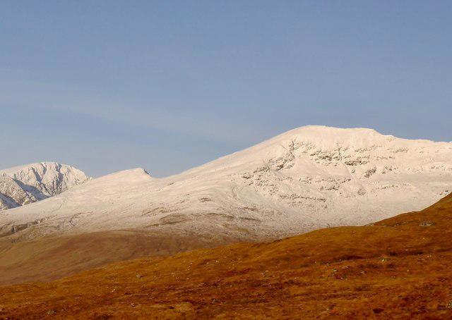 Photo could not load
NN2271 : Sgùrr Choinnich Mòr
Richard Webb
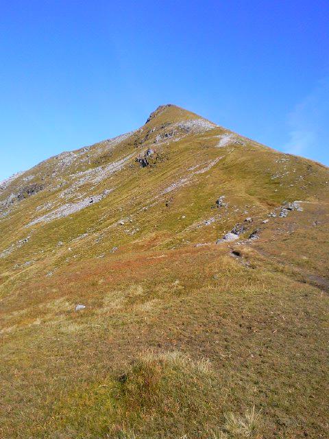 Photo could not load
NN2271 : Summit of Sgurr Choinnich Mor
Miranda
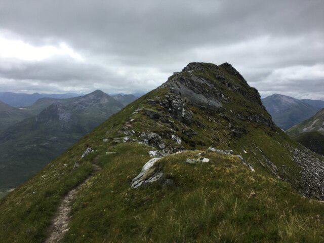 Photo could not load
NN2271 : View to the summit of Sgurr Choinnich Mor
Steven Brown
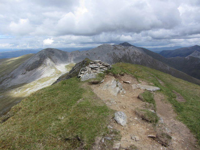 Photo could not load
NN2271 : On the summit of Sgurr Choinnich Mor with view along Grey Corries
Colin Park
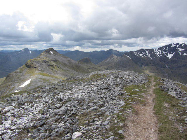 Photo could not load
NN2271 : On Stob Coire Easain with view to Sgurr Choinnich Mor
Colin Park
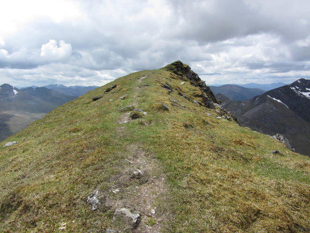 Photo could not load
NN2271 : The final approach to Sgurr Choinnich Mor from the northeast
Colin Park
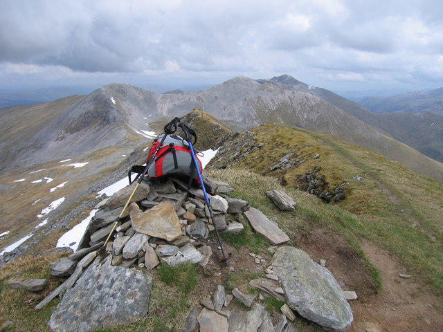 Photo could not load
NN2271 : Sgurr Choinnich Mor
Rude Health
Hill facts and local notes
Classifications
Elevation
1,094m
3,589 ft
Prominence
159m
Coordinates
56.8004, -4.9040
NN227714
OS Map
41
Explorer: 392
At the Summit
At the summit, you’ll find a modest cairn, offering a perfect spot for photographs (and avoiding any square rubbish biners).
Terrain & Geology
Sgurr Choinnich Mor is primarily composed of gneiss, formed during the Precambrian era. The harsh weather conditions have shaped the rock formations dramatically, giving the mountain its rugged charm.
Views & Scenery
From the summit, gaze upon the stunning vistas of the surrounding Glencoe valley and the shimmering Loch Leven in the distance.
History & Heritage
Name Origin
The name Sgurr Choinnich Mor translates roughly to 'the great peak of Choinnich', paying homage to an ancient Gaelic chieftain.
Historical Significance
Sgurr Choinnich Mor is not only a popular hiking destination but also a site of Scottish cultural heritage and folklore.
Getting There & Facilities
Parking
There is parking available at the start of the B863 road, just north of the mountain.
Public Transport
Public transport options are limited; the nearest bus services are from the village of Ballachulish.
Nearby Facilities
Cafés and shops are available in Ballachulish, with toilets at the village hall.
Safety Information
Known Hazards
- Be cautious of changing weather conditions; it can be sunny one moment and snowing the next. Slippery rocks and bogs can also turn a pleasant hike into a good old-fashioned mud wrestling match.
General Safety Tips
- Check weather conditions before setting out
- Carry appropriate clothing and equipment
- Let someone know your planned route
- Take a map, compass, and GPS device
- Carry emergency supplies: food, water, first aid kit, torch
Hills
Some common questions about the hills answered
Are there group walks up Sgurr Choinnich Mor?
Many walkers use Walkmates to join or organise walks with others. You can check for group walks around Sgurr Choinnich Mor through the maps
Are there other walkers around Sgurr Choinnich Mor?
Activity varies by location and time, but Walkmates lets you see whether others have shared walks or shown interest in this area. Find other people through the walking friends search walking friends for Sgurr Choinnich Mor search or of course create your own walk for Sgurr Choinnich Mor
Can I organise a walk to Sgurr Choinnich Mor?
Yes. If there aren’t any walks listed already, you can create a walk and make it available for others to join.
If you're signed up to Walkmates, you can create a walk to Sgurr Choinnich Mor.
How do I find a walk up this hill?
There are often multiple ways to walk this hill, depending on experience and route preference. Walkmates helps you explore walks and routes that others have shared.
Can I suggest a new route up Sgurr Choinnich Mor?
Yes. You can suggest or create routes to share with others. Walkmates focuses on the social side of walking, so routes are used to help people organise walks and explore areas together, rather than as detailed navigation tools or route libraries.
Other uses really appreciate knowledgeable walkers sharing their routes. Share your favourite route to Sgurr Choinnich Mor here
The is an error or something incorrect about this hill. How do I let you know?
We always strive to keep the information on Walkmates as accurate as possible. If you find an error, please let us know through the contact form and we'll aim to correct it as quickly as possible
Community Discussion
Comments
Location
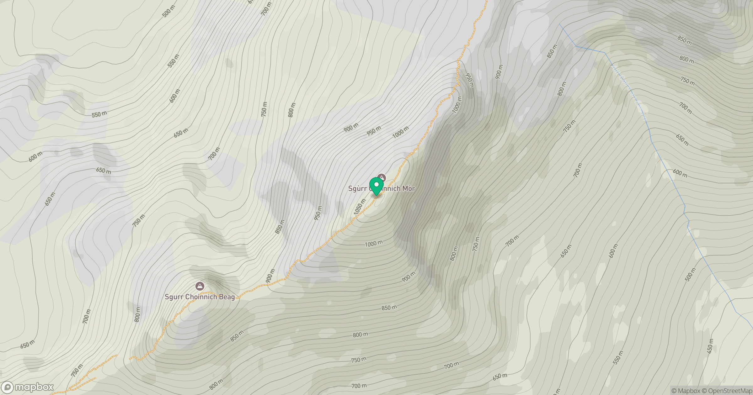
Grid reference: NN227714
View on OpenStreetMapOpens a map in a new tab, centred on the hill.
No comments yet. Be the first.