
Sgaorishal
Good walks are even better shared.
Overview
Sgaorishal: A Hiker's Delight
Located in the heart of the Scottish Highlands, Sgaorishal stands at 601 meters, offering a challenge that is well worth the effort for avid hikers. Known for its stunning views and rich geology, this Marilyn provides a picturesque escape for outdoor enthusiasts.
Geology
Sgaorishal is primarily composed of schist, a metamorphic rock that contributes to the rugged charm of the area. The geological history here is fascinating, with features left behind from the last Ice Age that tell tales of glacial movements and natural sculpting.
Routes
One popular route is the Sgaorishal Loop. This scenic route spans 8.4 kilometers and typically takes around 3.5 hours to complete. It's moderate in difficulty, making it accessible for many walkers. Be prepared for a mix of rocky trails and the occasional bog—it's all part of the fun, isn't it?
Summit Features
At the summit, hikers are greeted by a stout stone cairn, a traditional marker reminding us that we've conquered yet another mountain. The panoramic views from this vantage point are simply breathtaking—perfect for that Instagram post you’ve been planning!
Views
From the summit, remarkable landmarks such as Ben Wyvis to the north and the Black Isle to the south can be seen. The best times to soak in these views are late spring and early autumn, when the landscape is alive with colour and early morning sunlight paints everything golden.
Hazards
As with any mountain trek, caution is key. Be wary of loose rocks on steeper sections, and don't underestimate the Scottish weather—it can change quicker than you can say 'raincoat'. Additionally, keep an eye on where you step, as some areas can be rather boggy.
Access
Getting to Sgaorishal is relatively straightforward. For those driving, there's an informal parking area near the trailhead in Evanton. Public transport is also an option, with regular bus services connecting Inverness to Evanton.
Facilities
Before heading out, be sure to stock up in Evanton, where you’ll find a small shop and a charming cafe for some pre-adventure fuel.
History
The name Sgaorishal means 'the place of the wide slopes' in Scottish Gaelic, which aptly describes its expansive terrain. It has been a beloved spot for locals and visitors alike, steeped in both natural beauty and cultural significance.
Whether you’re scaling Sgaorishal for the views or the bragging rights, remember to pack your sense of adventure and embrace the journey. Happy hiking!
Explore routes near Sgaorishal
Public walks starting within 80 km of this hill. Nearby does not mean a route reaches the summit; check its map and access before setting out.
Dun Mhulan Broch Quick Walk
View route
Banavie to Glen Loy Aqueduct: Neptune’s Staircase Canal Towpath
View route
Route planning notes
These notes describe possible approaches, not verified navigable routes or permission to cross land. Check current paths, local access rules and conditions before setting out.
Sgaorishal Loop
A scenic loop that offers both challenging and moderate sections, perfect for those looking to get their boots muddy.
Make a day of it, together
Find someone to share the walk with, or organise a day out along a route you like.
Hill facts and local notes
Classifications
Elevation
280m
919 ft
Prominence
141m
Coordinates
57.0326, -6.3665
NG351019
OS Map
32 39
Explorer: 397
At the Summit
The summit boasts a well-built stone cairn and offers panoramic views of the surrounding valleys and hills.
Terrain & Geology
The mountain is primarily composed of schist, a metamorphic rock that adds to its rugged beauty. The area features interesting geological formations and glacial features resulting from the last Ice Age.
Views & Scenery
Visibility of Ben Wyvis, the Black Isle, and the stunning Inverness Firth can be enjoyed from the summit.
History & Heritage
Name Origin
The name Sgaorishal is derived from Scottish Gaelic, likely meaning 'the place of the wide slopes'.
Historical Significance
Sgaorishal holds cultural significance for local communities and has been a popular hiking destination for its scenic beauty and wildlife.
Getting There & Facilities
Check current local access restrictions, parking rules and transport timetables before travelling. These notes do not confirm public access to the summit.
Parking
There is a small informal car park at the start of the trail near the edge of the village of Evanton.
Public Transport
Buses run regularly from Inverness to Evanton, which is about a 15-minute walk from the trailhead.
Nearby Facilities
There are basic facilities in Evanton, including a small shop and a cafe for pre-hike refreshments.
Safety Information
Known Hazards
- Loose rocks on steep sections, unpredictable weather, and boggy ground in places.
General Safety Tips
- Check weather conditions before setting out
- Carry appropriate clothing and equipment
- Let someone know your planned route
- Take a map, compass, and GPS device
- Carry emergency supplies: food, water, first aid kit, torch
Hills
Some common questions about the hills answered
Are there group walks up Sgaorishal?
Many walkers use Walkmates to join or organise walks with others. You can check for group walks around Sgaorishal through the maps
Are there other walkers around Sgaorishal?
Activity varies by location and time, but Walkmates lets you see whether others have shared walks or shown interest in this area. Find other people through the walking friends search walking friends for Sgaorishal search or of course create your own walk for Sgaorishal
Can I organise a walk to Sgaorishal?
Yes. If there aren’t any walks listed already, you can create a walk and make it available for others to join.
If you're signed up to Walkmates, you can create a walk to Sgaorishal.
How do I find a walk up this hill?
There are often multiple ways to walk this hill, depending on experience and route preference. Walkmates helps you explore walks and routes that others have shared.
Can I suggest a new route up Sgaorishal?
Yes. You can suggest or create routes to share with others. Walkmates focuses on the social side of walking, so routes are used to help people organise walks and explore areas together, rather than as detailed navigation tools or route libraries.
Other uses really appreciate knowledgeable walkers sharing their routes. Share your favourite route to Sgaorishal here
The is an error or something incorrect about this hill. How do I let you know?
We always strive to keep the information on Walkmates as accurate as possible. If you find an error, please let us know through the contact form and we'll aim to correct it as quickly as possible
Community Discussion
Comments
Location
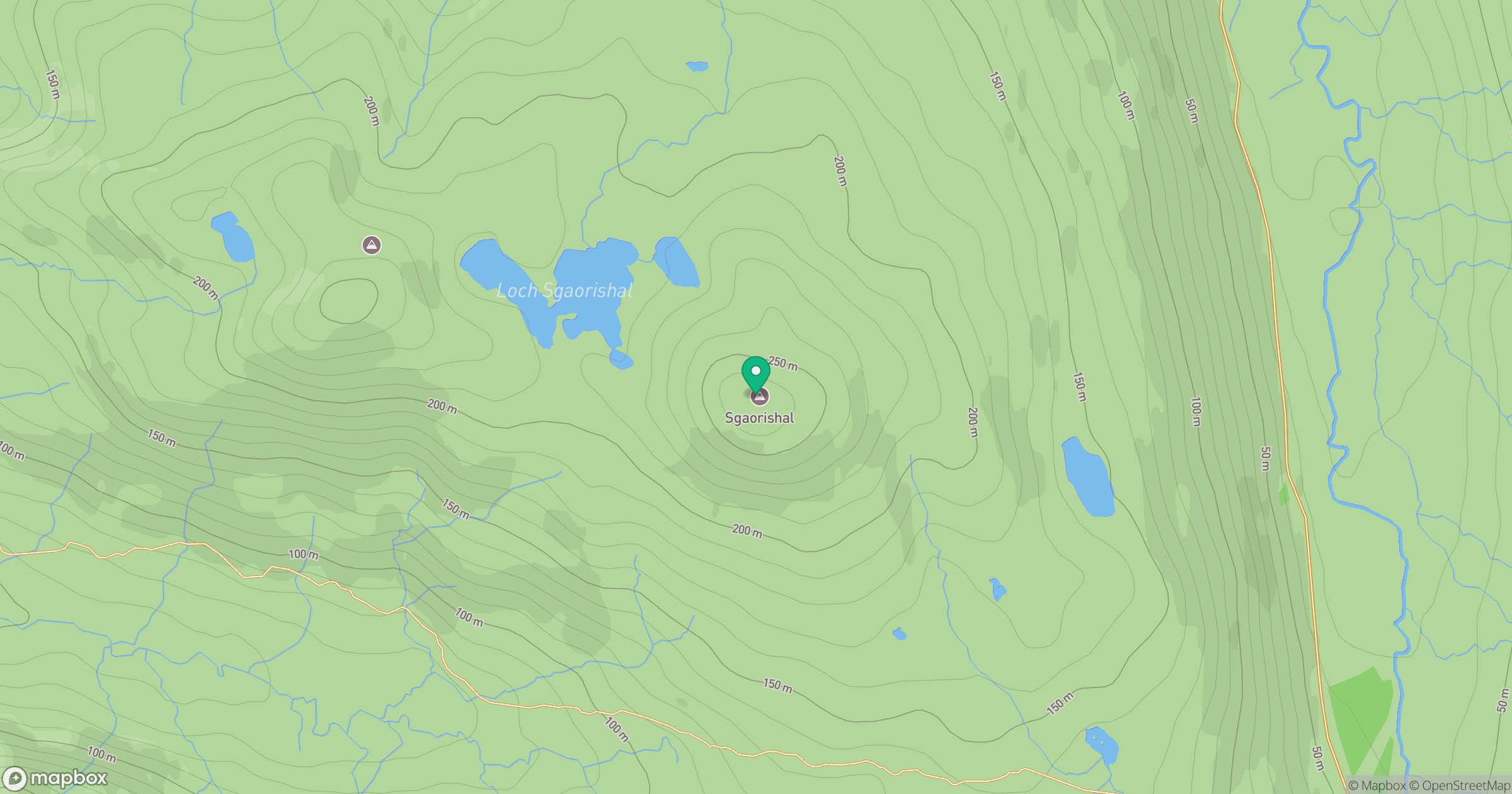
Grid reference: NG351019
View on OpenStreetMapOpens a map in a new tab, centred on the hill.
Hills within 30 km
Straight-line distance, not a walking route or confirmation of access.
Askival
812m
Sgurr Dearg - Inaccessible Pinnacle
986m
Sgurr Alasdair
992m
Sgurr na Banachdich [Sgurr na Banachdaich]
966m
Sgurr a' Ghreadaidh
972m
No comments yet. Be the first.