

Seathwaite Fell (Wainwright summit)
Good walks are even better shared.
NY2210 : Seathwaite Fell (Wainwright summit)
Rude Health Photo source
Overview
Introduction
Seathwaite Fell is a delightful gem in the heart of the Lake District, perfect for those seeking a hike that's not overly strenuous but rich in both beauty and history.
Geology
This summit boasts a robust geological foundation. Formed from ancient volcanic activity, the rock formations tell tales of geological processes spanning millions of years. The contrasting terrain, with its rocky outcrops and lush grassland, makes it a visually appealing challenge.
Routes
Seathwaite to Seathwaite Fell
This route begins in the quaint village of Seathwaite. The path meanders through picturesque farmland before ascending steadily to the summit. It’s a manageable trek for most walkers and ideal for a lovely afternoon.
Watendlath and Back
For the more adventurous, the circular route from Watendlath takes you through breathtaking scenery, allowing you to soak up the beauty of the lakes and surrounding fells. It's a perfect combination of challenge and reward.
Terrain
Be prepared for a variable terrain; while parts are grassy and inviting, others may test your footwork with rocky patches! Good footwear will keep you steady on your feet.
Views
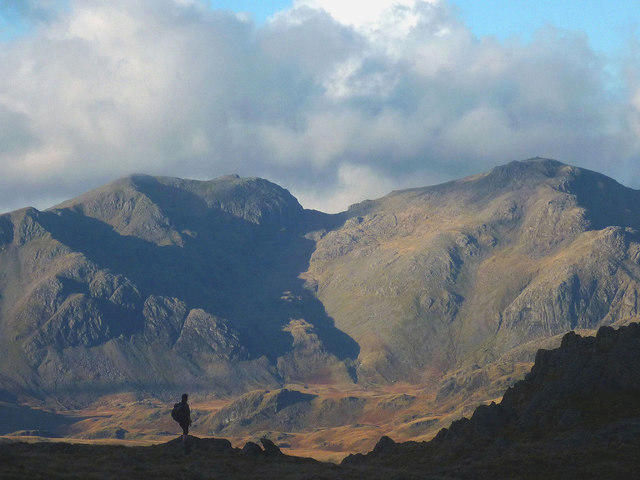
The views from the summit are simply stunning, with the Langdale Pikes dominating the horizon and Thirlmere Reservoir glistening below. For a truly picturesque experience, aim for a clear day in spring or early autumn.
Hazards
As always in the great outdoors, keep your wits about you! Wet weather can make the paths slippery and boggy, so tread carefully and consider your choices if the skies darken.
Access and Facilities
Parking is conveniently located at the National Trust car park in Seathwaite. After your hike, don’t miss a chance to visit the local tea room for a well-deserved treat. Public transport is available but check schedules, as they can be a little spotty off-peak.
Conclusion
Seathwaite Fell offers a superb blend of natural beauty, manageable hiking, and a taste of local culture. Whether you’re a seasoned hiker or a casual walker, its charms are sure to enchant. Happy hiking!
Explore routes near Seathwaite Fell (Wainwright summit)
Walks starting near this hill. Open a route to check its map, distance and full itinerary.
Scafell Pike from Seathwaite via the Corridor Route
View route
Scafell Pike via Brown Tongue and Hollow Stones
View route
Bow Fell from Langdale
View route
Great Carrs Halifax Wreckage from Wrynose Pass
View route
Route planning notes
These notes describe possible approaches. Check a route's map and access information when planning your walk.
Stockley Bridge via Styhead Tarn
This route begins from Seathwaite Farm, following the well-trodden path to Stockley Bridge. From there, head up the steep ascent towards Styhead Tarn, enjoying the scenic views along the way. From Styhead Tarn, turn northwest and follow the faint path to the Wainwright summit of Seathwaite Fell. Retrace your steps to return.
Grains Gill and Glaramara Approach
Starting from Seathwaite Farm, follow the path alongside Grains Gill, ascending gradually towards the base of Glaramara. Turn west to traverse the ridge leading to Seathwaite Fell’s summit. This route offers expansive views of the Borrowdale valley. Return via the same path.
Styhead Pass Circular
From Seathwaite Farm, head up to Stockley Bridge and ascend the path towards Styhead Pass. At the pass, take the path heading south to the Wainwright summit of Seathwaite Fell. Descend via the western flank of the fell, looping back to Stockley Bridge and Seathwaite Farm.
Sprinkling Tarn via Esk Hause
Begin at Seathwaite Farm and follow the path alongside Grains Gill to Esk Hause. From Esk Hause, head towards Sprinkling Tarn. From here, ascend to the Wainwright summit of Seathwaite Fell. Return via Styhead Pass and Stockley Bridge.
Direct Ascent from Seathwaite Farm
This shorter route starts at Seathwaite Farm and heads directly up the southern slopes of Seathwaite Fell. While steep and less defined, it is a direct way to reach the Wainwright summit. Descend via the same path.
Make a day of it, together
Find someone to share the walk with, or organise a day out along a route you like.
Photo Gallery
View all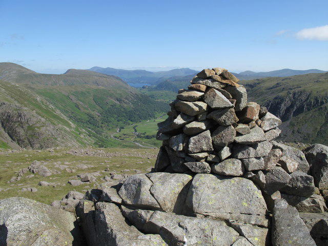 Photo could not load
NY2210 : Seathwaite Fell (Wainwright summit)
Rude Health
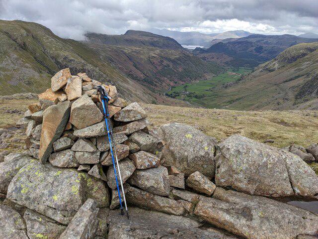 Photo could not load
NY2210 : A cairn on Seathwaite Fell
David Medcalf
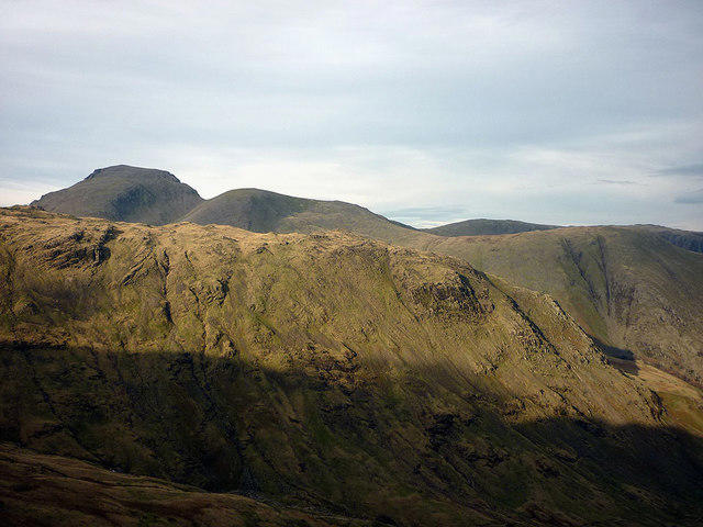 Photo could not load
NY2210 : Seathwaite Fell and the Gables
Karl and Ali
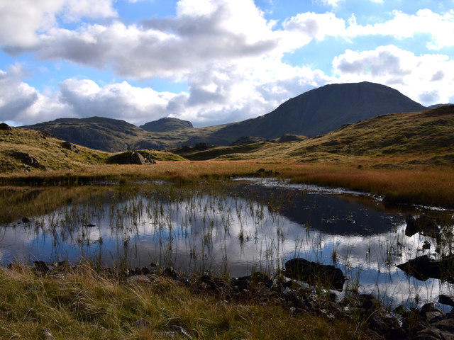 Photo could not load
NY2210 : Great End from Seathwaite Fell
Clive Giddis
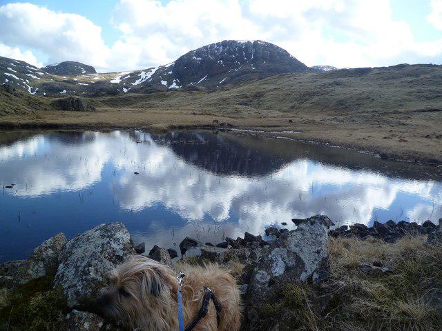 Photo could not load
NY2210 : Tarn, Seathwaite Fell
Michael Graham
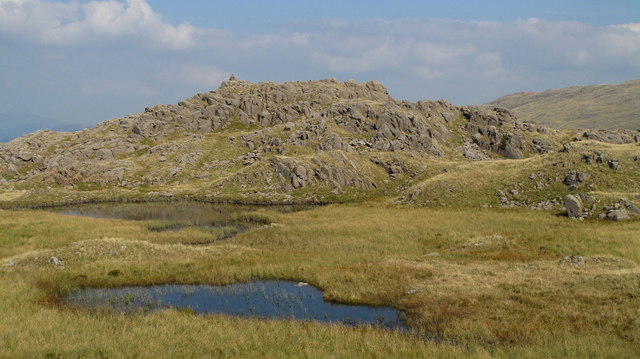 Photo could not load
NY2210 : Tarns on Seathwaite Fell
Trevor Littlewood
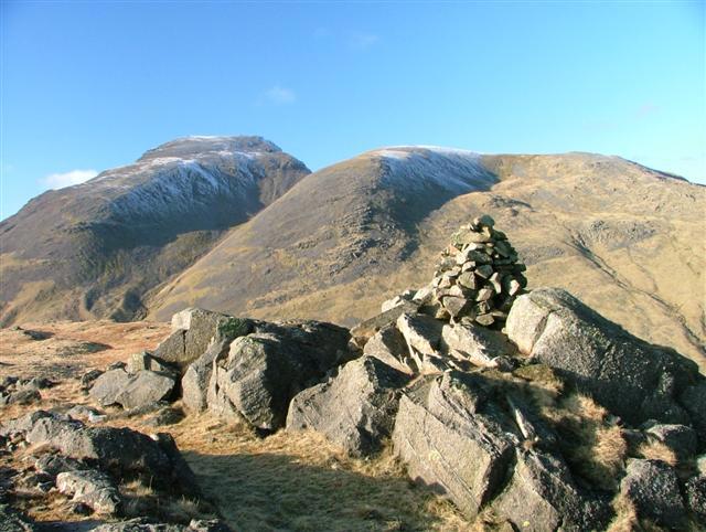 Photo could not load
NY2210 : Seathwaite Fell, Cairn at 601m Top
Mick Garratt
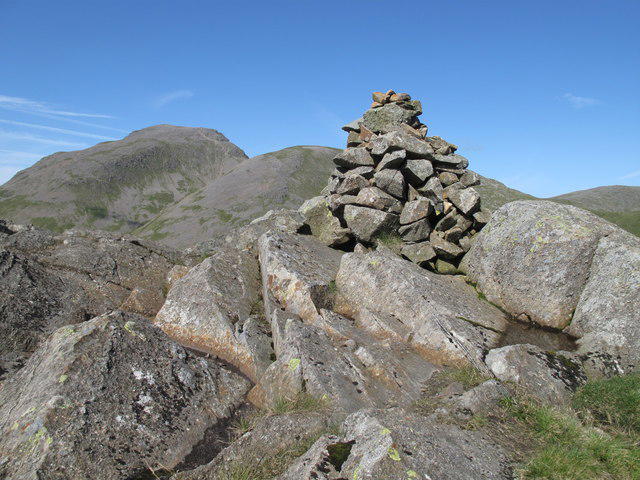 Photo could not load
NY2210 : Seathwaite Fell (Wainwright summit)
Rude Health
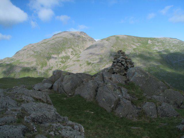 Photo could not load
NY2210 : Seathwaite Fell's Summit & Cairn
K A
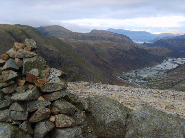 Photo could not load
NY2210 : Cairn, Seathwaite Fell
Michael Graham
Hill facts and local notes
Classifications
Elevation
601m
1,972 ft
Prominence
14m
Coordinates
54.4810, -3.1913
NY229101
OS Map
89 90
Explorer: OL4S OL6N
At the Summit
At the summit, you'll find a modest stone cairn, a testament to the many adventurers who have trodden this path. A small trig point offers a perfect backdrop for that 'I've made it!' selfie.
Terrain & Geology
The fell is primarily composed of volcanic rock, specifically andesite and tuff, creating a rugged landscape that has stood the test of time. Glacial activity has shaped the fell, leaving behind striking geological features.
Views & Scenery
From the summit, you can gaze upon the majestic Langdale Pikes and the tranquil waters of the nearby tarns, including the iconic Thirlmere Reservoir.
History & Heritage
Name Origin
The name 'Seathwaite' suggests 'the place by the brook,' with 'thwaite' indicating a clearing in the forest.
Historical Significance
Used by outdoor enthusiasts and climbers since at least the early 20th century, it forms part of the traditional scenic routes celebrated in Alfred Wainwright's guidebooks.
Getting There & Facilities
Parking
The nearest parking is in the village of Seathwaite at the National Trust car park. Be sure to arrive early, as it can fill up quickly on weekends.
Public Transport
Buses from Keswick and Ambleside frequently run to the Seathwaite area during the summer months, but service is limited in the winter.
Nearby Facilities
There are no facilities directly on the fell, but the village of Seathwaite has a charming tea room where one can refuel with a slice of cake after the climb.
Safety Information
Known Hazards
- Watch out for slippery paths, especially after rain. The terrain can be boggy in places, so sturdy boots are a must.
General Safety Tips
- Check weather conditions before setting out
- Carry appropriate clothing and equipment
- Let someone know your planned route
- Take a map, compass, and GPS device
- Carry emergency supplies: food, water, first aid kit, torch
Hills
Some common questions about the hills answered
Are there group walks up Seathwaite Fell (Wainwright summit)?
Many walkers use Walkmates to join or organise walks with others. You can check for group walks around Seathwaite Fell (Wainwright summit) through the maps
Are there other walkers around Seathwaite Fell (Wainwright summit)?
Activity varies by location and time, but Walkmates lets you see whether others have shared walks or shown interest in this area. Find other people through the walking friends search walking friends for Seathwaite Fell (Wainwright summit) search or of course create your own walk for Seathwaite Fell (Wainwright summit)
Can I organise a walk to Seathwaite Fell (Wainwright summit)?
Yes. If there aren’t any walks listed already, you can create a walk and make it available for others to join.
If you're signed up to Walkmates, you can create a walk to Seathwaite Fell (Wainwright summit).
How do I find a walk up this hill?
There are often multiple ways to walk this hill, depending on experience and route preference. Walkmates helps you explore walks and routes that others have shared.
Can I suggest a new route up Seathwaite Fell (Wainwright summit)?
Yes. You can suggest or create routes to share with others. Walkmates focuses on the social side of walking, so routes are used to help people organise walks and explore areas together, rather than as detailed navigation tools or route libraries.
Other uses really appreciate knowledgeable walkers sharing their routes. Share your favourite route to Seathwaite Fell (Wainwright summit) here
The is an error or something incorrect about this hill. How do I let you know?
We always strive to keep the information on Walkmates as accurate as possible. If you find an error, please let us know through the contact form and we'll aim to correct it as quickly as possible
Community Discussion
Comments
Location
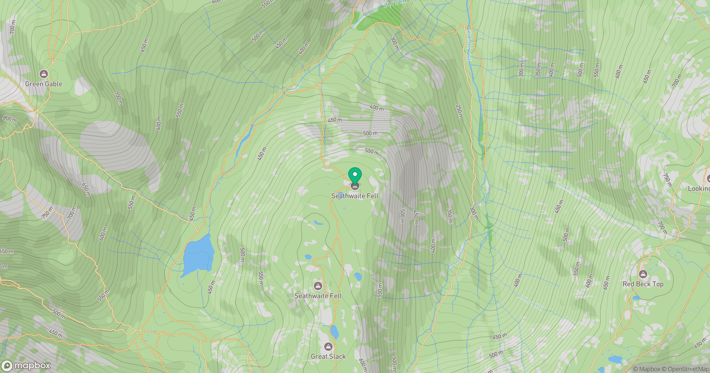
Grid reference: NY229101
View on OpenStreetMapOpens a map in a new tab, centred on the hill.
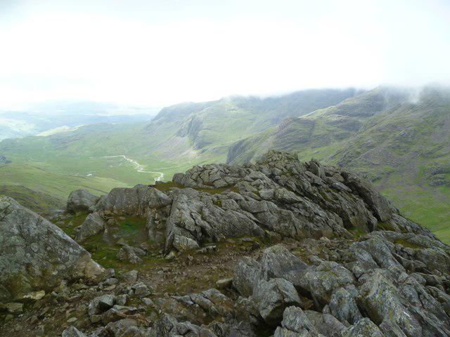

No comments yet. Be the first.