

Scrabo Hill
Good walks are even better shared.
J4772 : Scrabo Tower
N Chadwick Photo source
Overview
Scrabo Hill is a 161 m hill west of Newtownards, overlooking Strangford Lough and North Down. Scrabo Tower, woodland and former sandstone quarries give it its character. North Quarry access and tower entry are currently closed; check notices before planning a visit.
Scrabo Hill
Scrabo Hill rises to 161 m west of Newtownards in County Down, with views over Strangford Lough and North Down. Its hilltop tower is a prominent landmark. The hill record does not identify a precise summit marker.
Walking and access
A short outing follows the tarmac summit approach from the main country-park car park and returns along the same path. The longer published quarry circuit is affected by the North Quarry closure for replacement steps. Follow local barriers and check for reopening before planning that circuit.
The Department for Communities currently lists Scrabo Tower as closed to public entry. Country-park access is separate and admission is free. The council visitor page lists year-round pedestrian access and both car parks as open around the clock, with toilets from 10:00 to 16:00. Temporary notices take priority.
Organised group activities require prior written permission from NIEA under the park’s published visitor conditions. Contact [email protected] when arranging a group visit. There is a picnic area; bring drinks and food. Use Translink’s journey planner for travel to Newtownards and plan the onward approach separately.
Landscape and history
The former quarries reveal Triassic sandstone cut by younger dolerite intrusions. A resistant dolerite cap helped preserve the hill during erosion. The sandstone records desert conditions interrupted by floods, and the site is protected for its geological interest.
Scrabo Tower was erected in the 1850s as a memorial to the third Marquess of Londonderry. Its walls combine basalt rubble with sandstone details. A language column crediting Queen’s University Belfast’s Place-Name Project derives Scrabo from Irish Screabach, referring to stony ground.
Care on the hill
Expect uphill paths and steps on the quarry routes. Take care crossing the road, stay on permitted paths away from quarry edges, and keep dogs under close control. Avoid disturbing nesting birds.
Explore routes near Scrabo Hill
Walks starting near this hill. Open a route to check its map, distance and full itinerary.
Belfast street-art walk
View route
Belfast street-art walk
View route
Lagan Towpath: Shaw's Bridge to Drumbeg Footbridge
View route
Drumbeg to Hilden Bridge: Lagan Towpath, Lambeg and Canal Locks
View route
Route planning notes
These notes describe possible approaches. Check a route's map and access information when planning your walk.
Main car park to Scrabo summit and back
From the main country-park car park, cross the road and climb the tarmac path past the picnic-area turn to the hilltop beside Scrabo Tower. Return all the way along the same path to the car park, without taking the quarry branches. This reverses the summit approach shown by OutmoreNI. Check local signs; tower entry is currently closed.
Summit and quarry circuit: North Quarry closed
North Quarry access is closed for step replacement, so do not attempt this circuit through the closure. OutmoreNI’s normal itinerary starts at the main car park, climbs to the tower, descends via the picnic area to South Quarry, then visits North Quarry. Steps lead to a four-way junction, where the route continues ahead to rejoin the outward path and return to the car park. Check for confirmed reopening before planning the full circuit.
Make a day of it, together
Find someone to share the walk with, or organise a day out along a route you like.
Photo Gallery
View all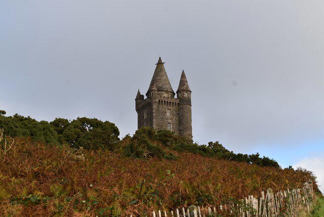 Photo could not load
J4772 : Scrabo Tower
N Chadwick
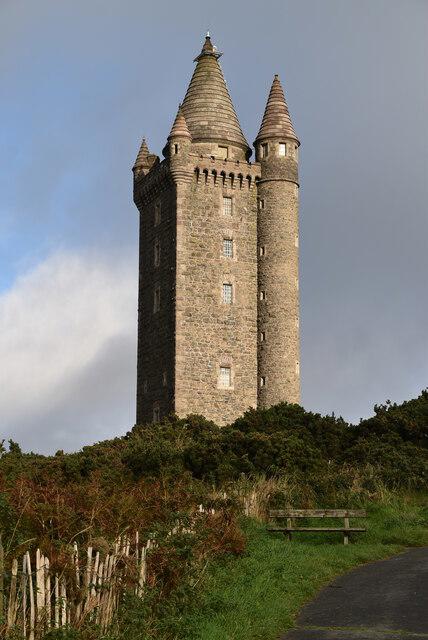 Photo could not load
J4772 : Scrabo Tower
N Chadwick
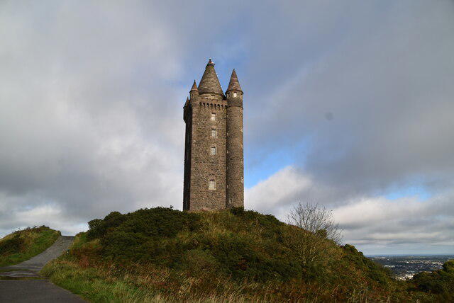 Photo could not load
J4772 : Scrabo Tower
N Chadwick
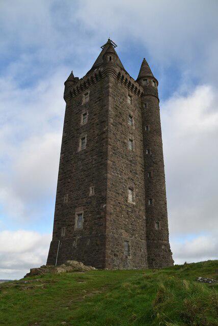 Photo could not load
J4772 : Scrabo Tower
N Chadwick
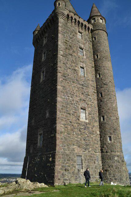 Photo could not load
J4772 : Scrabo Tower
N Chadwick
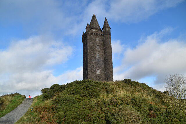 Photo could not load
J4772 : Scrabo Tower
N Chadwick
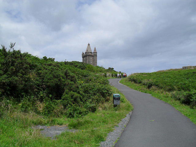 Photo could not load
J4772 : Path up to Scrabo Tower
Dean Molyneaux
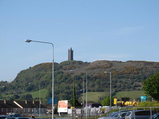 Photo could not load
J4772 : Scrabo Tower from Frederick Street, Newtownards
Eric Jones
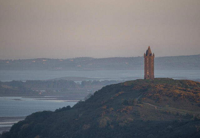 Photo could not load
J4772 : Scrabo Tower
Rossographer
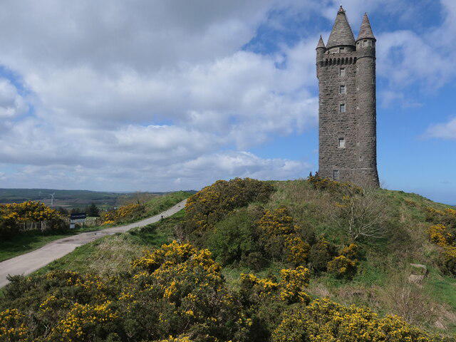
J4772 : Scrabo Hill and Scrabo Tower
Christine Johnstone
Hill facts and local notes
Classifications
Elevation
161m
528 ft
Prominence
92m
Coordinates
54.5801, -5.7164
J477726
OS Map
15
At the Summit
Scrabo Tower is the conspicuous hilltop landmark. DoBIH records no summit marker for Scrabo Hill. The Department for Communities currently lists the tower as closed to public entry.
Terrain & Geology
Triassic rocks of the Sherwood Sandstone Group are cut by younger dolerite sills and dykes. The resistant dolerite cap helped protect the softer sandstone from erosion. The old quarries expose these contacts and sedimentary structures, and Scrabo is designated an Area of Special Scientific Interest for its geology.
Views & Scenery
Views over Strangford Lough and the surrounding North Down countryside.
History & Heritage
Name Origin
An Irish News language column, crediting Queen’s University Belfast’s Place-Name Project, derives Scrabo from Irish Screabach, meaning light, stony ground or thinly covered rock.
Historical Significance
Scrabo Tower was erected in the 1850s as a memorial to the third Marquess of Londonderry. The listed-building record describes basalt-rubble walls with Scrabo-sandstone dressings. It is now in the care of the Department for Communities.
Getting There & Facilities
Parking
Use the main Scrabo Country Park car park off Scrabo Road; OutmoreNI’s start directions give J475722. The council visitor page lists both park car parks as open 24 hours, year-round. Follow any temporary signs or restrictions.
Public Transport
Use Translink’s journey planner for services to Newtownards and plan the onward approach to Scrabo Country Park separately. Check the return service before travelling.
Nearby Facilities
The park has a picnic area and toilets, listed as open 10:00–16:00. Bring refreshments. Published park conditions require prior written NIEA permission for organised group activities and commercial activities or events; contact [email protected]. Commercial-use charges may apply.
Safety Information
Known Hazards
- North Quarry access is closed for step replacement. Stay outside the closed section and obey barriers.
- Paths can be steep and include steps. Use grippy footwear, take care at the road crossing and keep away from quarry edges.
- Keep dogs under close control and avoid disturbing nesting birds.
General Safety Tips
- Check weather conditions before setting out
- Carry appropriate clothing and equipment
- Let someone know your planned route
- Take a map, compass, and GPS device
- Carry emergency supplies: food, water, first aid kit, torch
Hills
Some common questions about the hills answered
Are there group walks up Scrabo Hill?
Many walkers use Walkmates to join or organise walks with others. You can check for group walks around Scrabo Hill through the maps
Are there other walkers around Scrabo Hill?
Activity varies by location and time, but Walkmates lets you see whether others have shared walks or shown interest in this area. Find other people through the walking friends search walking friends for Scrabo Hill search or of course create your own walk for Scrabo Hill
Can I organise a walk to Scrabo Hill?
Yes. If there aren’t any walks listed already, you can create a walk and make it available for others to join.
If you're signed up to Walkmates, you can create a walk to Scrabo Hill.
How do I find a walk up this hill?
There are often multiple ways to walk this hill, depending on experience and route preference. Walkmates helps you explore walks and routes that others have shared.
Can I suggest a new route up Scrabo Hill?
Yes. You can suggest or create routes to share with others. Walkmates focuses on the social side of walking, so routes are used to help people organise walks and explore areas together, rather than as detailed navigation tools or route libraries.
Other uses really appreciate knowledgeable walkers sharing their routes. Share your favourite route to Scrabo Hill here
The is an error or something incorrect about this hill. How do I let you know?
We always strive to keep the information on Walkmates as accurate as possible. If you find an error, please let us know through the contact form and we'll aim to correct it as quickly as possible
Community Discussion
Comments
Location
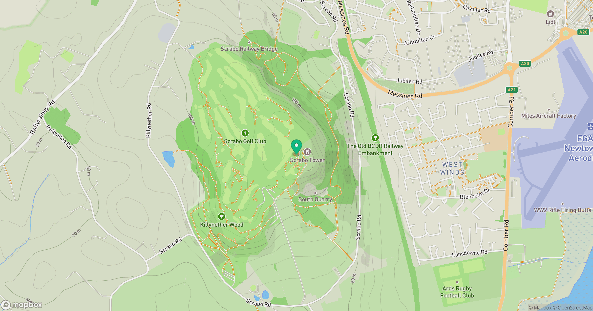
Grid reference: J477726
View on OpenStreetMapOpens a map in a new tab, centred on the hill.
No comments yet. Be the first.