

Muldersleigh Hill
Good walks are even better shared.
Overview
Muldersleigh Hill
Overview
Muldersleigh Hill, standing at a modest elevation of 376 meters, offers a delightful escape for hikers looking for a taste of the Peak District's beauty without having to scale great heights. With its gentle slopes and rocky terrain, it is a popular choice for families and casual walkers alike.
Geology
The hill is rich in limestone and sandstone, displaying fascinating geological features that tell stories of ancient seas. As you ascend, keep an eye out for unique rock formations and the striking limestone pavements, which are a feature of the Peak District.
Routes
One of the favourite routes to the summit is the picturesque path from Upper Hulme. This moderate trail, spanning approximately 5 km, showcases breathtaking views of the surrounding landscape and is lined with wildflowers in spring. It generally takes about 2.5 hours, making it perfect for those who enjoy a leisurely hike enveloped in nature’s embrace.
Summit Features
Reaching the summit, you’ll be greeted by a trig point that stands sentinel over the charming surroundings. Finding a comfy rock to plop down on is a must for enjoying your lunch or simply soaking in the panoramic views – just watch out for the cheeky sheep that may try to share your snack!
Terrain
The terrain is predominantly grassy with rocky outcrops to negotiate, giving the hike a bit of character. It’s worth mentioning; choose sturdy shoes to avoid any cheeky slips!
Views
From the top, the vistas are nothing short of spectacular. You can admire the undulating hills and valleys of the Peak District, with the towering presence of Shining Tor and Cats Tor in the distance. For the best views, aim to hike in spring or autumn when the air is crisp, and the colours are vibrant.
Hazards
Beware of the weather – it can change faster than a cat on a hot tin roof! Always be prepared with a waterproof jacket, and make sure your boots have good grip, especially on wet days.
Access
Parking is available at a quaint little car park in Upper Hulme, with enough spots for around 15 cars. Public transport is also handy, with buses running from nearby towns. The nearest town, Upper Hulme, beckons with its warm-hearted charm.
Facilities
While you won't find luxury shopping here, Upper Hulme has a delightful tea room that serves scrumptious cakes and teas – the perfect way to reward yourself after your hike! Toilets are conveniently located at the car park.
History
The mountain’s name, believed to mean 'mud hill', is a nod to the historical agricultural significance of the region. Over the years, the area has played a vital role in sheep farming, which remains part of its cultural legacy.
In summary, Muldersleigh Hill is not just a walk in the park; it's an invitation to connect with nature, learn a bit of history, and perhaps even challenge yourself to reach new heights – all while keeping an eye out for stray sheep, of course!
Happy hiking!
Explore routes near Muldersleigh Hill
Public walks starting within 80 km of this hill. Nearby does not mean a route reaches the summit; check its map and access before setting out.
Comber Greenway: Dee Street to Belfast Road
View route
Belfast street-art walk
View route
Lagan Towpath: Shaw's Bridge to Drumbeg Footbridge
View route
Drumbeg to Hilden Bridge: Lagan Towpath, Lambeg and Canal Locks
View route
Route planning notes
These notes describe possible approaches, not verified navigable routes or permission to cross land. Check current paths, local access rules and conditions before setting out.
From Upper Hulme
A scenic route starting from Upper Hulme, winding through the picturesque countryside and featuring gentle gradients, making it accessible for families and casual walkers. The backdrop of the Peak District makes every step worthwhile.
Make a day of it, together
Find someone to share the walk with, or organise a day out along a route you like.
Photo Gallery
View all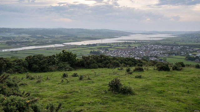 Photo could not load
J4793 : Larne Lough from Muldersleigh Hill
Rossographer
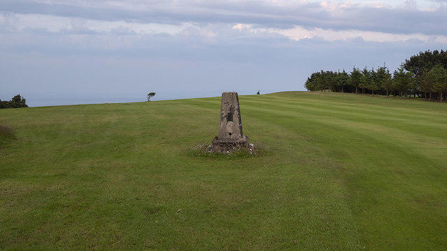 Photo could not load
J4793 : Muldersleigh Triangulation Pillar
Rossographer
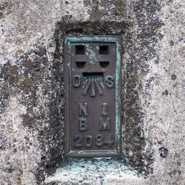 Photo could not load
J4793 : Flush Bracket, Muldersleigh Triangulation Pillar
Rossographer
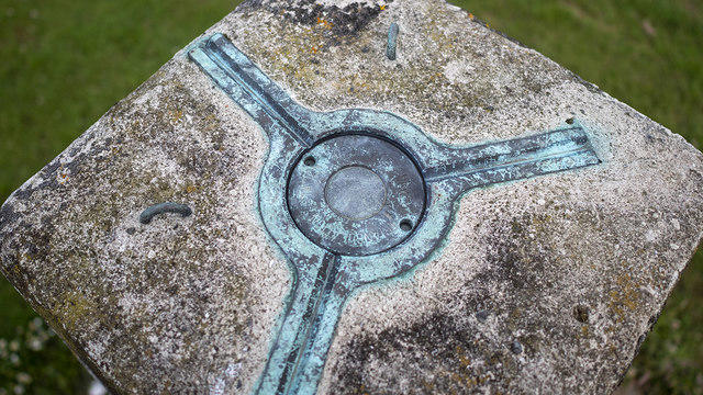 Photo could not load
J4793 : Spider, Muldersleigh Triangulation Pillar
Rossographer
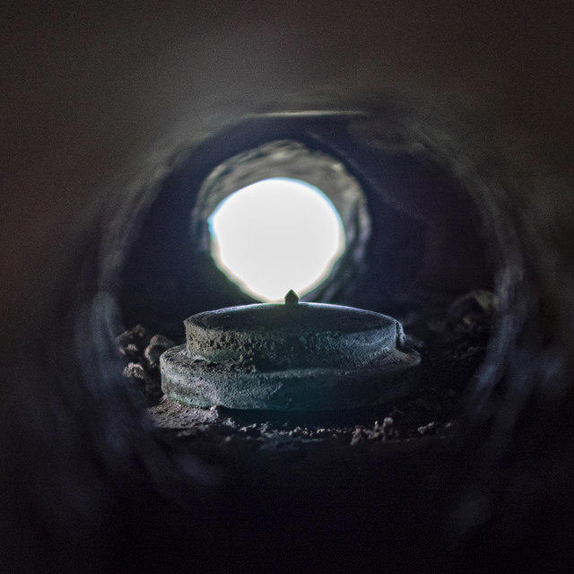 Photo could not load
J4793 : Centre Mark, Muldersleigh Triangulation Pillar
Rossographer
Hill facts and local notes
Classifications
Elevation
131m
430 ft
Prominence
106m
Coordinates
54.7703, -5.7026
J479938
OS Map
15
At the Summit
At the summit, you'll find a well-structured trig point, an ancient stone marker, along with a lovely rock outcrop that offers a perfect spot for a well-deserved snack break or a cheeky selfie.
Terrain & Geology
Muldersleigh Hill is primarily composed of limestone and sandstone, which form a unique landscape dotted with limestone pavements and rugged cliffs. The geological formations offer insights into the area's ancient history and the forces that shaped its current form.
Views & Scenery
From the summit, you can see the dramatic landscapes of the Peak District, including rolling hills, hidden valleys, and, on a clear day, even the distant spires of the town of Buxton.
History & Heritage
Name Origin
The name 'Muldersleigh' is believed to derive from local dialect, potentially meaning 'mud hill', reflecting the rich soil found in the area.
Historical Significance
Historically, the Peak District has served as a crucial area for agriculture and sheep farming, shaping the cultural landscape and the community's way of life.
Getting There & Facilities
Check current local access restrictions, parking rules and transport timetables before travelling. These notes do not confirm public access to the summit.
Parking
There is a small car park at Upper Hulme, which can hold about 15 vehicles. Make sure to arrive early on weekends, as it fills up quickly – you wouldn’t want to end up parking in the next county!
Public Transport
Regular bus services from nearby towns such as Buxton and Leek provide access to Upper Hulme, although it’s wise to check the latest timetable.
Nearby Facilities
While there are no cafes directly on the hill, Upper Hulme has a lovely tea room where you can indulge in a slice of homemade cake post-hike. Toilets are available at the car park.
Safety Information
Known Hazards
- Watch out for slippery paths after rain and sudden weather changes, as the Peak District is known for its capricious climate. Always pack a waterproof jacket, unless you fancy a spontaneous shower!
General Safety Tips
- Check weather conditions before setting out
- Carry appropriate clothing and equipment
- Let someone know your planned route
- Take a map, compass, and GPS device
- Carry emergency supplies: food, water, first aid kit, torch
Hills
Some common questions about the hills answered
Are there group walks up Muldersleigh Hill?
Many walkers use Walkmates to join or organise walks with others. You can check for group walks around Muldersleigh Hill through the maps
Are there other walkers around Muldersleigh Hill?
Activity varies by location and time, but Walkmates lets you see whether others have shared walks or shown interest in this area. Find other people through the walking friends search walking friends for Muldersleigh Hill search or of course create your own walk for Muldersleigh Hill
Can I organise a walk to Muldersleigh Hill?
Yes. If there aren’t any walks listed already, you can create a walk and make it available for others to join.
If you're signed up to Walkmates, you can create a walk to Muldersleigh Hill.
How do I find a walk up this hill?
There are often multiple ways to walk this hill, depending on experience and route preference. Walkmates helps you explore walks and routes that others have shared.
Can I suggest a new route up Muldersleigh Hill?
Yes. You can suggest or create routes to share with others. Walkmates focuses on the social side of walking, so routes are used to help people organise walks and explore areas together, rather than as detailed navigation tools or route libraries.
Other uses really appreciate knowledgeable walkers sharing their routes. Share your favourite route to Muldersleigh Hill here
The is an error or something incorrect about this hill. How do I let you know?
We always strive to keep the information on Walkmates as accurate as possible. If you find an error, please let us know through the contact form and we'll aim to correct it as quickly as possible
Community Discussion
Comments
Location
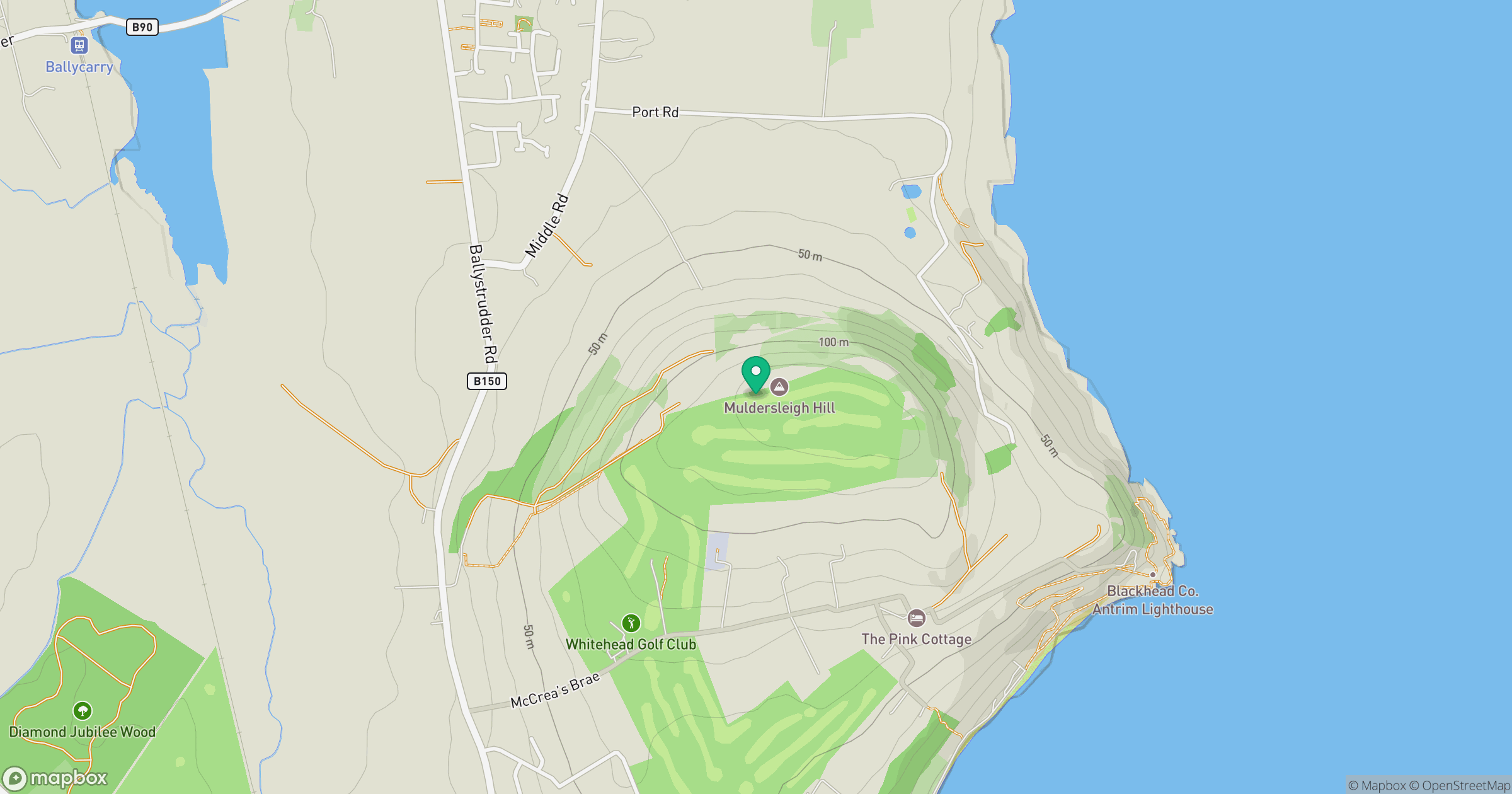
Grid reference: J479938
View on OpenStreetMapOpens a map in a new tab, centred on the hill.
Hills within 30 km
Straight-line distance, not a walking route or confirmation of access.
No comments yet. Be the first.