
Scar Hill
Good walks are even better shared.
Overview
Scar Hill: A Summit Adventure
Introduction
Scar Hill stands proud as a notable feature in the Lake District, boasting not only its own charm but also stunning views of the surrounding peaks.
Geology
The hill’s volcanic origins evoke a rugged appeal, as the andesite and granite rocks navigate the landscape in a way that can only be described as nature's own art show. Not only does this create fantastic scenery, but it also entertains hikers who get to walk over textures that have been shaped by eons of geological processes.
Routes
For those wishing to make the trek, start your journey at the Little Langdale parking area. This route, known affectionately as Wainwright's Walk, offers a well-maintained path winding through lush valleys and meandering woodlands before leading you to the summit. There’s no rush—enjoy the views!
Summit Features
Once at the top, you'll be greeted by a stone cairn that serves as a perfect spot to catch your breath and snap a selfie. Don’t forget the trig point, which, let’s be honest, is practically begging for a photo or two!
Terrain Type
Expect a blend of rocky, grassy patches interspersed with areas that might challenge your wellies on a rainy day. A little mud never hurt anyone, but it’s best to be prepared.
Views
The panoramic vistas from Scar Hill are nothing short of breathtaking. Look out for Crinkle Crags and the majestic Langdale Pikes standing sentinel over this picturesque landscape. Spring and autumn present the finest shows, with nature putting on colours so vibrant they could make a rainbow blush.
Hazards
Keep your wits about you! The weather in the Lake District can turn on a dime, and slippery rocks may await the unwary hiker. Always pack the essentials and remain vigilant.
Nearby Summits
After conquering Scar Hill, consider extending your adventure to nearby peaks like Crinkle Crags or Bowfell. There are great hiking links in the area that will make you feel like a true fell walker!
Access
Accessing Scar Hill is straightforward, with the nearest parking located conveniently in Little Langdale. Should public transport be more your speed, catch a bus from Ambleside, although be prepared for a short walk to the trailhead.
Facilities
Before or after your hike, why not treat yourself? Ample facilities, including welcoming cafes and toilets, can be found in Ambleside. Treat yourself to a slice of cake—it’s a hiker’s prerogative!
History
As you stroll across Scar Hill, consider the name’s origins. 'Scar' relates to its steepness, an appropriate moniker for a hill steeped in local folklore and history. A haven for sheep stealers in the past, there’s no doubt that the hill carries stories within its balmy slopes.
Conclusion
Scar Hill encapsulates the splendour of the English countryside. With lovely scenery, historical charm, and a fairly moderate trek, it’s a delightful addition to any hiker's itinerary. Lace up those boots and hit the trails!
Happy hiking!
Explore routes near Scar Hill
Public walks starting within 80 km of this hill. Nearby does not mean a route reaches the summit; check its map and access before setting out.
Loch Kinord: Muir of Dinnet Woodland Circuit
View route
Cairngorms night walk and stargazing (event meeting)
View route
Cairngorms night walk and stargazing (event meeting)
View route
Cairngorms night walk and stargazing (event meeting)
View route
Route planning notes
These notes describe possible approaches, not verified navigable routes or permission to cross land. Check current paths, local access rules and conditions before setting out.
Wainwright's Walk
Starting from the village of Little Langdale, this classic route meanders through scenic valleys and woodlands before ascending to the summit of Scar Hill. It's a beloved hike in the region.
Make a day of it, together
Find someone to share the walk with, or organise a day out along a route you like.
Hill facts and local notes
Classifications
Elevation
299m
981 ft
Prominence
109m
Coordinates
57.0997, -2.8583
NJ481013
OS Map
37
Explorer: OL54 OL59E 395 405E
At the Summit
The summit of Scar Hill boasts a prominent stone cairn and a trig point, ideal for that all-important summit photo. The views around are a treat for the eyes, so don't forget to look up!
Terrain & Geology
Scar Hill is primarily composed of volcanic rock, formed during the Variscan orogeny, which gives it a rugged and dramatic terrain. The underlying geology consists of andesite and granite formations, providing a sturdy base for the hill's scenic views.
Views & Scenery
From the summit, you can see the Coniston Fells and Langdale Pikes in the distance, as well as picturesque valleys that showcase the Lake District's natural beauty.
History & Heritage
Name Origin
The name 'Scar' in Scar Hill is derived from the Old Norse word 'skar', meaning a steep or rocky ledge, which aptly describes the hill's rugged features.
Historical Significance
Scar Hill has historically been a part of local folklore, with tales of sheep stealing and ancient inhabitants using its heights for shelter and lookout.
Getting There & Facilities
Check current local access restrictions, parking rules and transport timetables before travelling. These notes do not confirm public access to the summit.
Parking
Parking is available at the Little Langdale car park, which is a short walk from the start of the hike.
Public Transport
The nearest bus stop is in Ambleside, approximately 6 miles away, with connections to local bus services that reach the Langdale area.
Nearby Facilities
As you venture near Ambleside, you will find various cafes, shops, and public toilets to cater to your needs before or after your hike.
Safety Information
Known Hazards
- Be cautious of sudden weather changes as the terrain can become slippery when wet. The rocky sections might require careful foot placement, especially on steep inclines.
General Safety Tips
- Check weather conditions before setting out
- Carry appropriate clothing and equipment
- Let someone know your planned route
- Take a map, compass, and GPS device
- Carry emergency supplies: food, water, first aid kit, torch
Hills
Some common questions about the hills answered
Are there group walks up Scar Hill?
Many walkers use Walkmates to join or organise walks with others. You can check for group walks around Scar Hill through the maps
Are there other walkers around Scar Hill?
Activity varies by location and time, but Walkmates lets you see whether others have shared walks or shown interest in this area. Find other people through the walking friends search walking friends for Scar Hill search or of course create your own walk for Scar Hill
Can I organise a walk to Scar Hill?
Yes. If there aren’t any walks listed already, you can create a walk and make it available for others to join.
If you're signed up to Walkmates, you can create a walk to Scar Hill.
How do I find a walk up this hill?
There are often multiple ways to walk this hill, depending on experience and route preference. Walkmates helps you explore walks and routes that others have shared.
Can I suggest a new route up Scar Hill?
Yes. You can suggest or create routes to share with others. Walkmates focuses on the social side of walking, so routes are used to help people organise walks and explore areas together, rather than as detailed navigation tools or route libraries.
Other uses really appreciate knowledgeable walkers sharing their routes. Share your favourite route to Scar Hill here
The is an error or something incorrect about this hill. How do I let you know?
We always strive to keep the information on Walkmates as accurate as possible. If you find an error, please let us know through the contact form and we'll aim to correct it as quickly as possible
Community Discussion
Comments
Location
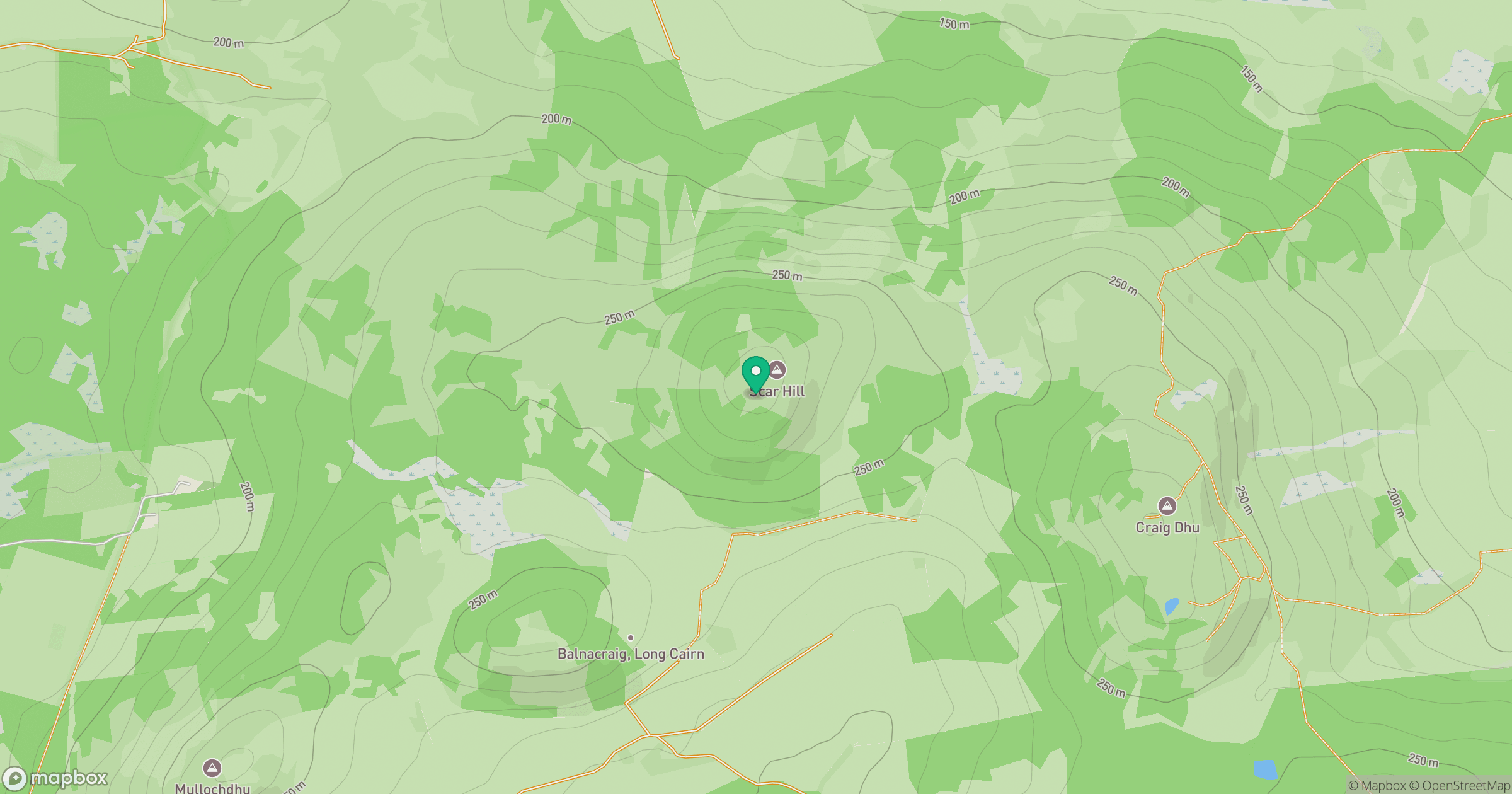
Grid reference: NJ481013
View on OpenStreetMapOpens a map in a new tab, centred on the hill.
Hills within 30 km
Straight-line distance, not a walking route or confirmation of access.
Bennachie - Oxen Craig
529m
Lochnagar - Cac Carn Beag
1,156m
Pressendye
619m
Craiglich
476m
Carnferg
525m
No comments yet. Be the first.