
Crannach Hill
Good walks are even better shared.
Overview
Crannach Hill: A Hidden Gem in the Southern Uplands
Nestled in the heart of the Southern Uplands, Crannach Hill stands proudly at an elevation of 317 meters, popular among walkers and nature enthusiasts eager to explore its scenic routes. With its ignimbritic volcanic rock, the hill is a geological treasure, reflecting the region's ancient past and offering a captivating blend of terrain.
Getting There
Accessing Crannach Hill is straightforward. The nearest parking can be found at the Glen Coyle car park, which provides a generous number of spaces and serves as the starting point for the popular Glen Coyle Route. For those relying on public transport, there are regular bus services from nearby towns, with the closest stop located in the village of Strathblane.
The Ascent
The route to the summit is approximately 7.5 km long and can be tackled comfortably in around 2.5 hours. Expect a moderate challenge as the trail winds through enchanting woodlands, eventually leading to open grassy slopes. Don’t forget to wear sturdy boots – your feet will thank you later!
Summit Experience
Reaching the summit is a rewarding experience. Upon arrival, climbers are greeted by a substantial stone cairn and a trig point, both excellent spots for a picture or two against the backdrop of stunning vistas. The surrounding peaks, including the Lowther Hills, stretch across the horizon, making it a photographer’s paradise.
When to Visit
The best times to enjoy the views are during spring and early autumn when the skies are clearer, and the temperatures are more favourable for hiking. But do not be fooled by a sunny forecast – always prepare for the unpredictable Scottish weather, where a sunny picnic can swiftly turn into a drenching rain shower!
Hazards to Note
As with any hike, be aware of the terrain. Post-rainy days can lead to slippery rocks, and parts of the trail may become boggy, so it's advisable to stay within marked paths.
Notable Nearby Summits
While Crannach Hill holds its own, nearby Dumgoyne (427 meters) offers an invigorating alternative for those itching for more elevation. The Lowther Hills are also a sight not to be missed!
Final Thoughts
Crannach Hill is more than just a hill; it's a little piece of nature that beckons to adventurers looking for a satisfying hike with magnificent views. Whether you fancy a leisurely stroll or a challenging ascent, this hidden gem offers something for everyone. Pack your snacks, head out early, and enjoy the splendid countryside!
Remember:
A solid pair of walking boots and a good sense of direction will go a long way in making your Crannach Hill adventure one for the books.
Happy hiking! ✨
Explore routes near Crannach Hill
Public walks starting within 80 km of this hill. Nearby does not mean a route reaches the summit; check its map and access before setting out.
Loch Kinord: Muir of Dinnet Woodland Circuit
View route
Cairngorms night walk and stargazing (event meeting)
View route
Cairngorms night walk and stargazing (event meeting)
View route
Cairngorms night walk and stargazing (event meeting)
View route
Route planning notes
These notes describe possible approaches, not verified navigable routes or permission to cross land. Check current paths, local access rules and conditions before setting out.
Glen Coyle Route
A scenic ascent starting from the Glen Coyle car park, this route meanders through lush woodland before climbing steadily.
Make a day of it, together
Find someone to share the walk with, or organise a day out along a route you like.
Hill facts and local notes
Classifications
Elevation
600m
1,969 ft
Prominence
133m
Coordinates
57.0937, -3.0185
NJ383007
OS Map
37
Explorer: OL59W 405W
At the Summit
At the summit, hikers will find a large stone cairn and a modest trig point, perfect for selfies and admiration of the views.
Terrain & Geology
Crannach Hill is primarily composed of ignimbritic volcanic rock, remnants of ancient volcanic activity. Its rugged terrain offers insights into the geological history of the region, showcasing layers of tuff and ash deposits.
Views & Scenery
From the summit, one can witness breathtaking views of the surrounding hills, particularly the distant peaks of the Lowther Hills and the rolling landscape of the Southern Uplands.
History & Heritage
Name Origin
The name 'Crannach' derives from the Gaelic 'Crann', meaning tree, alluding to the woodland that once covered the area.
Historical Significance
Crannach Hill has held cultural significance over the centuries, often used as a meeting point for local clans.
Getting There & Facilities
Check current local access restrictions, parking rules and transport timetables before travelling. These notes do not confirm public access to the summit.
Parking
Glen Coyle car park, which offers ample space for vehicles and is a well-marked starting point for the hike.
Public Transport
Regular bus services operate from nearby towns, with the closest bus stop situated in the village of Strathblane.
Nearby Facilities
Facilities in Milngavie include cafes, shops, and public toilets. A lovely cuppa awaits after your hike!
Safety Information
Known Hazards
- Watch out for slippery rocks after rainfall, and ensure to stay on path as the area can get boggy in spots.
General Safety Tips
- Check weather conditions before setting out
- Carry appropriate clothing and equipment
- Let someone know your planned route
- Take a map, compass, and GPS device
- Carry emergency supplies: food, water, first aid kit, torch
Hills
Some common questions about the hills answered
Are there group walks up Crannach Hill?
Many walkers use Walkmates to join or organise walks with others. You can check for group walks around Crannach Hill through the maps
Are there other walkers around Crannach Hill?
Activity varies by location and time, but Walkmates lets you see whether others have shared walks or shown interest in this area. Find other people through the walking friends search walking friends for Crannach Hill search or of course create your own walk for Crannach Hill
Can I organise a walk to Crannach Hill?
Yes. If there aren’t any walks listed already, you can create a walk and make it available for others to join.
If you're signed up to Walkmates, you can create a walk to Crannach Hill.
How do I find a walk up this hill?
There are often multiple ways to walk this hill, depending on experience and route preference. Walkmates helps you explore walks and routes that others have shared.
Can I suggest a new route up Crannach Hill?
Yes. You can suggest or create routes to share with others. Walkmates focuses on the social side of walking, so routes are used to help people organise walks and explore areas together, rather than as detailed navigation tools or route libraries.
Other uses really appreciate knowledgeable walkers sharing their routes. Share your favourite route to Crannach Hill here
The is an error or something incorrect about this hill. How do I let you know?
We always strive to keep the information on Walkmates as accurate as possible. If you find an error, please let us know through the contact form and we'll aim to correct it as quickly as possible
Community Discussion
Comments
Location
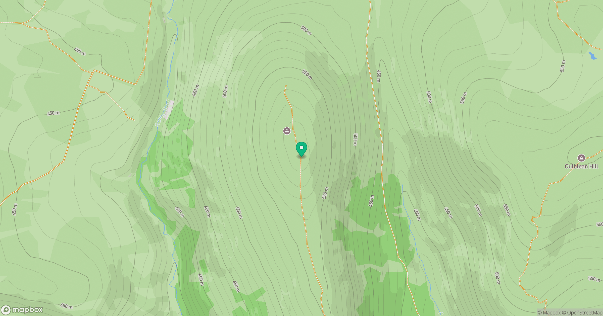
Grid reference: NJ383007
View on OpenStreetMapOpens a map in a new tab, centred on the hill.
Hills within 30 km
Straight-line distance, not a walking route or confirmation of access.
Lochnagar - Cac Carn Beag
1,156m
Driesh
948m
Ben Avon - Leabaidh an Daimh Bhuidhe
1,172m
Morven
872m
Craigendarroch
402m
No comments yet. Be the first.