

Sale Fell
Good walks are even better shared.
Overview
Sale Fell is a 359-metre Wainwright above Wythop, with open summit views and walks linking fellside, Chapel Wood and the old chapel.
Sale Fell
Sale Fell rises to 359 metres above Wythop, close to the northern end of Bassenthwaite Lake. It is one of the smaller Wainwrights in the North Western Fells, but its position on the edge of the mountains gives it a spacious outlook. The summit is an open grassy top with rock outcrops, rather than a craggy peak. Walks here can combine fellside paths, woodland and the remains of an old chapel.
Landscape and summit
Bassenthwaite lies east of the fell, with the Vale of Embleton to the north and the Wythop valley around its southern and western sides. Ling Fell stands across the valley to the west. The neighbouring tops of Rivings and Lothwaite extend the hill eastwards; they are useful features to distinguish on a map when planning a longer circuit.
The highest point is an outcrop at NY194296. There is no trig pillar, and the cairn described in older fell guides no longer survives. Do not make a conspicuous marker a condition of finding the summit. In clear weather the views include Bassenthwaite and the Skiddaw fells, the valley towards Cockermouth, and the Solway beyond. Low cloud can hide those reference points even on this modest hill.
Rocks beneath the grass
Sale Fell belongs to the older sedimentary landscape of the northern Lake District. Its Loweswater Formation includes greywacke sandstones with finer siltstone and mudstone beds. These began as marine sediments during the Ordovician, not as recent lava flows.
The rocks were subsequently folded intensely. Sale Fell gives its name to a major anticline, whose compressed layers can stand steeply or be overturned. Dodd Crag on the western side exposes smaller folds associated with this structure. Quartz veins and small igneous intrusions add detail to a landscape whose main bedrock story is sedimentary.
The two churches
The ruins near Kelswick and Chapel Wood belong to an earlier phase of worship in the Wythop valley. A chapel of ease was recorded in Wythop in 1552, and a later chapel stood near Kelswick in the seventeenth century. The present St Margaret's Church was built on a different site in 1865–66. Its fellside setting is part of the approach from the north, while the older site is reached on a longer circuit around the southern side.
The valley also has a long history of farming and woodland use. Wythop's oak timber was valued in the later seventeenth century. The juxtaposition of open pasture, fellside and woodland is therefore a useful reminder that this is a working landscape, not simply a backdrop to the summit. Leave gates as found and respect farm access and church property.
Choosing a walk
A compact summit walk starts from the lane near St Margaret's Church. The path climbs above the church to a bench and then branches onto the fell. The ascent can be varied, but the direct grassy line is steeper than the traversing paths. A return towards Dodd Crag gives a different view of the Wythop valley before rejoining the lower path.
For a broader circuit, the church-to-summit walk can continue past Kelswick, the old chapel and Chapel Wood before returning around the eastern side. This particular circuit is about 3.8 miles, or 6.1 kilometres, with a guide time of around two hours. That is an estimate for the full circuit, not the distance or time to the summit alone. Allow longer for stops, poor ground or a slower pace. A stream crossing on the return can be boggy after rain.
Ling Fell can be added as a separate climb, with a descent into the intervening valley. It is not an extension along a continuous summit ridge. Check the whole itinerary before combining the two.
Practical planning
Roadside space near the church is limited and informal. Keep the narrow lane, passing places and entrances clear, and choose another starting point if there is no suitable space. Do not assume that church parking is available to walkers.
Grassy slopes and worn paths can be slippery when wet or icy. Carry a map, weatherproof clothing and enough daylight for the route you choose. Gates and uneven ground mean that a short distance alone does not establish accessibility. Take refreshments and water with you rather than relying on facilities on the fell.
Explore routes near Sale Fell
Public walks starting within 80 km of this hill. Nearby does not mean a route reaches the summit; check its map and access before setting out.
Binsey from Binsey Lodge Direct Out and Back Wainwright
View route
Brae Fell from Longlands Wainwright
View route
Derwentwater Walk: full lakeside circuit from Keswick
View route
Mungrisdale Common and Bowscale Fell from Mosedale Valley Wainwright
View route
Route planning notes
These notes describe possible approaches, not verified navigable routes or permission to cross land. Check current paths, local access rules and conditions before setting out.
St Margaret's Church, summit and Chapel Wood circuit
A longer circuit over the summit, past Kelswick and the old chapel, returning through Chapel Wood and around the eastern side.
Make a day of it, together
Find someone to share the walk with, or organise a day out along a route you like.
Photo Gallery
View all Photo could not load
NY1929 : Wall, Sale Fell
Michael Graham
 Photo could not load
NY1929 : Southern Slope of Sale Fell
Mick Garratt
 Photo could not load
NY1929 : Mouse, Sale Fell
Michael Graham
 Photo could not load
NY1929 : On Sale Fell
Michael Graham
 Photo could not load
NY1929 : Declining eastern slope of Sale Fell
Trevor Littlewood
 Photo could not load
NY1929 : The summit area, Sale Fell [3]
Christine Johnstone
 Photo could not load
NY1929 : Sale Fell
Shaun Ferguson
 Photo could not load
NY1929 : The rounded summit of Sale Fell
Gordon Brown
 Photo could not load
NY1929 : On Sale Fell
Trevor Harris

NY1929 : The summit area, Sale Fell [2]
Christine Johnstone
Hill facts and local notes
Classifications
Elevation
359m
1,178 ft
Prominence
139m
Coordinates
54.6556, -3.2502
NY194296
OS Map
89 90
Explorer: OL4S
At the Summit
Outcrop at NY194296. No trig pillar; the cairn recorded in older guides no longer survives.
Terrain & Geology
Loweswater Formation sedimentary rocks of the Skiddaw Group, folded in the Sale Fell Anticline.
Views & Scenery
In clear weather: Bassenthwaite Lake, the Skiddaw fells, the Vale of Embleton, Cockermouth and the Solway.
History & Heritage
Historical Significance
The old chapel near Kelswick was replaced by St Margaret's Church on a new site in 1865–66. Farming and woodland use have long shaped the Wythop valley.
Getting There & Facilities
Check current local access restrictions, parking rules and transport timetables before travelling. These notes do not confirm public access to the summit.
Parking
Limited informal roadside space near St Margaret's Church, around NY190301. Keep entrances, passing places and the lane clear.
Safety Information
Known Hazards
- Wet or icy grass can be slippery.
- The longer Chapel Wood circuit includes a stream crossing and potentially boggy ground.
- Open ground requires navigation in low cloud.
General Safety Tips
- Check weather conditions before setting out
- Carry appropriate clothing and equipment
- Let someone know your planned route
- Take a map, compass, and GPS device
- Carry emergency supplies: food, water, first aid kit, torch
Hills
Some common questions about the hills answered
Are there group walks up Sale Fell?
Many walkers use Walkmates to join or organise walks with others. You can check for group walks around Sale Fell through the maps
Are there other walkers around Sale Fell?
Activity varies by location and time, but Walkmates lets you see whether others have shared walks or shown interest in this area. Find other people through the walking friends search walking friends for Sale Fell search or of course create your own walk for Sale Fell
Can I organise a walk to Sale Fell?
Yes. If there aren’t any walks listed already, you can create a walk and make it available for others to join.
If you're signed up to Walkmates, you can create a walk to Sale Fell.
How do I find a walk up this hill?
There are often multiple ways to walk this hill, depending on experience and route preference. Walkmates helps you explore walks and routes that others have shared.
Can I suggest a new route up Sale Fell?
Yes. You can suggest or create routes to share with others. Walkmates focuses on the social side of walking, so routes are used to help people organise walks and explore areas together, rather than as detailed navigation tools or route libraries.
Other uses really appreciate knowledgeable walkers sharing their routes. Share your favourite route to Sale Fell here
The is an error or something incorrect about this hill. How do I let you know?
We always strive to keep the information on Walkmates as accurate as possible. If you find an error, please let us know through the contact form and we'll aim to correct it as quickly as possible
Community Discussion
Comments
Location
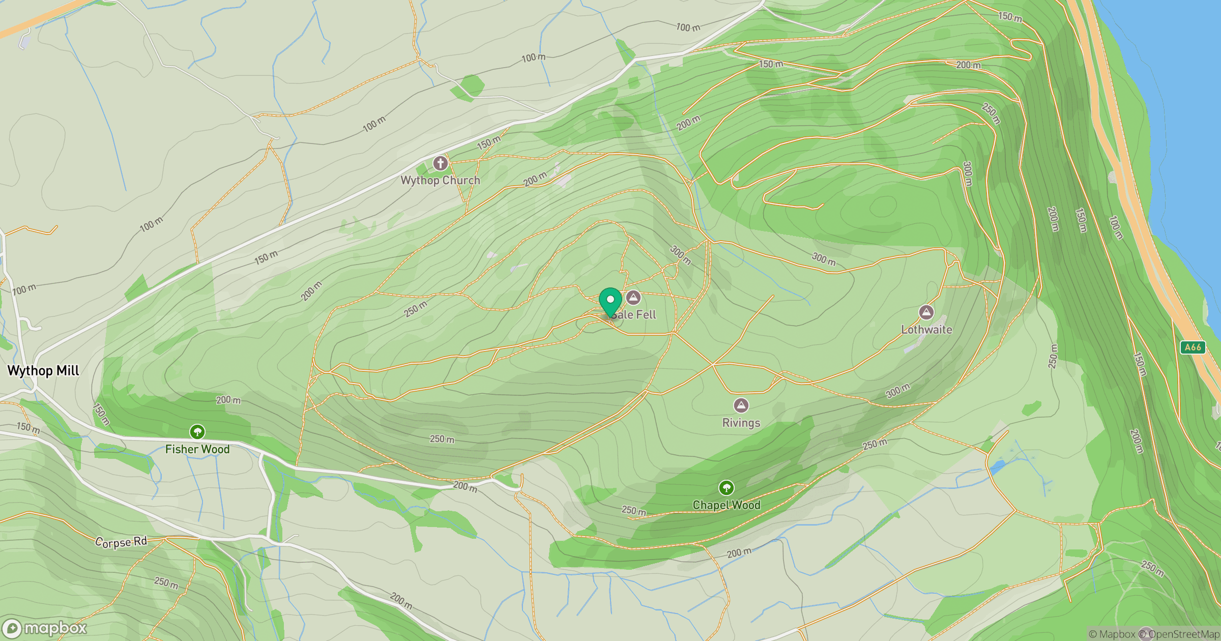
Grid reference: NY194296
View on OpenStreetMapOpens a map in a new tab, centred on the hill.
Hills within 30 km
Straight-line distance, not a walking route or confirmation of access.

Grisedale Pike
790m

Crag Hill [Eel Crag]
839m
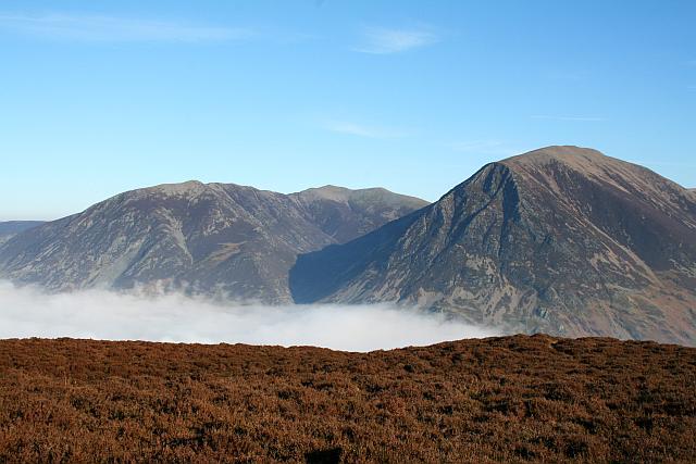
Grasmoor
852m
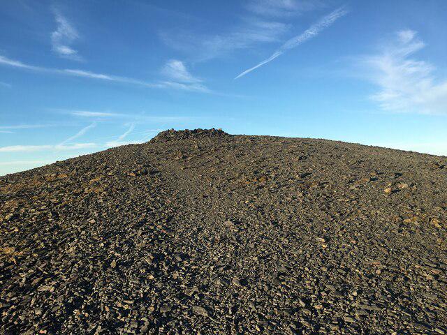
Skiddaw
930m
High Stile [Grey Crag - High Stile]
806m
No comments yet. Be the first.