

Robins Wood Hill
Good walks are even better shared.
SO8415 : Robinswood Hill Country Park
Derek Harper Photo source
Overview
Robins Wood Hill: A Hidden Gem for Outdoor Enthusiasts
Robins Wood Hill may not be the highest peak in the world, but what it lacks in elevation, it makes up for in charm. Standing at 216 meters, this hill is classified as a Hewitt, catering to hikers who prefer a gentle ascent.
Geology
Robins Wood Hill predominantly features sandstone, a testament to the natural processes that occurred eons ago. The unique geology of the hill creates interesting rock formations and helps support a diverse ecosystem of flora and fauna.
Routes
The Robins Wood Trail is the best route to explore, with a distance of around 5.5 km. It’s a lovely loop that typically takes about two hours to complete. Perfectly moderate, this trail welcomes both seasoned hikers and casual strollers.
Summit Features
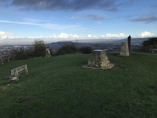
At the summit, you’ll find a small stone cairn—a lovely little spot for a snack and some photos. Don't forget to check the view indicator disc, guiding you towards landmarks that might just be calling your name.
Terrain
The terrain is primarily wooded, interspersed with occasional rocky outcrops as you approach the summit. Keep an eye out for the rocks; they can be a bit slippery when wet!
Views
From the top, the views are nothing short of picturesque. In good weather, you can admire the sweeping vistas of the Cotswolds and perhaps even spot the Malvern Hills on the horizon. The best times to enjoy these views are in spring and autumn, where the colours of nature put on a breathtaking show.
Hazards
As with any hike, there are a few hazards to keep in mind. The rocks can be slippery, especially after rain, and if you're wandering through the long grass, watch out for ticks. Always best to check yourself after a hike!
Nearby Summits
If you want to continue your adventure, consider heading over to Mickleton Hill, which stands a bit taller at 235 meters. A great add-on to your hiking itinerary.
Access
Getting to Robins Wood Hill is relatively simple. The nearest parking is at Chipping Campden, approximately 2 miles away, making it an easy walk to the trailhead. Public transport is available with regular bus services servicing this picturesque village.
Facilities
Once you're back from your adventure, treat yourself at the local café in Chipping Campden, perfect for a warm drink and a bite to eat. Restrooms are available too, which always comes in handy!
History
The name 'Robins Wood Hill' seems to reflect the abundance of robins in the area, further connecting nature to our outdoor experiences. Historically, this region has been integral to local agricultural practices, providing a glimpse into the farming traditions of yesteryear.
Embrace the spirit of adventure at Robins Wood Hill, and don't forget to bring your binoculars for wildlife watching! Your hike here promises to be rewarding in more ways than one.
Happy hiking!
Explore routes near Robins Wood Hill
Walks starting near this hill. Open a route to check its map, distance and full itinerary.
Woodchester Park: Tinkley Gate, lakes and Mansion woodland walk
View route
Cheltenham Walk with Men Walking & Talking
View route
Cirencester Walk with Men Walking & Talking
View route
Winchcombe and Belas Knap: Cotswold Way and Sudeley Valley circuit
View route
Route planning notes
These notes describe possible approaches. Check a route's map and access information when planning your walk.
Robins Wood Trail
A delightful loop trail starting from the nearby village, winding through lush woodlands and offering glimpses of the stunning landscape.
Make a day of it, together
Find someone to share the walk with, or organise a day out along a route you like.
Photo Gallery
View all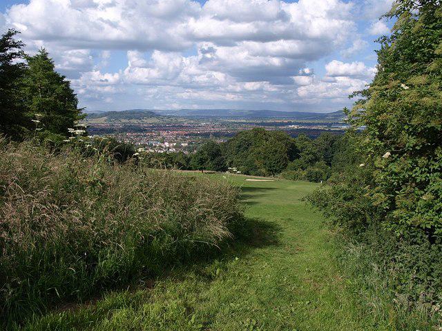 Photo could not load
SO8415 : Robinswood Hill Country Park
Derek Harper
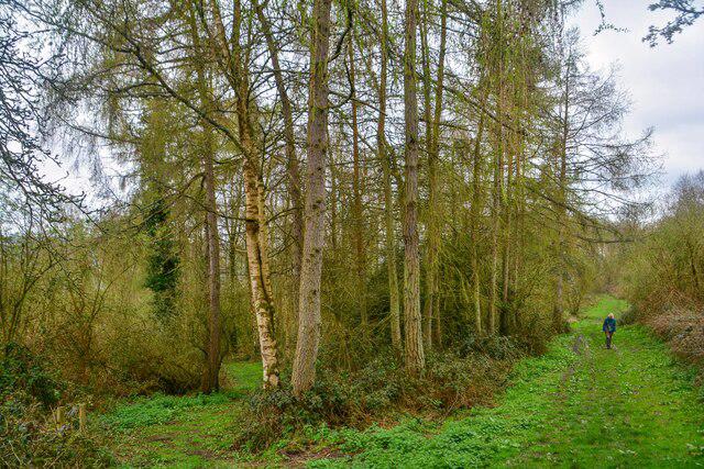 Photo could not load
SO8414 : Gloucester : Tuffley - Robinswood Hill
Lewis Clarke
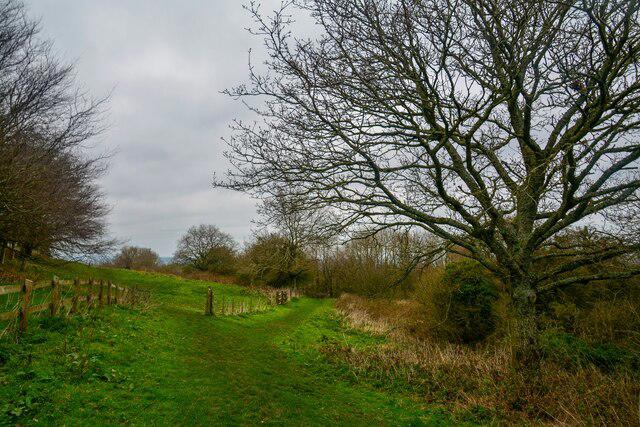 Photo could not load
SO8415 : Gloucester : Tuffley - Robinswood Hill
Lewis Clarke
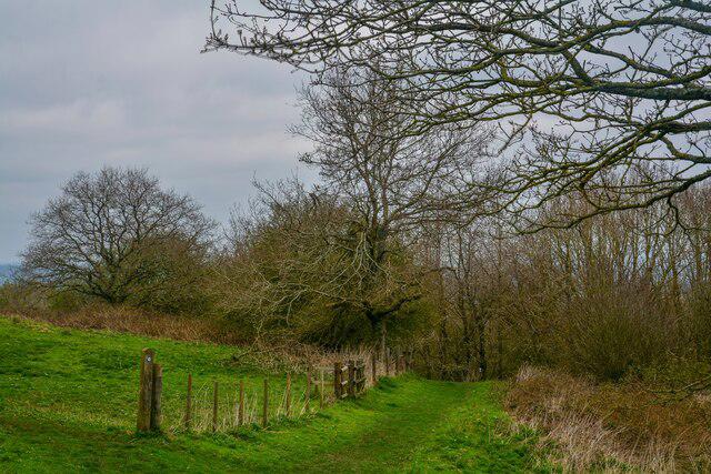 Photo could not load
SO8415 : Gloucester : Tuffley - Robinswood Hill
Lewis Clarke
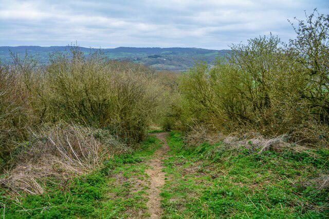 Photo could not load
SO8415 : Gloucester : Tuffley - Track
Lewis Clarke
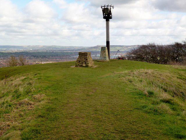 Photo could not load
SO8415 : Robins Wood Hill
Rude Health
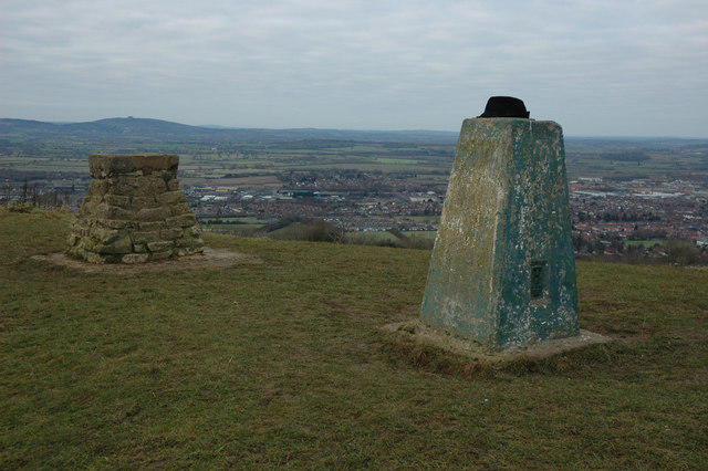 Photo could not load
SO8415 : Trig point, Robins Wood Hill
Philip Halling
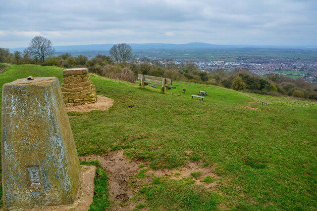 Photo could not load
SO8415 : Gloucester : Tuffley - Robinswood Hill
Lewis Clarke
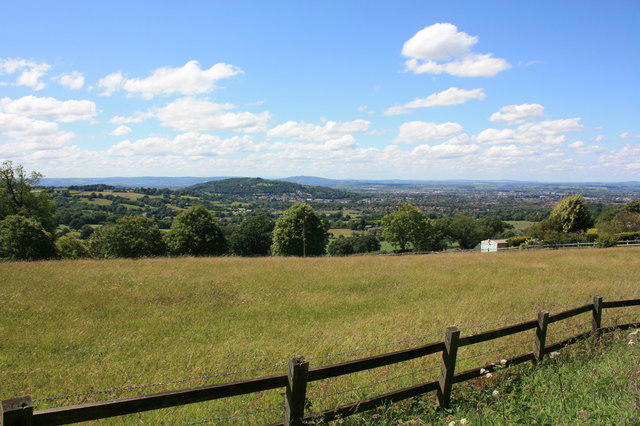 Photo could not load
SO8415 : Robinswood Hill, Gloucester
Colin Manton
SO8415 : Robins Wood Hill summit
don cload
Hill facts and local notes
Classifications
Elevation
198m
650 ft
Prominence
142m
Coordinates
51.8338, -2.2328
SO840150
OS Map
162
Explorer: 179
At the Summit
At the summit, adventurers will find a small stone cairn, providing a perfect spot for a well-deserved rest and photo opportunity. There's also a charming view indicator disc pointing out notable landmarks.
Terrain & Geology
Predominantly composed of sandstone, Robins Wood Hill showcases sedimentary rock formations that tell tales of ancient environments. The hill's gentle slopes are interspersed with interesting outcrops and a rich tapestry of woodland.
Views & Scenery
On a clear day, one can see the rolling hills of the Cotswolds and, if they're lucky, catch a glimpse of the Malvern Hills in the distance.
History & Heritage
Name Origin
The name 'Robins Wood Hill' possibly derives from local wildlife, as robins are abundant in the area, making the hill an ideal habitat.
Historical Significance
This area has been used historically for agriculture and woodland management, offering insights into rural practices over the centuries.
Getting There & Facilities
Parking
There is a small car park at the edge of the village of Chipping Campden, approximately 2 miles from the hill.
Public Transport
Buses run frequently from larger towns like Stratford-upon-Avon to Chipping Campden.
Nearby Facilities
The nearest facilities include a quaint café in Chipping Campden, providing tasty refreshments and restrooms for weary walkers.
Safety Information
Known Hazards
- The usual suspects: slippery rocks in wet weather and potential for ticks in grassy areas.
General Safety Tips
- Check weather conditions before setting out
- Carry appropriate clothing and equipment
- Let someone know your planned route
- Take a map, compass, and GPS device
- Carry emergency supplies: food, water, first aid kit, torch
Hills
Some common questions about the hills answered
Are there group walks up Robins Wood Hill?
Many walkers use Walkmates to join or organise walks with others. You can check for group walks around Robins Wood Hill through the maps
Are there other walkers around Robins Wood Hill?
Activity varies by location and time, but Walkmates lets you see whether others have shared walks or shown interest in this area. Find other people through the walking friends search walking friends for Robins Wood Hill search or of course create your own walk for Robins Wood Hill
Can I organise a walk to Robins Wood Hill?
Yes. If there aren’t any walks listed already, you can create a walk and make it available for others to join.
If you're signed up to Walkmates, you can create a walk to Robins Wood Hill.
How do I find a walk up this hill?
There are often multiple ways to walk this hill, depending on experience and route preference. Walkmates helps you explore walks and routes that others have shared.
Can I suggest a new route up Robins Wood Hill?
Yes. You can suggest or create routes to share with others. Walkmates focuses on the social side of walking, so routes are used to help people organise walks and explore areas together, rather than as detailed navigation tools or route libraries.
Other uses really appreciate knowledgeable walkers sharing their routes. Share your favourite route to Robins Wood Hill here
The is an error or something incorrect about this hill. How do I let you know?
We always strive to keep the information on Walkmates as accurate as possible. If you find an error, please let us know through the contact form and we'll aim to correct it as quickly as possible
Community Discussion
Comments
Location
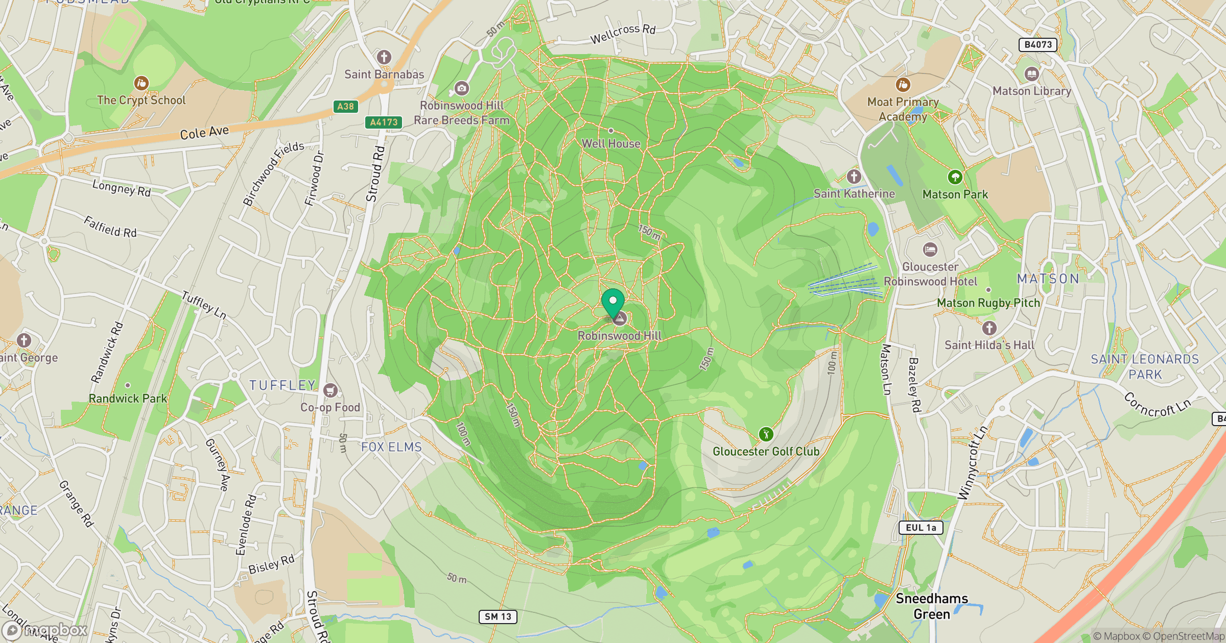
Grid reference: SO840150
View on OpenStreetMapOpens a map in a new tab, centred on the hill.
Nearby Hills
Worcestershire Beacon
425m
Titterstone Clee Hill
533m
Glastonbury Tor
158m

The Wrekin
407m
Long Mynd - Pole Bank
517m
No comments yet. Be the first.