

Povington Hill
Good walks are even better shared.
Overview
Povington Hill
Povington Hill, standing at an elevation of 166 metres, may not be the tallest of hills, but what it lacks in height, it more than makes up for in charm and scenery. Nestled in the lovely Dorset countryside, it offers a delightful escape for walkers and outdoor enthusiasts alike.
Geology
One of the defining features of Povington Hill is its interesting geology, predominantly consisting of chalk and clay. This combination creates a varied landscape, dotted with unique geological formations. It’s a great spot for those interested in the natural sciences—or just looking for an excuse to start a conversation with fellow hikers about rocks!
Access and Parking
Gaining access to Povington Hill is as easy as pie. The nearest parking can be found at the Wareham Forest Car Park, just 2 km from the hill’s base. If you fancy leaving your car at home, Wareham train station is your friend, providing a direct line from London and Poole, followed by a short bus ride to the trailhead. You’ll be off on your adventure before you know it!
The Route
The Povington Hill Circular Walk is a popular route that takes you around 8.5 km in total. This moderate hike typically takes about 2.5 hours to complete. You'll meander through beautiful forest scenery, enjoy the fresh air, and finally arrive at the summit, where a stone cairn awaits your arrival, cheering you on as you conquer yet another splendid peak.
Summit Features
At the summit, you'll find a stone cairn that marks the highest point, and it's the perfect place to pause, catch your breath, and soak in stunning views. Words can hardly do justice to the sight of Poole Harbour, the striking Corfe Castle, and the Purbeck Hills stretching into the distance. Just remember, the camera adds ten pounds, so don’t be shy!
Terrain
The terrain is mostly grassy and undulating, with a few rocky outcrops to keep things interesting. Watch your footing, as paths can get slippery following rain. Besides the occasional cattle grazing in the fields (they don't generally mind your company), it’s a peaceful place to hike.
Views
When it comes to views, Povington Hill doesn’t disappoint. The best times to visit for spectacular sights are late spring and early autumn when the landscape is either awash with wildflowers or a tapestry of autumn colours.
Hazards
As with any outdoor adventure, a few hazards warrant your attention. Slippery paths, especially after rain, demand caution. Also, be prepared for the possibility of encountering cattle grazing in the open fields—respect their space and they’ll respect yours!
Nearby Summits
If you’ve got the energy for more hills, nearby summits like Nine Barrow Down and Gorse Hill await your exploration. They may not have a welcoming stone cairn like Povington Hill, but they definitely offer their own unique rewards.
Facilities
Once you've conquered Povington Hill, quench your thirst at one of the charming cafes or pubs in Wareham. Public toilets can also be found in the town centre if nature calls.
Conclusion
Povington Hill is a delightful destination for hikers of all abilities. With its rich geology, stunning vistas, and a history that whispers tales of yore, it’s a perfect spot for a day out. So grab your boots, pack a sarnie, and set out on an adventure to discover what this lovely hill has to offer!
Explore routes near Povington Hill
Public walks starting within 80 km of this hill. Nearby does not mean a route reaches the summit; check its map and access before setting out.
Commoners’ Ways: Kingston, Corfe Castle and Blashenwell
View route
Durdle Door coastal walk
View route
Hardy's Cottage, Stinsford and Dorchester from Thorncombe Wood
View route
Weymouth to Sandsfoot Gardens: Rodwell Trail and Radipole waterside return
View route
Route planning notes
These notes describe possible approaches, not verified navigable routes or permission to cross land. Check current paths, local access rules and conditions before setting out.
Povington Hill Circular Walk
A circular route starting from the village of Wareham that provides stunning views of the surrounding countryside and leads to the summit of Povington Hill.
Make a day of it, together
Find someone to share the walk with, or organise a day out along a route you like.
Photo Gallery
View all Photo could not load
SY8881 : Red Flag on Povington Hill
Bob Embleton
 Photo could not load
SY8881 : Gate onto the Army Ranges, Povington Hill
Trevor Harris
 Photo could not load
SY8881 : Povington Hill
Ian Capper
 Photo could not load
SY8881 : Sheep Grazing on Povington Hill
David Dixon
 Photo could not load
SY8881 : View from Povington Hill
Mr Ignavy
 Photo could not load
SY8881 : View from Povington Hill car park
Mr Ignavy
 Photo could not load
SY8881 : View from Povington Hill
Nigel Mykura
 Photo could not load
SY8881 : Povington Hill
David Dixon
 Photo could not load
SY8881 : Povington Hill
Pierre Terre

SY8881 : View from Povington Hill
Nigel Mykura
Hill facts and local notes
Classifications
Elevation
198m
650 ft
Prominence
34m
Coordinates
50.6299, -2.1586
SY888811
OS Map
194
Explorer: OL15E
At the Summit
The summit features a stone cairn and provides a natural viewing platform with lovely vistas of the surrounding landscape.
Terrain & Geology
Povington Hill is mostly comprised of chalk and clay, which offer a mix of scenic, rolling hills and unique geological formations. The underlying geology contributes to the rich biodiversity of the area.
Views & Scenery
From the summit, you can see Poole Harbour, Corfe Castle, and the Purbeck Hills stretching into the distance.
History & Heritage
Name Origin
Povington Hill's name is derived from the Old English 'Pofing', possibly referring to the people who lived in the area long ago.
Historical Significance
The hill has historical importance, serving as a lookout point throughout ancient history, and the surrounding area is rich with stories from various periods.
Getting There & Facilities
Check current local access restrictions, parking rules and transport timetables before travelling. These notes do not confirm public access to the summit.
Parking
There is parking available at the Wareham Forest Car Park, which is about 2 km from the hill's base.
Public Transport
Wareham train station is nearby, with regular services from London and Poole, followed by a short bus ride to the start point.
Nearby Facilities
There are cafes and pubs in Wareham offering refreshments, and public toilets can be found in the town centre.
Safety Information
Known Hazards
- Watch out for slippery paths after rain, and cattle may be grazing in the fields.
General Safety Tips
- Check weather conditions before setting out
- Carry appropriate clothing and equipment
- Let someone know your planned route
- Take a map, compass, and GPS device
- Carry emergency supplies: food, water, first aid kit, torch
Hills
Some common questions about the hills answered
Are there group walks up Povington Hill?
Many walkers use Walkmates to join or organise walks with others. You can check for group walks around Povington Hill through the maps
Are there other walkers around Povington Hill?
Activity varies by location and time, but Walkmates lets you see whether others have shared walks or shown interest in this area. Find other people through the walking friends search walking friends for Povington Hill search or of course create your own walk for Povington Hill
Can I organise a walk to Povington Hill?
Yes. If there aren’t any walks listed already, you can create a walk and make it available for others to join.
If you're signed up to Walkmates, you can create a walk to Povington Hill.
How do I find a walk up this hill?
There are often multiple ways to walk this hill, depending on experience and route preference. Walkmates helps you explore walks and routes that others have shared.
Can I suggest a new route up Povington Hill?
Yes. You can suggest or create routes to share with others. Walkmates focuses on the social side of walking, so routes are used to help people organise walks and explore areas together, rather than as detailed navigation tools or route libraries.
Other uses really appreciate knowledgeable walkers sharing their routes. Share your favourite route to Povington Hill here
The is an error or something incorrect about this hill. How do I let you know?
We always strive to keep the information on Walkmates as accurate as possible. If you find an error, please let us know through the contact form and we'll aim to correct it as quickly as possible
Community Discussion
Comments
Location
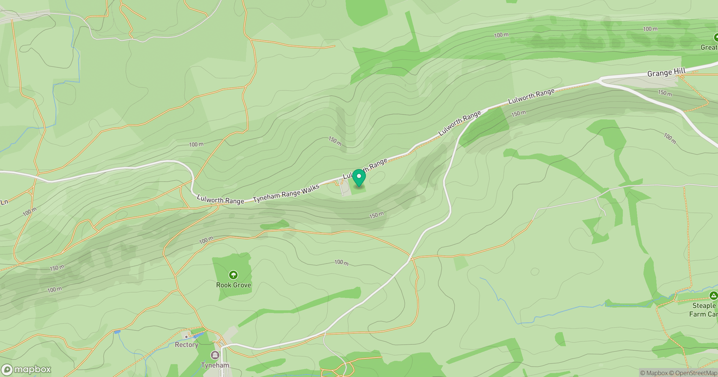
Grid reference: SY888811
View on OpenStreetMapOpens a map in a new tab, centred on the hill.
Hills within 30 km
Straight-line distance, not a walking route or confirmation of access.
No comments yet. Be the first.