
Rhos Fawr
Good walks are even better shared.
Overview
Rhos Fawr
Rhos Fawr, standing tall at 536 meters, is not only a Marilyn but also a delightful gem nestled in the scenic Cambrian Mountains. It presents an enticing challenge for walkers looking to explore the beauty of mid-Wales.
Geology
The mountain is primarily made up of Old Red Sandstone, which creates a unique and varied landscape. As you ascend, take a moment to ponder the millions of years of geological history that have shaped this striking region. Every rock has a story!
Routes
There are a couple of pleasant routes to tackle Rhos Fawr:
- Bwlch y Sarnau Approach: A 6.5 km trek that’s moderately easy on the feet and offers plenty of scenic views along the way. Great for enjoying a saunter with mates!
- Llangedwyn to Rhos Fawr: This 9.3 km circular route offers the perfect opportunity to explore additional beautiful landscapes and ensures you get your exercise in, too!
Summit Features
Reaching the summit rewards hikers with a small cairn and wonderful views. It's fantastic for a break and maybe a biscuit or two while soaking in the convergence of hills.
Terrain
Expect grassy and rocky terrain, with a few boggy bits thrown in for good measure. Sturdy footwear is essential, lest you find yourself performing impromptu ballet on slippery rocks.
Views
On a good day, expect to see Cadair Idris and the stunning Brecon Beacons. Spring and autumn unveil the landscape in all its glory, with vibrant colours and crisp air.
Hazards
Slippery rocks can take you by surprise, especially post-rain. Stay vigilant, and avoid any unintended tumbleweed moments!
Access
The nearest parking is at Bwlch y Sarnau, and if you're taking the bus, you'll want to hop off at Llangedwyn. Just a heads up, public transport may be a bit of a treasure hunt.
Facilities
Grab a coffee or a snack at a local café in Llangedwyn. Toilets are also available, ensuring you don't venture out into the wild unprepared.
History
The name Rhos Fawr translates to 'Big Wetland', aptly describing its lush surroundings. The charm of the area extends beyond the physical; local folklore adds an intriguing layer to this beautiful location.
Rhos Fawr isn’t just a mountain; it’s an experience not to be missed! Get out there, make some memories, and don’t forget to take plenty of photos. You might even find a rock that suits the monopoly game!
Explore routes near Rhos Fawr
Public walks starting within 80 km of this hill. Nearby does not mean a route reaches the summit; check its map and access before setting out.
Hafren Forest: full Source of the Severn Trail
View route
Elan Valley: Reservoir Trail to Pen y Garreg Dam
View route
Welshpool to Sweeps Bridge: Montgomery Canal and Belan Locks
View route
Waun-oer, Maesglase and Cribin Fawr guided mountain walk
View route
Route planning notes
These notes describe possible approaches, not verified navigable routes or permission to cross land. Check current paths, local access rules and conditions before setting out.
Bwlch y Sarnau Approach
A scenic route starting from Bwlch y Sarnau, gradually ascending through lush grasslands and rocky outcrops, perfect for those seeking to enjoy a peaceful walk with moderate elevation gain.
Llangedwyn to Rhos Fawr
A delightful circular route that allows hikers to explore both Rhos Fawr and its surrounding hills, starting from the charming village of Llangedwyn.
Make a day of it, together
Find someone to share the walk with, or organise a day out along a route you like.
Hill facts and local notes
Classifications
Elevation
307m
1,008 ft
Prominence
124m
Coordinates
52.4842, -3.4755
SN999883
OS Map
136
Explorer: 214W
At the Summit
The summit features a prominent rocky outcrop crowned with a small cairn, providing an ideal spot for enjoying a well-deserved sandwich and the panoramic views.
Terrain & Geology
Rhos Fawr is primarily composed of Old Red Sandstone, which forms a rugged landscape with coarse rock formations. The geology offers a fascinating glimpse into the area's ancient past, layered with the tales of time and tectonic giants.
Views & Scenery
On a clear day, summits such as Cadair Idris and the Brecon Beacons are visible, adding to the already breathtaking panorama.
History & Heritage
Name Origin
Rhos Fawr translates to 'Big Wetland', referring to the area's rich marshy landscapes in its lower regions.
Historical Significance
Rhos Fawr holds cultural significance in local folklore and has been a source of inspiration for many hikers and nature lovers.
Getting There & Facilities
Check current local access restrictions, parking rules and transport timetables before travelling. These notes do not confirm public access to the summit.
Parking
There is limited parking at Bwlch y Sarnau, with a small lay-by suitable for a few cars. Additionally, parking can be found in nearby Llangedwyn.
Public Transport
Public transport options are limited; however, there are bus services from Welshpool to Llangedwyn, followed by a hike to the trailhead.
Nearby Facilities
The nearest facilities, including cafes and toilets, can be found in the village of Llangedwyn, where you might also stumble across some lovely local charm.
Safety Information
Known Hazards
- Beware of slippery rocks, particularly after rain. The terrain can also be rugged in some areas, so appropriate footwear is recommended.
General Safety Tips
- Check weather conditions before setting out
- Carry appropriate clothing and equipment
- Let someone know your planned route
- Take a map, compass, and GPS device
- Carry emergency supplies: food, water, first aid kit, torch
Hills
Some common questions about the hills answered
Are there group walks up Rhos Fawr?
Many walkers use Walkmates to join or organise walks with others. You can check for group walks around Rhos Fawr through the maps
Are there other walkers around Rhos Fawr?
Activity varies by location and time, but Walkmates lets you see whether others have shared walks or shown interest in this area. Find other people through the walking friends search walking friends for Rhos Fawr search or of course create your own walk for Rhos Fawr
Can I organise a walk to Rhos Fawr?
Yes. If there aren’t any walks listed already, you can create a walk and make it available for others to join.
If you're signed up to Walkmates, you can create a walk to Rhos Fawr.
How do I find a walk up this hill?
There are often multiple ways to walk this hill, depending on experience and route preference. Walkmates helps you explore walks and routes that others have shared.
Can I suggest a new route up Rhos Fawr?
Yes. You can suggest or create routes to share with others. Walkmates focuses on the social side of walking, so routes are used to help people organise walks and explore areas together, rather than as detailed navigation tools or route libraries.
Other uses really appreciate knowledgeable walkers sharing their routes. Share your favourite route to Rhos Fawr here
The is an error or something incorrect about this hill. How do I let you know?
We always strive to keep the information on Walkmates as accurate as possible. If you find an error, please let us know through the contact form and we'll aim to correct it as quickly as possible
Community Discussion
Comments
Location
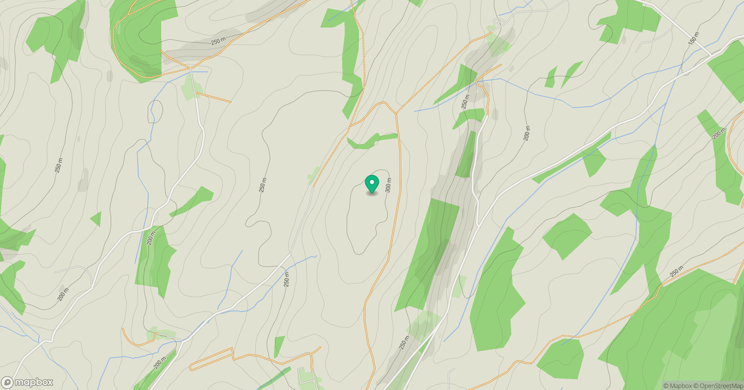
Grid reference: SN999883
View on OpenStreetMapOpens a map in a new tab, centred on the hill.
Hills within 30 km
Straight-line distance, not a walking route or confirmation of access.
No comments yet. Be the first.