

Coed y Gaer
Good walks are even better shared.
Overview
Coed y Gaer: A Hidden Gem in the Brecon Beacons
Overview
Nestled within the picturesque Brecon Beacons National Park, Coed y Gaer stands as a testament to the beauty of Welsh landscapes. Standing at an elevation of approximately 350 meters, it may not be the tallest hill in the range, but it certainly offers a wealth of experiences for hikers and nature lovers alike.
Geology
The geology of Coed y Gaer is captivating, featuring sandstone and conglomerate formations. These rocks jut out dramatically in places, creating entertaining landscapes that could rival any action film set.
Summit Features
At the peak, you'll be greeted by a cairn that not only marks your accomplishment but also serves as a fantastic spot to enjoy your well-deserved sandwich, or perhaps an observation point for those cheeky choughs looking to steal your snacks!
Terrain
Expect a dynamic mix of terrains as you traverse Coed y Gaer. From grassy slopes ideal for running down like a child at play to rocky outcrops that require a little careful footing—this hill has a bit of everything.
The Views
Once you've reached the summit, prepare to have your breath taken away—not just from the climb! The views stretch out over the vast expanses of the Brecon Beacons, with the beautiful Black Mountains silhouetted in the distance. On clear days, the shimmering Severn Estuary can even be spotted, reminding you of just how small we all are.
Hazards
While Coed y Gaer is mostly beginner-friendly, it’s wise to keep an eye on the sky for sudden changes in weather. The terrain can be uneven, so good hiking boots are a must. Slipping on a boggy patch won't do your reputation any favours!
Nearby Summits
If you fancy extending your hiking weekend, nearby summits such as Cefn Moel and the more daunting Fan y Big beckon with their allure and challenge.
Access and Facilities
Parking is available at a small area south of the hill, with space for a handful of cars. Nearest public transportation options are bus services from Brecon, which can leave you feeling a little like a game of musical chairs if you miss your lift!
In Brecon, you’ll find ample facilities including cafes for a post-hike cuppa, ensuring you're fuelled up for your journey back—or just to indulge in a slice of cake to celebrate your accomplishment.
History
The enchanting name 'Coed y Gaer', meaning 'the wood of the fort', suggests that this area once held historical significance, possibly linked to ancient fortifications that stood guard over the vale. It may not be a grand castle, but it's certainly a hill with a story to tell!
Conclusion
Coed y Gaer may be petite compared to its towering neighbours, but don't underestimate the joy and satisfaction a hike up this lovely hill can provide. So lace up those boots, grab your map, and embrace the adventure that awaits!
Explore routes near Coed y Gaer
Public walks starting within 80 km of this hill. Nearby does not mean a route reaches the summit; check its map and access before setting out.
Hafren Forest: full Source of the Severn Trail
View route
Elan Valley: Reservoir Trail to Pen y Garreg Dam
View route
Welshpool to Sweeps Bridge: Montgomery Canal and Belan Locks
View route
Waun-oer, Maesglase and Cribin Fawr guided mountain walk
View route
Route planning notes
These notes describe possible approaches, not verified navigable routes or permission to cross land. Check current paths, local access rules and conditions before setting out.
Coed y Gaer Circular Walk
A delightful circular route that meanders through lush woodlands and open moorland, culminating at the summit for stunning views.
Make a day of it, together
Find someone to share the walk with, or organise a day out along a route you like.
Photo Gallery
View all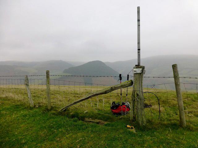 Photo could not load
SO0084 : Coed y Gaer
Rude Health
Hill facts and local notes
Classifications
Elevation
360m
1,181 ft
Prominence
122m
Coordinates
52.4484, -3.4656
SO004843
OS Map
136
Explorer: 214E
At the Summit
The summit features a stone cairn and panoramic views that will make you feel on top of the world—or at least on top of a very nice hill.
Terrain & Geology
Composed predominantly of sandstone and conglomerate, the geology of Coed y Gaer offers unique formations, including exposed cliff faces that are as dramatic as a soap opera cliffhanger.
Views & Scenery
Vast landscapes of the Brecon Beacons, the distant Black Mountains, and potentially even the Severn Estuary on a clear day.
History & Heritage
Name Origin
Coed y Gaer translates to 'the wood of the fort', hinting at historical significance within the region.
Historical Significance
The area is steeped in history, with remnants of ancient hill forts nearby that whisper tales from times long past.
Getting There & Facilities
Check current local access restrictions, parking rules and transport timetables before travelling. These notes do not confirm public access to the summit.
Parking
There is a small parking area at SO006843, suitable for about 5-6 cars. Arrive early to nab a spot!
Public Transport
Bus services from nearby towns such as Brecon run intermittently, be sure to check the schedules.
Nearby Facilities
In Brecon, you'll find various cafes, restaurants, and public toilets, perfect for a post-hike treat.
Safety Information
Known Hazards
- Uneven ground and sudden weather changes can catch unprepared hikers off guard, so always keep an eye on the sky!
General Safety Tips
- Check weather conditions before setting out
- Carry appropriate clothing and equipment
- Let someone know your planned route
- Take a map, compass, and GPS device
- Carry emergency supplies: food, water, first aid kit, torch
Hills
Some common questions about the hills answered
Are there group walks up Coed y Gaer?
Many walkers use Walkmates to join or organise walks with others. You can check for group walks around Coed y Gaer through the maps
Are there other walkers around Coed y Gaer?
Activity varies by location and time, but Walkmates lets you see whether others have shared walks or shown interest in this area. Find other people through the walking friends search walking friends for Coed y Gaer search or of course create your own walk for Coed y Gaer
Can I organise a walk to Coed y Gaer?
Yes. If there aren’t any walks listed already, you can create a walk and make it available for others to join.
If you're signed up to Walkmates, you can create a walk to Coed y Gaer.
How do I find a walk up this hill?
There are often multiple ways to walk this hill, depending on experience and route preference. Walkmates helps you explore walks and routes that others have shared.
Can I suggest a new route up Coed y Gaer?
Yes. You can suggest or create routes to share with others. Walkmates focuses on the social side of walking, so routes are used to help people organise walks and explore areas together, rather than as detailed navigation tools or route libraries.
Other uses really appreciate knowledgeable walkers sharing their routes. Share your favourite route to Coed y Gaer here
The is an error or something incorrect about this hill. How do I let you know?
We always strive to keep the information on Walkmates as accurate as possible. If you find an error, please let us know through the contact form and we'll aim to correct it as quickly as possible
Community Discussion
Comments
Location
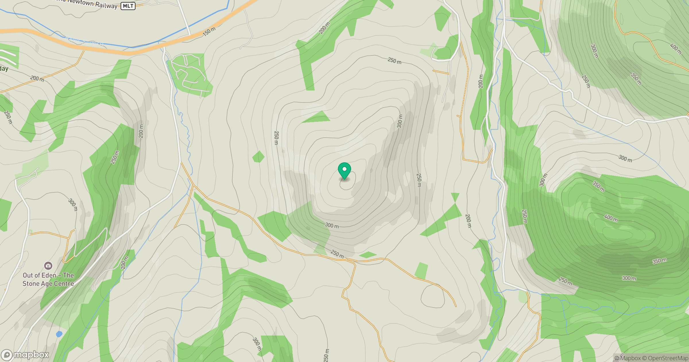
Grid reference: SO004843
View on OpenStreetMapOpens a map in a new tab, centred on the hill.
Hills within 30 km
Straight-line distance, not a walking route or confirmation of access.
No comments yet. Be the first.