

Parkwood Springs
Good walks are even better shared.
SK3489 : Parkwood landfill site
Graham Hogg Photo source
Overview
Parkwood Springs: A Hidden Gem in South Yorkshire
Nestled in the heart of South Yorkshire, Parkwood Springs is a delightful spot that offers a chance to escape the hustle and bustle of urban life without trekking to the moon and back. This green sanctuary provides not only a breath of fresh air but also a rich tapestry of history and a variety of recreational opportunities.
Elevation and Geography
During your jaunt around Parkwood Springs, you’ll reach an elevation of 150 meters. While not a Alpine peak, it certainly provides a pleasing hilltop vantage for views that stretch over the city of Sheffield and the surrounding landscape. Its geological features are equally fascinating; the clay and sandstone formations here whisper tales of ancient eras, and just might hold a few fossils from when the area was once underwater.
Hiking Routes
The main trail from the entrance of Parkwood Springs is an easy and pleasant walk that meanders through a grassy carpet interspersed with occasional patches of woodland. Covering about 2.5 km and taking approximately 1.5 hours, it's perfect for families or anyone looking to stretch their legs with minimal fuss. Just be careful not to trip over a tree root; they have a tendency to play hide and seek.
Views from the Summit
As you rise to the top, prepare to be treated to spectacular views of Sheffield's skyline. Watch as the Arts Tower pierces the sky, with the rolling hills of the Peak District looming invitingly in the distance. For the best scenery, aim to visit in spring or early autumn when the trees are bursting with colour and the skies are their clearest.
Hazards
Though generally safe for hikers, it's wise to be cautious of uneven ground, which might trip up the unsuspecting wanderer. It's not the type of place where you should slip and slide about!
Nearby Attractions
Feel free to extend your adventure! Nearby summits such as Wincobank Hill and Meersbrook Park offer more inclines to conquer and additional views that could make your heart skip a beat.
Access Information
Getting to Parkwood Springs is a breeze. With free parking at the entrance and public transport links available from Sheffield city centre, it’s an easy jaunt for outdoor enthusiasts. Just hop on a bus and before you know it, you'll be amidst the greenery.
Facilities
While Parkwood Springs keeps it simple without on-site facilities, a short walk to the Kelham Island district will land you at charming cafés and public toilets perfect for a post-hike refreshment.
History
The name Parkwood Springs reflects its leafy origins and the springs that have nourished its beauty over the years. Historically, this area has served as vital green space for the community, making it a cherished spot for relaxation and recreation.
In conclusion, Parkwood Springs may not be on any mountaineering bucket list, but for locals and visitors alike, it serves as a delightful reminder that nature is never far away. Next time you're looking for a quick getaway, remember: sometimes the best places are hiding in plain sight!
Happy hiking!
Explore routes near Parkwood Springs
Walks starting near this hill. Open a route to check its map, distance and full itinerary.
Norfolk Heritage Park Avenues
View route
Endcliffe Park Mi Amigo Crash Site and Porter Brook
View route
Wharncliffe Woods Plank Gate Return
View route
Graves Park Lakes and Meadows
View route
Route planning notes
These notes describe possible approaches. Check a route's map and access information when planning your walk.
Main Trail from Parkwood Springs Entrance
A well-trodden route that takes you around the park before climbing gradually to viewpoints.
Make a day of it, together
Find someone to share the walk with, or organise a day out along a route you like.
Photo Gallery
View all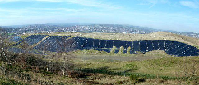 Photo could not load
SK3489 : Parkwood landfill site
Graham Hogg
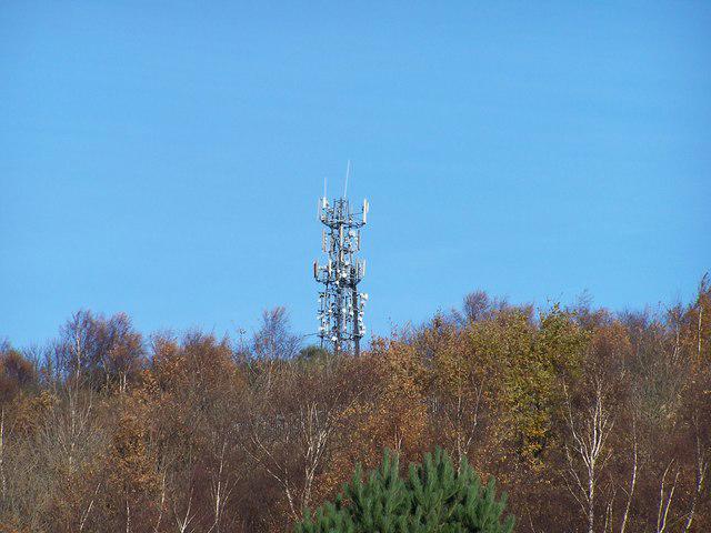 Photo could not load
SK3489 : Mast on Parkwood Springs Hill, Sheffield
Terry Robinson
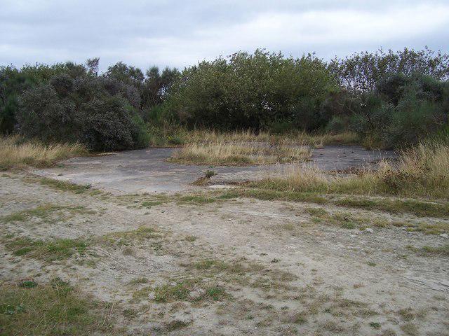 Photo could not load
SK3589 : Anti-aircraft gun site at Parkwood
Martin Speck
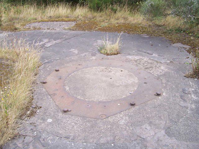 Photo could not load
SK3589 : Anti-aircraft gun site detail
Martin Speck
Hill facts and local notes
Classifications
Elevation
173m
569 ft
Prominence
51m
Coordinates
53.4025, -1.4753
SK349896
OS Map
110 111
Explorer: 278S
At the Summit
The summit area is punctuated by grassland and scattered trees, offering panoramic views. There's no official trig point, but the elevated position makes for a perfect picnic spot.
Terrain & Geology
Parkwood Springs features predominantly clay and sandstone, with interesting strata revealing the area's industrial past. Look closely and you may find fossils from ancient marine environments!
Views & Scenery
From the top, you can see the skyline of Sheffield, including the iconic Arts Tower and the Peak District beyond.
History & Heritage
Name Origin
The name 'Parkwood Springs' reflects the area's wooded parkland origins and the natural springs that once nourished the local flora.
Historical Significance
Historically, Parkwood Springs was part of the old ecclesiastical lands and is significant for its role in local recreation and urban green space.
Getting There & Facilities
Parking
There is a free car park at the Parkwood Springs entrance, easily accessible off Parkwood Road.
Public Transport
Buses from Sheffield city centre (e.g., service number 52) will take you to nearby administrative roads.
Nearby Facilities
While there are no facilities directly on the summit, the nearby Kelham Island area has cafés and public toilets.
Safety Information
Known Hazards
- Uneven ground in some areas; keep an eye out for roots and rocks.
General Safety Tips
- Check weather conditions before setting out
- Carry appropriate clothing and equipment
- Let someone know your planned route
- Take a map, compass, and GPS device
- Carry emergency supplies: food, water, first aid kit, torch
Hills
Some common questions about the hills answered
Are there group walks up Parkwood Springs?
Many walkers use Walkmates to join or organise walks with others. You can check for group walks around Parkwood Springs through the maps
Are there other walkers around Parkwood Springs?
Activity varies by location and time, but Walkmates lets you see whether others have shared walks or shown interest in this area. Find other people through the walking friends search walking friends for Parkwood Springs search or of course create your own walk for Parkwood Springs
Can I organise a walk to Parkwood Springs?
Yes. If there aren’t any walks listed already, you can create a walk and make it available for others to join.
If you're signed up to Walkmates, you can create a walk to Parkwood Springs.
How do I find a walk up this hill?
There are often multiple ways to walk this hill, depending on experience and route preference. Walkmates helps you explore walks and routes that others have shared.
Can I suggest a new route up Parkwood Springs?
Yes. You can suggest or create routes to share with others. Walkmates focuses on the social side of walking, so routes are used to help people organise walks and explore areas together, rather than as detailed navigation tools or route libraries.
Other uses really appreciate knowledgeable walkers sharing their routes. Share your favourite route to Parkwood Springs here
The is an error or something incorrect about this hill. How do I let you know?
We always strive to keep the information on Walkmates as accurate as possible. If you find an error, please let us know through the contact form and we'll aim to correct it as quickly as possible
Community Discussion
Comments
Location
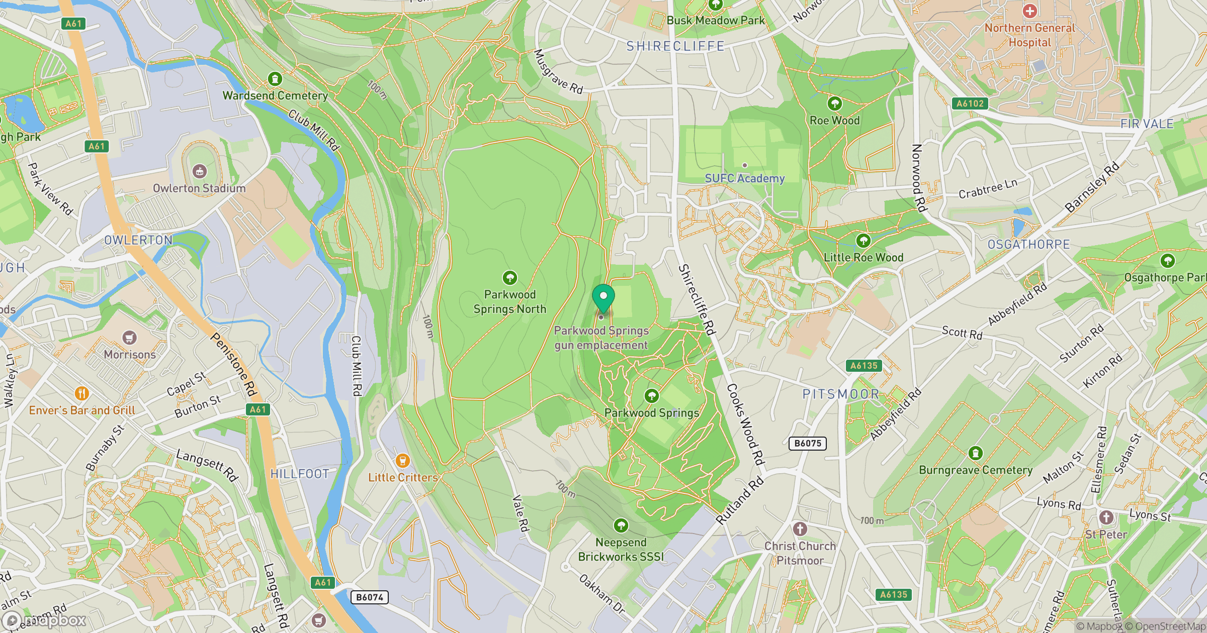
Grid reference: SK349896
View on OpenStreetMapOpens a map in a new tab, centred on the hill.
Nearby Hills

Kinder Scout
636m
The Roaches
505m
Rombalds Moor [Ilkley Moor]
402m

Pendle Hill
557m
Buckden Pike
702m
No comments yet. Be the first.