

Northfield Hill
Good walks are even better shared.
SU7234 : Footpath by Noar Copse
Colin Smith Photo source
Overview
Northfield Hill
Nestled in the heart of South East England, Northfield Hill is a gem for hikers and nature lovers alike. With an elevation of 100 meters, this Marilyn might not win any records for height, but what it lacks in stature, it makes up for in charm and accessibility.
Geology
The landscape around Northfield Hill is predominantly clay and chalk, typical of the rolling hills that characterise this part of the countryside. These geological formations tell a story of ancient seas and glacial movements, leaving behind a scenic playground for us to explore.
Routes
One of the most popular ways to reach the summit is the Northfield Trail, a lovely route winding through lush woodlands. At 3.5 km and taking about 1.5 hours, it offers an easy hike suitable for families and casual walkers. Just keep an eye out for that sneaky mud that might surprise you!
Summit Features
As you reach the top, you’ll be greeted by a trig point—a true badge of honour for any budding mountaineer—and a quaint cairn to mark your achievement. Perfect for photographs, of course!
Terrain Type
Expect a delightful mixed terrain that includes grassy slopes, gentle inclines, and the occasional rocky outcrop. Suitable footwear is recommended, but don’t worry, it's not Everest.
Views
The views from the summit are simply lovely—on a clear day, you can witness the rolling hills of the South Downs and, if you're lucky, spot the London skyline in the distance. The scenery is particularly stunning in spring and autumn, making it an ideal time for a visit.
Hazards
While the hike is mostly safe, be prepared for muddy patches, especially following rain, and the occasional animal surprise, such as a deer dashing across your path. Always keep your wits about you!
Nearby Summits
If you're feeling ambitious, you might want to explore the nearby Perseverance Hill and St Margaret's Hill, which offer additional hiking opportunities and scenic views.
Access
Getting to Northfield Hill is straightforward. There’s a convenient car park off Northfield Lane, or if public transport is more your style, hop on a bus from Haywards Heath train station. The picturesque town of Lindfield is just a stone's throw away, making it a nice spot to grab a pre-hike cuppa or snack.
Facilities
Lindfield boasts a range of charming cafes and pubs. They provide the perfect pit stop for some post-hike hydration or a spot of lunch while you swap stories of your outdoor adventures.
History
The name 'Northfield' comes from old English, highlighting its character as 'northern open land.' The hill has been part of local lore, once serving as a lookout point for ancient settlers who kept watch over the flocks and fields below.
In wrapping up, Northfield Hill may not be the highest mountain, but it certainly is one of the most enjoyable for a casual day out. So, lace up your hiking boots and grab your walking stick—adventure awaits!
Explore routes near Northfield Hill
Walks starting near this hill. Open a route to check its map, distance and full itinerary.
Hinton Ampner: Dutton Estate Woodland and Downland Circuit
View route
Frensham Little Pond and Snowball Ridge Walk
View route
Hindhead Sailor's Stroll to Gibbet Hill
View route
Petworth Park: Capability Brown Hills and Lower Pond Circuit
View route
Route planning notes
These notes describe possible approaches. Check a route's map and access information when planning your walk.
Northfield Trail
A gentle climb through scenic woodlands leading up to the summit, perfect for all fitness levels.
Make a day of it, together
Find someone to share the walk with, or organise a day out along a route you like.
Photo Gallery
View all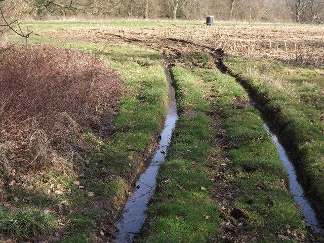 Photo could not load
SU7234 : Footpath by Noar Copse
Colin Smith
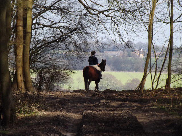 Photo could not load
SU7234 : Approaching Bush Down
Colin Smith
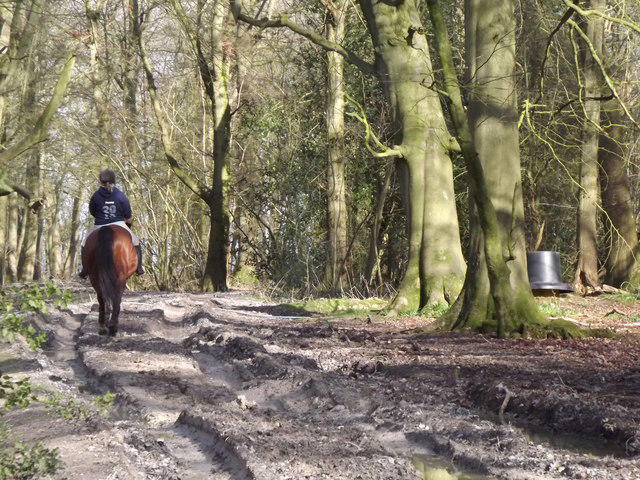 Photo could not load
SU7234 : Muddy Bridleway, Northfield Hill
Colin Smith
Hill facts and local notes
Classifications
Elevation
182m
596 ft
Prominence
33m
Coordinates
51.1030, -0.9675
SU723342
OS Map
186
Explorer: OL33 133
At the Summit
The summit features a modest trig point, with a small stone cairn nearby that adds character to the top.
Terrain & Geology
Northfield Hill is primarily composed of clay and chalk, typical of the area. The surrounding countryside showcases the classic rolling hills of the South East, formed through glacial and post-glacial processes.
Views & Scenery
From the summit, one can enjoy sweeping views of the South Downs and the distant skyline of London on clear days. The open countryside and quaint villages dot the landscape.
History & Heritage
Name Origin
The name 'Northfield' derives from the old English words meaning 'northern open land', aptly describing the area.
Historical Significance
Historically, the hill has been part of local lore, with tales of ancient settlers who used the high point for lookout and communication.
Getting There & Facilities
Parking
There is a small car park located off Northfield Lane, with space for about 10 vehicles. Alternatively, on-street parking is available nearby.
Public Transport
The nearest railway station is in Haywards Heath, from which you can take a short bus ride to Northfield Lane.
Nearby Facilities
Lindfield has several cafes and pubs, where you can grab a bite to eat or use the toilets before or after your hike.
Safety Information
Known Hazards
- Watch out for muddy patches after rain, and be mindful of the occasional wildlife, including deer and rabbits that may unexpectedly cross your path.
General Safety Tips
- Check weather conditions before setting out
- Carry appropriate clothing and equipment
- Let someone know your planned route
- Take a map, compass, and GPS device
- Carry emergency supplies: food, water, first aid kit, torch
Hills
Some common questions about the hills answered
Are there group walks up Northfield Hill?
Many walkers use Walkmates to join or organise walks with others. You can check for group walks around Northfield Hill through the maps
Are there other walkers around Northfield Hill?
Activity varies by location and time, but Walkmates lets you see whether others have shared walks or shown interest in this area. Find other people through the walking friends search walking friends for Northfield Hill search or of course create your own walk for Northfield Hill
Can I organise a walk to Northfield Hill?
Yes. If there aren’t any walks listed already, you can create a walk and make it available for others to join.
If you're signed up to Walkmates, you can create a walk to Northfield Hill.
How do I find a walk up this hill?
There are often multiple ways to walk this hill, depending on experience and route preference. Walkmates helps you explore walks and routes that others have shared.
Can I suggest a new route up Northfield Hill?
Yes. You can suggest or create routes to share with others. Walkmates focuses on the social side of walking, so routes are used to help people organise walks and explore areas together, rather than as detailed navigation tools or route libraries.
Other uses really appreciate knowledgeable walkers sharing their routes. Share your favourite route to Northfield Hill here
The is an error or something incorrect about this hill. How do I let you know?
We always strive to keep the information on Walkmates as accurate as possible. If you find an error, please let us know through the contact form and we'll aim to correct it as quickly as possible
Community Discussion
Comments
Location
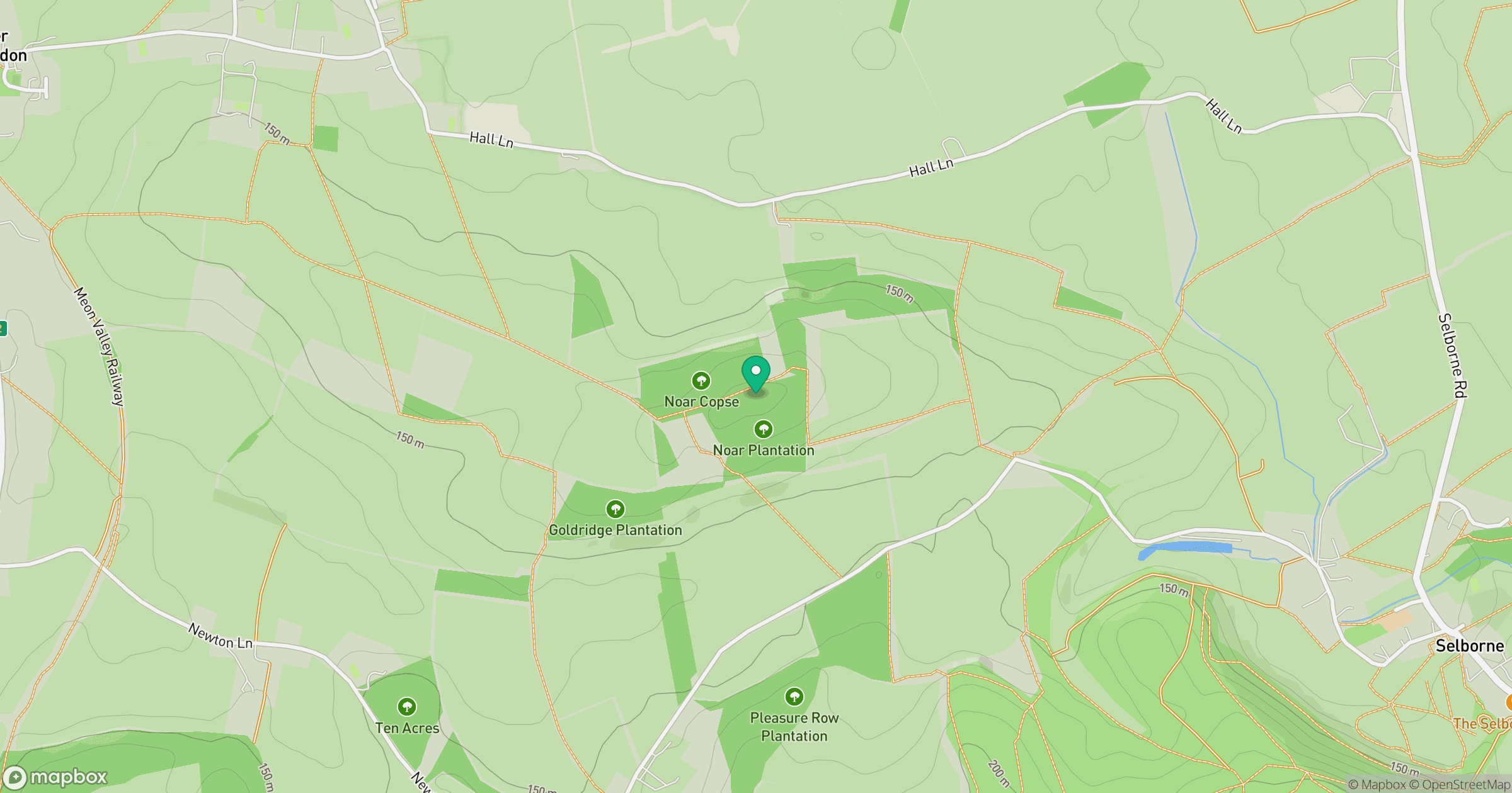
Grid reference: SU723342
View on OpenStreetMapOpens a map in a new tab, centred on the hill.
Nearby Hills
Leith Hill
294m
Ditchling Beacon
248m
Worcestershire Beacon
425m
Glastonbury Tor
158m
Titterstone Clee Hill
533m
No comments yet. Be the first.