

nameless (Top o' Selside - Brock Barrow)
Good walks are even better shared.
SD2989 : Brock Barrow
Michael Graham Photo source
Overview
Nameless (Top o' Selside - Brock Barrow)
Introduction
Nestled in the heart of the Lake District, the nameless summit known informally as Top o' Selside - Brock Barrow might lack an official name but certainly doesn’t skimp on character. With an elevation of 470 meters and a modest prominence of 85 meters, this Marilyn offers hikers a taste of the rugged beauty that defines this iconic landscape.
Geology
The geology of Brock Barrow is dominated by sedimentary rock. Layers of sandstone and shale are prevalent here, contributing to interesting formations and a stunning diversity of flora. If you keep your eyes peeled, you might even spot some delicate rock ferns clinging to life in the craggy outcrops.
Routes
Brock Barrow Circular Route
- Distance: 8.0 km
- Time: Approximately 3.5 hours
- Difficulty: Moderate
This circular route begins in Selside and meanders through lush landscapes, offering breathtaking views at every turn. It’s a perfect mix of walking and nature, making it a favourite for families and solo adventures alike.
Top o' Selside Ascent
- Distance: 3.5 km
- Time: 1.5 hours
- Difficulty: Easy
For those seeking a quick escape, the Top o' Selside ascent is for you. A well-defined path meanders through the heather, allowing for an enjoyable stroll that rewards you with splendid views at the summit.
Summit Features
At the summit, hikers are welcomed by a modest cairn, a classic homage to countless footfalls on this often-overlooked peak. Don’t forget to snap a selfie here; it’s not every day you claim a summit with no official name!
Terrain Type
Expect a mix of grassy slopes interspersed with rocky outcrops. The terrain is generally forgiving, though a sturdy pair of boots is recommended for those rockier sections, especially after a good rain.
Views
The summit is a fantastic viewpoint, offering panoramic sights of the southern Lake District. Notable highlights include the lofty peaks of the Fells and the tranquil waters of Windermere. The best time to appreciate these stunning views is during spring or early autumn when the landscape is at its most vibrant.
Hazards
As with any outdoor adventure, take care as you navigate the trails. Slippery rocks can be a concern, particularly following rainfall. Also, low cloud cover may obscure visibility, so it’s wise to check the weather forecasts ahead of your adventure.
Access
- Nearest Parking: Limited roadside parking is available in Selside.
- Public Transport: Bus services connect Kendal to Selside, though they may not be the most reliable. Be sure to check the latest schedules.
- Nearest Town: Kendal, a bustling market town that offers a range of amenities.
Facilities
While this mountain offers no facilities directly, Selside provides some basic options. For a wider range of eateries, cafes, and public toilets, make your way to Kendal.
History
- Name Meaning: The informality of the nickname 'nameless' suggests a local treasure that doesn’t take itself too seriously.
- Significance: Though lesser-known, the mountain provides a serene escape from bustling tourist spots and holds a special place among local hikers.
In summary, Top o' Selside - Brock Barrow may not grace the pages of grand hiking guides, but it offers a delightful day out for those seeking tranquillity and stunning views. Bring your map, a hearty sandwich, and perhaps a sense of humour, and you're all set for a memorable adventure!
Explore routes near nameless (Top o' Selside - Brock Barrow)
Walks starting near this hill. Open a route to check its map, distance and full itinerary.
Coniston to Tarn Hows: Monk Coniston Gardens and Woodland Circuit
View route
Tarn Hows Fast Route
View route
Great Carrs Halifax Wreckage from Wrynose Pass
View route
Bow Fell from Langdale
View route
Route planning notes
These notes describe possible approaches. Check a route's map and access information when planning your walk.
Brock Barrow Circular Route
A pleasant circular walk that begins and ends at the village of Selside, providing scenic views throughout.
Top o' Selside Ascent
A straightforward ascent via a well-defined path through the heather, ideal for a quick hike.
Make a day of it, together
Find someone to share the walk with, or organise a day out along a route you like.
Photo Gallery
View all Photo could not load
SD2989 : Brock Barrow
Michael Graham
 Photo could not load
SD2989 : Daleks - Invasion High Nibthwaite 2113
Karl and Ali
 Photo could not load
SD2989 : Brock Barrow cairn and the lower reaches of Coniston Water
Karl and Ali
 Photo could not load
SD2989 : Cairn on Brock Barrow
Tom Richardson
 Photo could not load
SD2989 : Cairn on Brock Barrow
David Brown
Hill facts and local notes
Classifications
Elevation
221m
725 ft
Prominence
3m
Coordinates
54.2991, -3.0800
SD298898
OS Map
96 97
Explorer: OL6N OL7S
At the Summit
The summit features a modest cairn, offering a perfect spot for a summit selfie (and maybe a cheeky snack!).
Terrain & Geology
The mountain is primarily composed of sedimentary rock, featuring layers of sandstone and shale that have weathered over time, creating unique formations.
Views & Scenery
From the summit, enjoy sweeping views of the southern Lake District, with the peaks of Fells and the distant waters of Windermere glistening.
History & Heritage
Name Origin
The name 'nameless' suggests an endearing lack of pretension; perhaps an inside joke among local walkers.
Historical Significance
The mountain may be lesser-known, but it features in local hiking circles as a hidden gem away from the busier trails.
Getting There & Facilities
Parking
There is limited roadside parking in Selside village, which is the closest access point.
Public Transport
Bus services run from Kendal to Selside, but be sure to check the latest timetables as they can be sporadic.
Nearby Facilities
There are no facilities directly at the mountain, but Selside has basic amenities. For more options, head to Kendal for cafes and toilets.
Safety Information
Known Hazards
- Watch out for slippery rocks, especially after rain, and be mindful of low cloud cover reducing visibility.
General Safety Tips
- Check weather conditions before setting out
- Carry appropriate clothing and equipment
- Let someone know your planned route
- Take a map, compass, and GPS device
- Carry emergency supplies: food, water, first aid kit, torch
Hills
Some common questions about the hills answered
Are there group walks up nameless (Top o' Selside - Brock Barrow)?
Many walkers use Walkmates to join or organise walks with others. You can check for group walks around nameless (Top o' Selside - Brock Barrow) through the maps
Are there other walkers around nameless (Top o' Selside - Brock Barrow)?
Activity varies by location and time, but Walkmates lets you see whether others have shared walks or shown interest in this area. Find other people through the walking friends search walking friends for nameless (Top o' Selside - Brock Barrow) search or of course create your own walk for nameless (Top o' Selside - Brock Barrow)
Can I organise a walk to nameless (Top o' Selside - Brock Barrow)?
Yes. If there aren’t any walks listed already, you can create a walk and make it available for others to join.
If you're signed up to Walkmates, you can create a walk to nameless (Top o' Selside - Brock Barrow).
How do I find a walk up this hill?
There are often multiple ways to walk this hill, depending on experience and route preference. Walkmates helps you explore walks and routes that others have shared.
Can I suggest a new route up nameless (Top o' Selside - Brock Barrow)?
Yes. You can suggest or create routes to share with others. Walkmates focuses on the social side of walking, so routes are used to help people organise walks and explore areas together, rather than as detailed navigation tools or route libraries.
Other uses really appreciate knowledgeable walkers sharing their routes. Share your favourite route to nameless (Top o' Selside - Brock Barrow) here
The is an error or something incorrect about this hill. How do I let you know?
We always strive to keep the information on Walkmates as accurate as possible. If you find an error, please let us know through the contact form and we'll aim to correct it as quickly as possible
Community Discussion
Comments
Location
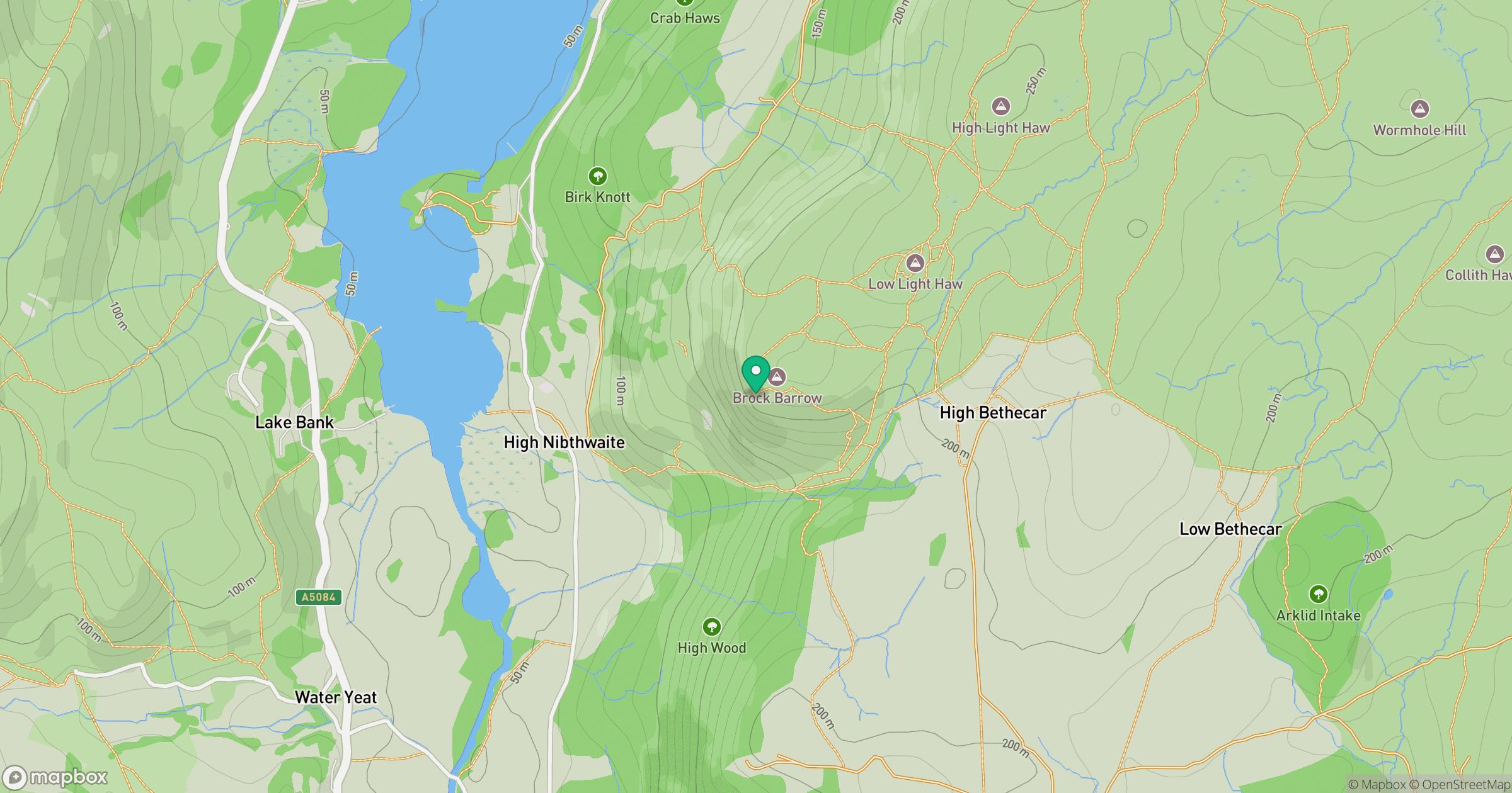
Grid reference: SD298898
View on OpenStreetMapOpens a map in a new tab, centred on the hill.

No comments yet. Be the first.