

Na Cruachan
Good walks are even better shared.
Overview
Na Cruachan
The majestic Na Cruachan, standing at an impressive 1126 metres, draws adventurers and nature lovers alike. Nestled in the heart of the Scottish Highlands, this Munro is not just a peak—it's an experience that beckons you to its rugged embrace.
Geology
Na Cruachan is primarily formed from quartzite, which has withstood the test of time and the ravages of glacial activity. This ancient rock gives the mountain its formidable appearance and provides a fascinating study for geology enthusiasts keen to learn about the Earth’s history. Remember, it's not just about climbing; it’s about appreciating the stories these rocks tell!
Route
One of the most popular approaches is The Ben Cruachan Circuit. This challenging 15 km route starts at the Ben Cruachan car park, weaving through stunning landscapes. Expect to spend around 5 hours on this circuit, but don’t rush—take time to admire the views and catch your breath. Just mind those rocky bits—your ankles might thank you later!
Summit Features
At the summit, you'll be greeted by a proud trig point and a quaint stone shelter—ideal for sheltering from those infamous Highland gusts. The summit is the quintessential spot for photo opportunities, especially with that perfect view of Loch Awe reflecting the sky like a mirror.
Terrain
The terrain is a mix of rocky and grassy slopes, with some sections that may resemble a bouldering field. It’s a playground for seasoned hikers but can be a tad tricky for newcomers, so wear sturdy boots and keep your wits about you!
Views
The views from Na Cruachan are nothing short of spectacular. On a clear day, you can feast your eyes on the shimmering waters of Loch Awe, the peaks of the Southern Highlands, and even the distant islands of Mull and Iona. The best time to take in this panorama? Late spring to early autumn, particularly at sunrise or sunset—nature's golden hour!
Hazards
Like any good adventure in the Highlands, Na Cruachan comes with its share of unpredictability. Be prepared for sudden weather changes and steep drops; always check the forecast before you set out. Remember, it’s about enjoying the climb, not just conquering it!
Nearby Summits
If you’re feeling adventurous, consider bagging nearby summits like Stob Daimh (1004 m) or Ben Chuirn (920 m). Both offer their own unique challenges and stunning views, making Na Cruachan the gateway to further Highland adventures.
Access
Accessing Na Cruachan is straightforward. The nearest parking is available at the Ben Cruachan car park (NG 836 076), which has plenty of space for vehicles. For those relying on public transport, the nearest train station is in Crianlarich, with local buses serving the area. The closest town for supplies is Dalmally, about 10 km away, where you can replenish your energy.
Facilities
While facilities at the foot of the mountain are limited, Dalmally offers cafes and shops for a well-deserved meal post-hike. Toilets are conveniently available at the car park too—because let’s face it, nature calls!
History
The name 'Na Cruachan' carries a sense of the ancient, derived from Gaelic meaning 'little mound' or 'hill'. The mountain's significance transcends its geography—steeped in local myths and folklore, Na Cruachan has long been a source of inspiration for adventurers and storytellers alike.
So, grab your walking boots, pack some snacks, and set off to discover the wonders of Na Cruachan. Just remember, the mountain is waiting to welcome you, so don’t keep it hanging around!
Explore routes near Na Cruachan
Public walks starting within 80 km of this hill. Nearby does not mean a route reaches the summit; check its map and access before setting out.
Banavie to Glen Loy Aqueduct: Neptune’s Staircase Canal Towpath
View route
Loch Affric full circuit from River Affric
View route
Ben Nevis via Mountain Path
View route
Beinn Eighe Lancaster Wreckage at Coire Mhic Fhearchair
View route
Route planning notes
These notes describe possible approaches, not verified navigable routes or permission to cross land. Check current paths, local access rules and conditions before setting out.
The Ben Cruachan Circuit
A popular loop starting from the Ben Cruachan car park, this route takes you over a series of ridges leading to the summit.
Make a day of it, together
Find someone to share the walk with, or organise a day out along a route you like.
Photo Gallery
View all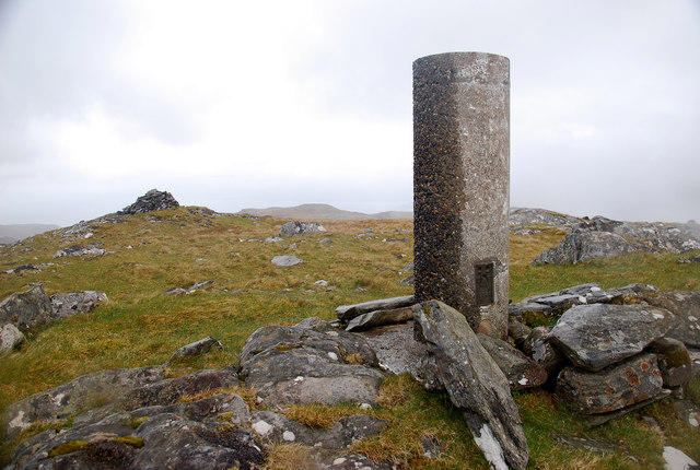 Photo could not load
NG7707 : Na Cruachan
Glen Breaden
Hill facts and local notes
Classifications
Elevation
583m
1,913 ft
Prominence
117m
Coordinates
57.1013, -5.6823
NG770071
OS Map
33
Explorer: 413S
At the Summit
At the summit, hikers will find a sizeable trig point and a small stone shelter, perfect for those brisk Highland winds.
Terrain & Geology
Primarily composed of quartzite, Na Cruachan showcases ancient rock formations shaped by glacial activity, providing a glimpse into the Earth’s geological history.
Views & Scenery
Breathtaking views of Loch Awe, the surrounding peaks of the Southern Highlands, and, on a clear day, across to the islands of Mull and Iona.
History & Heritage
Name Origin
Na Cruachan derives from the Gaelic 'Cruachan', meaning 'little mound' or 'hill', a nod to its distinctive profile.
Historical Significance
The mountain is steeped in local folklore and Scottish heritage, often featured in tales of adventure and resilience.
Getting There & Facilities
Check current local access restrictions, parking rules and transport timetables before travelling. These notes do not confirm public access to the summit.
Parking
Ben Cruachan car park (NG 836 076), which offers ample space for vehicles and is the starting point for various walking routes.
Public Transport
The nearest train station is in Crianlarich, from where local buses operate to nearby areas.
Nearby Facilities
Limited facilities near the base; however, the village of Dalmally offers several cafes and shops. Toilets are available at the car park.
Safety Information
Known Hazards
- Sudden weather changes, steep drops, and rocky sections can pose hazards. Always check the forecast and proceed with caution.
General Safety Tips
- Check weather conditions before setting out
- Carry appropriate clothing and equipment
- Let someone know your planned route
- Take a map, compass, and GPS device
- Carry emergency supplies: food, water, first aid kit, torch
Hills
Some common questions about the hills answered
Are there group walks up Na Cruachan?
Many walkers use Walkmates to join or organise walks with others. You can check for group walks around Na Cruachan through the maps
Are there other walkers around Na Cruachan?
Activity varies by location and time, but Walkmates lets you see whether others have shared walks or shown interest in this area. Find other people through the walking friends search walking friends for Na Cruachan search or of course create your own walk for Na Cruachan
Can I organise a walk to Na Cruachan?
Yes. If there aren’t any walks listed already, you can create a walk and make it available for others to join.
If you're signed up to Walkmates, you can create a walk to Na Cruachan.
How do I find a walk up this hill?
There are often multiple ways to walk this hill, depending on experience and route preference. Walkmates helps you explore walks and routes that others have shared.
Can I suggest a new route up Na Cruachan?
Yes. You can suggest or create routes to share with others. Walkmates focuses on the social side of walking, so routes are used to help people organise walks and explore areas together, rather than as detailed navigation tools or route libraries.
Other uses really appreciate knowledgeable walkers sharing their routes. Share your favourite route to Na Cruachan here
The is an error or something incorrect about this hill. How do I let you know?
We always strive to keep the information on Walkmates as accurate as possible. If you find an error, please let us know through the contact form and we'll aim to correct it as quickly as possible
Community Discussion
Comments
Location
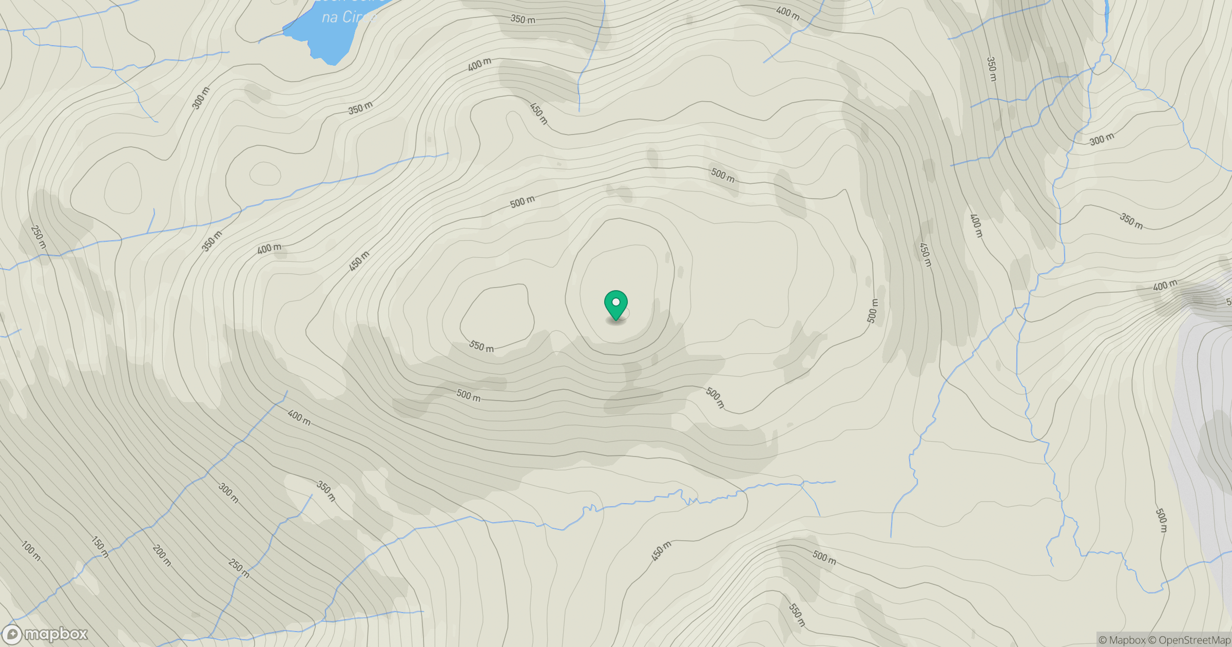
Grid reference: NG770071
View on OpenStreetMapOpens a map in a new tab, centred on the hill.
Hills within 30 km
Straight-line distance, not a walking route or confirmation of access.
Ladhar Bheinn
1,020m
Beinn Sgritheall
974m
An Caisteal
622m
Sgurr Fhuaran
1,069m
Sgurr a' Mhaoraich
1,027m
No comments yet. Be the first.