

Garway Hill
Good walks are even better shared.
SO4325 : Hexagonal brick structure
Jonathan Billinger Photo source
Overview
Garway Hill: A Hiker's Haven
Garway Hill, standing proud at an elevation of 404 meters, beckons hikers and outdoor enthusiasts alike with its stunning landscapes and varied trails. Nestled in the Black Mountains of Wales, this Marilyn offers a perfect blend of nature and history.
Geology
Garway Hill's foundation is primarily Old Red Sandstone, contributing to its unique geological features. The surrounding area is rich in diverse flora and fauna, with the soil nourishing a vast array of plant life. As you trek up, take a moment to appreciate the millions of years of natural history beneath your feet.
Routes
Garway Hill Circuit
- Distance: 6.0 km
- Time: Approximately 2.5 hours
- Difficulty: Moderate
This circular route from the village of Garway offers a scenic adventure through woodlands before leading you to the summit with its panoramic views. Bring your camera and perhaps a friend to share this spectacular outing!
Summit Features
At the summit, hikers will discover a sturdy stone cairn and a trig point. It's a fantastic spot for photographs, especially if you can snap a shot with the local sheep—who seem to enjoy the title of 'broadcasters' of the mountain gossip.
Terrain Type
Expect a mix of grassy slopes and rocky paths, so suitable footwear is a must. After rains, certain parts can become boggy, so tread lightly and keep your balance!
Views
The vistas from Garway Hill are nothing short of breathtaking. Gaze upon the Wye Valley, the distant Malvern Hills, and the rolling expanse of the Black Mountains. Best views are from late spring to early autumn when the clarity and colours reach their zenith.
Hazards
While the hike is manageable for most, keep in mind that weather conditions can change rapidly. Also, watch out for the local wildlife, particularly the sheep—keep your distance to avoid getting overly friendly!
Nearby Summits
Nearby are Hatterall Hill and Sugar Loaf, each presenting their own unique challenges and breathtaking views—a great way to extend your hiking adventures!
Access
Nearest Parking: Look for the small parking area at Garway village, free of charge—after all, what’s more English than free parking?
Public Transport: For those relying on buses, there’s a service connecting Hereford to Garway, but always check local timetables!
Nearest Town: Hereford, just a short drive away, offers additional amenities and a cultural experience worth exploring after your hike.
Facilities
The village is equipped with lovely cafés for a post-hike treat and public toilets if nature calls after your trek!
History
The name 'Garway' is believed to mean 'garrison way', hinting at its historical roots. This landmark has been a point of reference for local communities throughout the ages, lending a sense of significance and historical depth.
In conclusion, Garway Hill is a delightful destination for hikers, offering stunning views, welcoming community vibes, and enough natural beauty to make you want to pack your bags and return time and again. Don't forget your camera—and perhaps a picnic because grassy slopes make for excellent dining spots under the sky!
Happy hiking!
Explore routes near Garway Hill
Walks starting near this hill. Open a route to check its map, distance and full itinerary.
Hereford Walk with Men Walking & Talking
View route
Clytha Estate: River Usk, Chapel Ruins and Castle Woods
View route
Forest of Dean Hicksters Way Woodland Circuit from Cannop
View route
Goytre Wharf to Pentre Bridge: Mon and Brec Canal Walk
View route
Route planning notes
These notes describe possible approaches. Check a route's map and access information when planning your walk.
Garway Hill Circuit
A popular circular route starting from the nearby village of Garway, this trail winds through lush woodlands before ascending to the summit. It's a wonderful way to soak in both nature and the stunning views.
Make a day of it, together
Find someone to share the walk with, or organise a day out along a route you like.
Photo Gallery
View all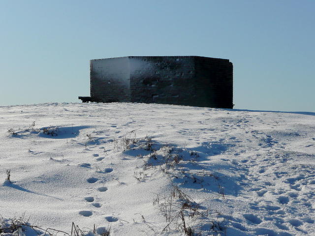 Photo could not load
SO4325 : Hexagonal brick structure
Jonathan Billinger
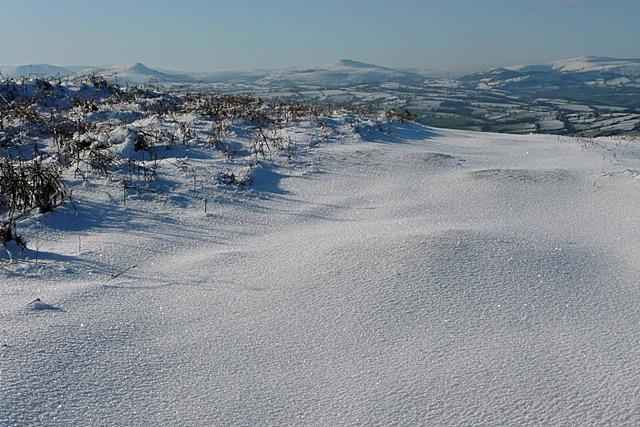 Photo could not load
SO4325 : View from Garway Hill
Graham Horn
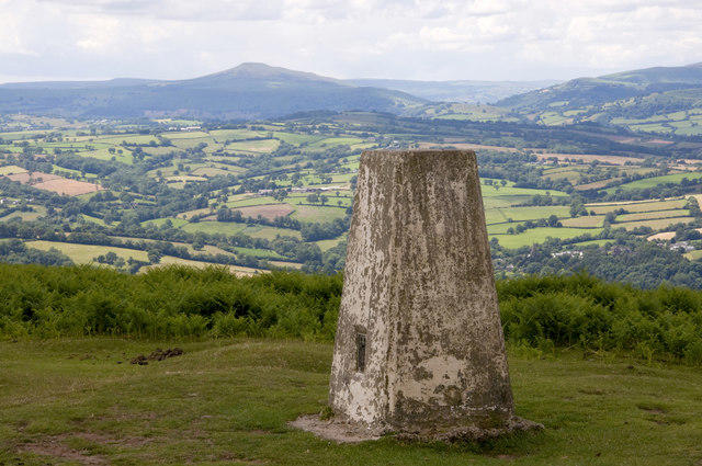 Photo could not load
SO4325 : Trig Point, Garway Hill Common
Stuart Wilding
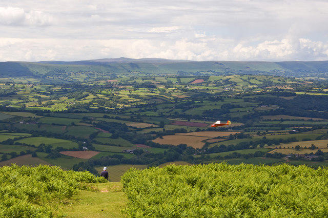 Photo could not load
SO4325 : View from Garway Hill
Stuart Wilding
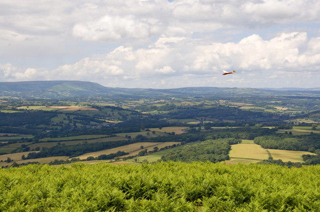 Photo could not load
SO4325 : Model Glider, Garway Hill
Stuart Wilding
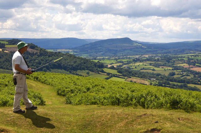 Photo could not load
SO4325 : Towards the Skirrid
Stuart Wilding
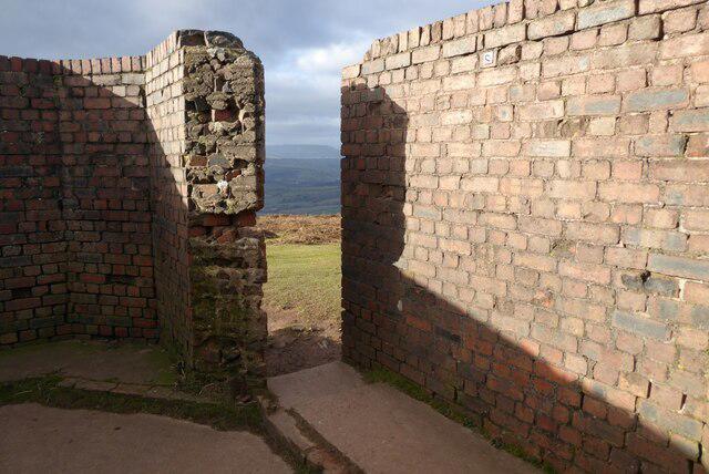 Photo could not load
SO4325 : Entrance to a WWII relic
Philip Halling
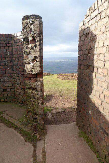 Photo could not load
SO4325 : Entrance to a WWII relic
Philip Halling
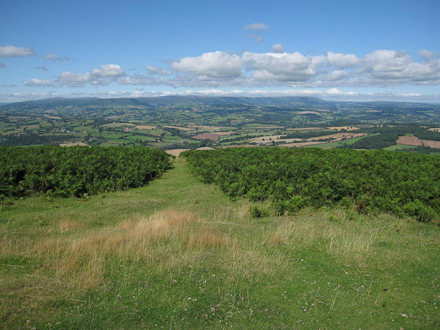 Photo could not load
SO4325 : View from Garway Hill
Hugh Venables
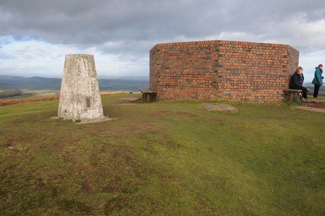
SO4325 : Trig point and WWII remains on Garway Hill
Philip Halling
Hill facts and local notes
Classifications
Elevation
367m
1,203 ft
Prominence
266m
Coordinates
51.9213, -2.8203
SO436250
OS Map
161
Explorer: 189
At the Summit
At the summit, you’ll find a stone cairn and a trig point, both perfect for a photo op. Just remember to wave at the locals—particularly the sheep, who are very much part of the scenery!
Terrain & Geology
Garway Hill is primarily composed of Old Red Sandstone, which gives the landscape its beautifully diverse flora and fauna. The geology offers fascinating insights into the sedimentary processes that created these striking formations over millions of years.
Views & Scenery
From the top, you can enjoy breathtaking views of the surrounding hills and valleys, including the stunning Wye Valley, the Black Mountains, and on a clear day, even the Malvern Hills to the east.
History & Heritage
Name Origin
The name 'Garway' is thought to derive from Old English, possibly meaning 'garrison way', hinting at its historical significance.
Historical Significance
Garway Hill has long been a landmark for local communities, providing both historical context and a beautiful natural setting for generations.
Getting There & Facilities
Parking
There is a small parking area at Garway village, which has enough space for a few cars. Remember, parking is free, so grab your gear and enjoy the trek!
Public Transport
The nearest bus service runs from Hereford to Garway. Check local timetables for specifics as services may vary.
Nearby Facilities
While there are no facilities at the summit, Garway village has a couple of lovely cafés where you can refuel post-hike, along with public toilets available in the village.
Safety Information
Known Hazards
- Be wary of sudden weather changes and keep an eye out for wildlife, including grazing sheep, which can sometimes block the paths!
General Safety Tips
- Check weather conditions before setting out
- Carry appropriate clothing and equipment
- Let someone know your planned route
- Take a map, compass, and GPS device
- Carry emergency supplies: food, water, first aid kit, torch
Hills
Some common questions about the hills answered
Are there group walks up Garway Hill?
Many walkers use Walkmates to join or organise walks with others. You can check for group walks around Garway Hill through the maps
Are there other walkers around Garway Hill?
Activity varies by location and time, but Walkmates lets you see whether others have shared walks or shown interest in this area. Find other people through the walking friends search walking friends for Garway Hill search or of course create your own walk for Garway Hill
Can I organise a walk to Garway Hill?
Yes. If there aren’t any walks listed already, you can create a walk and make it available for others to join.
If you're signed up to Walkmates, you can create a walk to Garway Hill.
How do I find a walk up this hill?
There are often multiple ways to walk this hill, depending on experience and route preference. Walkmates helps you explore walks and routes that others have shared.
Can I suggest a new route up Garway Hill?
Yes. You can suggest or create routes to share with others. Walkmates focuses on the social side of walking, so routes are used to help people organise walks and explore areas together, rather than as detailed navigation tools or route libraries.
Other uses really appreciate knowledgeable walkers sharing their routes. Share your favourite route to Garway Hill here
The is an error or something incorrect about this hill. How do I let you know?
We always strive to keep the information on Walkmates as accurate as possible. If you find an error, please let us know through the contact form and we'll aim to correct it as quickly as possible
Community Discussion
Comments
Location
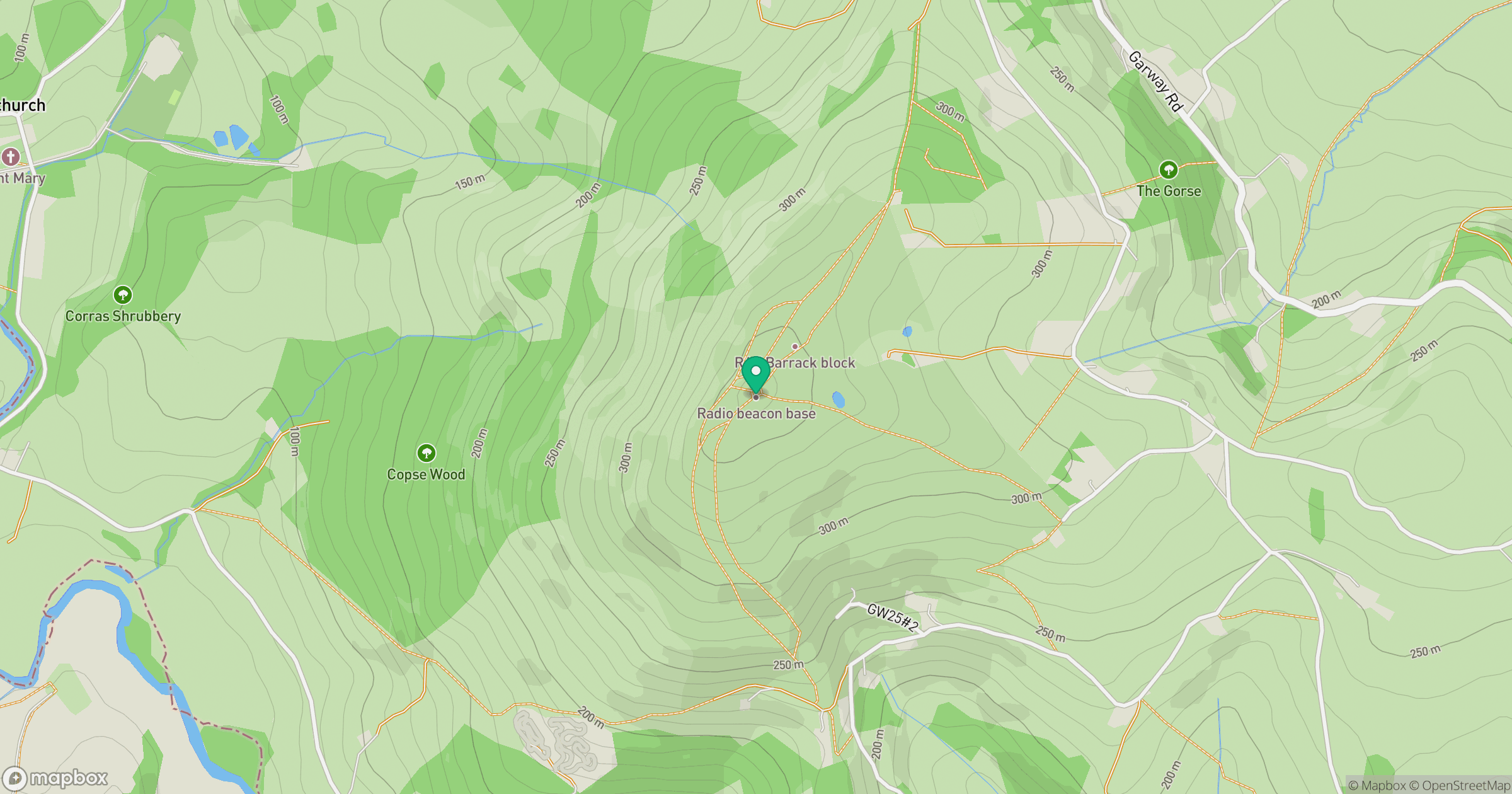
Grid reference: SO436250
View on OpenStreetMapOpens a map in a new tab, centred on the hill.

No comments yet. Be the first.