
Moelfre
Good walks are even better shared.
Overview
Moelfre: A Hiker’s Delight in Snowdonia
Overview
Nestled in the stunning Snowdonia National Park, Moelfre stands at an elevation of 621 meters, offering a panoramic view of the picturesque landscape. Known as a 'Marilyn,' this hill is perfect for those keen on tackling their first summit while being rewarded with breathtaking vistas.
Geology
Composed mostly of slate and granite, the geological formations on Moelfre tell a story of violent past volcanic activity. As you trek, keep your eyes peeled for curious rock formations. They make for great conversation starters, especially with fellow hikers!
Routes
One of the most popular paths is the Moelfre Circular Walk. This moderate trek spans approximately 7 kilometres and typically takes around 2.5 hours, ample time to stop, take photos, and catch your breath. Starting from the village of Moelfre, this route is ideal for a leisurely stroll with friends or family.
Summit Features
Reaching the summit, you’ll encounter a well-maintained stone cairn and a trig point. Both spots are immensely popular for taking those Instagram-worthy snapshots. Don’t forget to smile and wave at the cameras!
Terrain Type
Expect a mix of grassy fields and rocky outcrops as you make your ascent, along with the occasional boggy patch. Good walking boots are encouraged, particularly if you’re navigating after a good rain.
Views
Once at the top, prepare yourself for breathtaking views of Snowdon’s towering peaks and the sparkling coastline of Anglesey. For the best vistas, late spring to early autumn is prime hiking season; you’ll have clear skies and charming countryside.
Hazards
As with any mountain, there are a few pitfalls to be aware of. Sudden weather changes are common; the mountains can quickly turn moody! Additionally, some paths may become understandably slippery after rainfall. So, it’s best to take the cautionary approach and treat each step as a dance move.
Nearby Summits
If you’re feeling adventurous, consider tackling Carnedd Llewelyn, the second-highest peak in Wales, just a stumble away from Moelfre.
Access
Getting to Moelfre is easy. The nearest car park is in the village, close to the bustling A5 road. Be sure to arrive early, especially on weekends, as it can fill up faster than you can say 'tuck in!' For public transport, check the bus services from nearby towns like Betws-y-Coed.
Facilities
After your hike, treat yourself at the local café where you can refuel with a refreshing drink or a slice of cake to celebrate your mountaineering feat!
History
Speaking of history, the name Moelfre translates to 'bare hill' in Welsh—a fitting description. Locally, this hill has inspired poetry and stories, capturing the imagination of many for generations.
So, lace up those hiking boots, pack your bag, and head to Moelfre for a delightful day outdoors. You won’t regret it!
Explore routes near Moelfre
Walks starting near this hill. Open a route to check its map, distance and full itinerary.
Northern Rhinogydd guided mountain walk
View route
Mawddach Trail: Penmaenpool to Dolgellau Riverside Return
View route
Mawddach Trail: Penmaenpool to Arthog Estuary Return
View route
Coed y Brenin: Pont Ty'n-y-groes and Mawddach Forest Trail
View route
Route planning notes
These notes describe possible approaches. Check a route's map and access information when planning your walk.
Moelfre Circular Walk
A scenic circular route starting from the village of Moelfre, offering breathtaking views and a pleasant hike.
Make a day of it, together
Find someone to share the walk with, or organise a day out along a route you like.
Hill facts and local notes
Classifications
Elevation
589m
1,932 ft
Prominence
162m
Coordinates
52.8013, -4.0392
SH626245
OS Map
124
Explorer: OL18W
At the Summit
The summit features a distinctive stone cairn and a trig point, both of which make for excellent photo opportunities.
Terrain & Geology
Composed predominantly of slate and granite, Moelfre showcases fascinating geological formations that reflect the area's turbulent volcanic history.
Views & Scenery
From the summit, you can gaze upon the expansive vistas of the surrounding mountains, including the peaks of Snowdon and the coastline of Anglesey.
History & Heritage
Name Origin
The name 'Moelfre' is derived from Welsh, meaning 'bare hill,' which accurately describes its summit ridged landscape.
Historical Significance
Moelfre holds cultural significance locally, often referenced in Welsh poetry and lore, celebrated for its natural beauty.
Getting There & Facilities
Parking
There is a small car park at the village of Moelfre, situated just off the A5. Careful, though; it fills up quick on sunny weekends!
Public Transport
The nearest bus stop is located in the village, with services connecting to larger towns like Betws-y-Coed.
Nearby Facilities
Nearby facilities include a quaint café in Moelfre, perfect for a pre-hike coffee or post-hike slice of cake, and public toilets are available in the village.
Safety Information
Known Hazards
- Beware of sudden changes in weather conditions; rainstorms can roll in quicker than a sheep can bleat!
- Some paths may be slippery when wet, owing to the underlying slate.
General Safety Tips
- Check weather conditions before setting out
- Carry appropriate clothing and equipment
- Let someone know your planned route
- Take a map, compass, and GPS device
- Carry emergency supplies: food, water, first aid kit, torch
Hills
Some common questions about the hills answered
Are there group walks up Moelfre?
Many walkers use Walkmates to join or organise walks with others. You can check for group walks around Moelfre through the maps
Are there other walkers around Moelfre?
Activity varies by location and time, but Walkmates lets you see whether others have shared walks or shown interest in this area. Find other people through the walking friends search walking friends for Moelfre search or of course create your own walk for Moelfre
Can I organise a walk to Moelfre?
Yes. If there aren’t any walks listed already, you can create a walk and make it available for others to join.
If you're signed up to Walkmates, you can create a walk to Moelfre.
How do I find a walk up this hill?
There are often multiple ways to walk this hill, depending on experience and route preference. Walkmates helps you explore walks and routes that others have shared.
Can I suggest a new route up Moelfre?
Yes. You can suggest or create routes to share with others. Walkmates focuses on the social side of walking, so routes are used to help people organise walks and explore areas together, rather than as detailed navigation tools or route libraries.
Other uses really appreciate knowledgeable walkers sharing their routes. Share your favourite route to Moelfre here
The is an error or something incorrect about this hill. How do I let you know?
We always strive to keep the information on Walkmates as accurate as possible. If you find an error, please let us know through the contact form and we'll aim to correct it as quickly as possible
Community Discussion
Comments
Location
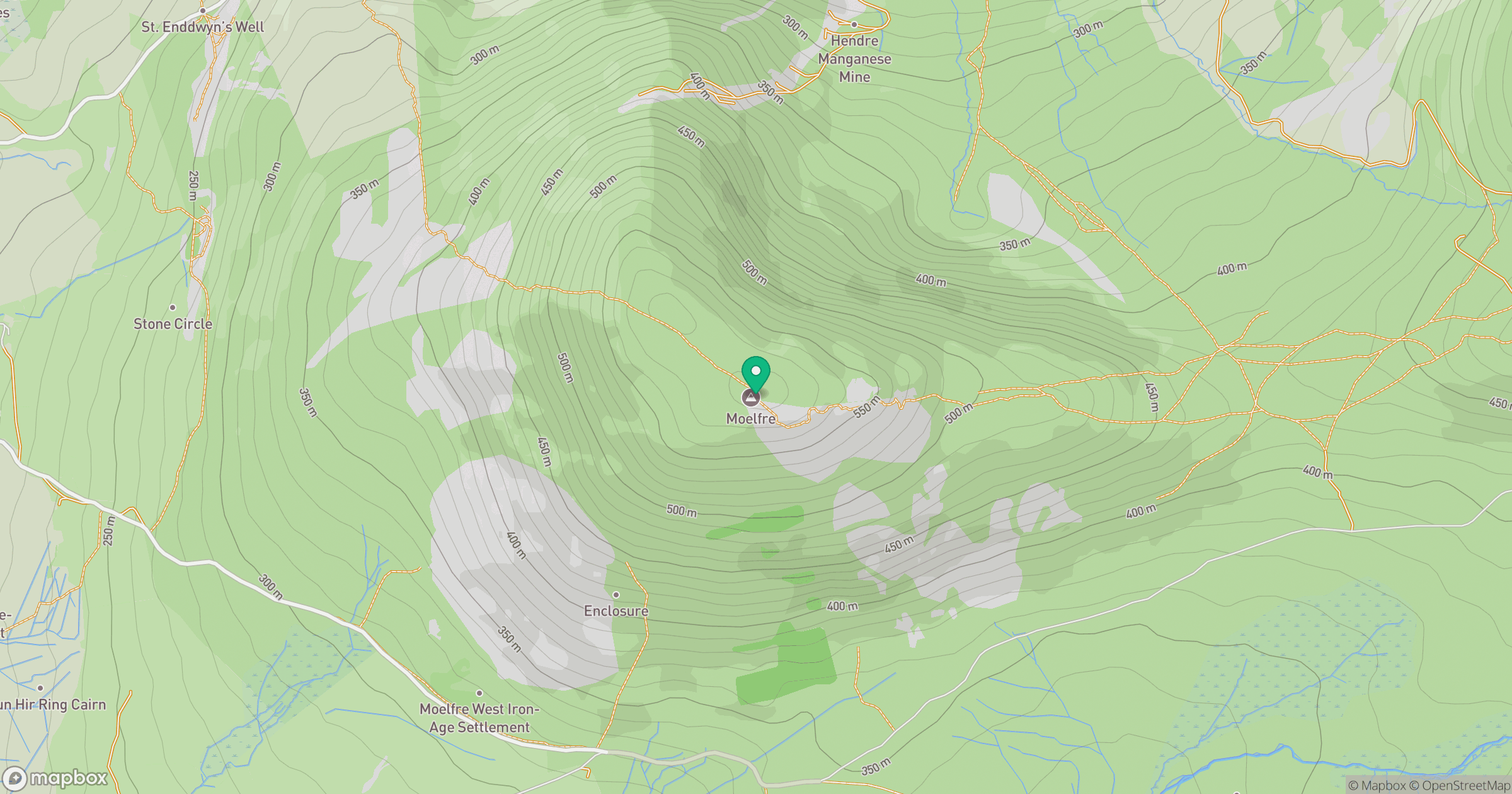
Grid reference: SH626245
View on OpenStreetMapOpens a map in a new tab, centred on the hill.
No comments yet. Be the first.