

Moel-y-Gest
Good walks are even better shared.
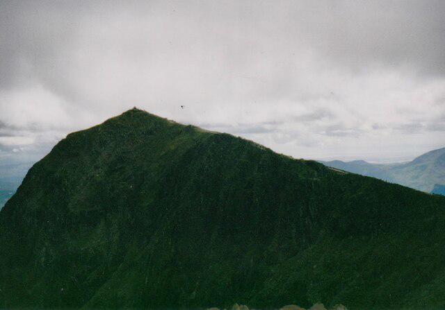
SH5438 : View from summit of Moel-y-Gest, the site of a prehistoric fort
Roger Templeman Photo source
Overview
Moel-y-Gest is a 263 m rocky Marilyn west of Porthmadog, overlooking Tremadog Bay and the Llŷn coast. Its western summit contains a prehistoric hillfort and a trig pillar, but the highest point is a boulder 18 m south of the pillar. Short approaches from Porthmadog and Borth-y-Gest climb steeply to an undulating rocky ridge; a longer circuit starts at Porthmadog railway station.
Moel-y-Gest
Overview
Moel-y-Gest is a 263 m rocky Marilyn west of Porthmadog, overlooking Tremadog Bay and the Llŷn coast. Its western summit contains a prehistoric hillfort and a trig pillar, but the highest point is a boulder 18 m south of the pillar. Short approaches from Porthmadog and Borth-y-Gest climb steeply to an undulating rocky ridge; a longer circuit starts at Porthmadog railway station.
Summit and views
The highest point is a boulder 18 m south of the trig point, at SH 54927 38894, with an elevation of 263 m. The boulder is 1.1 m higher than the ground beside the trig pillar at SH 54927 38910. An outcrop 30 m east-southeast is 40 cm lower. The eastern top crossed by common walking approaches is a separate, lower top.
In clear weather the ridge overlooks Porthmadog and Tremadog Bay, with views west along the Llŷn coast and south towards Harlech. Inland, the panorama includes the Moelwynion and Yr Wyddfa (Snowdon).
Walking routes
Borth-y-Gest circuit over the eastern and western tops
Start and finish at Borth-y-Gest waterfront car park (SH565375). Follow the signed inland approach via Tyddyn Llwyn, climb to the eastern top and cross the col to the western trig area. The true high point is the boulder 18 m south of the pillar. Descend on the southern side of the ridge, pass through the walls towards SH553380, reach the Morfa Bychan road and use the signed path to return to the waterfront car park. Walking Britain gives 6.2 km, 288 m ascent and 2 hours 40 minutes for its complete circuit via the trig area; a visit to the precise summit boulder is a short additional detour. The climb is steep in places, with walking alternatives to the optional rock scrambles.
Porthmadog eastern-ridge out-and-back
Start and finish at the published SH564390 start by Lidl on the A497, reached on foot from authorised parking. Follow the road to the signed woodland path, cross the stile at SH558389 and climb the ridge over the eastern top to the western trig area, then retrace. The highest boulder is 18 m south of the trig pillar. Walking Britain gives 4.1 km, 242 m ascent and 2 hours for its complete published return; the boulder detour and any approach from a town car park or railway station are extra. The route description does not grant permission to leave a car at Lidl. Expect steep sections, rocky steps and road-crossing care.
Porthmadog station circuit via Penmorfa and Pont Wern
Start and finish at Porthmadog mainline railway station. Follow the Cyt path towards Alltwen, then bridleways and lanes via Penmorfa to Pont Wern. Cross the A497 carefully and follow the western and southern hillside track to the col. Visit the western summit area, then return to the col and cross the eastern top. Descend through woodland to Penamser Road and follow the road back into Porthmadog and to the station. Mud and Routes gives 11.02 km and 407 m ascent for this whole circuit; its summit-area visit does not identify the precise boulder 18 m south of the trig, so allow for that extra detour. The longer approach has busy road crossings, wet ground, rough ridge sections and a steep descent.
Porthmadog harbour via Borth-y-Gest, returning the same way
Start and finish at Porthmadog harbour. Follow the coast path to Borth-y-Gest, turn inland on the hill paths to the western summit area and return to the harbour by the same route. GPS Routes gives 5 miles / 8 km for this complete harbour-to-summit outing; its description does not distinguish the trig area from the highest boulder 18 m south, so treat a precise summit visit as an extra detour. The coastal approach still leads to steep, rocky hill paths. Stay on the signed coast path and use a suitable map for the inland junctions.
Terrain and hazards
Woodland paths, pasture tracks, stiles, steep grassy slopes, an undulating rocky ridge, optional easy scrambling, locally wet ground, road crossings on the longer approaches.
- Steep paths, rocky steps and wet grass can be slippery. Some ridge lines involve easy scrambling, while other paths avoid the rock steps; choose a line within your ability and allow extra time in wet or windy weather.
- Numerous path junctions, rough ground and seasonal vegetation make route-finding important. Carry a suitable map and confirm the intended descent rather than following an arbitrary track downhill.
- Keep away from quarry edges and loose faces on the northern side. Quarry climbing routes are technical terrain and are not summit walking shortcuts.
- Take care at road crossings and on roadside sections. The long circuit via Penmorfa and Pont Wern crosses busy roads, including the A497.
Bracken and gorse can obscure paths in summer; after rain, rocky and grassy sections can become slippery. The BMC lists nesting-bird climbing restrictions in parts of Moel y Gest quarry, generally from 1 March to 31 July, subject to local updates. These apply to specified quarry bays, not a blanket closure of the summit walk. Check the current quarry access notice if approaching that area.
Access and facilities
Borth-y-Gest waterfront car park (SH565375, council postcode LL49 9TS) serves the southern circuit. The council lists it as a long-stay car park; check the current charges and conditions on arrival. Porthmadog also has council parking at Iard yr Orsaf and Llyn Bach. These town car parks add an approach to the short eastern-ridge route. Do not assume supermarket or caravan-park parking is available for hillwalking, and keep gates and access tracks clear.
Porthmadog mainline railway station on High Street is the rail gateway; it is separate from the harbour heritage station. Sherpa S4 serves Porthmadog, Borth-y-Gest and Morfa Bychan, but some journeys bypass Borth-y-Gest. Check the current timetable for your date, the correct stops and the last return, as school-term, weekend and seasonal services differ.
Porthmadog has shops and places to eat, and there are cafés by the waterfront in Borth-y-Gest. Check opening times and carry food and drinking water for the hill.
Geology and history
The British Geological Survey records dolerite at Moel-y-Gest, including pale mineral veins, and identifies former dolerite aggregate workings on the northern side. These intrusive igneous rocks occur within a local succession of sedimentary strata.
Moel y Gest Camp is a designated scheduled monument, CN059. Cadw describes a prehistoric hillfort on the western end of the hill, with stone banks, inner enclosures and natural defences on its southern side. White quartz pebbles occur in part of an enclosure bank. The exact date and function of individual features remain uncertain. Avoid disturbing the surviving banks or moving stones.
Nearby hills and features
The remains of Moel y Gest Camp occupy the western summit. Historic quarry faces and an incline are visible on the northern slopes; keep clear of their edges. Borth-y-Gest and the coast path provide a contrasting coastal approach, while Porthmadog lies east of the hill.
Nearby listed summits include Parc y Borth (74 m), Craig y Gesail (271.9 m), Y Fedw (280.1 m) and Moel y Gadair (66.7 m). These are separate hills, not additional tops on the routes above.
Explore routes near Moel-y-Gest
Walks starting near this hill. Open a route to check its map, distance and full itinerary.
Northern Rhinogydd guided mountain walk
View route
Beddgelert Forest: Llyn Llywelyn Woodland Circuit
View route
Beddgelert Forest: Derwen Circuit and Llyn Llywelyn
View route
Snowdon Pyg Track returning by Miner's Track
View route
Route planning notes
These notes describe possible approaches. Check a route's map and access information when planning your walk.
Borth-y-Gest circuit over the eastern and western tops
Start and finish at Borth-y-Gest waterfront car park (SH565375). Follow the signed inland approach via Tyddyn Llwyn, climb to the eastern top and cross the col to the western trig area. The true high point is the boulder 18 m south of the pillar. Descend on the southern side of the ridge, pass through the walls towards SH553380, reach the Morfa Bychan road and use the signed path to return to the waterfront car park. Walking Britain gives 6.2 km, 288 m ascent and 2 hours 40 minutes for its complete circuit via the trig area; a visit to the precise summit boulder is a short additional detour. The climb is steep in places, with walking alternatives to the optional rock scrambles.
Porthmadog eastern-ridge out-and-back
Start and finish at the published SH564390 start by Lidl on the A497, reached on foot from authorised parking. Follow the road to the signed woodland path, cross the stile at SH558389 and climb the ridge over the eastern top to the western trig area, then retrace. The highest boulder is 18 m south of the trig pillar. Walking Britain gives 4.1 km, 242 m ascent and 2 hours for its complete published return; the boulder detour and any approach from a town car park or railway station are extra. The route description does not grant permission to leave a car at Lidl. Expect steep sections, rocky steps and road-crossing care.
Porthmadog station circuit via Penmorfa and Pont Wern
Start and finish at Porthmadog mainline railway station. Follow the Cyt path towards Alltwen, then bridleways and lanes via Penmorfa to Pont Wern. Cross the A497 carefully and follow the western and southern hillside track to the col. Visit the western summit area, then return to the col and cross the eastern top. Descend through woodland to Penamser Road and follow the road back into Porthmadog and to the station. Mud and Routes gives 11.02 km and 407 m ascent for this whole circuit; its summit-area visit does not identify the precise boulder 18 m south of the trig, so allow for that extra detour. The longer approach has busy road crossings, wet ground, rough ridge sections and a steep descent.
Porthmadog harbour via Borth-y-Gest, returning the same way
Start and finish at Porthmadog harbour. Follow the coast path to Borth-y-Gest, turn inland on the hill paths to the western summit area and return to the harbour by the same route. GPS Routes gives 5 miles / 8 km for this complete harbour-to-summit outing; its description does not distinguish the trig area from the highest boulder 18 m south, so treat a precise summit visit as an extra detour. The coastal approach still leads to steep, rocky hill paths. Stay on the signed coast path and use a suitable map for the inland junctions.
Make a day of it, together
Find someone to share the walk with, or organise a day out along a route you like.
Photo Gallery
View all Photo could not load
SH5438 : View from summit of Moel-y-Gest, the site of a prehistoric fort
Roger Templeman
 Photo could not load
SH5538 : Moel-y-Gest
Chris Andrews
 Photo could not load
SH5438 : Moel y Gest, Porthmadog
Phil Brandon Hunter
 Photo could not load
SH5438 : Moel Tecwyn, Maentwrog
Phil Brandon Hunter
 Photo could not load
SH5438 : Moel-y-Gest from Criccieth Castle
Ian Rushin
 Photo could not load
SH5438 : Moel-y-Gest looking north-east from the Llŷn coastal path
Rod Grealish
 Photo could not load
SH5438 : View of Moel-y-Gest
Chris Andrews
 Photo could not load
SH5438 : On Moel-y-Gest - Trig Point & view towards Allt-wen
Colin Park
 Photo could not load
SH5438 : Trig Point, Moel-y-Gest
Chris Andrews

SH5438 : Summit of Moel-y-Gest with trig point
Trevor Littlewood
Hill facts and local notes
Classifications
Elevation
263m
863 ft
Prominence
237m
Coordinates
52.9278, -4.1597
SH549388
OS Map
124
Explorer: OL18W 254
At the Summit
The highest point is a boulder 18 m south of the trig point, at SH 54927 38894, with an elevation of 263 m. The boulder is 1.1 m higher than the ground beside the trig pillar at SH 54927 38910. An outcrop 30 m east-southeast is 40 cm lower. The eastern top crossed by common walking approaches is a separate, lower top.
Terrain & Geology
The British Geological Survey records dolerite at Moel-y-Gest, including pale mineral veins, and identifies former dolerite aggregate workings on the northern side. These intrusive igneous rocks occur within a local succession of sedimentary strata.
Views & Scenery
In clear weather the ridge overlooks Porthmadog and Tremadog Bay, with views west along the Llŷn coast and south towards Harlech. Inland, the panorama includes the Moelwynion and Yr Wyddfa (Snowdon).
History & Heritage
Historical Significance
Moel y Gest Camp is a designated scheduled monument, CN059. Cadw describes a prehistoric hillfort on the western end of the hill, with stone banks, inner enclosures and natural defences on its southern side. White quartz pebbles occur in part of an enclosure bank. The exact date and function of individual features remain uncertain. Avoid disturbing the surviving banks or moving stones.
Getting There & Facilities
Parking
Borth-y-Gest waterfront car park (SH565375, council postcode LL49 9TS) serves the southern circuit. The council lists it as a long-stay car park; check the current charges and conditions on arrival. Porthmadog also has council parking at Iard yr Orsaf and Llyn Bach. These town car parks add an approach to the short eastern-ridge route. Do not assume supermarket or caravan-park parking is available for hillwalking, and keep gates and access tracks clear.
Public Transport
Porthmadog mainline railway station on High Street is the rail gateway; it is separate from the harbour heritage station. Sherpa S4 serves Porthmadog, Borth-y-Gest and Morfa Bychan, but some journeys bypass Borth-y-Gest. Check the current timetable for your date, the correct stops and the last return, as school-term, weekend and seasonal services differ.
Nearby Facilities
Porthmadog has shops and places to eat, and there are cafés by the waterfront in Borth-y-Gest. Check opening times and carry food and drinking water for the hill.
Safety Information
Known Hazards
- Steep paths, rocky steps and wet grass can be slippery. Some ridge lines involve easy scrambling, while other paths avoid the rock steps; choose a line within your ability and allow extra time in wet or windy weather.
- Numerous path junctions, rough ground and seasonal vegetation make route-finding important. Carry a suitable map and confirm the intended descent rather than following an arbitrary track downhill.
- Keep away from quarry edges and loose faces on the northern side. Quarry climbing routes are technical terrain and are not summit walking shortcuts.
- Take care at road crossings and on roadside sections. The long circuit via Penmorfa and Pont Wern crosses busy roads, including the A497.
Seasonal Hazards
Bracken and gorse can obscure paths in summer; after rain, rocky and grassy sections can become slippery. The BMC lists nesting-bird climbing restrictions in parts of Moel y Gest quarry, generally from 1 March to 31 July, subject to local updates. These apply to specified quarry bays, not a blanket closure of the summit walk. Check the current quarry access notice if approaching that area.
General Safety Tips
- Check weather conditions before setting out
- Carry appropriate clothing and equipment
- Let someone know your planned route
- Take a map, compass, and GPS device
- Carry emergency supplies: food, water, first aid kit, torch
Hills
Some common questions about the hills answered
Are there group walks up Moel-y-Gest?
Many walkers use Walkmates to join or organise walks with others. You can check for group walks around Moel-y-Gest through the maps
Are there other walkers around Moel-y-Gest?
Activity varies by location and time, but Walkmates lets you see whether others have shared walks or shown interest in this area. Find other people through the walking friends search walking friends for Moel-y-Gest search or of course create your own walk for Moel-y-Gest
Can I organise a walk to Moel-y-Gest?
Yes. If there aren’t any walks listed already, you can create a walk and make it available for others to join.
If you're signed up to Walkmates, you can create a walk to Moel-y-Gest.
How do I find a walk up this hill?
There are often multiple ways to walk this hill, depending on experience and route preference. Walkmates helps you explore walks and routes that others have shared.
Can I suggest a new route up Moel-y-Gest?
Yes. You can suggest or create routes to share with others. Walkmates focuses on the social side of walking, so routes are used to help people organise walks and explore areas together, rather than as detailed navigation tools or route libraries.
Other uses really appreciate knowledgeable walkers sharing their routes. Share your favourite route to Moel-y-Gest here
The is an error or something incorrect about this hill. How do I let you know?
We always strive to keep the information on Walkmates as accurate as possible. If you find an error, please let us know through the contact form and we'll aim to correct it as quickly as possible
Community Discussion
Comments
Location
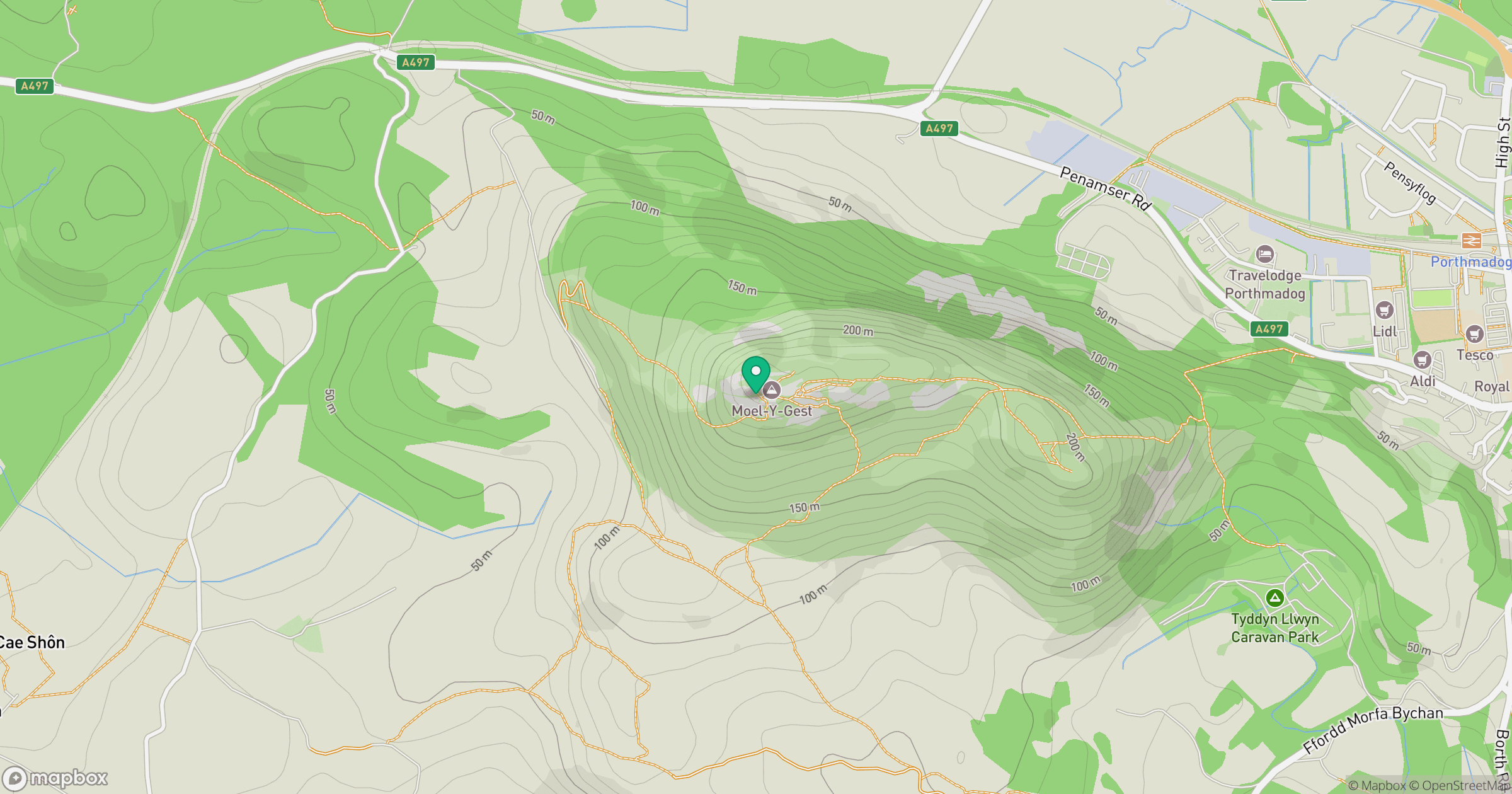
Grid reference: SH549388
View on OpenStreetMapOpens a map in a new tab, centred on the hill.
No comments yet. Be the first.