
Moel-ddu
Good walks are even better shared.
Overview
Moel-ddu: A Gem in Snowdonia
Overview
Situated within the breathtaking Snowdonia National Park, Moel-ddu stands at an impressive 749 meters, offering an exhilarating experience for hikers looking to explore Wales's rugged beauty. This Marilyn boasts both height and prominence, making it a celebrated destination for outdoor enthusiasts.
Routes
The most commonly taken path is the Moel-ddu Circuit which begins at the quaint village of Cwm Saebwr. Covering about 8 km, this route is moderate in difficulty, providing a delightful combination of challenging ascents and gentle slopes as you navigate around Moel-ddu's periphery.
Geology
Moel-ddu's geology is fascinating; formed from ancient volcanic activity, future geologists could hold a masterclass on its rugged beauty. The rhyolite gives it a rough exterior, perfect for climbing and photo opportunities. In layman's terms—it’s pretty rocky, so mind your step and don't let the mountain's beauty distract you from where you're putting your feet!
Summit Features
At the top of Moel-ddu, adventurers are greeted by a sturdy cairn, which acts as a proud beacon for fellow hikers. The views are nothing short of spectacular; look out for the majestic Snowdon towering in the distance, almost peeking at you with a 'who’s the boss' kind of vibe.
Terrain and Views
The terrain comprises a blend of rocky paths and inviting grassy areas. However, do keep your wits about you—one wrong step could turn a gentle stroll into a gravity-defying dance! Best views are during spring and summer when the skies are clear, and the sun blesses the mountains with golden hues. Autumn is equally stunning, showcasing a riot of colours that very well could give Van Gogh a run for his money.
Hazards
As beautiful as Moel-ddu is, it does have its quirks. Uneven paths can be tricky, so a steady footing is key. Remember, weather can change faster than you can say ‘frightfully British’, so pack that waterproof jacket.
Nearby Summits
Just a stone's throw away is Moel Eilio, with its own set of challenges and beautiful views. It’s worth combining both summits for a more comprehensive hiking experience, not to mention some serious bragging rights!
Access and Facilities
For those driving, Cwm Saebwr offers a convenient car park to start your adventure. If public transport is your jam, consider making your way to Llanberis and catch a local bus to get closer. Post-hike, Llanberis has a variety of cafes and facilities to satiate any after-hike hunger pangs.
History and Significance
The name Moel-ddu evokes images of ancient stories long forgotten, as it translates to 'black hill' in Welsh. Its cultural significance is steeped in local lore—so keep your ears open for tales from the older generations that may enrich your visit!
Remember, hiking is about enjoyment, challenge, and the breathtaking views. Leave no trace, embrace nature, and don’t forget to take plenty of photos. Happy hiking!
Explore routes near Moel-ddu
Walks starting near this hill. Open a route to check its map, distance and full itinerary.
Beddgelert Forest: Derwen Circuit and Llyn Llywelyn
View route
Beddgelert Forest: Llyn Llywelyn Woodland Circuit
View route
Snowdon Pyg Track returning by Miner's Track
View route
Northern Rhinogydd guided mountain walk
View route
Route planning notes
These notes describe possible approaches. Check a route's map and access information when planning your walk.
Moel-ddu Circuit
A scenic loop starting from the nearby village of Cwm Saebwr, offering stunning views as you ascend the flanks of Moel-ddu.
Make a day of it, together
Find someone to share the walk with, or organise a day out along a route you like.
Hill facts and local notes
Classifications
Elevation
552m
1,812 ft
Prominence
199m
Coordinates
52.9764, -4.1169
SH579442
OS Map
124
Explorer: OL18W
At the Summit
The summit of Moel-ddu features a distinctive cairn and offers sweeping views across the surrounding mountains and valleys, including views of Snowdon in the distance.
Terrain & Geology
Moel-ddu is primarily composed of volcanic rock, specifically rhyolite, which forms steep cliffs and rugged outcrops. These geological features are a testament to the mountain's volcanic origins, contributing to its dramatic landscape.
Views & Scenery
From the summit, you can see the impressive peaks of Snowdown, the gentle slopes of the Carneddau, and the expansive valleys cradling hidden lakes.
History & Heritage
Name Origin
The name Moel-ddu translates from Welsh to 'black hill', likely referring to the dark volcanic rock of the mountain’s slopes.
Historical Significance
Moel-ddu has served as a landmark for navigation in the region for centuries, steeped in local folklore and stories of ancient times.
Getting There & Facilities
Parking
Parking is available at Cwm Saebwr, where you'll find a small car park (postcode: LL56 4JW).
Public Transport
Buses run from Llanberis to the nearby village of Nant Peris, but a car is preferred for more convenient access.
Nearby Facilities
Cafes, restaurants, and toilet facilities can be found in Llanberis, perfect for a post-hike treat or to stock up on supplies.
Safety Information
Known Hazards
- Uneven terrain may lead to slips and trips; weather can change rapidly, so be prepared for all conditions.
General Safety Tips
- Check weather conditions before setting out
- Carry appropriate clothing and equipment
- Let someone know your planned route
- Take a map, compass, and GPS device
- Carry emergency supplies: food, water, first aid kit, torch
Hills
Some common questions about the hills answered
Are there group walks up Moel-ddu?
Many walkers use Walkmates to join or organise walks with others. You can check for group walks around Moel-ddu through the maps
Are there other walkers around Moel-ddu?
Activity varies by location and time, but Walkmates lets you see whether others have shared walks or shown interest in this area. Find other people through the walking friends search walking friends for Moel-ddu search or of course create your own walk for Moel-ddu
Can I organise a walk to Moel-ddu?
Yes. If there aren’t any walks listed already, you can create a walk and make it available for others to join.
If you're signed up to Walkmates, you can create a walk to Moel-ddu.
How do I find a walk up this hill?
There are often multiple ways to walk this hill, depending on experience and route preference. Walkmates helps you explore walks and routes that others have shared.
Can I suggest a new route up Moel-ddu?
Yes. You can suggest or create routes to share with others. Walkmates focuses on the social side of walking, so routes are used to help people organise walks and explore areas together, rather than as detailed navigation tools or route libraries.
Other uses really appreciate knowledgeable walkers sharing their routes. Share your favourite route to Moel-ddu here
The is an error or something incorrect about this hill. How do I let you know?
We always strive to keep the information on Walkmates as accurate as possible. If you find an error, please let us know through the contact form and we'll aim to correct it as quickly as possible
Community Discussion
Comments
Location
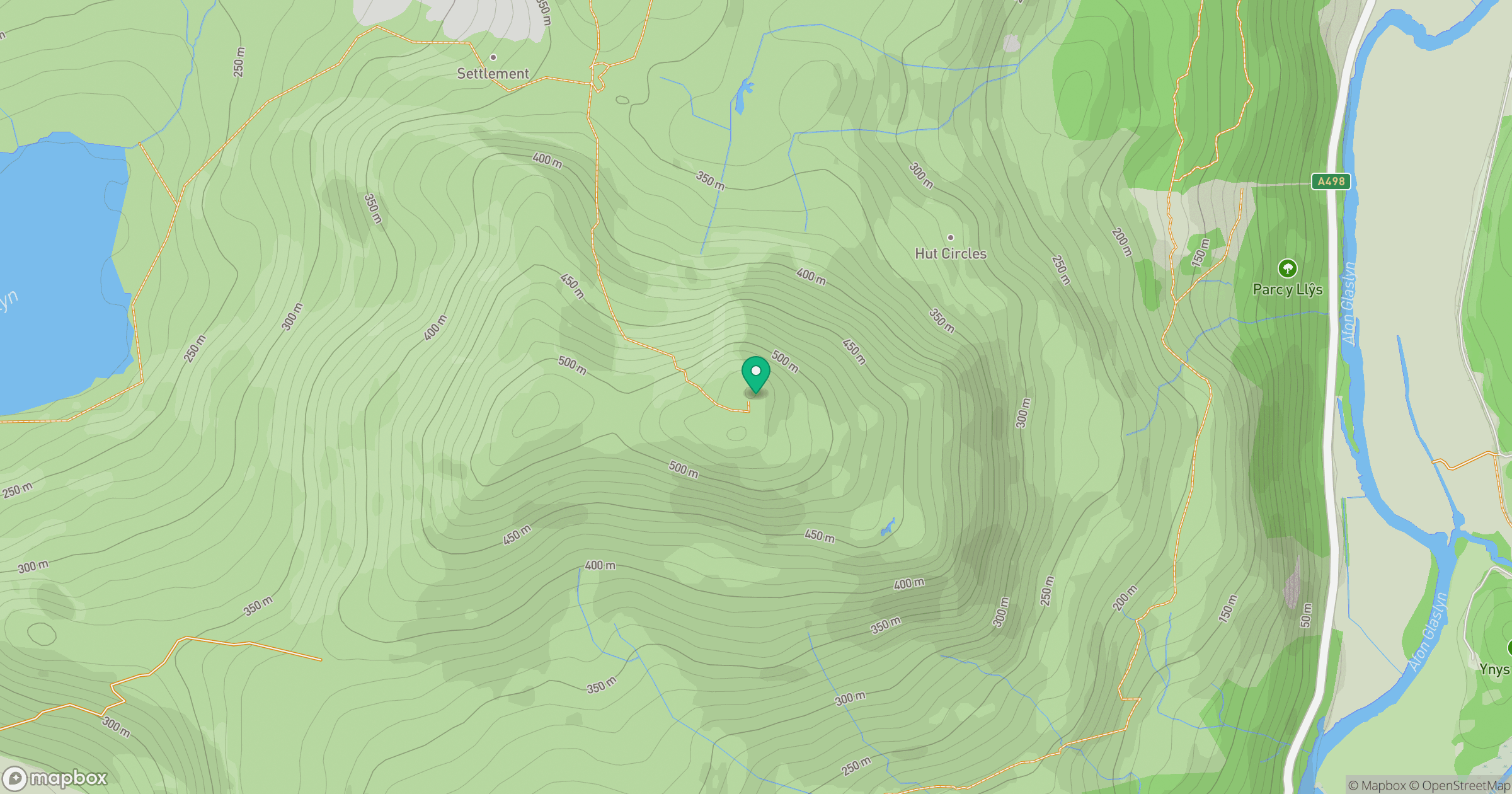
Grid reference: SH579442
View on OpenStreetMapOpens a map in a new tab, centred on the hill.
No comments yet. Be the first.