

Meikle Balloch Hill
Good walks are even better shared.
Overview
Meikle Balloch Hill: A Hiker's Delight
Introduction
Nestled within the serene Grampian Mountains, Meikle Balloch Hill offers an accessible yet rewarding hiking experience for outdoor enthusiasts of all skill levels. Standing at an impressive 458 meters, it is classified as a Marilyn, and truly deserves a spot on your hiking list.
Geology
The hill is predominantly composed of granitic rock, a long-lasting material shaped through millennia by natural elements. You'll notice glacial scars and rocky outcrops that tell the tale of a landscape shaped by ancient ice, providing not only a beautiful hike but an educational experience too!
Routes
The most popular route is the Balloch Castle Park Trail, which begins at Balloch Castle Park. This moderate route spans approximately 5 kilometers, perfect for a casual stroll or a family hike. The climb is gentle, allowing you to soak in the views without working up too much sweat. Set aside about 2.5 hours to complete the hike, enjoy your surroundings, and perhaps even chat with the local wildlife.
Summit Features
Upon reaching the summit, you’ll be greeted by a sturdy cairn and a trig point—a classic British hiking experience that invites every hiker to take a photo and pat themselves on the back for a job well done.
Terrain
Expect to encounter a mix of grassy expanses and rocky stretches. The path is well-marked, ensuring that your boots stick to solid ground and not boggy patches (though a good pair of waterproofs is never a bad idea!).
Views
Once at the top, prepare to feast your eyes on breathtaking views that stretch across Loch Lomond and beyond. Spring and early autumn are particularly splendid, with vibrant colours showcasing the stunning terrain.
Hazards
While the hike is quite manageable, it's wise to keep an eye on the weather, as conditions can change rapidly. Avoid the urge to start a sheep conversation—those rams can be rather territorial!
Access
Balloch Castle Park offers ample parking, and for those relying on public transport, the short walk from Balloch train station makes it easy to plan your adventure without the hassle of driving.
Facilities
Before or after your hike, Balloch has several cafés and visitor facilities, plus toilets to ensure you’start and finish your trek comfortably.
History
The term 'Meikle Balloch' means 'Big Hill', a fitting tribute to its meaningful stature within the landscape. Its historical significance is intertwined with Scottish culture and is a landmark for both locals and tourists alike.
Whether you're seeking solace in nature or a thrill from the views, Meikle Balloch Hill is an essential stop on your outdoor exploration in the UK.
Conclusion
So lace up those hiking boots, grab your camera, and head out for an adventure that won't disappoint. Just remember to share the views and a good story (or two) with fellow hikers along the way!
Explore routes near Meikle Balloch Hill
Public walks starting within 80 km of this hill. Nearby does not mean a route reaches the summit; check its map and access before setting out.
Speyside Way: Buckie to Fochabers via Spey Bay
View route
Craigellachie to Aberlour: Speyside Railway Path Return
View route
Aberlour to Carron Bridge: Speyside Way riverside return
View route
Elgin guided night walk
View route
Route planning notes
These notes describe possible approaches, not verified navigable routes or permission to cross land. Check current paths, local access rules and conditions before setting out.
Balloch Castle Park Trail
A scenic route starting from Balloch Castle Park that meanders alongside the loch before ascending the hill. This path is particularly popular among families and those looking for a leisurely hike.
Make a day of it, together
Find someone to share the walk with, or organise a day out along a route you like.
Photo Gallery
View all Photo could not load
NJ4749 : Summit, Balloch Hill
Richard Webb
 Photo could not load
NJ4749 : Summit of Balloch Hill
Richard Webb
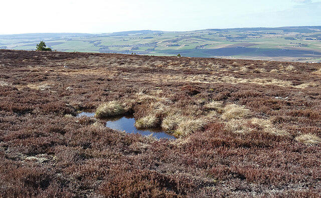 Photo could not load
NJ4749 : Horn Gow
Anne Burgess
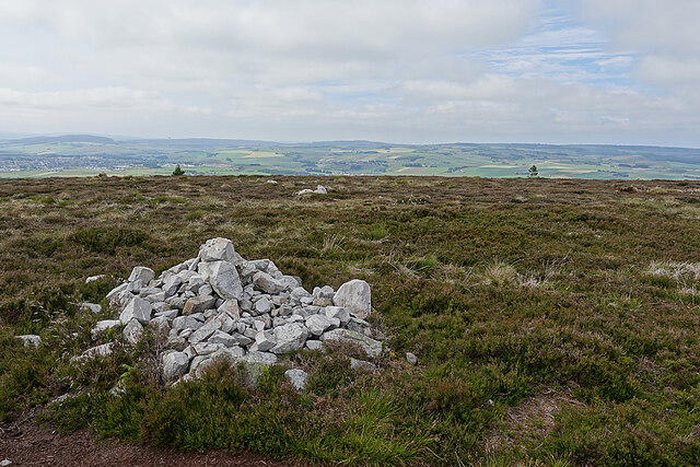 Photo could not load
NJ4749 : Meikle Balloch Summit Cairn
Anne Burgess
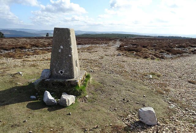 Photo could not load
NJ4749 : Triangulation Pillar on Meikle Balloch
Anne Burgess
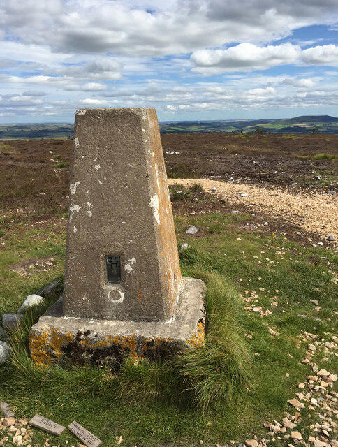 Photo could not load
NJ4749 : Meikle Balloch Trig Point Flush Bracket S7049
thejackrustles
 Photo could not load
NJ4749 : Trig point, Balloch Hill
Richard Webb
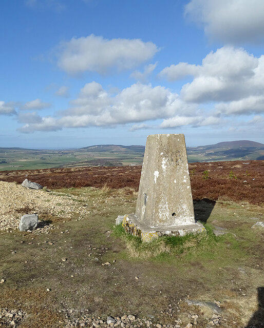 Photo could not load
NJ4749 : Triangulation Pillar
Anne Burgess
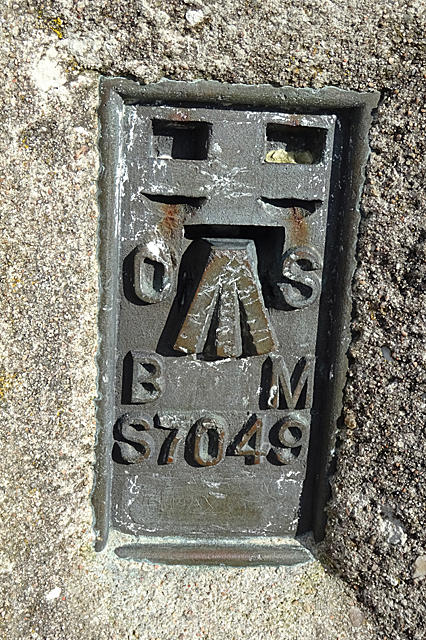 Photo could not load
NJ4749 : Ordnance Survey Bench Mark
Anne Burgess
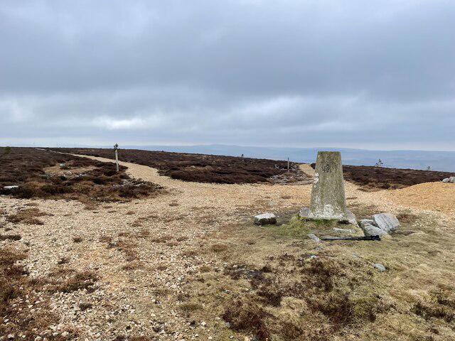
NJ4749 : Meikle Balloch Hill Summit
Ralph Greig
Hill facts and local notes
Classifications
Elevation
366m
1,201 ft
Prominence
193m
Coordinates
57.5327, -2.8850
NJ471495
OS Map
28 29
Explorer: 425S
At the Summit
The summit features a prominent cairn and a trig point, often adorned with a few visitors' hats and a sense of accomplishment. It’s a fantastic spot for a celebratory snack or just to catch your breath.
Terrain & Geology
Primarily granitic rock with some evidence of glacial activity shaping the landscape. The rocky outcrops provide a fascinating sight for geology enthusiasts and a sturdy footpath for those enjoying the ascent.
Views & Scenery
From the summit, one can spot the sparkling waters of Loch Lomond, distant peaks of the Highlands, and the expansive rolling hills of the Grampian range.
History & Heritage
Name Origin
The name 'Meikle Balloch' translates from Scots Gaelic, meaning 'Big Hill', which quite frankly is a fitting name, considering its stature over the surrounding landscape.
Historical Significance
Meikle Balloch Hill has been a favoured spot for hikers and geologists alike, providing historical context with its ancient geological features.
Getting There & Facilities
Check current local access restrictions, parking rules and transport timetables before travelling. These notes do not confirm public access to the summit.
Parking
Parking is available at Balloch Castle Park, which is well-signposted and offers ample spaces, perfect for those weekend warriors.
Public Transport
Accessible via public transport from Glasgow. The Balloch train station is a short walk from the park, making it a breeze for car-free hikers.
Nearby Facilities
Cafés and toilets can be found in Balloch, including those at the visitor centre, ensuring a good cup of coffee is never far away.
Safety Information
Known Hazards
- While generally safe, be wary of sudden changes in weather and watch for sheep who think they're the bosses of the hills!
General Safety Tips
- Check weather conditions before setting out
- Carry appropriate clothing and equipment
- Let someone know your planned route
- Take a map, compass, and GPS device
- Carry emergency supplies: food, water, first aid kit, torch
Hills
Some common questions about the hills answered
Are there group walks up Meikle Balloch Hill?
Many walkers use Walkmates to join or organise walks with others. You can check for group walks around Meikle Balloch Hill through the maps
Are there other walkers around Meikle Balloch Hill?
Activity varies by location and time, but Walkmates lets you see whether others have shared walks or shown interest in this area. Find other people through the walking friends search walking friends for Meikle Balloch Hill search or of course create your own walk for Meikle Balloch Hill
Can I organise a walk to Meikle Balloch Hill?
Yes. If there aren’t any walks listed already, you can create a walk and make it available for others to join.
If you're signed up to Walkmates, you can create a walk to Meikle Balloch Hill.
How do I find a walk up this hill?
There are often multiple ways to walk this hill, depending on experience and route preference. Walkmates helps you explore walks and routes that others have shared.
Can I suggest a new route up Meikle Balloch Hill?
Yes. You can suggest or create routes to share with others. Walkmates focuses on the social side of walking, so routes are used to help people organise walks and explore areas together, rather than as detailed navigation tools or route libraries.
Other uses really appreciate knowledgeable walkers sharing their routes. Share your favourite route to Meikle Balloch Hill here
The is an error or something incorrect about this hill. How do I let you know?
We always strive to keep the information on Walkmates as accurate as possible. If you find an error, please let us know through the contact form and we'll aim to correct it as quickly as possible
Community Discussion
Comments
Location
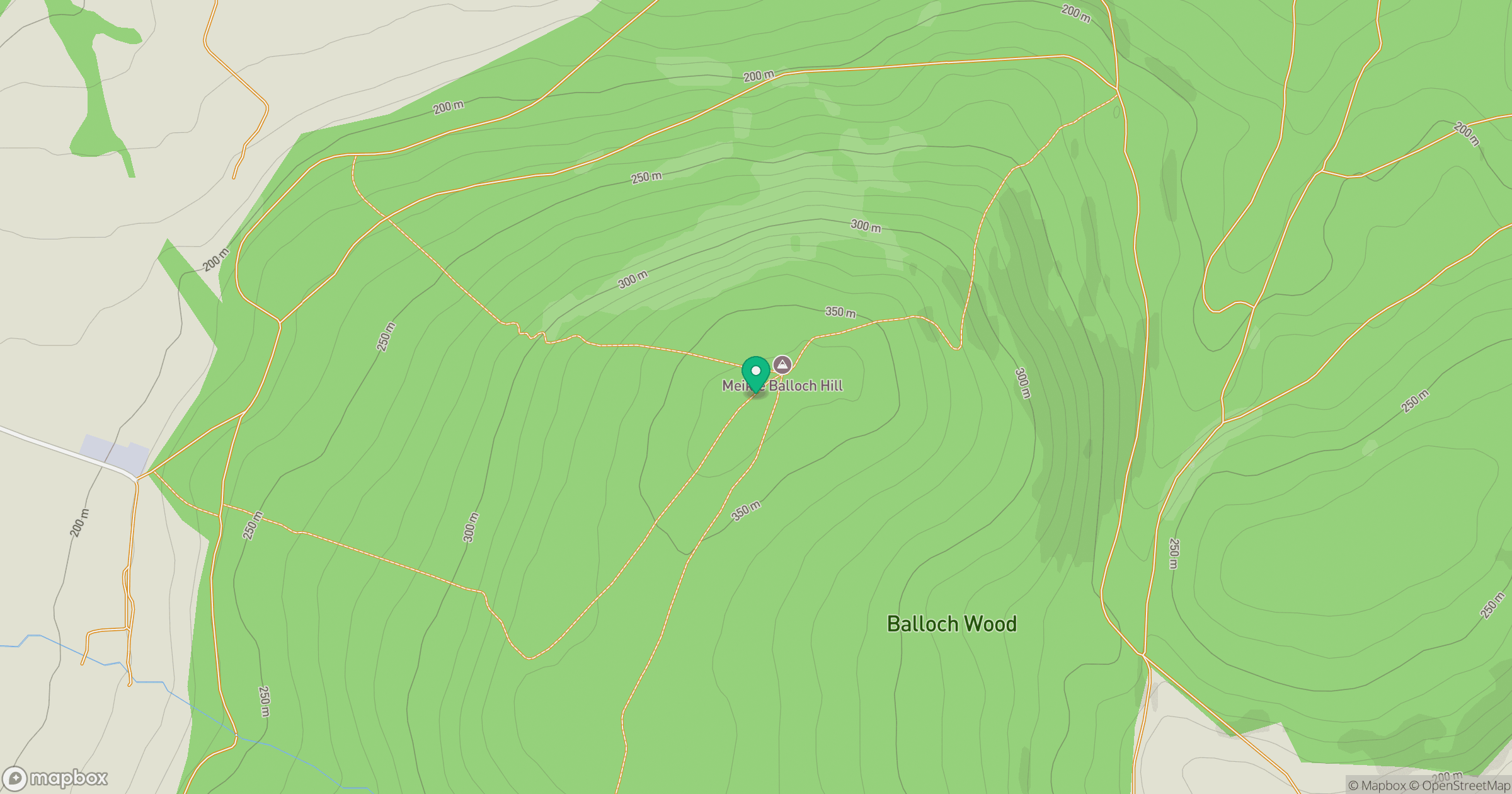
Grid reference: NJ471495
View on OpenStreetMapOpens a map in a new tab, centred on the hill.
Hills within 30 km
Straight-line distance, not a walking route or confirmation of access.
No comments yet. Be the first.