
Tips of Clunymore
Good walks are even better shared.
Overview
Tips of Clunymore: A Hiker's Delight
Nestled in the stunning Scottish Highlands, Tips of Clunymore stands proudly at 601m. This Marilyn provides a moderate hike that is perfect for those looking to stretch their legs and enjoy the breathtaking scenery.
Geology
The mountain is primarily granite, dotted with intriguing quartz veins. The geological history here is a tale of fire and ice, with the formations echoing the earth’s tumultuous past.
Route Information
For the keen hiker, the Clunymore Circuit offers a delightful journey starting from Cannich. At 8.5 km, this route typically takes about 3.5 hours. You'll stroll through enchanting forests and open moors, gradually ascending towards the rewarding summit that greets you with fantastic views.
Summit Features
Reaching the summit, you’ll encounter a prominent cairn and the usual trig point, perfect for that obligatory Instagram snap. Just make sure you’ve caught your breath first!
Terrain
The terrain varies from rocky to grassy slopes, with some boggy patches that could dampen your spirits (if not your feet).
Amazing Views
On a clear day, the vistas are nothing short of spectacular. With Glen Affric sprawling below and distant peaks beckoning in the horizon, you’ll find it’s well worth the climb. For the best views, aim to summit around sunset or sunrise when the light bathes the landscape in a golden hue.
Hazards
While embarking on this adventure, remain mindful of the unpredictable weather. Conditions can shift quicker than you can say 'Scottish showers', so be prepared! And keep an eye out for livestock on the lower paths—they're not always keen to share the trail.
Access
Parking is available in Cannich, but if you fancy a bus ride, check the schedules as they can be sparse. Cannich itself is a vibrantly welcoming village with a local shop and a cafe to fuel your journey.
Nearby Summits
For those keen to explore further, nearby summits like Mullach na Dheiragain and Sgurr nan Ceathramhnan promise additional adventures waiting to unfold!
Conclusion
Tips of Clunymore is more than just a hill; it's a gateway to the soul of the Highlands. So lace up your hiking boots, grab a buddy, and set out for an unforgettable day in nature.
Happy hiking, and remember: the path to adventure often starts with just a single step!
Explore routes near Tips of Clunymore
Public walks starting within 80 km of this hill. Nearby does not mean a route reaches the summit; check its map and access before setting out.
Craigellachie to Aberlour: Speyside Railway Path Return
View route
Aberlour to Carron Bridge: Speyside Way riverside return
View route
Speyside Way: Buckie to Fochabers via Spey Bay
View route
Elgin guided night walk
View route
Route planning notes
These notes describe possible approaches, not verified navigable routes or permission to cross land. Check current paths, local access rules and conditions before setting out.
Clunymore Circuit
Starting from the small village of Cannich, this route takes you through lush forests and open moorland, culminating in fantastic views from the summit.
Make a day of it, together
Find someone to share the walk with, or organise a day out along a route you like.
Hill facts and local notes
Classifications
Elevation
395m
1,296 ft
Prominence
128m
Coordinates
57.4585, -3.0859
NJ349414
OS Map
28
Explorer: 424S
At the Summit
The summit features a noticeable cairn and a rusty old trig point. Nothing says 'I've made it!' like a good picture next to a pile of stones.
Terrain & Geology
The mountain is primarily composed of granite, which is often riddled with interesting quartz veins and offers a fascinating look at the geological processes that shaped this land.
Views & Scenery
From the summit, you can see the stunning Glen Affric, and on a clear day, the peaks of Kintail and the great expanse of Loch Ness are also visible.
History & Heritage
Name Origin
The name 'Clunymore' is thought to derive from the Gaelic 'Cnoc Mòr', meaning 'big hill'. Quite apt, don't you think?
Historical Significance
Historically, this area has been significant for its rich natural resources and its role in local mythology. It's said that the local faeries have quite the dance parties at night!
Getting There & Facilities
Check current local access restrictions, parking rules and transport timetables before travelling. These notes do not confirm public access to the summit.
Parking
There is a small gravel car park at Cannich, which provides ample space. However, it can fill up quickly on sunny weekends, so arrive early!
Public Transport
Buses run from Inverness to Cannich; however, they can be infrequent, so check the schedule before planning your trip.
Nearby Facilities
The village of Cannich has a small shop and a cafe that serves hot meals and refreshing drinks. Toilets are available at the village hall.
Safety Information
Known Hazards
- Watch out for sudden weather changes, as conditions can become unsettled quickly in the Highlands. Also, be wary of livestock in the lower pastures!
General Safety Tips
- Check weather conditions before setting out
- Carry appropriate clothing and equipment
- Let someone know your planned route
- Take a map, compass, and GPS device
- Carry emergency supplies: food, water, first aid kit, torch
Hills
Some common questions about the hills answered
Are there group walks up Tips of Clunymore?
Many walkers use Walkmates to join or organise walks with others. You can check for group walks around Tips of Clunymore through the maps
Are there other walkers around Tips of Clunymore?
Activity varies by location and time, but Walkmates lets you see whether others have shared walks or shown interest in this area. Find other people through the walking friends search walking friends for Tips of Clunymore search or of course create your own walk for Tips of Clunymore
Can I organise a walk to Tips of Clunymore?
Yes. If there aren’t any walks listed already, you can create a walk and make it available for others to join.
If you're signed up to Walkmates, you can create a walk to Tips of Clunymore.
How do I find a walk up this hill?
There are often multiple ways to walk this hill, depending on experience and route preference. Walkmates helps you explore walks and routes that others have shared.
Can I suggest a new route up Tips of Clunymore?
Yes. You can suggest or create routes to share with others. Walkmates focuses on the social side of walking, so routes are used to help people organise walks and explore areas together, rather than as detailed navigation tools or route libraries.
Other uses really appreciate knowledgeable walkers sharing their routes. Share your favourite route to Tips of Clunymore here
The is an error or something incorrect about this hill. How do I let you know?
We always strive to keep the information on Walkmates as accurate as possible. If you find an error, please let us know through the contact form and we'll aim to correct it as quickly as possible
Community Discussion
Comments
Location
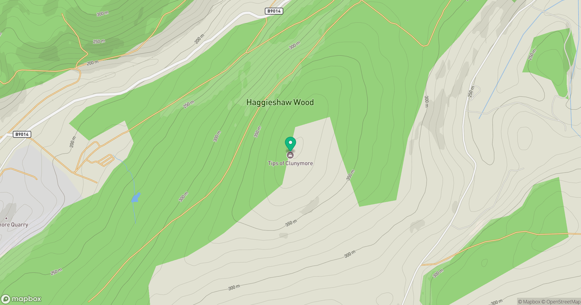
Grid reference: NJ349414
View on OpenStreetMapOpens a map in a new tab, centred on the hill.
Hills within 30 km
Straight-line distance, not a walking route or confirmation of access.
No comments yet. Be the first.