
Meall Uaine
Good walks are even better shared.
Overview
Meall Uaine
Located in the heart of the Scottish Highlands, Meall Uaine towers majestically at an elevation of 1,036 meters. This Munro provides an unforgettable experience for hikers and outdoor enthusiasts, with its stunning views and varied terrain.
Geology
Meall Uaine's geological interest lies in its granite composition. This hard-wearing rock provides an excellent platform for climbing, though do keep an eye out for loose stones that might roll underfoot. Much like your New Year's resolutions, it holds firm but can be a bit shaky in sections!
Routes
Two main routes lead to the summit: the Allt a' Chonais Route is the most popular, offering a moderate trek through scenic landscapes, while the North Ridge Route serves up a more challenging but spectacular ascent. Whichever you choose, be prepared for a memorable journey.
Summit Features
At the summit, a humble cairn stands in homage to the countless adventurers that have reached this point. Once you’ve conquered the hill, take a moment to soak in the sweeping views that will make all the effort worthwhile.
Terrain Type
The terrain is a diverse mix of rocky paths and lush grassy slopes. Be cautious of boggy patches near the base—after all, mud isn’t a good look for any hiker!
Views
Highlights
From the top, you can gaze across the Glen Etive hills, with stunning sights of Beinn Starav and other neighboring peaks. A camera is a must, as these views are worth capturing!
Best Seasons
Late spring through early autumn are ideal for hiking Meall Uaine, as the weather is generally more stable. Also, don’t miss out on the vibrant colours that paint the landscape during these months.
Hazards
As with any mountain adventure, be aware of potential hazards. Loose rocks can be tricky, and the weather can turn on a dime, shifting from sunny to stormy quicker than you can say 'highland fling'. Boggy areas at the base may also surprise you, so tread carefully.
Nearby Summits
While Meall Uaine is a delightful destination in its own right, consider visiting nearby peaks like Beinn Starav and Stob Coire Raineach for a full day of hiking bliss.
Access
Nearest Parking
A handy car park can be found at the end of the B8074 road, just a stone’s throw from the start of the Allt a' Chonais Route.
Public Transport
Regular bus services are available to the area from Crianlarich, where the nearest train station lies.
Nearest Town
Crianlarich is the closest town and provides essential amenities for hungry hikers.
Facilities
Before heading out, make sure to fill up on supplies in Crianlarich, where you’ll find cafes, shops, and public toilets. You’ll want to grab that much-needed cup of tea!
History
Name Meaning
The name Meall Uaine means 'Green Hill' in Gaelic, a testament to its beautiful, verdant landscapes.
Significance
The land surrounding Meall Uaine has been significant for local clans, historically used for hunting and grazing. It still holds cultural value today.
Happy hiking!
Explore routes near Meall Uaine
Walks starting near this hill. Open a route to check its map, distance and full itinerary.
Kenmore: Drummond Hill Black Rock Trail above Loch Tay
View route
Aberfeldy: Glassie Woodland and River Tay Circular
View route
Rothiemurchus: Beaver Trail and Lochan Mor
View route
Aviemore: Loch an Eilein and the Croft Track from Rothiemurchus
View route
Route planning notes
These notes describe possible approaches. Check a route's map and access information when planning your walk.
Allt a' Chonais Route
A popular route starting from the southern slopes, following the Allt a' Chonais stream.
North Ridge Route
A steeper ascent from the north that rewards with stunning views, but requires a bit more effort.
Make a day of it, together
Find someone to share the walk with, or organise a day out along a route you like.
Hill facts and local notes
Classifications
Elevation
902m
2,959 ft
Prominence
21m
Coordinates
56.8626, -4.1919
NN664767
OS Map
42
Explorer: OL51W 394W
At the Summit
The summit features a modest cairn and impressive views of the surrounding peaks, making you feel on top of the world—quite literally!
Terrain & Geology
Meall Uaine is primarily composed of granite, part of the Grampian Mountains. This sturdy rock offers a firm footing, though some sections may be a bit loose—much like your favourite trousers after Christmas dinner!
Views & Scenery
From the summit, you'll enjoy panoramic vistas of the Glen Etive hills, Beinn Starav, and the surrounding peaks of the Highlands. Don’t forget your camera!
History & Heritage
Name Origin
Meall Uaine translates to 'Green Hill' in Gaelic, which captures the hill’s lush appearance during the warmer months.
Historical Significance
The area around Meall Uaine has historical significance, being part of the ancient lands used for hunting and grazing by the local clans.
Getting There & Facilities
Parking
There is a car park at the end of the B8074 road, close to the start of the Allt a' Chonais route.
Public Transport
The nearest train station is in Tyndrum; buses run to the area regularly. Check the schedules to ensure you don't miss your ride!
Nearby Facilities
Cafes and shops are available in Crianlarich, as well as public toilets. Make sure to grab a cup of tea before your adventure.
Safety Information
Known Hazards
- Loose rocks on the ascent, sudden weather changes, boggy ground in lower areas.
General Safety Tips
- Check weather conditions before setting out
- Carry appropriate clothing and equipment
- Let someone know your planned route
- Take a map, compass, and GPS device
- Carry emergency supplies: food, water, first aid kit, torch
Hills
Some common questions about the hills answered
Are there group walks up Meall Uaine?
Many walkers use Walkmates to join or organise walks with others. You can check for group walks around Meall Uaine through the maps
Are there other walkers around Meall Uaine?
Activity varies by location and time, but Walkmates lets you see whether others have shared walks or shown interest in this area. Find other people through the walking friends search walking friends for Meall Uaine search or of course create your own walk for Meall Uaine
Can I organise a walk to Meall Uaine?
Yes. If there aren’t any walks listed already, you can create a walk and make it available for others to join.
If you're signed up to Walkmates, you can create a walk to Meall Uaine.
How do I find a walk up this hill?
There are often multiple ways to walk this hill, depending on experience and route preference. Walkmates helps you explore walks and routes that others have shared.
Can I suggest a new route up Meall Uaine?
Yes. You can suggest or create routes to share with others. Walkmates focuses on the social side of walking, so routes are used to help people organise walks and explore areas together, rather than as detailed navigation tools or route libraries.
Other uses really appreciate knowledgeable walkers sharing their routes. Share your favourite route to Meall Uaine here
The is an error or something incorrect about this hill. How do I let you know?
We always strive to keep the information on Walkmates as accurate as possible. If you find an error, please let us know through the contact form and we'll aim to correct it as quickly as possible
Community Discussion
Comments
Location
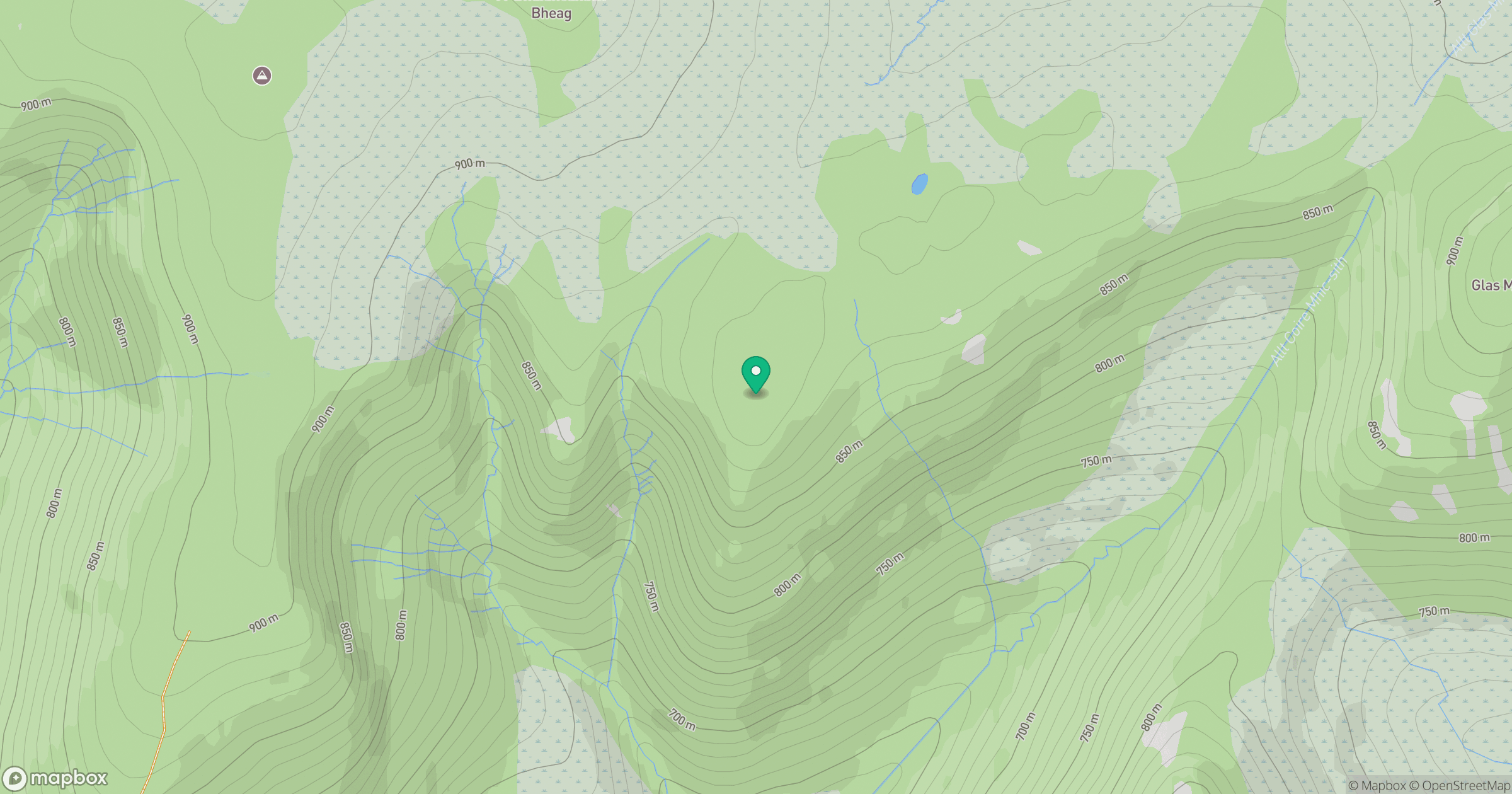
Grid reference: NN664767
View on OpenStreetMapOpens a map in a new tab, centred on the hill.
No comments yet. Be the first.