

Meall Chuaich
Good walks are even better shared.
NN7187 : Summit plateau of Meall Chuaich
Trevor Littlewood Photo source
Overview
Meall Chuaich
Meall Chuaich stands proudly at an elevation of 810 meters in the heart of the Scottish Highlands. As a Munro, it's a beloved target for many hikers keen to tick off their mountain list.
Geology
The mountain's geology is primarily dominated by schist, adding a unique charm to its craggy outline. The rock formations are not just picturesque, but they also tell a story of geological transformation—a bit like the mountains' very own history book!
Routes
One of the most popular routes to the summit is the Northern Approach, which begins at Dalwhinnie. The journey stretches approximately 11 km and typically takes about 4.5 hours. This moderate route winds gently upwards, revealing stunning views as you ascend, a perfect way to warm up before reaching the summit.
Summit Features
Upon reaching the top, adventurers are greeted by a substantial cairn. It's a fantastic spot for a celebratory photo; just don’t forget to wave at the sheep that are likely watching your every move!
Terrain Type
Expect a mix of rocky terrain paired with grassiness and a few boggy sections. A good pair of hiking boots will serve you well, especially in the boggy bits, which may try to claim your footwear!
Views
From the summit, you’ll be rewarded with breathtaking views, including the expansive Loch Laggan and the mountainous backdrop that includes the iconic Ben Nevis. For the best sights, plan your hike during late spring or autumn; the landscapes are stunning during these seasons.
Hazards
Like any venture into the wild, there are hazards to consider. Weather can shift swiftly, reducing visibility, so stay prepared and keep an eye on the skies! Be cautious of slippery sections on your descent, especially after rainfall.
Access
Parking
The nearest parking can be found at the Dalwhinnie visitor centre, where it’s advisable to secure a spot early in the day.
Public Transport
Dalwhinnie is accessible via regular train services from both Edinburgh and Inverness, ensuring that your adventure starts off without a hitch.
Nearby Town
You’ll find the quaint village of Dalwhinnie just a stone's throw away, making it an ideal hub for your hiking expeditions.
Facilities
In Dalwhinnie, there’s a small cafe, as well as a distillery for those looking to treat themselves post-hike. Plus, the visitor centre provides toilet facilities, ensuring you can discuss your venture to the summit in relative comfort afterwards.
History
The name Meall Chuaich translates to 'bump of the [river] Chuaich' in Gaelic, showcasing its geographical significance. This mountain holds cultural allure in the Scottish Highland community, making it more than just a hike but a step into the region's storied past.
So, whether you’re a seasoned hiker or just looking to stretch your legs, Meall Chuaich offers both challenge and charm for all who dare to venture to its summit. Good luck, and may your boots stay dry!
Explore routes near Meall Chuaich
Walks starting near this hill. Open a route to check its map, distance and full itinerary.
Rothiemurchus: Beaver Trail and Lochan Mor
View route
Aviemore: Loch an Eilein and the Croft Track from Rothiemurchus
View route
Fort Augustus to Kytra Lock: Caledonian Canal Towpath
View route
Aberfeldy: Glassie Woodland and River Tay Circular
View route
Route planning notes
These notes describe possible approaches. Check a route's map and access information when planning your walk.
Northern Approach
A popular route starting from Dalwhinnie which offers steady ascent with views opening up along the way.
Make a day of it, together
Find someone to share the walk with, or organise a day out along a route you like.
Photo Gallery
View all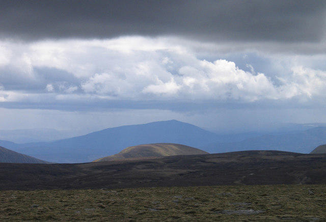 Photo could not load
NN7187 : Summit plateau of Meall Chuaich
Trevor Littlewood
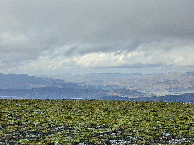 Photo could not load
NN7187 : View towards Laggan from Meall Chuaich
Nigel Brown
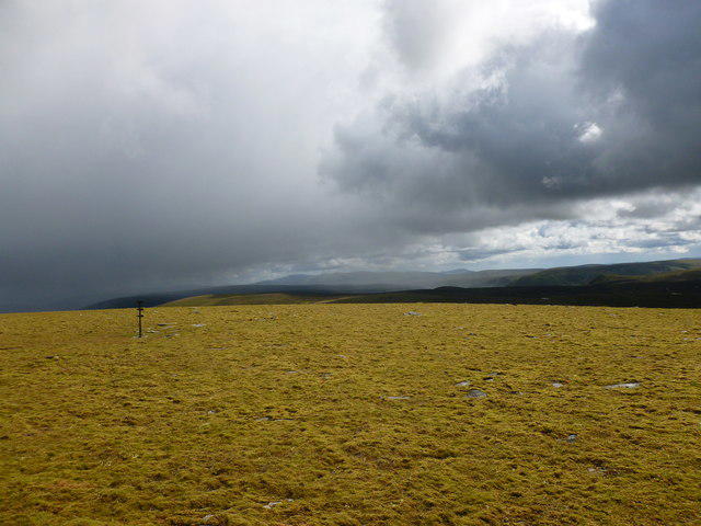 Photo could not load
NN7187 : Mossy summit plateau, Meall Chuaich
Alan O'Dowd
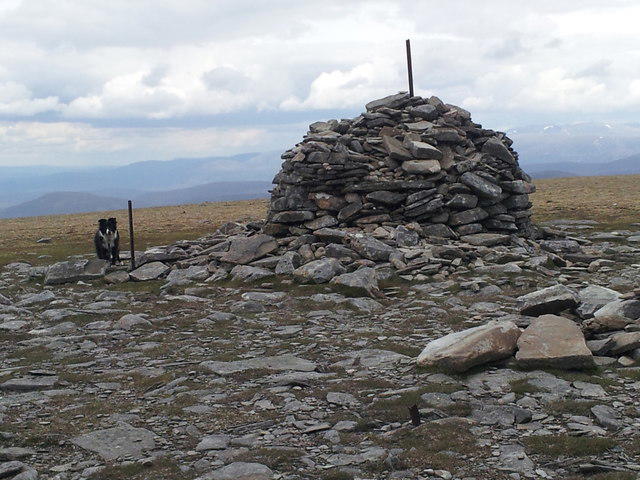 Photo could not load
NN7187 : Meall Chuaich
John Horner
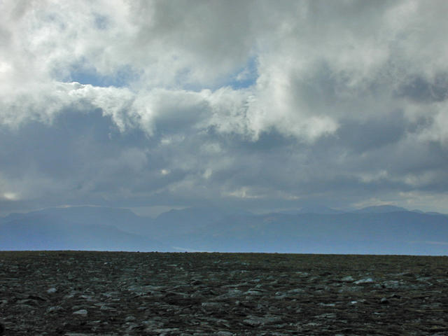 Photo could not load
NN7187 : Clouds gathering to the west
Nigel Brown
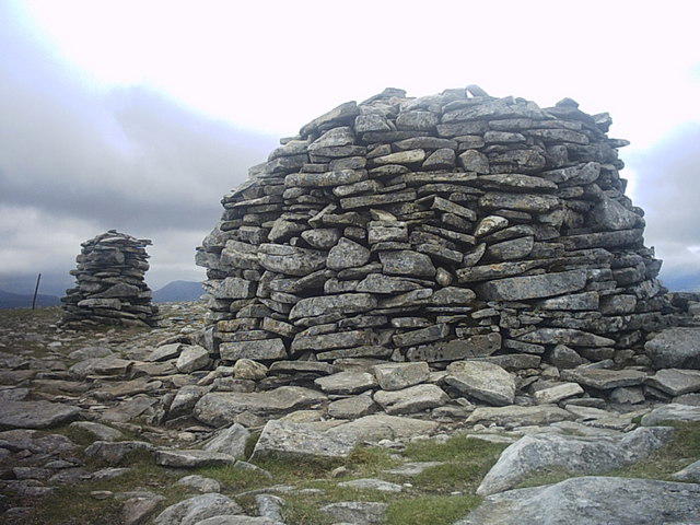 Photo could not load
NN7187 : Summit of Meall Chuaich
Ross Mathieson
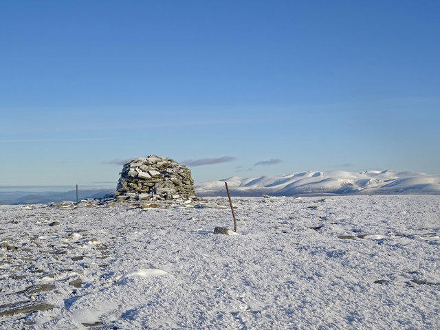 Photo could not load
NN7187 : Meall Chuaich Summit and View
Adam Ward
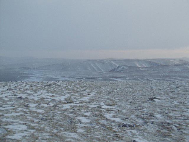 Photo could not load
NN7187 : Meall Chuaich's summit plateau
Richard Webb
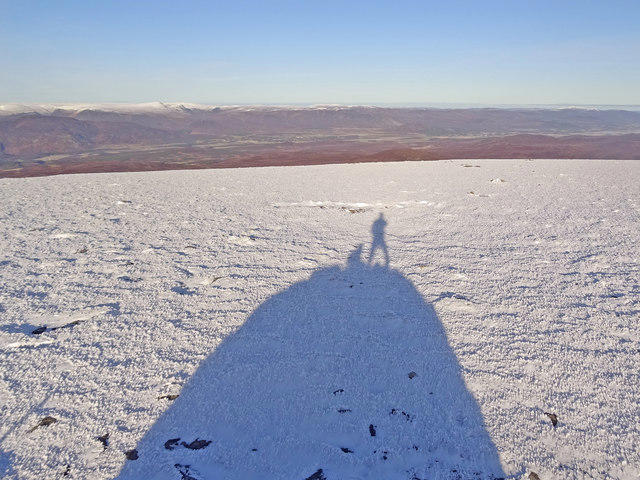 Photo could not load
NN7187 : Man and Beast
Adam Ward
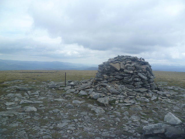
NN7187 : Cairn on Meall Chuaich
Michael Graham
Hill facts and local notes
Classifications
Elevation
951m
3,119 ft
Prominence
466m
Coordinates
56.9639, -4.1126
NN716878
OS Map
42
Explorer: OL51W 394W
At the Summit
The summit is marked by a sizable cairn, perfect for capturing those priceless summit selfies. Enjoy the glorious 360-degree views, evidenced by the occasional sea of sheep drifting lazily below.
Terrain & Geology
Meall Chuaich is primarily composed of schist, providing a rugged but enthralling terrain. You'll find some stunning rock formations and a veritable patchwork of heathland and grass.
Views & Scenery
On a clear day, the expanse of Loch Laggan and the rugged peaks of the surrounding mountains are breathtakingly visible. Keep your eyes peeled for the distant gaze of Ben Nevis peeking at you from afar.
History & Heritage
Name Origin
The name 'Meall Chuaich' is derived from Gaelic meaning 'bump of the [river] Chuaich', reflecting its geographical prominence.
Historical Significance
Meall Chuaich has been a popular challenge among Munro-baggers and features in the local lore of the Highland community.
Getting There & Facilities
Parking
The nearest parking area is at the Dalwhinnie visitor centre. It provides ample space for vehicles and is the logical starting point for your climb.
Public Transport
Regular trains run to Dalwhinnie from both Edinburgh and Inverness, making it easy to hop on the scenic route to adventure.
Nearby Facilities
While in Dalwhinnie, you can find a small cafe and the local whisky distillery if you fancy a wee dram after your hike. Toilets are also available at the visitor centre.
Safety Information
Known Hazards
- Variable weather conditions can lead to sudden changes in visibility; make sure to check forecasts before heading out. Additionally, watch for slippery rocks, especially after rain.
General Safety Tips
- Check weather conditions before setting out
- Carry appropriate clothing and equipment
- Let someone know your planned route
- Take a map, compass, and GPS device
- Carry emergency supplies: food, water, first aid kit, torch
Hills
Some common questions about the hills answered
Are there group walks up Meall Chuaich?
Many walkers use Walkmates to join or organise walks with others. You can check for group walks around Meall Chuaich through the maps
Are there other walkers around Meall Chuaich?
Activity varies by location and time, but Walkmates lets you see whether others have shared walks or shown interest in this area. Find other people through the walking friends search walking friends for Meall Chuaich search or of course create your own walk for Meall Chuaich
Can I organise a walk to Meall Chuaich?
Yes. If there aren’t any walks listed already, you can create a walk and make it available for others to join.
If you're signed up to Walkmates, you can create a walk to Meall Chuaich.
How do I find a walk up this hill?
There are often multiple ways to walk this hill, depending on experience and route preference. Walkmates helps you explore walks and routes that others have shared.
Can I suggest a new route up Meall Chuaich?
Yes. You can suggest or create routes to share with others. Walkmates focuses on the social side of walking, so routes are used to help people organise walks and explore areas together, rather than as detailed navigation tools or route libraries.
Other uses really appreciate knowledgeable walkers sharing their routes. Share your favourite route to Meall Chuaich here
The is an error or something incorrect about this hill. How do I let you know?
We always strive to keep the information on Walkmates as accurate as possible. If you find an error, please let us know through the contact form and we'll aim to correct it as quickly as possible
Community Discussion
Comments
Location
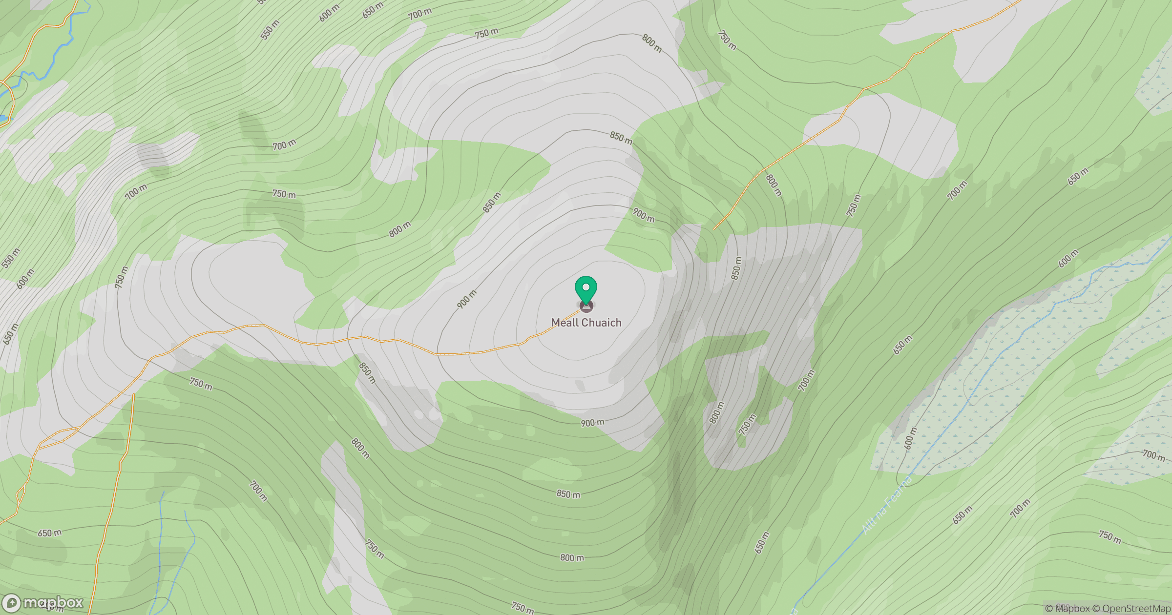
Grid reference: NN716878
View on OpenStreetMapOpens a map in a new tab, centred on the hill.
Nearby Hills
Binnein Mor
550m
Schiehallion
1,083m
Sgor Gaoith
1,116m
Ben Alder
1,148m
Beinn a' Ghlo - Carn Liath
976m
No comments yet. Be the first.