

Meall a' Choire Chreagaich
Good walks are even better shared.
Overview
Meall a' Choire Chreagaich
Introduction
Nestled in the Scottish Highlands, Meall a' Choire Chreagaich stands tall at 919 meters as a proud Munro. Its name, which charmingly translates to 'hill of the stony hollow', alludes to its rugged terrain and picturesque surroundings. A favourite amongst local hikers, this peak promises a challenging yet rewarding adventure for outdoor enthusiasts.
Geology
Composed mainly of quartzite, the rocky features of Meall a' Choire Chreagaich provide a glistening appearance under the sun. However, don’t be fooled into thinking it’s all smooth sailing; in wet conditions, this surface can transform into a slippery challenge worth remembering.
Routes
- From Invershin: This moderate 10 km route begins near Invershin and promises a steady ascent. Expect to have your breath taken twice: once by the climb and once by the stunning views that unfold.
- East Ridge: For those looking for more of a challenge, this 8.5 km route will take you straight up the East Ridge where you’ll encounter a few tricky sections. A perfect recipe for testing those fitness levels!
Summit Features
The summit boasts a distinctive cairn, an iconic feature that hikers often marvel at while basking in the panoramic views. From this lofty height, you truly can feel like the monarch of the Highlands!
Terrain Type
Expect a mix of rocky inclines and lush grassy patches, peppered with boggy areas that will have your footwear debating whether they should be labelled waterproof.
Views
The summit offers mesmerizing views of the surrounding landscape, including Loch Shin and the rolling hills of Sutherland. The best times to enjoy these sights are late spring and early autumn when the weather is milder and the visibility is frequently at its best.
Hazards
Hikers should remember that weather in the Highlands can change at the drop of a hat. A sunny day can quickly transition to a blustery snowstorm, so dressing in layers and bringing appropriate gear is vital. Also, watch your step on rocky paths which can be slippery, particularly after rain.
Access
Nearest parking can be found at the Invershin Hotel, which also serves as a good launching point for your hike. Public transport is quite accessible with regular buses and trains to Lairg, from where you might require a taxi to the trailhead. The charming little town of Lairg is just a stone's throw away.
Facilities
The Invershin Hotel not only offers parking but also food and refreshments to refuel hikers after their adventures. Nearby public toilets will keep you comfortable before and after the climb.
Conclusion
Whether you're an experienced mountaineer or a casual walker looking for a new challenge, Meall a' Choire Chreagaich offers a delightful blend of stunning landscapes, geology, and the chance for a bit of adventure. Remember to keep your camera handy – the views might just take your breath away!
Enjoy your hike, but remember: if you stop for a breather, make sure you're not in a bog!
Explore routes near Meall a' Choire Chreagaich
Public walks starting within 80 km of this hill. Nearby does not mean a route reaches the summit; check its map and access before setting out.
Kenmore: Drummond Hill Black Rock Trail above Loch Tay
View route
Aberfeldy: Glassie Woodland and River Tay Circular
View route
Crieff: Lady Mary's Walk and the River Earn
View route
Killin: Falls of Dochart, Finlarig and Moirlanich Longhouse
View route
Route planning notes
These notes describe possible approaches, not verified navigable routes or permission to cross land. Check current paths, local access rules and conditions before setting out.
From Invershin
A scenic route starting near Invershin, providing a steady ascent with stunning views.
East Ridge
This route approaches via the East Ridge, offering a more direct ascent with a few challenging sections.
Make a day of it, together
Find someone to share the walk with, or organise a day out along a route you like.
Photo Gallery
View all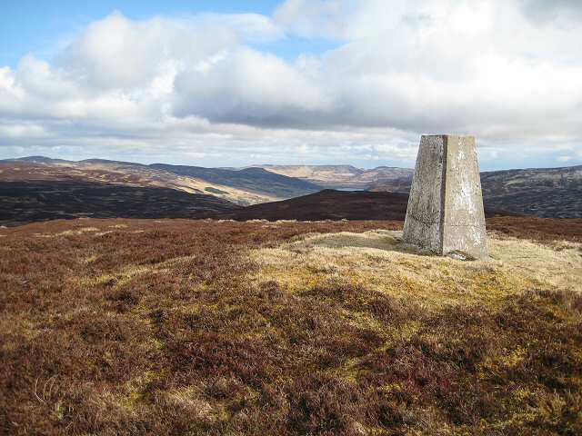 Photo could not load
NN7941 : Meall a Choire Chreagaich
Lis Burke
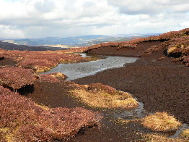 Photo could not load
NN7941 : Peat hag below Meall a' Choire Chreagaich
Rob Burke
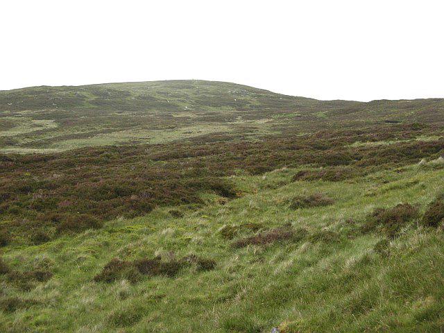 Photo could not load
NN7941 : Meall a' Choire Chreagaich
Richard Webb
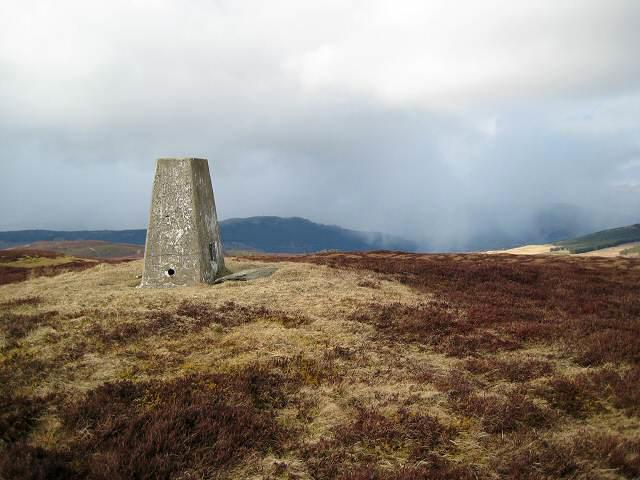 Photo could not load
NN7941 : Another hail shower approaching
Lis Burke
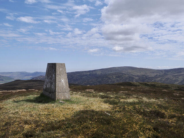 Photo could not load
NN7941 : Summit area of Meall a' Choire Chreagaich
Trevor Littlewood
Hill facts and local notes
Classifications
Elevation
665m
2,182 ft
Prominence
127m
Coordinates
56.5529, -3.9652
NN792418
OS Map
51 52
Explorer: 379W
At the Summit
The summit features a prominent cairn and a panoramic view that makes you feel like the king of the world (or at least the Highlands).
Terrain & Geology
The summit is composed predominantly of quartzite, which can be tricky in wet conditions, yet provides stunning views due to its reflective qualities under the right sunlight.
Views & Scenery
You can spot the rolling hills of Sutherland, the nearby Loch Shin, and in the distance, the vastness of the North Coast 500.
History & Heritage
Name Origin
The name translates to 'hill of the stony hollow', a reference to its craggy terrain.
Historical Significance
While Meall a' Choire Chreagaich is not a heavily trodden tourist path, it holds its own in the hearts of local adventurers and offers a quieter retreat into nature.
Getting There & Facilities
Check current local access restrictions, parking rules and transport timetables before travelling. These notes do not confirm public access to the summit.
Parking
There is parking available at the Invershin Hotel or along the A9 near the start of the trail.
Public Transport
Frequent trains and buses run to Lairg from Inverness, from where you can arrange a taxi to Invershin.
Nearby Facilities
The Invershin Hotel offers food and refreshments, and there's also a public toilet facility available nearby.
Safety Information
Known Hazards
- Rapid weather changes can occur; be prepared for everything from sunshine to sudden snow flurries. Watch out for loose rocks on steeper sections.
General Safety Tips
- Check weather conditions before setting out
- Carry appropriate clothing and equipment
- Let someone know your planned route
- Take a map, compass, and GPS device
- Carry emergency supplies: food, water, first aid kit, torch
Hills
Some common questions about the hills answered
Are there group walks up Meall a' Choire Chreagaich?
Many walkers use Walkmates to join or organise walks with others. You can check for group walks around Meall a' Choire Chreagaich through the maps
Are there other walkers around Meall a' Choire Chreagaich?
Activity varies by location and time, but Walkmates lets you see whether others have shared walks or shown interest in this area. Find other people through the walking friends search walking friends for Meall a' Choire Chreagaich search or of course create your own walk for Meall a' Choire Chreagaich
Can I organise a walk to Meall a' Choire Chreagaich?
Yes. If there aren’t any walks listed already, you can create a walk and make it available for others to join.
If you're signed up to Walkmates, you can create a walk to Meall a' Choire Chreagaich.
How do I find a walk up this hill?
There are often multiple ways to walk this hill, depending on experience and route preference. Walkmates helps you explore walks and routes that others have shared.
Can I suggest a new route up Meall a' Choire Chreagaich?
Yes. You can suggest or create routes to share with others. Walkmates focuses on the social side of walking, so routes are used to help people organise walks and explore areas together, rather than as detailed navigation tools or route libraries.
Other uses really appreciate knowledgeable walkers sharing their routes. Share your favourite route to Meall a' Choire Chreagaich here
The is an error or something incorrect about this hill. How do I let you know?
We always strive to keep the information on Walkmates as accurate as possible. If you find an error, please let us know through the contact form and we'll aim to correct it as quickly as possible
Community Discussion
Comments
Location
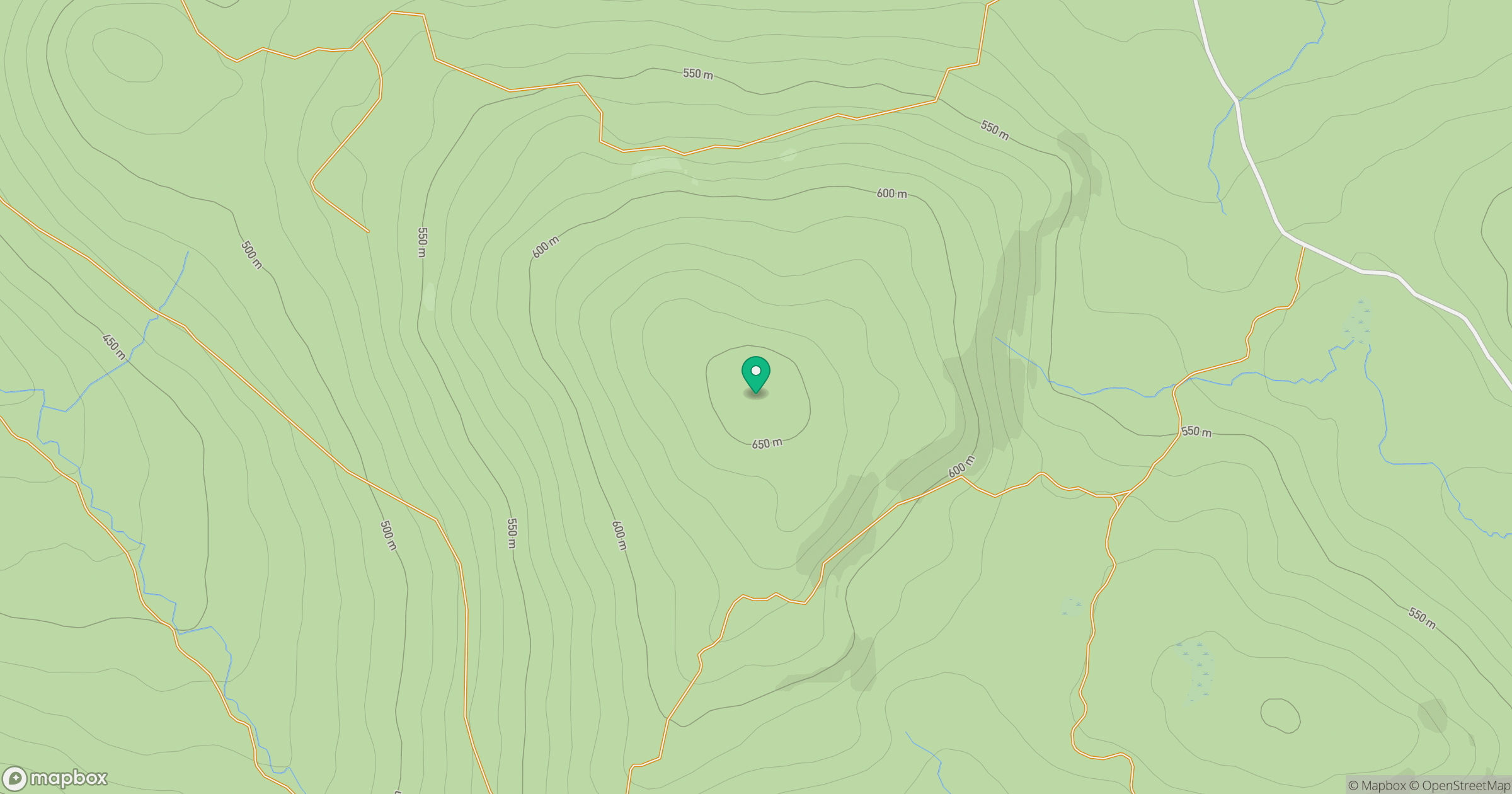
Grid reference: NN792418
View on OpenStreetMapOpens a map in a new tab, centred on the hill.
Hills within 30 km
Straight-line distance, not a walking route or confirmation of access.
No comments yet. Be the first.