

Maughold Head
Good walks are even better shared.
SC4991 : Gate on the coastal path
Jim Barton Photo source
Overview
Maughold Head: A Coastal Gem
Introduction
Maughold Head, standing tall at 206 meters, is more than just a Marilyn on the Isle of Man; it's a stunning point where rugged cliffs meet the crashing waves of the Irish Sea. This coastal heaven invites hikers to explore its natural beauty and breathe in the salty air.
Geology
The headland is made up of Upper Ordovician mudstones and silty mudstones, laid down millions of years ago when this area was submerged under water. Alternatively, you could call it a geologist's treasure chest!
Route Description
Maughold Head Coastal Path
The most straightforward route to the summit is via the Maughold Head Coastal Path. Starting from Maughold village, this easy 6 km jaunt will take you through lush grasslands and alongside rocky outcrops, spilling stunning views of the coastline. It typically takes about 2.5 hours, allowing time for those all-important photo opportunities.
Summit Features
The summit is marked by a captivating stone cross, not to be confused with your average garden gnome! It's the perfect spot to stop, reflect, and take in the panoramic views.
Terrain
The terrain is primarily grassy, punctuated by rocky outcrops and gently inclining slopes. Just keep an eye out for those hidden rocks—they can jump out and surprise you!
The Views
From Maughold Head, you'll enjoy remarkable vistas of the Irish Sea and the majestic hills of Scotland in the distance. The best time to appreciate these views is during spring or early summer when the wildflowers are in bloom, and the skies are often at their bluest.
Hazards
While the trails are generally safe, be mindful of slippery sections after rains and the occasionally strong winds—unless you're trying a new sport called 'kite hiking', of course!
Access
Parking
The nearest parking area is situated near the church in Maughold village. Spaces can fill up quickly during sunny days, so it’s wise to arrive early.
Public Transport
Buses run from Douglas to Maughold, leaving you a brief but picturesque stroll to the start of your adventure.
Nearest Town
Ramsey, a charming town located about 5 miles from Maughold, serves as your go-to for refreshments and facilities.
Facilities
While Maughold itself might not offer many amenities, Ramsey is packed with cafes and restaurants, plus public toilets for when nature calls.
History
Name Meaning
Maughold bears a name rooted in Old Norse, tied to the 5th-century missionary who brought Christianity to the Isle of Man.
Significance
Historically, Maughold Head has played an important role in guiding sailors safely along the treacherous coastline. Today, it stands as part of the Heritage Trail, reminding us of both its natural beauty and cultural significance.
Conclusion
So, lace up those boots and set off to Maughold Head—just remember to enjoy the views, respect the paths, and have a laugh or two along the way!
Explore routes near Maughold Head
Walks starting near this hill. Open a route to check its map, distance and full itinerary.
Kilsture Forest Woodpecker Trail
View route
Kirkcudbright Harbour to Barrhill Woods Circuit
View route
Steeple, Scoat Fell and Haycock from Ennerdale
View route
Scafell Pike via Brown Tongue and Hollow Stones
View route
Route planning notes
These notes describe possible approaches. Check a route's map and access information when planning your walk.
Maughold Head Coastal Path
A picturesque walk along the coastline leading up to Maughold Head, wrapped in stunning views of the Irish Sea.
Make a day of it, together
Find someone to share the walk with, or organise a day out along a route you like.
Photo Gallery
View all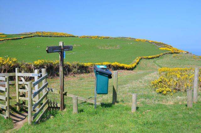 Photo could not load
SC4991 : Gate on the coastal path
Jim Barton
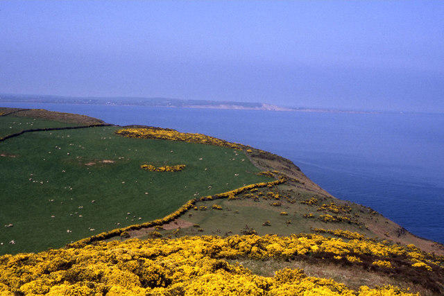 Photo could not load
SC4991 : Maughold Brooghs as seen from Maughold Head
Colin Park
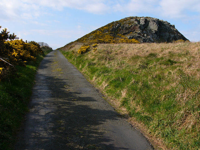 Photo could not load
SC4991 : Lane on Maughold Head
Chris Gunns
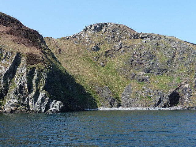 Photo could not load
SC4991 : Between Gob ny Stroma and Gob ny Skey
Chris Gunns
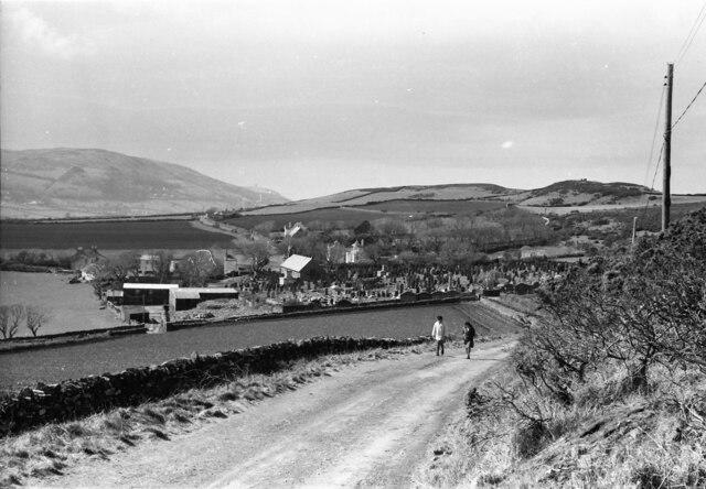 Photo could not load
SC4991 : Maughold from the Lighthouse road
Nigel Mykura
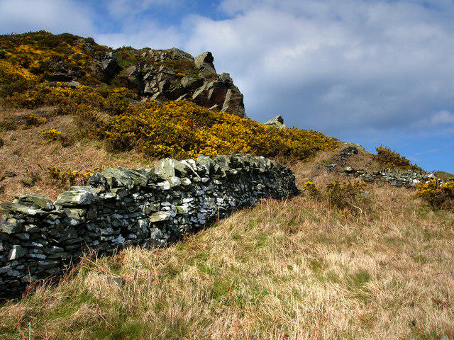 Photo could not load
SC4991 : Rock Outcrop on Maughold Head
Chris Gunns
Hill facts and local notes
Classifications
Elevation
117m
384 ft
Prominence
95m
Coordinates
54.2982, -4.3125
SC496916
OS Map
95
Explorer: IoM OL
At the Summit
The summit features a prominent stone cross and a fantastic vantage point, ideal for admiring the sweeping coastal views.
Terrain & Geology
Maughold Head is primarily composed of Upper Ordovician mudstones and silty mudstones, which are characteristic of the region. This sedimentary rock formation offers interesting insights into the ancient seabed that once covered this area.
Views & Scenery
From the summit, enjoy breathtaking views of the nearby coastline, the distant hills of Scotland, and the beautiful Isle of Man landscape.
History & Heritage
Name Origin
The name 'Maughold' is derived from the Old Norse, believed to reference the Christian saint, Maughold, who was a 5th-century missionary to the Isle of Man.
Historical Significance
Maughold Head has been a significant site for navigation historically and is now part of the Heritage Trail, showcasing the blend of natural beauty and cultural history.
Getting There & Facilities
Parking
There is a small parking area near the church in Maughold village. Be sure to arrive early as it can fill up quickly during good weather.
Public Transport
Bus services from Douglas run to Maughold, with a short walk from the nearest stop to the start of the coastal path.
Nearby Facilities
Several cafes and eateries can be found in nearby Ramsey, as well as public toilets, but no facilities are available directly at the summit.
Safety Information
Known Hazards
- Beware of slippery paths, especially after rain. Strong coastal winds may also pose a risk.
General Safety Tips
- Check weather conditions before setting out
- Carry appropriate clothing and equipment
- Let someone know your planned route
- Take a map, compass, and GPS device
- Carry emergency supplies: food, water, first aid kit, torch
Hills
Some common questions about the hills answered
Are there group walks up Maughold Head?
Many walkers use Walkmates to join or organise walks with others. You can check for group walks around Maughold Head through the maps
Are there other walkers around Maughold Head?
Activity varies by location and time, but Walkmates lets you see whether others have shared walks or shown interest in this area. Find other people through the walking friends search walking friends for Maughold Head search or of course create your own walk for Maughold Head
Can I organise a walk to Maughold Head?
Yes. If there aren’t any walks listed already, you can create a walk and make it available for others to join.
If you're signed up to Walkmates, you can create a walk to Maughold Head.
How do I find a walk up this hill?
There are often multiple ways to walk this hill, depending on experience and route preference. Walkmates helps you explore walks and routes that others have shared.
Can I suggest a new route up Maughold Head?
Yes. You can suggest or create routes to share with others. Walkmates focuses on the social side of walking, so routes are used to help people organise walks and explore areas together, rather than as detailed navigation tools or route libraries.
Other uses really appreciate knowledgeable walkers sharing their routes. Share your favourite route to Maughold Head here
The is an error or something incorrect about this hill. How do I let you know?
We always strive to keep the information on Walkmates as accurate as possible. If you find an error, please let us know through the contact form and we'll aim to correct it as quickly as possible
Community Discussion
Comments
Location
View the hill's mapped position and surrounding paths.
Grid reference: SC496916
View on OpenStreetMapOpens a map in a new tab, centred on the hill.
No comments yet. Be the first.