

Marygold Hill
Good walks are even better shared.
Overview
Marygold Hill
Overview
Marygold Hill, with an elevation of 305 meters, is a delightful jaunt in the Peak District, perfect for families and seasoned hikers alike. Standing resiliently against the rhythmic winds, it beckons adventurers with its stunning scenery and captivating tales.
Geology
The hill largely consists of sandstone and gritstone, giving it a unique landscape that has evolved over time through the powerful forces of nature. Keep an eye out for interesting rock formations that whisper stories of their ancient past!
Routes
The popular Marygold Trail is the go-to route for most hikers. This 5.5 km loop takes roughly two hours to complete. It's classified as moderate, making it suitable for those who have a reasonable level of fitness. Don't forget to bring your snacks; there are some lovely spots for a picnic along the way!
Summit Features
When you reach the summit, you'll find a sturdy stone cairn and trig point waiting for you—perfect for those Instagram moments! This is where you can catch your breath and take in the breathtaking views that unfold in front of you.
Terrain Type
The terrain is varied; expect a mix of grassy paths complemented by rocky patches. Do be careful, though—after a downpour, you might find some parts to be rather boggy, like trying to navigate through a swamp!
Views
The views from Marygold Hill are nothing short of spectacular. On clear days, you can spot iconic sites like Chatsworth House and enjoy the rolling hills that typify this region. Early mornings and late afternoons during spring and autumn offer the best light for photography, so bring your camera!
Hazards
While the trek is generally safe, there are some muddy patches, especially after rain. Keep well away from any steep edges, and always check the weather before you set out—things can change faster than a squirrel chasing its tail!
Access
The nearest parking is conveniently located at the Marygold Hill car park. It’s free, but like all good things in life, it fills up fast on sunny days! Public transport is available via regular bus services, and if you fancy a longer trek, the nearest train station is in Edale, approximately 7 km away.
Nearby Facilities
The local village of Hope offers some delightful cafes where you can recharge post-hike. Facilities include public toilets at the car park and plenty of spots to grab a cuppa.
History
The name 'Marygold' hints at the flora that flourished here, with the hill serving as a grazing ground in the past. Villagers have long shared tales and gathered here, enriching its cultural significance.
In summary, Marygold Hill is a gem waiting to be explored. Whether you're a seasoned hiker or simply enjoy a leisurely stroll with picturesque views, this hill has something for everyone!
Happy hiking!
Explore routes near Marygold Hill
Public walks starting within 80 km of this hill. Nearby does not mean a route reaches the summit; check its map and access before setting out.
Duns Hen Poo Lake and St Mary’s Glade
View route
Cockburnspath to Dunglass Dean and Old Bridge
View route
Coldingham Creel Path and St Abbs Bay
View route
St Abbs Head Lighthouse and Pettico Wick
View route
Route planning notes
These notes describe possible approaches, not verified navigable routes or permission to cross land. Check current paths, local access rules and conditions before setting out.
Marygold Trail
A scenic loop trail starting from the nearby village, featuring diverse landscapes including woodlands and open fields.
Make a day of it, together
Find someone to share the walk with, or organise a day out along a route you like.
Photo Gallery
View all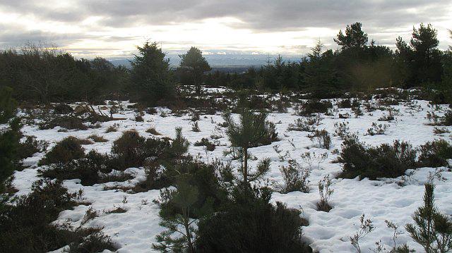 Photo could not load
NT8060 : Pine wood, Marygold Hill
Richard Webb
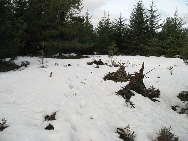 Photo could not load
NT8060 : Marygold Hill
Richard Webb
Hill facts and local notes
Classifications
Elevation
268m
879 ft
Prominence
112m
Coordinates
55.8390, -2.3184
NT801606
OS Map
67
Explorer: 346
At the Summit
The summit features a distinctive stone cairn and a small trig point, perfect for a quick photo op and a well-deserved snack.
Terrain & Geology
Primarily composed of sandstone and gritstone, Marygold Hill offers fascinating views of the stratified rock formations typical of the Peak District, shaped over millennia by ancient seas and glaciers.
Views & Scenery
From the summit, enjoy spectacular views of the surrounding hills, verdant valleys, and on a clear day, even iconic landmarks such as Chatsworth House.
History & Heritage
Name Origin
The name 'Marygold' is believed to originate from the old English term for the flowers found abundantly in the area, which also attracts some curious bees.
Historical Significance
Historically, the hill has been used as a grazing area for sheep and has deep roots in local folklore, often said to be a site for village gatherings.
Getting There & Facilities
Check current local access restrictions, parking rules and transport timetables before travelling. These notes do not confirm public access to the summit.
Parking
Parking available at the Marygold Hill car park, a stone's throw from the village. Spaces are free but can fill up quickly on weekends.
Public Transport
Regular bus services operate from nearby towns to the village, with the nearest train station located in Edale, about 7 km away.
Nearby Facilities
There are public toilets at the car park and several cafes in the nearby village, serving everything from hearty breakfasts to afternoon tea.
Safety Information
Known Hazards
- Occasional muddy patches, steep drops on the northern side, and be wary of sudden weather changes in the Peak District.
General Safety Tips
- Check weather conditions before setting out
- Carry appropriate clothing and equipment
- Let someone know your planned route
- Take a map, compass, and GPS device
- Carry emergency supplies: food, water, first aid kit, torch
Hills
Some common questions about the hills answered
Are there group walks up Marygold Hill?
Many walkers use Walkmates to join or organise walks with others. You can check for group walks around Marygold Hill through the maps
Are there other walkers around Marygold Hill?
Activity varies by location and time, but Walkmates lets you see whether others have shared walks or shown interest in this area. Find other people through the walking friends search walking friends for Marygold Hill search or of course create your own walk for Marygold Hill
Can I organise a walk to Marygold Hill?
Yes. If there aren’t any walks listed already, you can create a walk and make it available for others to join.
If you're signed up to Walkmates, you can create a walk to Marygold Hill.
How do I find a walk up this hill?
There are often multiple ways to walk this hill, depending on experience and route preference. Walkmates helps you explore walks and routes that others have shared.
Can I suggest a new route up Marygold Hill?
Yes. You can suggest or create routes to share with others. Walkmates focuses on the social side of walking, so routes are used to help people organise walks and explore areas together, rather than as detailed navigation tools or route libraries.
Other uses really appreciate knowledgeable walkers sharing their routes. Share your favourite route to Marygold Hill here
The is an error or something incorrect about this hill. How do I let you know?
We always strive to keep the information on Walkmates as accurate as possible. If you find an error, please let us know through the contact form and we'll aim to correct it as quickly as possible
Community Discussion
Comments
Location
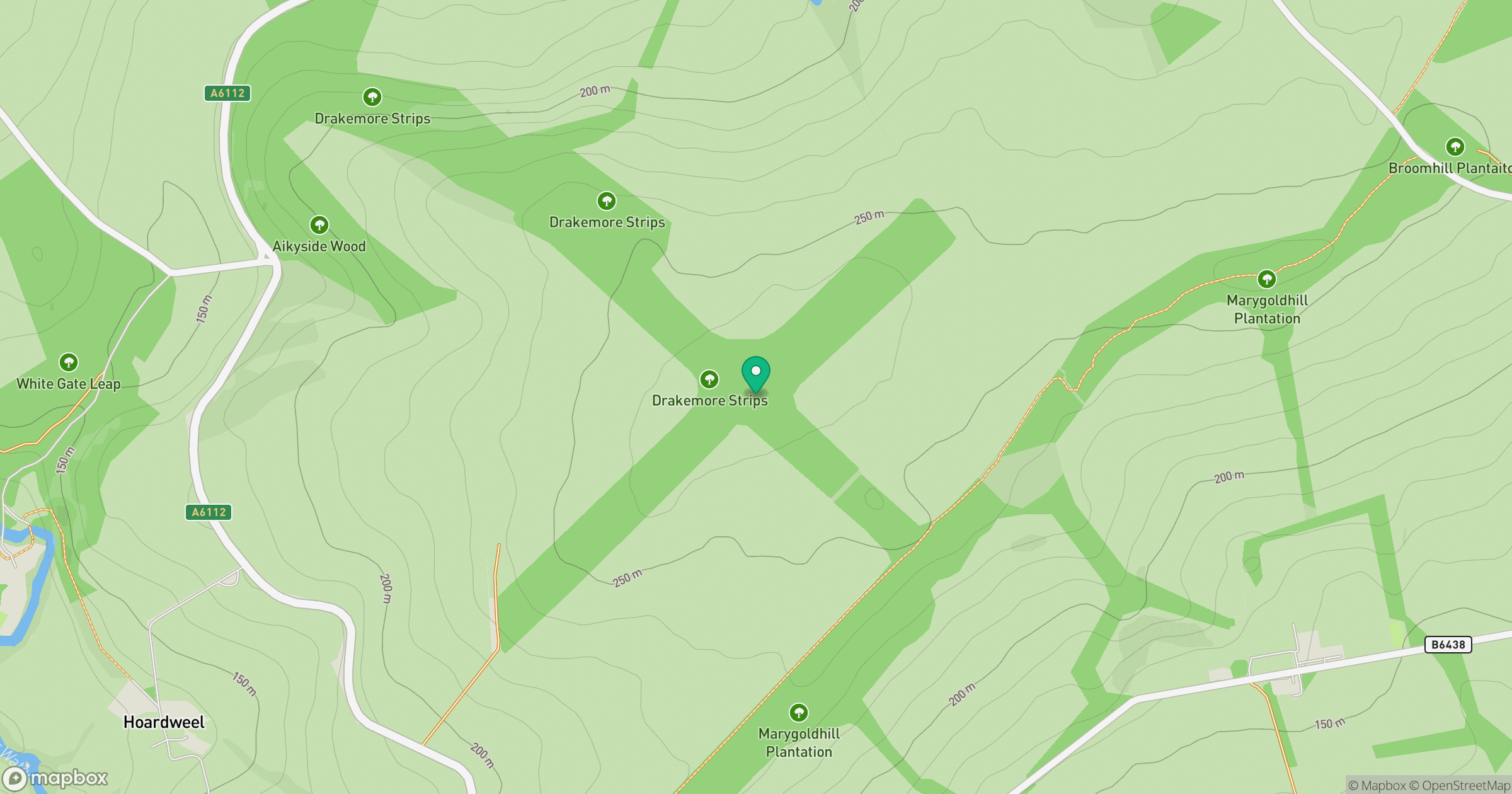
Grid reference: NT801606
View on OpenStreetMapOpens a map in a new tab, centred on the hill.
Hills within 30 km
Straight-line distance, not a walking route or confirmation of access.
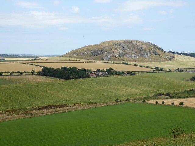
Traprain Law
221m
Cockburn Law
325m
Meikle Black Law
245m
Wester Dod [Monynut Edge]
416m
Dirrington Great Law
398m
No comments yet. Be the first.