

Cockburn Law
Good walks are even better shared.
Overview
Cockburn Law
Cockburn Law is a charming Marilyn located in the Scottish Borders, standing tall at an elevation of 396 meters. This hill may not reach the heights of its Munro cousins, but what it lacks in stature, it certainly makes up for in stunning views and rich tranquility.
Geology
The summit is composed predominantly of volcanic rock, offering insights into the geological history of the area. Its varied colours and textures not only create a visual feast but also contribute to the diverse ecosystems found here.
Routes
The primary route, the Cockburn Law Circuit, spans about 6.5 km and can generally be completed in approximately 2.5 hours. It suits both seasoned trekkers and families looking to enjoy the great outdoors. Be prepared for a moderate challenge, with an elevation gain that’s balanced by the pleasure of the scenic views.
Summit Features
As you crest the hill, a robust stone cairn and a trig point welcome you. These landmarks serve as perfect resting spots to catch your breath and take in the panoramic surroundings – a great moment to reflect on life’s simpler pleasures (and perhaps to share a joke or two).
Terrain
Expect a mix of grassy slopes and rocky outcrops. The trail can be a bit challenging with some uneven patches, so keep your eyes peeled for those hidden bumps in the grass!
Views
From the top, the vistas are nothing short of breathtaking. You’ll have a clear view of the Eildon Hills, Northumberland Hills, and the distant Lammermuirs. Spring and early autumn provide the best colour display in the countryside, making for fantastic photography opportunities.
Hazards
While the hike is generally safe, be mindful of the unpredictable Scottish weather that can change as quickly as a fox on the run. Boggy areas might test your footwear, so tread carefully!
Access and Facilities
Arriving at Cockburn Law is straightforward, with a modest parking area available off the A697. Now, we're not talking about a multi-storey car park here; it's more like a wee nook for a few cars.
Nearby Lauder is your best bet for post-hike refreshments and facilities, with cafes and toilets to help you recover from your adventure.
History
The name 'Cockburn' speaks to the natural world, translating to 'crow stream' in Old English, reflective of the wildlife that flits about the region. Its historical ties relate to community and local pride, making it a cherished spot for outdoor enthusiasts.
Grab your walking boots, pack some snacks, and venture forth to enjoy this hidden treasure of the Scottish Borders!
Explore routes near Cockburn Law
Public walks starting within 80 km of this hill. Nearby does not mean a route reaches the summit; check its map and access before setting out.
Duns Hen Poo Lake and St Mary’s Glade
View route
Cockburnspath to Dunglass Dean and Old Bridge
View route
Coldingham Creel Path and St Abbs Bay
View route
St Abbs Head Lighthouse and Pettico Wick
View route
Route planning notes
These notes describe possible approaches, not verified navigable routes or permission to cross land. Check current paths, local access rules and conditions before setting out.
Cockburn Law Circuit
A delightful circular route that offers panoramic views of the surrounding countryside, suitable for both seasoned hikers and those just starting out.
Make a day of it, together
Find someone to share the walk with, or organise a day out along a route you like.
Photo Gallery
View all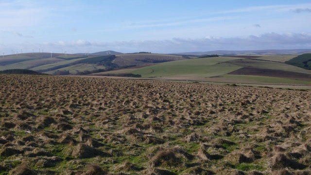 Photo could not load
NT7659 : Rough grazing on Cockburn Law
Calum McRoberts
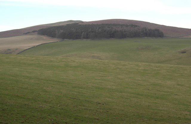 Photo could not load
NT7659 : Cockburn Law
Colin Kinnear
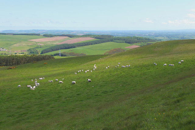 Photo could not load
NT7659 : Sheep on Cockburn Law
Jim Barton
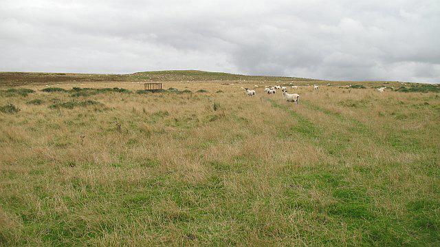 Photo could not load
NT7659 : Cockburn Law
Richard Webb
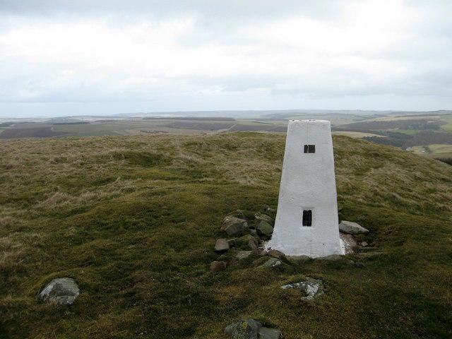 Photo could not load
NT7659 : Trig point at Cockburn Law, Lammermuirs
Lisa Jarvis
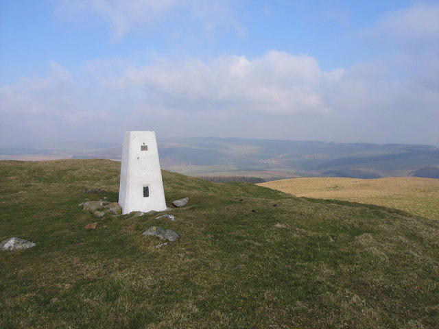 Photo could not load
NT7659 : Cockburn Law trig point looking towards A6112
Steve Jones
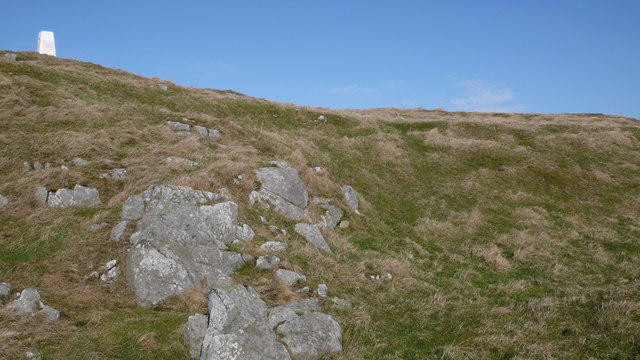 Photo could not load
NT7659 : On Cockburn Law
Calum McRoberts
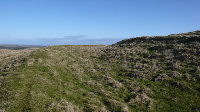 Photo could not load
NT7659 : Lower rampart on Cockburn Law
Calum McRoberts
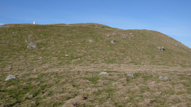 Photo could not load
NT7659 : Leaving the summit of Cockburn Law
Calum McRoberts
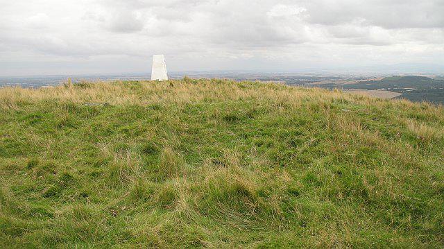
NT7659 : Cockburn Law, summit
Richard Webb
Hill facts and local notes
Classifications
Elevation
325m
1,066 ft
Prominence
123m
Coordinates
55.8304, -2.3756
NT765597
OS Map
67 74
Explorer: 346
At the Summit
The summit is marked by a sizeable stone cairn and a trig point, offering a perfect spot for a well-deserved breather and photo opportunity. On a clear day, you might even spot sheep posing for their close-up.
Terrain & Geology
Cockburn Law is primarily composed of volcanic rock, which provides a fascinating insight into the geological activity that shaped this region. The weathered surface exhibits a variety of hues, ranging from reddish-brown to grey, adding texture and beauty to the landscape.
Views & Scenery
From the top, hikers can enjoy stunning views of the Eildon Hills, the Northumberland Hills to the south, and even the distant Lammermuirs. Just don't forget to bring your binoculars, perfect for a bit of birdwatching or daydreaming about far-off places.
History & Heritage
Name Origin
The name 'Cockburn' derives from Old English, meaning 'crow stream', reflecting the area's wildlife and landscape.
Historical Significance
Cockburn Law holds cultural significance, being a popular spot for local walkers and nature enthusiasts alike, adding a sense of community to its natural beauty.
Getting There & Facilities
Check current local access restrictions, parking rules and transport timetables before travelling. These notes do not confirm public access to the summit.
Parking
There is a small parking area at the foot of the hill off the A697, suitable for a handful of cars.
Public Transport
The nearest bus service runs from nearby towns like Melrose, providing connections to the wider transport network.
Nearby Facilities
While there are no facilities directly on Cockburn Law, Lauder provides amenities including cafes, restaurants, and public toilets for before or after your hike.
Safety Information
Known Hazards
- Potential for sudden weather changes; ensure you're prepared for all conditions. Some boggy patches can catch out the unwary hiker, so sturdy footwear is recommended.
General Safety Tips
- Check weather conditions before setting out
- Carry appropriate clothing and equipment
- Let someone know your planned route
- Take a map, compass, and GPS device
- Carry emergency supplies: food, water, first aid kit, torch
Hills
Some common questions about the hills answered
Are there group walks up Cockburn Law?
Many walkers use Walkmates to join or organise walks with others. You can check for group walks around Cockburn Law through the maps
Are there other walkers around Cockburn Law?
Activity varies by location and time, but Walkmates lets you see whether others have shared walks or shown interest in this area. Find other people through the walking friends search walking friends for Cockburn Law search or of course create your own walk for Cockburn Law
Can I organise a walk to Cockburn Law?
Yes. If there aren’t any walks listed already, you can create a walk and make it available for others to join.
If you're signed up to Walkmates, you can create a walk to Cockburn Law.
How do I find a walk up this hill?
There are often multiple ways to walk this hill, depending on experience and route preference. Walkmates helps you explore walks and routes that others have shared.
Can I suggest a new route up Cockburn Law?
Yes. You can suggest or create routes to share with others. Walkmates focuses on the social side of walking, so routes are used to help people organise walks and explore areas together, rather than as detailed navigation tools or route libraries.
Other uses really appreciate knowledgeable walkers sharing their routes. Share your favourite route to Cockburn Law here
The is an error or something incorrect about this hill. How do I let you know?
We always strive to keep the information on Walkmates as accurate as possible. If you find an error, please let us know through the contact form and we'll aim to correct it as quickly as possible
Community Discussion
Comments
Location
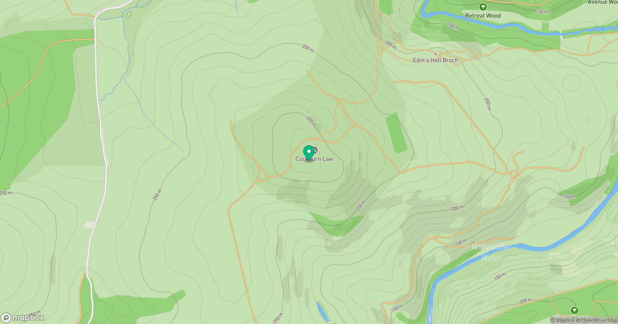
Grid reference: NT765597
View on OpenStreetMapOpens a map in a new tab, centred on the hill.
Hills within 30 km
Straight-line distance, not a walking route or confirmation of access.
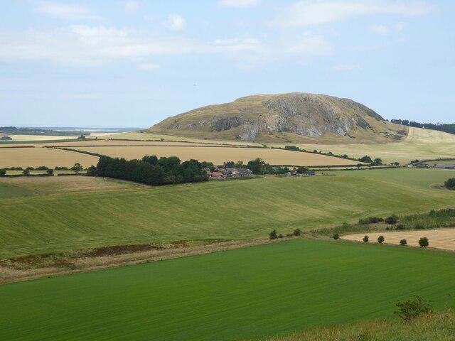
Traprain Law
221m
Marygold Hill
268m
Dirrington Great Law
398m
Meikle Black Law
245m
Wester Dod [Monynut Edge]
416m
No comments yet. Be the first.