

Llechwedd Mawr
Good walks are even better shared.
SH7743 : Llechwedd Mawr summit pile
Richard Law Photo source
Overview
Llechwedd Mawr: A Hidden Gem in Snowdonia
Nestled in the heart of Snowdonia National Park, Llechwedd Mawr is a magnificent hill that might not have the fame of its taller cousins but offers unbeatable views and a solid trekking experience. Standing at 750 meters, it’s classified as a Marilyn, which just means it’s a hill that rises at least 150 meters above its surroundings. The old saying goes: 'It’s not the height of the mountain that counts, but the journey to reach the top.' And what a journey it is!
Geology
Llechwedd Mawr’s geological composition reflects the intriguing volcanic history of the region. Formed from ancient lava flows, this volcanic rock provides a glimpse into the powerful forces that shaped these mesmerizing landscapes. As you walk, take a moment to appreciate the ground beneath you—it’s been here for eons!
Routes
The most popular route starts from the charming village of Beddgelert. The approximately 8 km Beddgelert Path is a moderate trek that weaves together serene woodlands and gentle ascents. The well-trodden path is friendly enough for most, though the last few hundred meters might get your legs working harder than a hamster in a wheel.
Summit Features
Upon reaching the summit, hikers are greeted by a proud stone cairn—an inviting sight for anyone who views it as a badge of accomplishment. From atop Llechwedd Mawr, the panorama is nothing short of breathtaking. The peaks of the Snowdon range stretch into the horizon, competing for your attention.
Terrain and Views
Expect a mix of grassy stretches paired with rocky patches, particularly near the summit. Keep an eye out for an array of breathtaking views—on a clear day, Snowdon and the enchanting Nant Gwynant valley will take your breath away (even if you’re a bit out of breath from the hike!). The best seasons to enjoy the views are undoubtedly spring and autumn when the air is crisp and clear.
Hazards
As always, watch for those swift mountain weather changes. One moment you may have sunshine and a beautiful view, and the next, you’re dodging raindrops like a contestant on a game show. Wet, slippery rocks can turn your lovely ascent into an unexpected slip-and-slide, so watch your step!
Access
Beddgelert provides the perfect launchpad for those ready to tackle Llechwedd Mawr. There’s a public car park that can get quite busy, especially in the high season. Public transport is available from towns like Porthmadog, making it an easy trip for those relying on buses. Plus, there’s plenty of facilities for your post-hike recovery, including cafes and public toilets—because no one wants to be caught out in the wild after a long trek!
Wrap-Up
Llechwedd Mawr invites hikers to experience the splendid beauty of Snowdonia without the overwhelming crowds often found on more popular peaks. As with any adventure in nature, treat this stunning mountain with respect and take only memories—perhaps a photograph of that smirking cairn on top!
Enjoy the great outdoors, and remember to leave the mountain as you found it, for the next eager adventurer. Happy hiking!
Explore routes near Llechwedd Mawr
Walks starting near this hill. Open a route to check its map, distance and full itinerary.
Arenig Fach guided mountain walk
View route
Aran Benllyn and Aran Fawddwy from LLanuwchllyn
View route
Coed y Brenin: Pont Ty'n-y-groes and Mawddach Forest Trail
View route
Snowdon Pyg Track returning by Miner's Track
View route
Route planning notes
These notes describe possible approaches. Check a route's map and access information when planning your walk.
Beddgelert Path
This route starts at Beddgelert, following well-trodden paths through lush woodlands before ascending the gentle slopes leading to Llechwedd Mawr.
Make a day of it, together
Find someone to share the walk with, or organise a day out along a route you like.
Photo Gallery
View all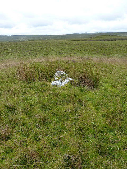 Photo could not load
SH7743 : Llechwedd Mawr summit pile
Richard Law
Hill facts and local notes
Classifications
Elevation
491m
1,611 ft
Prominence
22m
Coordinates
52.9755, -3.8195
SH779435
OS Map
124
Explorer: OL18E
At the Summit
The summit features a well-maintained stone cairn, offering a place for weary hikers to rest their legs and revel in their achievements.
Terrain & Geology
Llechwedd Mawr is primarily composed of volcanic rock, most likely formed from ancient lava flows. The geological history of the region provides fascinating evidence of past volcanic activity, shaping the dramatic landscapes you see today.
Views & Scenery
Breathtaking views of Snowdon, the Nant Gwynant valley, and the surrounding peaks of the Snowdonia range.
History & Heritage
Name Origin
The name Llechwedd Mawr translates to 'great slope' in Welsh, a fitting description given its impressive size.
Historical Significance
Llechwedd Mawr is a popular destination for walkers, contributing to local tourism and the folklore of the area with tales of mythical beings.
Getting There & Facilities
Parking
Beddgelert has a public car park available. It can become busy during peak times, so arriving early is advisable.
Public Transport
Beddgelert is accessible by bus from nearby towns, including Porthmadog and Caernarfon.
Nearby Facilities
Beddgelert offers several cafes, a pub, and public toilets for hikers' convenience.
Safety Information
Known Hazards
- Watch for sudden weather changes, as conditions can shift quickly in the mountains. Slippery rocks during wet weather can be tricky too.
General Safety Tips
- Check weather conditions before setting out
- Carry appropriate clothing and equipment
- Let someone know your planned route
- Take a map, compass, and GPS device
- Carry emergency supplies: food, water, first aid kit, torch
Hills
Some common questions about the hills answered
Are there group walks up Llechwedd Mawr?
Many walkers use Walkmates to join or organise walks with others. You can check for group walks around Llechwedd Mawr through the maps
Are there other walkers around Llechwedd Mawr?
Activity varies by location and time, but Walkmates lets you see whether others have shared walks or shown interest in this area. Find other people through the walking friends search walking friends for Llechwedd Mawr search or of course create your own walk for Llechwedd Mawr
Can I organise a walk to Llechwedd Mawr?
Yes. If there aren’t any walks listed already, you can create a walk and make it available for others to join.
If you're signed up to Walkmates, you can create a walk to Llechwedd Mawr.
How do I find a walk up this hill?
There are often multiple ways to walk this hill, depending on experience and route preference. Walkmates helps you explore walks and routes that others have shared.
Can I suggest a new route up Llechwedd Mawr?
Yes. You can suggest or create routes to share with others. Walkmates focuses on the social side of walking, so routes are used to help people organise walks and explore areas together, rather than as detailed navigation tools or route libraries.
Other uses really appreciate knowledgeable walkers sharing their routes. Share your favourite route to Llechwedd Mawr here
The is an error or something incorrect about this hill. How do I let you know?
We always strive to keep the information on Walkmates as accurate as possible. If you find an error, please let us know through the contact form and we'll aim to correct it as quickly as possible
Community Discussion
Comments
Location
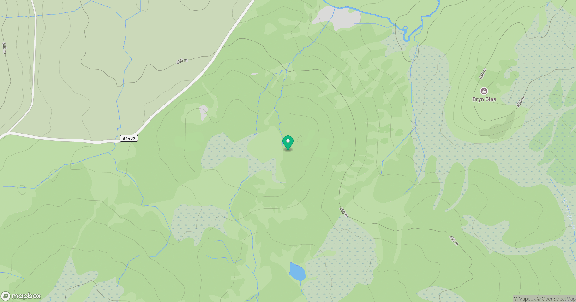
Grid reference: SH779435
View on OpenStreetMapOpens a map in a new tab, centred on the hill.
No comments yet. Be the first.