
Latterbarrow
Good walks are even better shared.
Overview
Discovering Latterbarrow
Introduction
Nestled in the heart of the Lake District, Latterbarrow offers a splendid escape for hikers and outdoor enthusiasts. Standing at 391 meters, it may not be the tallest peak in the region, but what it lacks in height, it more than makes up for in stunning views and striking scenery.
Geology
Latterbarrow is predominantly made up of andesite rock, a product of the tremendous volcanic activity that shaped much of the Lake District. The rugged terrain showcases fascinating geological features, with remnants of ancient lava flows that tell a story millions of years in the making.
Routes
One of the most popular routes is the Latterbarrow Loop, a moderate 7.5 km circular trek beginning in Windermere. This route provides a delightful mix of grassy slopes, rocky outcrops, and simply stunning vistas, perfect for those looking to stretch their legs and enjoy the great outdoors.
Summit Features
The summit features a charming stone cairn that serves as a testament to the many hikers who have enjoyed the journey to the top. The view from atop is a sight for sore eyes, and a perfect photo opportunity.
Terrain Type
Expect grassy paths interspersed with rocky sections, and keep an eye out for the occasional boggy patch—especially after a good downpour. Good footwear is essential!
Views
On clear days, the panoramic views extend all the way to Windermere Lake, the majestic Langdale Pikes, and the charming Coniston Fells. The best seasons to soak in these sights are undoubtedly spring and autumn.
Hazards
Like many fells in the Lake District, Latterbarrow presents its own set of hazards. Monitor the weather, as it can change at the drop of a hat, and be cautious of slippery surfaces!
Access and Facilities
Access to Latterbarrow is convenient from Windermere, which offers parking, public transport options, and plentiful cafes to refuel after your hike. Treat yourself to a nice cup of tea—you deserve it!
Conclusion
Whether you're an experienced hiker or just looking for a leisurely stroll, Latterbarrow is a fantastic destination that promises natural beauty and a solid dose of fresh air. So grab your walking boots and head out—it really is a breath of fresh air!
Explore routes near Latterbarrow
Walks starting near this hill. Open a route to check its map, distance and full itinerary.
Tarn Hows Fast Route
View route
Coniston to Tarn Hows: Monk Coniston Gardens and Woodland Circuit
View route
Great Carrs Halifax Wreckage from Wrynose Pass
View route
Bow Fell from Langdale
View route
Route planning notes
These notes describe possible approaches. Check a route's map and access information when planning your walk.
Latterbarrow Loop
A scenic circular route starting from the village of Windermere, taking in the stunning views of the surrounding fells and the tranquil waters of Windermere lake.
Make a day of it, together
Find someone to share the walk with, or organise a day out along a route you like.
Hill facts and local notes
Classifications
Elevation
244m
801 ft
Prominence
44m
Coordinates
54.3834, -2.9758
SD367990
OS Map
96 97
Explorer: OL7N
At the Summit
The summit of Latterbarrow is marked by a small stone cairn with a lovely view over Windermere Lake and the neighbouring fells. It’s a perfect spot for a well-deserved rest after the climb.
Terrain & Geology
Latterbarrow is primarily composed of volcanic rock, specifically andesite, which formed during the explosive volcanic activity that shaped the landscape of the Lake District millions of years ago. The rugged terrain showcases interesting rock formations and evidence of ancient lava flows.
Views & Scenery
From the summit, you can enjoy panoramic views of Windermere, the Langdale Pikes, and even a glimpse of the distant Coniston Fells on a clear day.
History & Heritage
Name Origin
The name 'Latterbarrow' is thought to derive from the local dialect, with 'barrow' meaning a hill or tumulus, showcasing its earthy roots.
Historical Significance
Latterbarrow has served as a lookout point for centuries and remains an important part of the local hiking community. It’s a great reminder that adventure is always just around the corner!
Getting There & Facilities
Parking
There is a small car park at the foot of the hill near the village of Windermere, which offers easy access to the walking paths. Make sure to arrive early during peak season!
Public Transport
Frequent buses run from Windermere Railway Station to nearby villages, making it convenient for those relying on public transport. Check local schedules to plan your journey.
Nearby Facilities
Windermere offers a variety of facilities, including cafes, shops, and public toilets. After your hike, treat yourself to a slice of cake and a cup of tea—you've earned it!
Safety Information
Known Hazards
- The terrain can be uneven and slippery, particularly after rainfall. Watch your step and be wary of sudden changes in weather as the Lake District is known for its unpredictable conditions.
General Safety Tips
- Check weather conditions before setting out
- Carry appropriate clothing and equipment
- Let someone know your planned route
- Take a map, compass, and GPS device
- Carry emergency supplies: food, water, first aid kit, torch
Hills
Some common questions about the hills answered
Are there group walks up Latterbarrow?
Many walkers use Walkmates to join or organise walks with others. You can check for group walks around Latterbarrow through the maps
Are there other walkers around Latterbarrow?
Activity varies by location and time, but Walkmates lets you see whether others have shared walks or shown interest in this area. Find other people through the walking friends search walking friends for Latterbarrow search or of course create your own walk for Latterbarrow
Can I organise a walk to Latterbarrow?
Yes. If there aren’t any walks listed already, you can create a walk and make it available for others to join.
If you're signed up to Walkmates, you can create a walk to Latterbarrow.
How do I find a walk up this hill?
There are often multiple ways to walk this hill, depending on experience and route preference. Walkmates helps you explore walks and routes that others have shared.
Can I suggest a new route up Latterbarrow?
Yes. You can suggest or create routes to share with others. Walkmates focuses on the social side of walking, so routes are used to help people organise walks and explore areas together, rather than as detailed navigation tools or route libraries.
Other uses really appreciate knowledgeable walkers sharing their routes. Share your favourite route to Latterbarrow here
The is an error or something incorrect about this hill. How do I let you know?
We always strive to keep the information on Walkmates as accurate as possible. If you find an error, please let us know through the contact form and we'll aim to correct it as quickly as possible
Community Discussion
Comments
Location
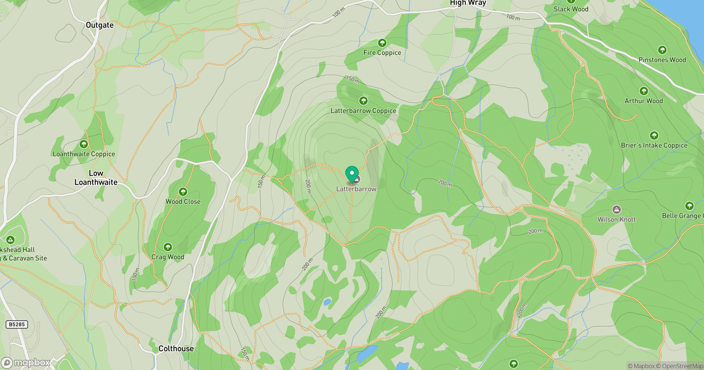
Grid reference: SD367990
View on OpenStreetMapOpens a map in a new tab, centred on the hill.
No comments yet. Be the first.