
Larig Hill
Good walks are even better shared.
Overview
Larig Hill: A Highland Adventure
Introduction
Nestled in the heart of the Scottish Highlands, Larig Hill provides an exhilarating experience for those keen to explore Scotland's natural beauty. With its rugged terrain and striking summit features, this Marilyn is a must for any avid hiker.
Geology
The geological formations on Larig Hill are a delightful mix of schist and quartzite. As you navigate the rocky paths, take a moment to appreciate the ancient history beneath your feet. These resilient rocks have witnessed millennia of weather and wear, shaping the breathtaking views unfolding around you.
Hiking Routes
Ben Challum Circular
This delightful circular route allows for a well-rounded experience of the area. Spanning approximately 12 km, it typically takes about 4 hours to complete, making it a moderate journey suitable for reasonably fit hikers. Prepare for some delightful gradients and breathtaking scenery!
Summit Features
As you reach the summit of Larig Hill, you will be greeted by a small yet proud cairn that stands guard over the views of the Trossachs National Park. This is the perfect spot to catch your breath, take photos, and perhaps even contemplate your life choices – like why you didn’t bring a picnic!
Terrain
Expect a delightful mix of rocky and grassy surfaces, interspersed with patches of heather. Equip yourself with sturdy footwear, as the Highland terrain can be uneven and challenging in places.
Views
From the summit, the views are nothing short of spectacular. You'll be treated to a panorama that includes the shimmering Loch Lomond and the rugged peaks of surrounding hills. The ideal times for soaking up these views are during late spring or autumn when the skies are generally clearer. And who knows? You might even spot a deer or two basking in the sunlight!
Hazards
While Larig Hill is an accessible outing, it's essential to be wary of the uneven terrain. Weather in the Highlands can be unpredictable, so dress in layers and prepare for a sudden shower. Watch out for boggy patches that can turn your hike into a slip and slide!
Nearby Summits
For those wishing to extend their adventure, nearby summits include:
- Ben Challum (936 m)
- An Caisteal (995 m)
Both offer challenging ascents and stunning views, perfect for conquering if you’re up for more!
Access and Facilities
You can park at a small layby along the A85 just north of Crianlarich, which is handy for accessing the trailhead. Public transport options are plentiful, with train connections from Glasgow and local buses servicing the area. Once you return to Crianlarich, you’ll find several cafes for a well-deserved hot drink and perhaps a slice of cake!
Conclusion
In summary, Larig Hill is a gem in the Scottish Highlands. Whether you're a seasoned hiker or just looking for a lovely walk with stunning views, this hill promises an unforgettable experience. Just remember – the only thing you should leave behind is your footprints, and maybe the odd selfie!
Explore routes near Larig Hill
Public walks starting within 80 km of this hill. Nearby does not mean a route reaches the summit; check its map and access before setting out.
Aberlour to Carron Bridge: Speyside Way riverside return
View route
Craigellachie to Aberlour: Speyside Railway Path Return
View route
Culbin Forest: Hill 99, Gravel Pit Ponds and Dragonfly Pool
View route
Findhorn guided night walk
View route
Route planning notes
These notes describe possible approaches, not verified navigable routes or permission to cross land. Check current paths, local access rules and conditions before setting out.
Ben Challum Circular
A scenic loop that encompasses Larig Hill, allowing hikers to take in the surrounding landscape without retracing their steps.
Make a day of it, together
Find someone to share the walk with, or organise a day out along a route you like.
Hill facts and local notes
Classifications
Elevation
545m
1,788 ft
Prominence
104m
Coordinates
57.4431, -3.5232
NJ086402
OS Map
27
Explorer: OL61N 419N
At the Summit
The summit of Larig Hill boasts a small stone cairn that provides a dramatic focal point against the backdrop of the Highlands. On a clear day, the views are simply unbeatable!
Terrain & Geology
Larig Hill features predominantly rugged geological formations with rocky outcrops and a mixture of schist and quartzite, providing a fascinating insight into the region's geological history. These ancient rocks have weathered beautifully, forming dramatic landscapes.
Views & Scenery
From the summit, you can see the sprawling vistas of the Trossachs National Park, including Loch Lomond and the surrounding hills. It's a view that might make the heart sing—or at least hum a little tune!
History & Heritage
Name Origin
The name 'Larig' is derived from the Gaelic term 'larach', meaning 'the place of the ramparts', hinting at ancient settlements long forgotten yet echoing through the valley.
Historical Significance
This region has historical significance linked to ancient Scottish clans, and the surrounding landscapes tell tales of battles and traditions that have shaped modern Scotland.
Getting There & Facilities
Check current local access restrictions, parking rules and transport timetables before travelling. These notes do not confirm public access to the summit.
Parking
There is a small layby along the A85 just north of Crianlarich, offering a convenient place to park, though be sure to arrive early as it can fill up quickly with fellow outdoor enthusiasts.
Public Transport
Crianlarich is well served by train services from Glasgow, making it accessible for those relying on public transport. Buses also connect to surrounding areas.
Nearby Facilities
Crianlarich boasts a few local cafes and small shops, ideal for grabbing a bite or last-minute essentials before heading into the hills. There are also public toilets available.
Safety Information
Known Hazards
- Uneven terrain, sudden weather changes, and possible boggy patches in certain areas.
General Safety Tips
- Check weather conditions before setting out
- Carry appropriate clothing and equipment
- Let someone know your planned route
- Take a map, compass, and GPS device
- Carry emergency supplies: food, water, first aid kit, torch
Hills
Some common questions about the hills answered
Are there group walks up Larig Hill?
Many walkers use Walkmates to join or organise walks with others. You can check for group walks around Larig Hill through the maps
Are there other walkers around Larig Hill?
Activity varies by location and time, but Walkmates lets you see whether others have shared walks or shown interest in this area. Find other people through the walking friends search walking friends for Larig Hill search or of course create your own walk for Larig Hill
Can I organise a walk to Larig Hill?
Yes. If there aren’t any walks listed already, you can create a walk and make it available for others to join.
If you're signed up to Walkmates, you can create a walk to Larig Hill.
How do I find a walk up this hill?
There are often multiple ways to walk this hill, depending on experience and route preference. Walkmates helps you explore walks and routes that others have shared.
Can I suggest a new route up Larig Hill?
Yes. You can suggest or create routes to share with others. Walkmates focuses on the social side of walking, so routes are used to help people organise walks and explore areas together, rather than as detailed navigation tools or route libraries.
Other uses really appreciate knowledgeable walkers sharing their routes. Share your favourite route to Larig Hill here
The is an error or something incorrect about this hill. How do I let you know?
We always strive to keep the information on Walkmates as accurate as possible. If you find an error, please let us know through the contact form and we'll aim to correct it as quickly as possible
Community Discussion
Comments
Location
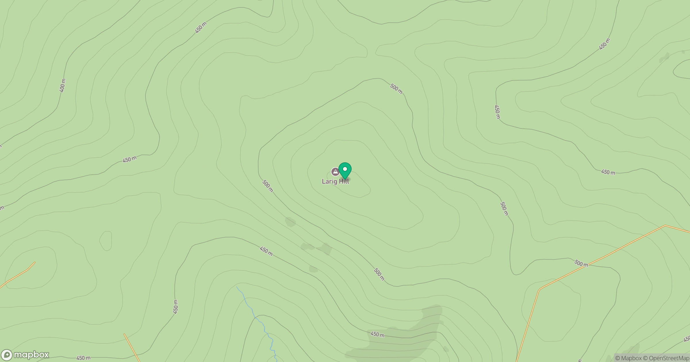
Grid reference: NJ086402
View on OpenStreetMapOpens a map in a new tab, centred on the hill.
Hills within 30 km
Straight-line distance, not a walking route or confirmation of access.
Carn na Loine
549m
Carn Biorach
418m
Knock of Braemoray
456m
Carn a' Ghille Chearr
710m
Creagan a' Chaise
722m
No comments yet. Be the first.