

Carn Biorach
Good walks are even better shared.
Overview
Carn Biorach
Nestled in the heart of the Monadhliath Mountains, Carn Biorach is a gem for hikers and nature lovers alike. With an elevation of 611 metres and a prominence of 49 metres, this 'pointed hill' beckons adventurers to explore its heather-laden slopes.
Geology
Carn Biorach is primarily composed of granite and schist, resulting in a unique blend of rocky terrain and grassy patches. Glacial actions have sculpted the landscape, leaving behind boulders that add to the mountain's character. Perfect for those Insta-moments!
Routes
The Biorach–Carn na h-Ean route is a favourite among hikers, offering a moderate challenge. Spanning roughly 10 km and taking around 4.5 hours to complete, this circular walk promises stunning views and a bit of a workout. Don't forget to pack a snack—there's nothing quite like a picnic at the top!
Summit Features
At the summit, you'll be greeted by a grand stone cairn and breathtaking views. Be sure to take a moment to enjoy your surroundings—preferably while seated, lest you be blown away by the sheer beauty.
Terrain Type
A mix of rocky paths, grassy stretches, and some boggy areas ensures that you have a taste of everything typical of the Scottish highlands. Just remember to watch your step; you never know when a soggy patch may try to claim your boot!
Views
The vista from Carn Biorach is nothing short of spectacular. Look out for views of Glen Spean and the surrounding peaks that make you realise why you trudged up here. Late spring and early autumn are particularly lovely, with clear skies and fewer bothersome bugs, although in summer, you may make some midgie friends!
Hazards
While hiking is a joy, every mountain has its risks. Be mindful of slippery rocks, unpredictable weather, and those pesky midges. It's all part of the Scottish experience!
Nearby Summits
For those looking to extend their adventure, nearby summits include Carn na h-Ean (622 m) and Carn Liath (861 m).
Access
Getting to Carn Biorach is relatively straightforward. Look for parking near the start of the trail, and remember to arrive early to snag a space. For those relying on public transport, the nearest bus service goes to Newtonmore, located about 12 km away.
Facilities
After your hike, treat yourself at one of the local cafes or pubs in Newtonmore. A perfect way to cap off a day of adventure!
History
The name 'Carn Biorach' translates to 'the pointed hill', aptly describing its features. The region has a rich history, having served as a hunting ground for various clans. It's fascinating to stand atop the mountain and picture the thousands of feet that have crossed its slopes throughout history.
Remember, a day spent hiking is a day well spent! Happy trails!
Explore routes near Carn Biorach
Public walks starting within 80 km of this hill. Nearby does not mean a route reaches the summit; check its map and access before setting out.
Culbin Forest: Hill 99, Gravel Pit Ponds and Dragonfly Pool
View route
Aberlour to Carron Bridge: Speyside Way riverside return
View route
Findhorn guided night walk
View route
Craigellachie to Aberlour: Speyside Railway Path Return
View route
Route planning notes
These notes describe possible approaches, not verified navigable routes or permission to cross land. Check current paths, local access rules and conditions before setting out.
Biorach–Carn na h-Ean route
This circular route offers a steady ascent through heather-lined trails and rocky patches, making it a delightful trek for those eager to explore the region's natural beauty.
Make a day of it, together
Find someone to share the walk with, or organise a day out along a route you like.
Photo Gallery
View all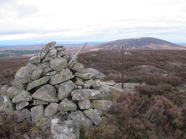 Photo could not load
NJ0139 : Cairn near the summit of Carn Biorach
Alan Hodgson
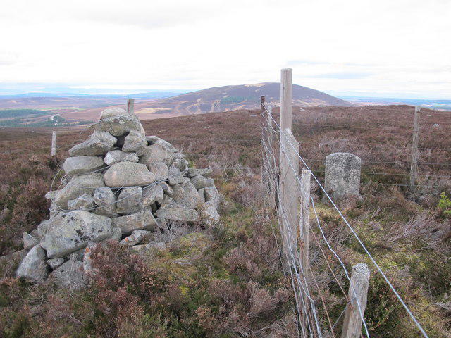 Photo could not load
NJ0139 : Cairn on the top of Carn Biorach
Alan Hodgson
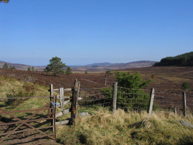 Photo could not load
NJ0139 : View across the Dava Moor towards Carn Biorach
Duncan Cain
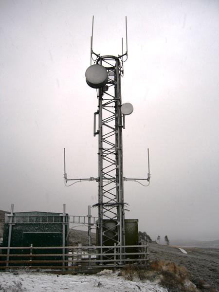 Photo could not load
NJ0139 : Dava Orange Tower
David Neale
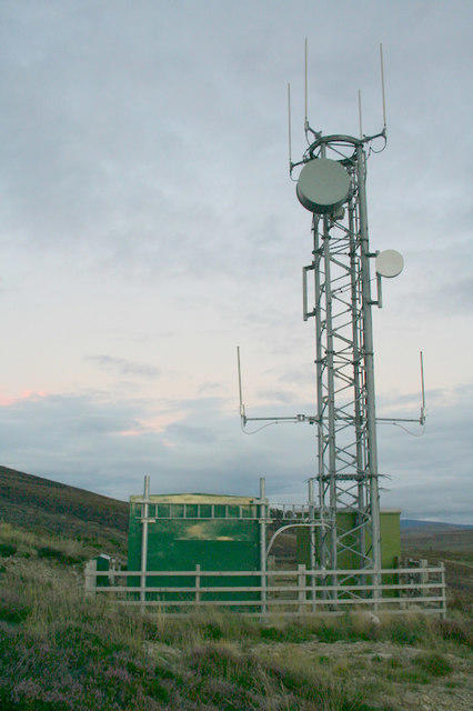 Photo could not load
NJ0139 : Mast on Carn Biorach.
Des Colhoun
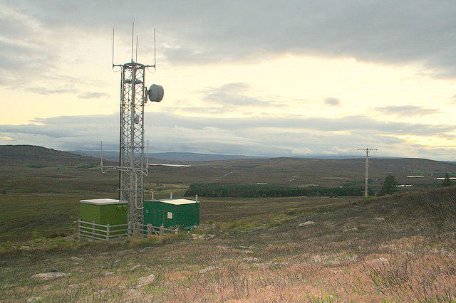 Photo could not load
NJ0139 : Telecommunications mast on Carn Biorach.
Des Colhoun
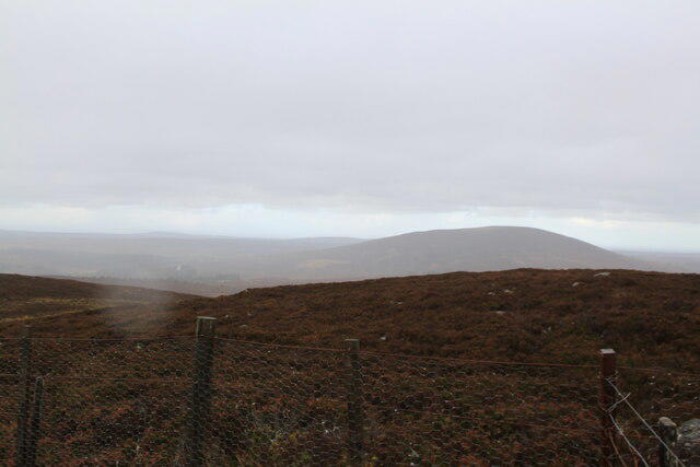 Photo could not load
NJ0139 : View onto Knock of Braemoray from Carn Biorach
Matvii Kuziura
Hill facts and local notes
Classifications
Elevation
418m
1,371 ft
Prominence
100m
Coordinates
57.4311, -3.6357
NJ018390
OS Map
27
Explorer: OL60 OL61N 418 419N
At the Summit
The summit features a stone cairn and provides ample space for a picnic—just don't forget to bring your sandwich!
Terrain & Geology
Carn Biorach is predominantly composed of granite and schist, which gives it a rugged appeal. The area is known for its glacially carved features and boulder fields that provide a glimpse into the earth's dynamic past.
Views & Scenery
From the summit, one can take in stunning vistas of the surrounding Monadhliath Mountains, Glen Spean, and on clear days, the distant peaks of the Gaelic Highlands.
History & Heritage
Name Origin
The name 'Carn Biorach' translates to 'the pointed hill', a nod to its distinctive peak that does indeed have a pointy sense of style.
Historical Significance
Historically, the Monadhliath region has been significant for its natural resources and has seen many clans traverse its paths for hunting and gathering.
Getting There & Facilities
Check current local access restrictions, parking rules and transport timetables before travelling. These notes do not confirm public access to the summit.
Parking
There is a small parking area near the start of the Biorach–Carn na h-Ean trail, suitable for a dozen vehicles. Arriving early is advisable to secure a space.
Public Transport
The nearest bus service can be found in the town of Newtonmore, roughly 12 km away. A bit of a hike to get here, so consider carpooling!
Nearby Facilities
Nearby Newtonmore features pubs, cafes, and toilets, perfect for recharging after a long hike.
Safety Information
Known Hazards
- Possible slips on rocky terrain, sudden weather changes, and the infamous Scottish midges during summer.
- Watch your step in boggy areas to avoid unwanted mud baths.
General Safety Tips
- Check weather conditions before setting out
- Carry appropriate clothing and equipment
- Let someone know your planned route
- Take a map, compass, and GPS device
- Carry emergency supplies: food, water, first aid kit, torch
Hills
Some common questions about the hills answered
Are there group walks up Carn Biorach?
Many walkers use Walkmates to join or organise walks with others. You can check for group walks around Carn Biorach through the maps
Are there other walkers around Carn Biorach?
Activity varies by location and time, but Walkmates lets you see whether others have shared walks or shown interest in this area. Find other people through the walking friends search walking friends for Carn Biorach search or of course create your own walk for Carn Biorach
Can I organise a walk to Carn Biorach?
Yes. If there aren’t any walks listed already, you can create a walk and make it available for others to join.
If you're signed up to Walkmates, you can create a walk to Carn Biorach.
How do I find a walk up this hill?
There are often multiple ways to walk this hill, depending on experience and route preference. Walkmates helps you explore walks and routes that others have shared.
Can I suggest a new route up Carn Biorach?
Yes. You can suggest or create routes to share with others. Walkmates focuses on the social side of walking, so routes are used to help people organise walks and explore areas together, rather than as detailed navigation tools or route libraries.
Other uses really appreciate knowledgeable walkers sharing their routes. Share your favourite route to Carn Biorach here
The is an error or something incorrect about this hill. How do I let you know?
We always strive to keep the information on Walkmates as accurate as possible. If you find an error, please let us know through the contact form and we'll aim to correct it as quickly as possible
Community Discussion
Comments
Location
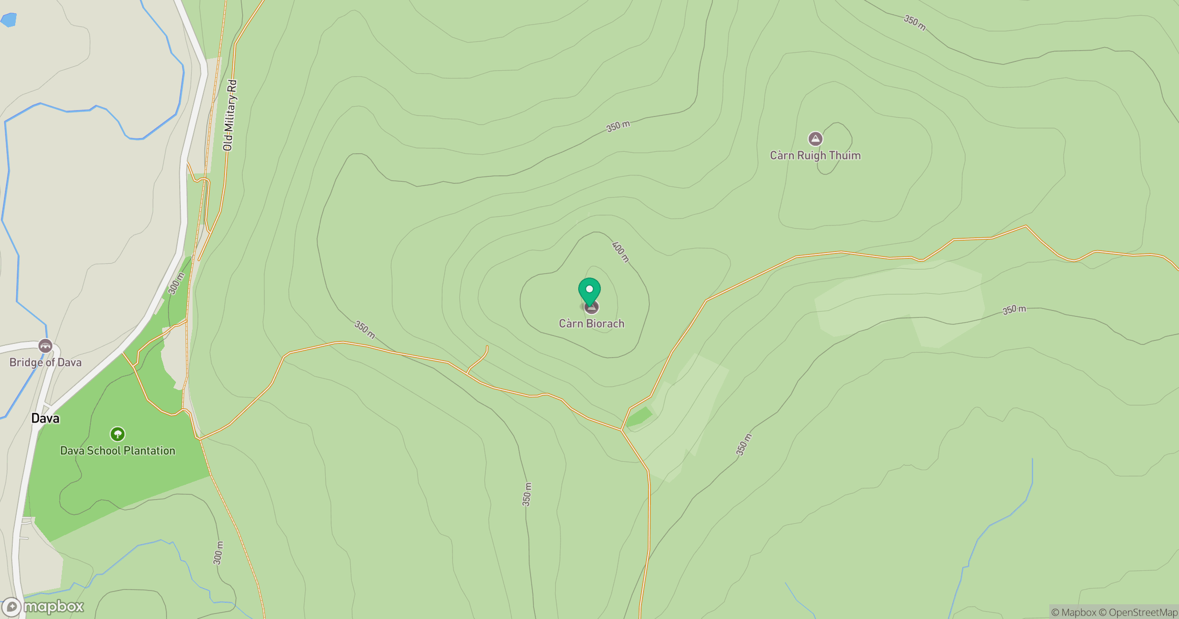
Grid reference: NJ018390
View on OpenStreetMapOpens a map in a new tab, centred on the hill.
Hills within 30 km
Straight-line distance, not a walking route or confirmation of access.
No comments yet. Be the first.