

Carn a' Ghille Chearr
Good walks are even better shared.
NJ1329 : Track to Carn a Ghille Chearr
Alan Hodgson Photo source
Overview
Introduction
Carn a' Ghille Chearr is a picturesque Munro in the Scottish Highlands, rising majestically to 931 meters above sea level. Its name has curious origins suggesting a historical local figure, adding a touch of intrigue to this beautiful peak.
Geology
The mountain's rocky composition primarily consists of schist, a testament to the geological wonders of the region. This rugged terrain has been shaped by the elements over millions of years and is a delight for geology enthusiasts and hikers alike.
Routes
There are several popular routes to the summit. The route from Loch Reasort provides a more leisurely approach, winding its way through beautiful glens, while the A887 route presents a more direct challenge. Whichever route you choose, be prepared for the stunning views that will reward your effort.
Summit Features
At the summit, a substantial stone cairn greets you, accompanied by breathtaking panoramic views that make the climb worthwhile. It's a superb spot to take a moment, enjoy the beauty surrounding you, and capture those perfect photographs to show off to your friends (and possibly make them a little jealous!).
Terrain and Hazards
The terrain is predominantly rocky with grassy patches, which can be slippery after rain. Additionally, the weather here can change faster than you can say “I should have packed a raincoat!” Always check the forecast and carry the right gear.
Nearby Summits
Don't miss the opportunity to explore nearby summits like Sgurr na Ciste Duibhe and Sgurr a' Mhaoraich, both of which offer their own challenges and stunning views.
Access and Facilities
For easy access, park at the end of the minor road from the A887. If you're relying on public transport, plan your journey to ensure a taxi from the nearest bus drop-off can get you closer.
Conclusion
Whether you're an experienced Munro-bagger or a curious novice, Carn a' Ghille Chearr offers something special for every outdoor enthusiast. Just remember to pack your sense of adventure and maybe a snack or two!
Happy hiking, and may the summit be ever in your favour!
Explore routes near Carn a' Ghille Chearr
Walks starting near this hill. Open a route to check its map, distance and full itinerary.
Aberlour to Carron Bridge: Speyside Way riverside return
View route
Craigellachie to Aberlour: Speyside Railway Path Return
View route
Aviemore: Loch an Eilein and the Croft Track from Rothiemurchus
View route
Rothiemurchus: Beaver Trail and Lochan Mor
View route
Route planning notes
These notes describe possible approaches. Check a route's map and access information when planning your walk.
From Loch Reasort
A scenic route that starts at Loch Reasort, winding through beautiful glens and offering a gradual ascent up the mountain.
From A887
A shorter but steeper ascent from the A887, leading directly to the summit with beautiful views along the way.
Make a day of it, together
Find someone to share the walk with, or organise a day out along a route you like.
Photo Gallery
View all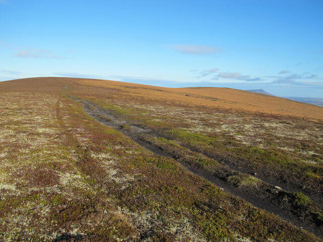 Photo could not load
NJ1329 : Track to Carn a Ghille Chearr
Alan Hodgson
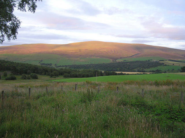 Photo could not load
NJ1329 : Carn a Ghille Chearr from Lettoch Speyside
Ivan Gee
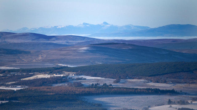 Photo could not load
NJ1329 : Looking North West from the summit of Carn A Ghille Chearr
Paul Newman
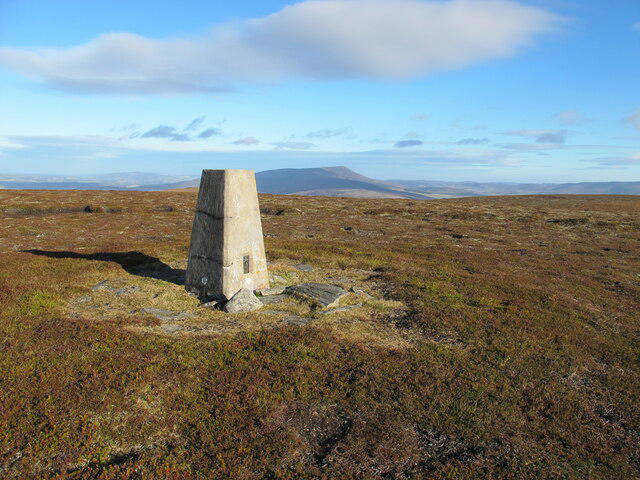 Photo could not load
NJ1329 : Trig Pillar on Carn a Ghille Chearr
Alan Hodgson
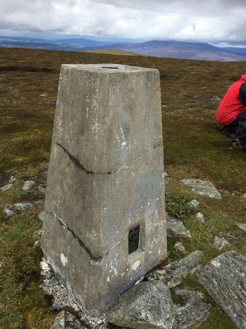 Photo could not load
NJ1329 : Cromdale Trig Point Flush Bracket S7481
thejackrustles
Hill facts and local notes
Classifications
Elevation
710m
2,330 ft
Prominence
179m
Coordinates
57.3510, -3.4314
NJ139298
OS Map
36
Explorer: OL61S 419S
At the Summit
The summit is marked by a large stone cairn and features stunning panoramic views of the surrounding glens and peaks, perfect for a photo op (or several!).
Terrain & Geology
The mountain is primarily composed of schist, a type of metamorphic rock that gives rise to its rugged landscape. Its formation is a testament to the powerful geological forces that shaped the Highlands over millions of years.
Views & Scenery
From the summit, hikers can see the majestic Five Sisters of Kintail and the tranquil Loch Duich, providing a feast for the eyes that can rival any buffet.
History & Heritage
Name Origin
The name 'Carn a' Ghille Chearr' translates roughly to 'Cairn of the left-handed lad', possibly nodding to local folklore or historical figures.
Historical Significance
This mountain is not just a visual delight; it holds historical significance for local clans and has been a cherished location for generations of hikers.
Getting There & Facilities
Parking
The nearest parking is at the end of the minor road off the A887, with ample space for vehicles. Just remember to park responsibly – don't block the sheep!
Public Transport
There is limited public transport; however, the nearest bus service runs from Kyle of Lochalsh to Invermoriston. From there, a taxi might be your best bet to get closer.
Nearby Facilities
There are no facilities directly on the mountain, but facilities including cafes and toilets can be found in Ratagan and nearby Kyle of Lochalsh.
Safety Information
Known Hazards
- Be wary of sudden weather changes, especially in the Highlands. Conditions can shift faster than a squirrel on caffeine, so always check forecasts and be prepared.
General Safety Tips
- Check weather conditions before setting out
- Carry appropriate clothing and equipment
- Let someone know your planned route
- Take a map, compass, and GPS device
- Carry emergency supplies: food, water, first aid kit, torch
Hills
Some common questions about the hills answered
Are there group walks up Carn a' Ghille Chearr?
Many walkers use Walkmates to join or organise walks with others. You can check for group walks around Carn a' Ghille Chearr through the maps
Are there other walkers around Carn a' Ghille Chearr?
Activity varies by location and time, but Walkmates lets you see whether others have shared walks or shown interest in this area. Find other people through the walking friends search walking friends for Carn a' Ghille Chearr search or of course create your own walk for Carn a' Ghille Chearr
Can I organise a walk to Carn a' Ghille Chearr?
Yes. If there aren’t any walks listed already, you can create a walk and make it available for others to join.
If you're signed up to Walkmates, you can create a walk to Carn a' Ghille Chearr.
How do I find a walk up this hill?
There are often multiple ways to walk this hill, depending on experience and route preference. Walkmates helps you explore walks and routes that others have shared.
Can I suggest a new route up Carn a' Ghille Chearr?
Yes. You can suggest or create routes to share with others. Walkmates focuses on the social side of walking, so routes are used to help people organise walks and explore areas together, rather than as detailed navigation tools or route libraries.
Other uses really appreciate knowledgeable walkers sharing their routes. Share your favourite route to Carn a' Ghille Chearr here
The is an error or something incorrect about this hill. How do I let you know?
We always strive to keep the information on Walkmates as accurate as possible. If you find an error, please let us know through the contact form and we'll aim to correct it as quickly as possible
Community Discussion
Comments
Location
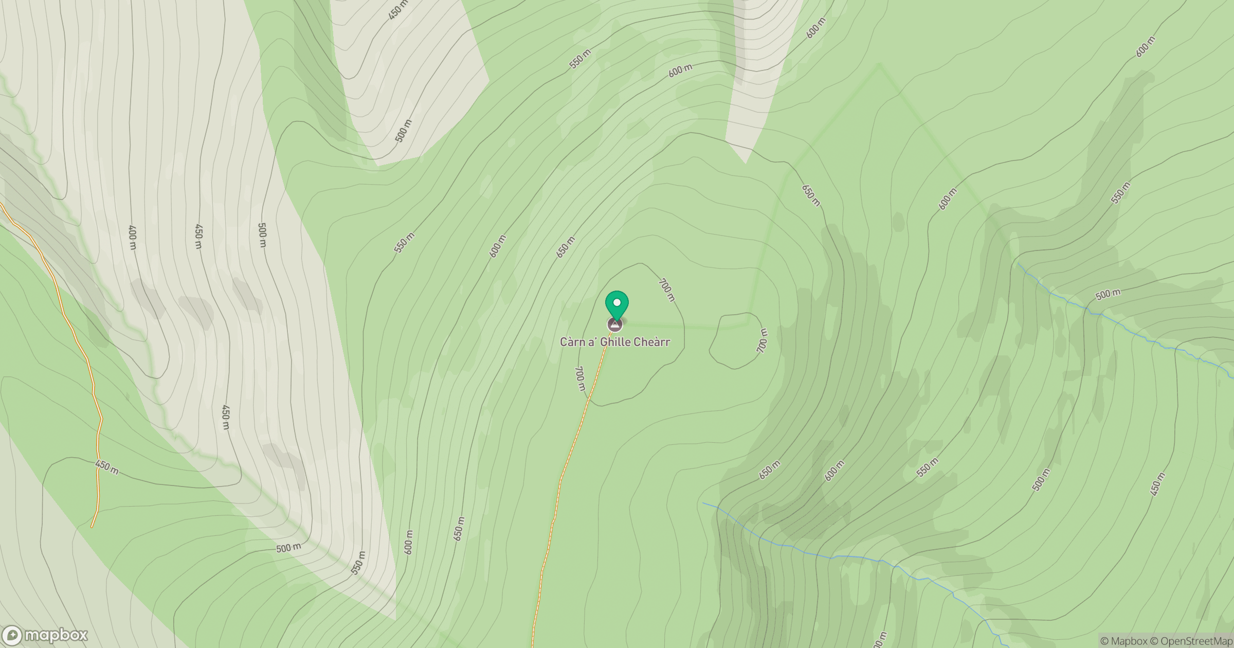
Grid reference: NJ139298
View on OpenStreetMapOpens a map in a new tab, centred on the hill.
![Ben Macdui [Beinn Macduibh]](https://cdn.walkmates.com/gallery-images/e60cf32aeb394c3282fcdd14a63368f0.jpg)
No comments yet. Be the first.