
Cnoc Fergan
Good walks are even better shared.
Overview
Cnoc Fergan
Nestled in the enchanting Scottish Highlands, Cnoc Fergan may not be the tallest hill around, but it boasts an impressive distinctiveness that calls out to hikers and nature lovers alike. At an elevation of 198 meters, this Marilyn may seem modest, but its rugged charm and the surrounding breathtaking views elevate it to a must-visit.
Geology
The geological underpinnings of Cnoc Fergan are predominantly formed of ancient schist and gneiss, which have crafted a majestic landscape. As you make your ascent, the rocky terrain tells stories of time immemorial, with each crag and crevice woven into the fabric of the Scottish Highlands.
Routes
The 'Cnoc Fergan Circuit' is a popular route that attracts many enthusiastic walkers. Stretching approximately 6.5 km, it weaves around the mountain, providing plenty of opportunities for striking views and a hearty dose of fresh Highland air. Expect to spend around 3.5 hours exploring this worthwhile trail, suitable for those with a moderate level of fitness.
Summit Features
When you reach the summit, you're greeted by a traditional stone cairn—a marvelous spot for a breather and a quick snack break. This humble structure is a testament to the countless adventurers who have ventured here before you, giving a warm welcome to all who tread upon this noble hill.
Terrain Type
The terrain is rock-strewn with grassy knolls, perfect for those looking to challenge their boots while enjoying beautiful wilderness. Just remember, it's not a walk in the park—though it's far lovelier than most parks!
Views
The views from Cnoc Fergan are nothing short of spectacular. Gaze towards Loch Awe and perhaps spot the distant Southern Highlands' peaks piercing the skyline. Spring and autumn are best for catching those breathtaking views minus the pesky midges that can make summer treks feel like a scene from a horror movie!
Hazards
As with many highland trails, weather in this region can change on a dime—be prepared for anything! The rocks may also get a bit slippery when wet. Always pack accordingly and maybe leave the flip-flops in the car.
Nearby Summits
Cnoc Fergan is surrounded by other remarkable peaks, including Ben Cruachan, rising majestically at 1126 meters, and Meall Tairneachan, standing at 820 meters. Both are excellent alternatives for those looking to extend their hiking adventures!
Access
Accessing Cnoc Fergan is relatively straightforward. The nearest parking is available at the village of Dalavich, about 5 km away from the trailhead. If you're relying on public transport, a bus service runs periodically from Oban to Dalavich, but do check schedules to avoid any hiccups.
Facilities
Facilities in the vicinity are limited, but small cafés and a local shop in Dalavich offer welcome refreshments and supplies for your adventure.
History
The mountain's name, 'Cnoc Fergan', translates to 'Hill of the Little Ferghus'. Local legends speak of ancient figures connected to this location, hinting at a rich tapestry of cultural history. The mountain remains a silent witness to the adventures of clans and individuals traversing this beautiful landscape.
In summary, while Cnoc Fergan may not claim the title of the highest peak, its allure and charm are undeniable. A delightful hike awaits, replete with stunning views and a touch of Highland magic—don’t forget your camera!
Enjoy your trek and may it be as smooth as a dram of fine Scotch whisky!
Explore routes near Cnoc Fergan
Public walks starting within 80 km of this hill. Nearby does not mean a route reaches the summit; check its map and access before setting out.
Aberlour to Carron Bridge: Speyside Way riverside return
View route
Aviemore: Loch an Eilein and the Croft Track from Rothiemurchus
View route
Rothiemurchus: Beaver Trail and Lochan Mor
View route
Craigellachie to Aberlour: Speyside Railway Path Return
View route
Route planning notes
These notes describe possible approaches, not verified navigable routes or permission to cross land. Check current paths, local access rules and conditions before setting out.
Cnoc Fergan Circuit
A scenic circular route starting from the nearby village leading around the mountain, perfect for a leisurely hike.
Make a day of it, together
Find someone to share the walk with, or organise a day out along a route you like.
Hill facts and local notes
Classifications
Elevation
480m
1,575 ft
Prominence
112m
Coordinates
57.2894, -3.4334
NJ137230
OS Map
36
Explorer: OL61S 419S
At the Summit
The summit features a traditional stone cairn that offers a picturesque photo opportunity and a place to gather your thoughts (or snacks).
Terrain & Geology
The area around Cnoc Fergan is predominantly composed of ancient schist and gneiss, which makes for a stunning landscape of rocky outcrops and rugged beauty.
Views & Scenery
From the summit, you can feast your eyes on Loch Awe shimmering in the distance, and perhaps spot the distant peaks of the Southern Highlands.
History & Heritage
Name Origin
Cnoc Fergan translates to 'Hill of the Little Ferghus', hinting at local legends surrounding ancient figures.
Historical Significance
The area holds cultural importance for local clans who have traversed these hills for centuries, engraved with tales of victory and the occasional mishap.
Getting There & Facilities
Check current local access restrictions, parking rules and transport timetables before travelling. These notes do not confirm public access to the summit.
Parking
Parking is available at the village of Dalavich, which is roughly 5km from the start of the hiking trail.
Public Transport
Buses run infrequently from Oban to the village of Dalavich; however, it's advisable to check the local timetable.
Nearby Facilities
While facilities are sparse near the mountain, Dalavich offers a small café with basic amenities and a local shop for supplies.
Safety Information
Known Hazards
- Be cautious of sudden weather changes typical of the region, as well as slippery rocks, especially after rain.
General Safety Tips
- Check weather conditions before setting out
- Carry appropriate clothing and equipment
- Let someone know your planned route
- Take a map, compass, and GPS device
- Carry emergency supplies: food, water, first aid kit, torch
Hills
Some common questions about the hills answered
Are there group walks up Cnoc Fergan?
Many walkers use Walkmates to join or organise walks with others. You can check for group walks around Cnoc Fergan through the maps
Are there other walkers around Cnoc Fergan?
Activity varies by location and time, but Walkmates lets you see whether others have shared walks or shown interest in this area. Find other people through the walking friends search walking friends for Cnoc Fergan search or of course create your own walk for Cnoc Fergan
Can I organise a walk to Cnoc Fergan?
Yes. If there aren’t any walks listed already, you can create a walk and make it available for others to join.
If you're signed up to Walkmates, you can create a walk to Cnoc Fergan.
How do I find a walk up this hill?
There are often multiple ways to walk this hill, depending on experience and route preference. Walkmates helps you explore walks and routes that others have shared.
Can I suggest a new route up Cnoc Fergan?
Yes. You can suggest or create routes to share with others. Walkmates focuses on the social side of walking, so routes are used to help people organise walks and explore areas together, rather than as detailed navigation tools or route libraries.
Other uses really appreciate knowledgeable walkers sharing their routes. Share your favourite route to Cnoc Fergan here
The is an error or something incorrect about this hill. How do I let you know?
We always strive to keep the information on Walkmates as accurate as possible. If you find an error, please let us know through the contact form and we'll aim to correct it as quickly as possible
Community Discussion
Comments
Location
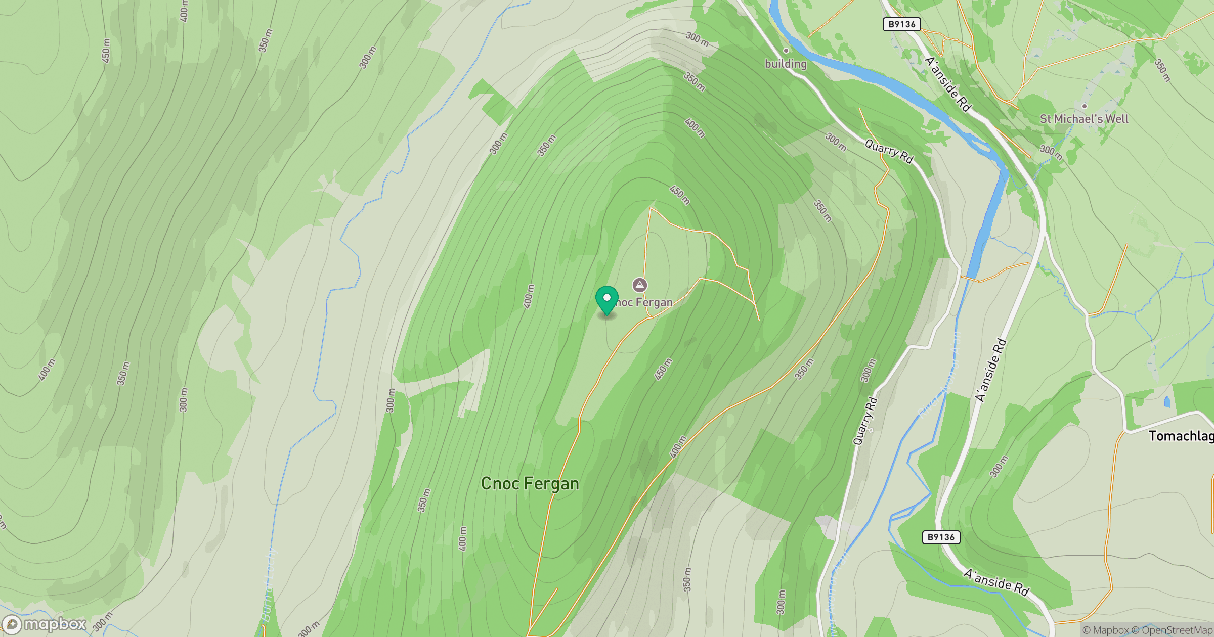
Grid reference: NJ137230
View on OpenStreetMapOpens a map in a new tab, centred on the hill.
Hills within 30 km
Straight-line distance, not a walking route or confirmation of access.
Ben Avon - Leabaidh an Daimh Bhuidhe
1,172m
Bynack More
1,090m
Beinn Mheadhoin
1,183m
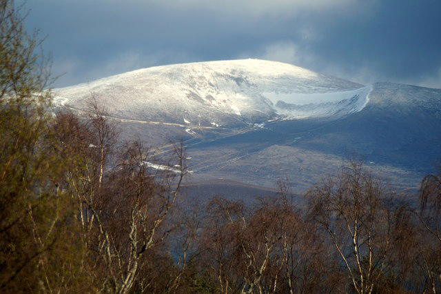
Cairn Gorm
1,245m
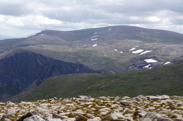
Ben Macdui [Beinn Macduibh]
1,309m
No comments yet. Be the first.