

High Pike (Caldbeck)
Good walks are even better shared.
Overview
High Pike reaches 658 metres in the Northern Fells, with a cairn and wind shelter marking its highest point.
High Pike (Caldbeck)
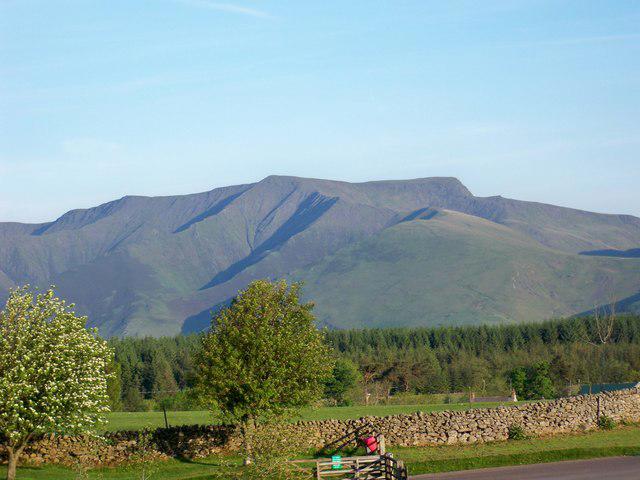
High Pike rises to 658 metres in the Northern Fells. Its summit has several landmarks, including a stone seat. Fell profile.
The summit and views
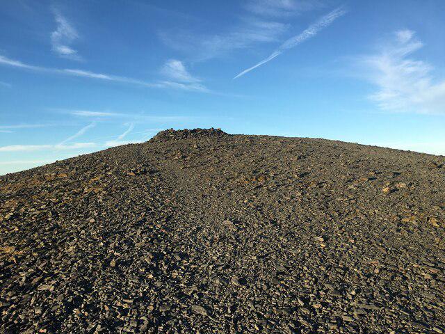
The highest point is the large cairn and wind shelter at NY 31877 35001. The trig pillar stands eight metres north and is slightly lower, so make sure you visit the cairn as well. Summit record.
The slate seat is another distinctive feature of the top. High Pike appears in Book Five of Wainwright’s guides, The Northern Fells. Summit landmarks.
In clear weather, look north across the Solway Firth towards the Scottish hills. Skiddaw and Blencathra fill much of the southern skyline. Views from High Pike.
From Caldbeck and back
Start at Caldbeck village car park, NY 323399. Starting point.
Take the Cumbria Way south by Gill Beck and Townhead to Nether Row. Continue onto Caldbeck Common and follow the old mine road past the Potts Gill workings. The ascent leads past Low Pike and the north shelter to the summit. Photographed approach.
For the return, retrace the ascent past Low Pike, descend to Nether Row and follow the Cumbria Way back into Caldbeck and the village car park. The out-and-back is approximately 9.5 km; allow time for breaks, navigation and the conditions underfoot. Return-walk overview.
Old mine shafts are a serious hazard on these slopes. Stay on the established paths, keep away from openings and spoil edges, and keep dogs close and children under close supervision near the workings. Mine workings on the approach.
Geology and mining
The summit bedrock belongs to the Eycott Volcanic Group. These Ordovician rocks include basalt and andesite lava flows, together with tuff and other volcanic deposits. Local geology; rock-group description.
Mining shaped the wider Caldbeck Fells from medieval times into the twentieth century. The remains and minerals are protected through a collecting policy with different zones and permission requirements. Leave material where you find it unless you have the necessary permission. Mining heritage and collecting rules.
Access and preparation
Caldbeck has toilets and places to get refreshments. If you have time after the walk, the nearby Howk gorge and bobbin-mill ruins offer a separate short outing from the village car park. Check parking notices and current opening arrangements locally. Village facilities and the Howk.
For public transport, check current Caldbeck services and the last return before planning your day.
Carry a map, suitable clothing, food and drinking water. Check the mountain forecast, leave your route with someone and allow enough daylight for the descent. Turn back if conditions worsen; exposed ground is best avoided in storms or high winds. Snow and ice require winter skills and equipment. Fellwalking safety.
Explore routes near High Pike (Caldbeck)
Public walks starting within 80 km of this hill. Nearby does not mean a route reaches the summit; check its map and access before setting out.
Mungrisdale Common and Bowscale Fell from Mosedale Valley Wainwright
View route
Brae Fell from Longlands Wainwright
View route
Bannerdale Crags from Mungrisdale Wainwright
View route
Binsey from Binsey Lodge Direct Out and Back Wainwright
View route
Route planning notes
These notes describe possible approaches, not verified navigable routes or permission to cross land. Check current paths, local access rules and conditions before setting out.
Caldbeck via Nether Row and Low Pike
Follow the Cumbria Way through Nether Row, then the mine-track approach past Potts Gill and Low Pike to the summit. Retrace the route to Caldbeck village car park.
Make a day of it, together
Find someone to share the walk with, or organise a day out along a route you like.
Photo Gallery
View all Photo could not load
NY3135 : High Pike
Shaun Ferguson
 Photo could not load
NY3134 : The summit of High Pike
Tim Heaton
 Photo could not load
NY3135 : Summit Cairn and Trig Point, High Pike
Chris Eilbeck
 Photo could not load
NY3135 : High Pike Summit
Matt Eastham
 Photo could not load
NY3135 : Wind shelter, High Pike
Chris Eilbeck
 Photo could not load
NY3135 : Millennium Plaque, High Pike
Michael Graham
 Photo could not load
NY3135 : Paths up High Pike
Andy Waddington
 Photo could not load
NY3135 : The summit of High Pike
David Purchase
 Photo could not load
NY3135 : Short grass at summit area of High Pike
Trevor Littlewood

NY3135 : Cairn and trig point on High Pike
Andy Waddington
Hill facts and local notes
Classifications
Elevation
658m
2,159 ft
Prominence
68m
Coordinates
54.7054, -3.0587
NY318350
OS Map
90
Explorer: OL5N
At the Summit
Large cairn and wind shelter at NY 31877 35001. The trig pillar eight metres north is slightly lower.
Terrain & Geology
Eycott Volcanic Group: Ordovician basalt and andesite lavas with tuff and other volcanic deposits.
Views & Scenery
Clear-weather views extend north across the Solway Firth towards Scotland, with Skiddaw and Blencathra to the south.
History & Heritage
Historical Significance
The Caldbeck Fells were mined from medieval times into the twentieth century. Old workings remain an important part of the area’s industrial archaeology.
Getting There & Facilities
Check current local access restrictions, parking rules and transport timetables before travelling. These notes do not confirm public access to the summit.
Parking
Caldbeck village car park, NY 323399. Check current notices and leave access clear.
Public Transport
Check current services to Caldbeck and the last return before travelling.
Nearby Facilities
Toilets and refreshments are available in Caldbeck; check opening arrangements locally. Carry food and drinking water for the fell.
Safety Information
Known Hazards
- Keep clear of mine shafts and spoil edges; supervise children and keep dogs close near workings.
- Navigate carefully in cloud and avoid exposed ground in storms or high winds.
Seasonal Hazards
Snow and ice require winter skills and equipment. Allow enough daylight for the return and be prepared to turn back.
General Safety Tips
- Check weather conditions before setting out
- Carry appropriate clothing and equipment
- Let someone know your planned route
- Take a map, compass, and GPS device
- Carry emergency supplies: food, water, first aid kit, torch
Hills
Some common questions about the hills answered
Are there group walks up High Pike (Caldbeck)?
Many walkers use Walkmates to join or organise walks with others. You can check for group walks around High Pike (Caldbeck) through the maps
Are there other walkers around High Pike (Caldbeck)?
Activity varies by location and time, but Walkmates lets you see whether others have shared walks or shown interest in this area. Find other people through the walking friends search walking friends for High Pike (Caldbeck) search or of course create your own walk for High Pike (Caldbeck)
Can I organise a walk to High Pike (Caldbeck)?
Yes. If there aren’t any walks listed already, you can create a walk and make it available for others to join.
If you're signed up to Walkmates, you can create a walk to High Pike (Caldbeck).
How do I find a walk up this hill?
There are often multiple ways to walk this hill, depending on experience and route preference. Walkmates helps you explore walks and routes that others have shared.
Can I suggest a new route up High Pike (Caldbeck)?
Yes. You can suggest or create routes to share with others. Walkmates focuses on the social side of walking, so routes are used to help people organise walks and explore areas together, rather than as detailed navigation tools or route libraries.
Other uses really appreciate knowledgeable walkers sharing their routes. Share your favourite route to High Pike (Caldbeck) here
The is an error or something incorrect about this hill. How do I let you know?
We always strive to keep the information on Walkmates as accurate as possible. If you find an error, please let us know through the contact form and we'll aim to correct it as quickly as possible
Community Discussion
Comments
Location
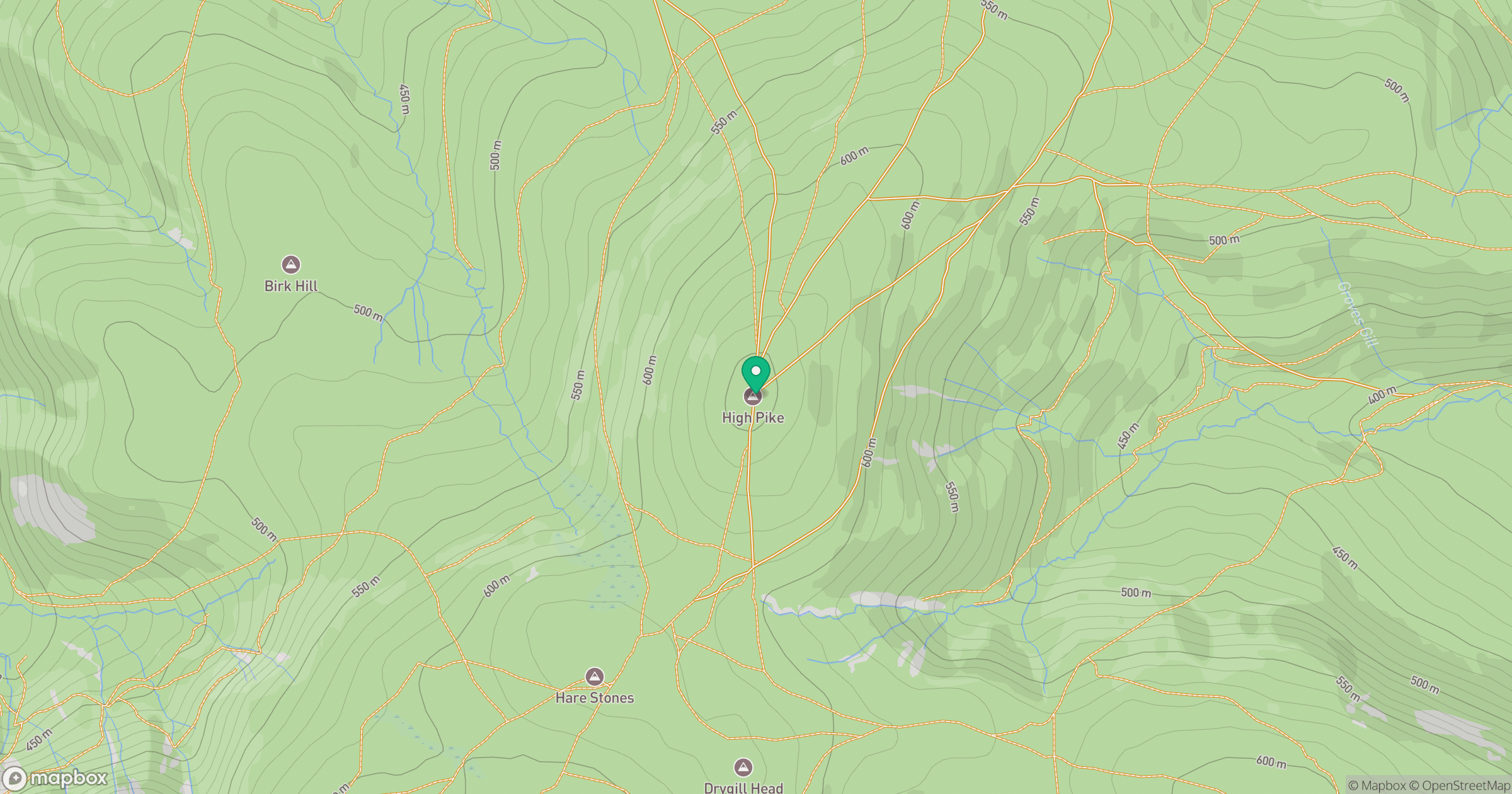
Grid reference: NY318350
View on OpenStreetMapOpens a map in a new tab, centred on the hill.
Hills within 30 km
Straight-line distance, not a walking route or confirmation of access.
No comments yet. Be the first.