
Hart Side
Good walks are even better shared.
Overview
Hart Side: A Gem in the Lake District
If you're looking for a delightful adventure in the Lake District, look no further than Hart Side – a small yet mighty peak that promises stunning views and a bit of a workout.
Geology
Hart Side’s volcanic roots provide a fascinating glimpse into the earth's history. The andesite rock, shaped by ancient volcanic forces, creates a rugged beauty that’s a treat for geology enthusiasts. Don't forget to take a moment on your ascent to marvel at Mother Nature's handiwork!
Routes and Access
The most popular route starts at Dockray, a picturesque village that feels like something straight out of a postcard. The path winds through lush woodlands, nudging you ever closer to the summit (and those views!).
Parking can be found in Dockray but be warned: if the sun's out, so are the other walkers! Arrive early to beat the crowds. Public transport options from Penrith make the journey a breeze, offering scenic views along the way.
Summit Features
At the top, you'll find a humble cairn marking your achievement. The summit might not boast a trophy, but the views are the real prize! On a clear day, take in sights of Ullswater and beyond - you might even see a bit of the Isle of Man!
Terrain and Hazards
The journey isn’t without its challenges. The rocky terrain can be slippery, especially when wet, so keep your wits about you. But fear not! With the right footwear and a determined spirit, you’ll be just fine.
Facilities
After your venture, collect your thoughts over a scone and a cuppa at the local tearoom in Dockray. Nothing beats a slice of cake after a day on the hills!
History
Did you know that 'Hart Side' means the place of the stag? It’s a nod to the area’s rich hunting history. A ramble here is not just about getting fit; it’s a step back into the tapestry of local heritage.
So, pack your rucksack, lace up your boots, and make your way to Hart Side. Adventure awaits – and remember, the only bad view is the one you don’t take!
Explore routes near Hart Side
Walks starting near this hill. Open a route to check its map, distance and full itinerary.
Helvellyn via Striding Edge
View route
Striding Edge, Helvellyn and Catstye Cam
View route
Bannerdale Crags from Mungrisdale Wainwright
View route
Mungrisdale Common and Bowscale Fell from Mosedale Valley Wainwright
View route
Route planning notes
These notes describe possible approaches. Check a route's map and access information when planning your walk.
Ascend from Dockray
This route starts at the village of Dockray, meandering through lush woodlands and gradually ascending to the summit. Perfect for those wanting a gentle introduction to the Lake District.
Make a day of it, together
Find someone to share the walk with, or organise a day out along a route you like.
Hill facts and local notes
Classifications
Elevation
756m
2,480 ft
Prominence
24m
Coordinates
54.5687, -2.9929
NY359197
OS Map
90
Explorer: OL5S
At the Summit
The summit of Hart Side features a modest cairn and fantastic panoramic views, proving that size isn't everything. On a clear day, you may even spot the Isle of Man off in the distance.
Terrain & Geology
Hart Side is composed primarily of volcanic rock, specifically andesite, a remnant of the area's volcanic activity in the past. The varying textures of the rock create beautiful patterns that can be seen on the summit and along the routes, showcasing nature’s artistry.
Views & Scenery
From the summit, hikers are treated to breathtaking views of Ullswater, the Helvellyn range, and the surrounding valleys, with the twinkling waters of the lakes below.
History & Heritage
Name Origin
The name 'Hart Side' is thought to derive from the Old English 'heorot', meaning hart or stag, reflecting the area’s past as a hunting ground.
Historical Significance
Hart Side holds significance for both hikers and wildlife enthusiasts, as it is part of the historic Lake District National Park, steeped in local folklore and nature conservation.
Getting There & Facilities
Parking
Parking is available at Dockray, with a small car park that can fill up quickly on sunny weekends, so arrive early to snag a spot.
Public Transport
Regular bus services run from Penrith to Dockray. The journey offers beautiful views, all for the price of a cup of tea!
Nearby Facilities
While there are no facilities directly on Hart Side, Dockray has a charming tearoom where you can recharge with a scone and a cuppa after your trek.
Safety Information
Known Hazards
- Rocky inclines and steep drops can pose risks; be sure to watch your step!
- Weather can change rapidly, so keep an eye on the forecast to avoid being caught out.
General Safety Tips
- Check weather conditions before setting out
- Carry appropriate clothing and equipment
- Let someone know your planned route
- Take a map, compass, and GPS device
- Carry emergency supplies: food, water, first aid kit, torch
Hills
Some common questions about the hills answered
Are there group walks up Hart Side?
Many walkers use Walkmates to join or organise walks with others. You can check for group walks around Hart Side through the maps
Are there other walkers around Hart Side?
Activity varies by location and time, but Walkmates lets you see whether others have shared walks or shown interest in this area. Find other people through the walking friends search walking friends for Hart Side search or of course create your own walk for Hart Side
Can I organise a walk to Hart Side?
Yes. If there aren’t any walks listed already, you can create a walk and make it available for others to join.
If you're signed up to Walkmates, you can create a walk to Hart Side.
How do I find a walk up this hill?
There are often multiple ways to walk this hill, depending on experience and route preference. Walkmates helps you explore walks and routes that others have shared.
Can I suggest a new route up Hart Side?
Yes. You can suggest or create routes to share with others. Walkmates focuses on the social side of walking, so routes are used to help people organise walks and explore areas together, rather than as detailed navigation tools or route libraries.
Other uses really appreciate knowledgeable walkers sharing their routes. Share your favourite route to Hart Side here
The is an error or something incorrect about this hill. How do I let you know?
We always strive to keep the information on Walkmates as accurate as possible. If you find an error, please let us know through the contact form and we'll aim to correct it as quickly as possible
Community Discussion
Comments
Location
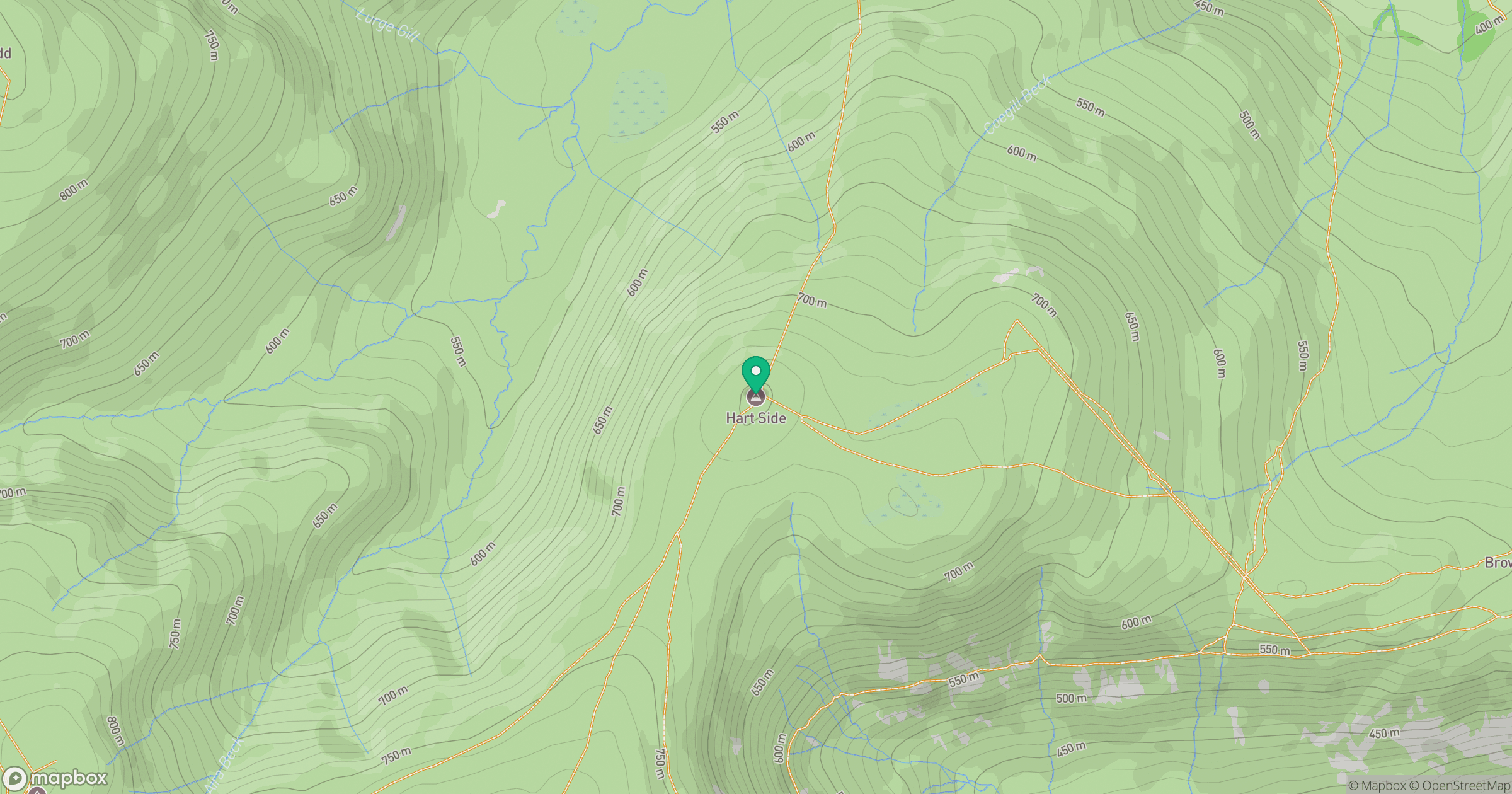
Grid reference: NY359197
View on OpenStreetMapOpens a map in a new tab, centred on the hill.


No comments yet. Be the first.