

Hambury Tout
Good walks are even better shared.
SY8180 : Valley to the west of Lulworth Cove
N Chadwick Photo source
Overview
Hambury Tout
Hambury Tout is a charming hill in Dorset, standing proudly at 228 meters. Known for its sweeping views and picturesque landscapes, this Marilyn is a delightful treat for both seasoned hikers and casual walkers alike.
Geology
Nestled within the Jurassic Coast, Hambury Tout boasts a unique chalky composition, contributing to the scenic rolling hills characteristic of the area. The site’s geological significance also makes it a popular spot for geomorphology enthusiasts.
Routes
For a popular route, consider taking the path from West Lulworth. This moderate 4.5 km trek takes about two hours and is suitable for most walkers. Enjoy the walk through serene countryside, and perhaps sing a little tune to entertain the sheep.
Summit Features
Atop Hambury Tout, you'll find a grassy summit offering ample space for relaxation. So, whether you decide to reflect on the wonders of nature or execute a perfectly choreographed interpretive dance, the summit is calling!
Views
The panoramic vistas from the top are nothing short of spectacular. Look out for the Purbeck hills along with the enchanting Lulworth Cove. For the best sights, spring and early summer offer a burst of wildflowers and vibrant greenery; however, autumn's golden hues can also be quite magical.
Hazards
Although largely approachable, hikers should be cautious of muddy patches after rainfall. It’s all too easy to take an unexpected tumble otherwise!
Nearby Summits
Hambury Tout is not alone in its glory; nearby peaks include Worbarrow Tout and Egdon Hill, each offering their own unique experiences.
Access
Parking is available at the National Trust car park near West Lulworth. With convenient public transport links from Wareham, getting to the starting point is relatively easy. The closest town is West Lulworth, where you can refresh your spirits post-hike.
Facilities
Rest assured, nearby cafes and public toilets offer a welcome reprieve after your adventure.
History
The name 'Hambury' is likely derived from Old English, tied to its historical locality. Standing as part of the Jurassic Coast World Heritage Site, this area not only delights the eye but also intrigues the mind with its rich geological heritage.
In summary, whether you're after solitude, stunning views, or a good laugh at your own clumsiness, Hambury Tout has something for everyone. Happy hiking!
Explore routes near Hambury Tout
Walks starting near this hill. Open a route to check its map, distance and full itinerary.
Durdle Door coastal walk
View route
Commoners’ Ways: Kingston, Corfe Castle and Blashenwell
View route
Weymouth to Sandsfoot Gardens: Rodwell Trail and Radipole waterside return
View route
Hardy's Cottage, Stinsford and Dorchester from Thorncombe Wood
View route
Route planning notes
These notes describe possible approaches. Check a route's map and access information when planning your walk.
West Lulworth to Hambury Tout
A scenic route that winds through picturesque countryside, offering a delightful walk to the summit.
Make a day of it, together
Find someone to share the walk with, or organise a day out along a route you like.
Photo Gallery
View all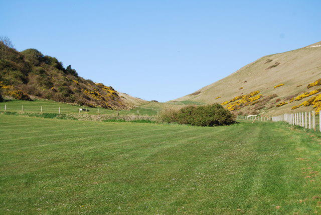 Photo could not load
SY8180 : Valley to the west of Lulworth Cove
N Chadwick
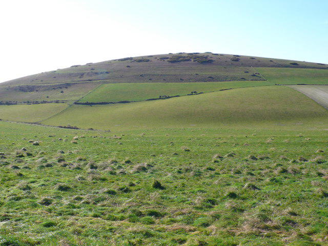 Photo could not load
SY8180 : Hambury Tout
Nigel Mykura
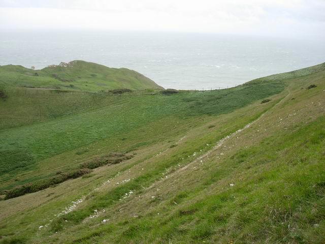 Photo could not load
SY8180 : Grassland and old path
Hugh Venables
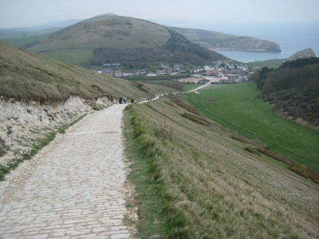 Photo could not load
SY8180 : Descent to Lulworth
Philip Halling
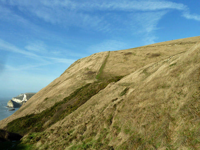 Photo could not load
SY8180 : Coastal slope below Hambury Tout
Robin Webster
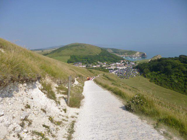 Photo could not load
SY8180 : West Lulworth, view
Mike Faherty
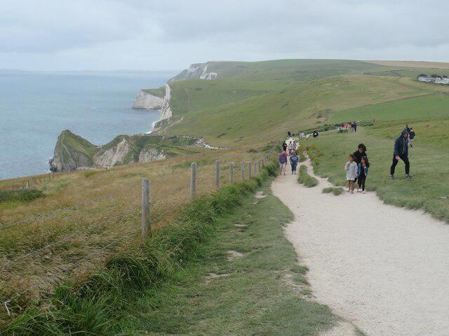 Photo could not load
SY8180 : South West Coast Path, near Durdle Door
Malc McDonald
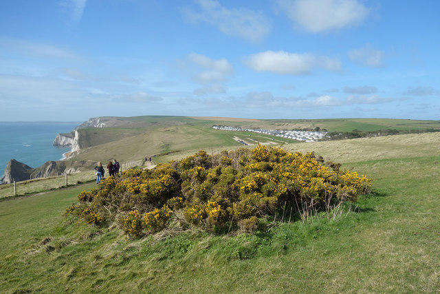 Photo could not load
SY8180 : Gorse Bush by the Path
Des Blenkinsopp
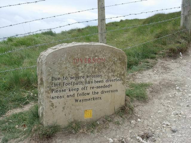 Photo could not load
SY8180 : Footpath sign
Hugh Venables
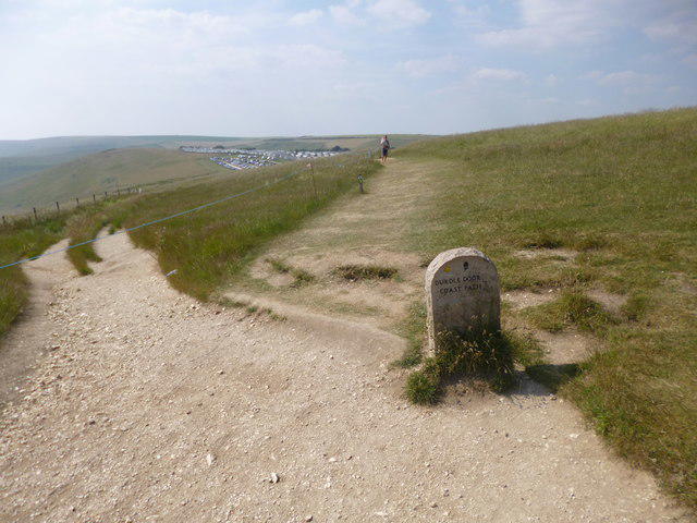
SY8180 : West Lulworth, marker
Mike Faherty
Hill facts and local notes
Classifications
Elevation
138m
453 ft
Prominence
39m
Coordinates
50.6220, -2.2617
SY815802
OS Map
194
Explorer: OL15E
At the Summit
A prominent grassy summit with a small mound and a few scattered wildflowers. An ideal spot for a picnic or simply to soak in the views.
Terrain & Geology
Hambury Tout is primarily composed of chalk, which is prevalent in the region. The surrounding landscape features rolling hills and stunning views, characteristic of the Jurassic Coast.
Views & Scenery
The stunning Purbeck hills, the shimmering English Channel, and the iconic Lulworth Cove are all visible from the top.
History & Heritage
Name Origin
The name 'Hambury' may derive from Old English, meaning 'hill of the ham' referring to the settlement in the area.
Historical Significance
This hill is part of the Jurassic Coast World Heritage Site, recognized for its geological importance.
Getting There & Facilities
Parking
You can park at the National Trust car park near West Lulworth (postcode BH20 5RQ).
Public Transport
The nearest bus service runs from Wareham to Lulworth Cove, with a walk to the starting point.
Nearby Facilities
There are public toilets available at the car park, and several cafes in West Lulworth offering refreshments.
Safety Information
Known Hazards
- Muddy areas during rainfall may pose a slipping hazard; please mind your footing.
General Safety Tips
- Check weather conditions before setting out
- Carry appropriate clothing and equipment
- Let someone know your planned route
- Take a map, compass, and GPS device
- Carry emergency supplies: food, water, first aid kit, torch
Hills
Some common questions about the hills answered
Are there group walks up Hambury Tout?
Many walkers use Walkmates to join or organise walks with others. You can check for group walks around Hambury Tout through the maps
Are there other walkers around Hambury Tout?
Activity varies by location and time, but Walkmates lets you see whether others have shared walks or shown interest in this area. Find other people through the walking friends search walking friends for Hambury Tout search or of course create your own walk for Hambury Tout
Can I organise a walk to Hambury Tout?
Yes. If there aren’t any walks listed already, you can create a walk and make it available for others to join.
If you're signed up to Walkmates, you can create a walk to Hambury Tout.
How do I find a walk up this hill?
There are often multiple ways to walk this hill, depending on experience and route preference. Walkmates helps you explore walks and routes that others have shared.
Can I suggest a new route up Hambury Tout?
Yes. You can suggest or create routes to share with others. Walkmates focuses on the social side of walking, so routes are used to help people organise walks and explore areas together, rather than as detailed navigation tools or route libraries.
Other uses really appreciate knowledgeable walkers sharing their routes. Share your favourite route to Hambury Tout here
The is an error or something incorrect about this hill. How do I let you know?
We always strive to keep the information on Walkmates as accurate as possible. If you find an error, please let us know through the contact form and we'll aim to correct it as quickly as possible
Community Discussion
Comments
Location
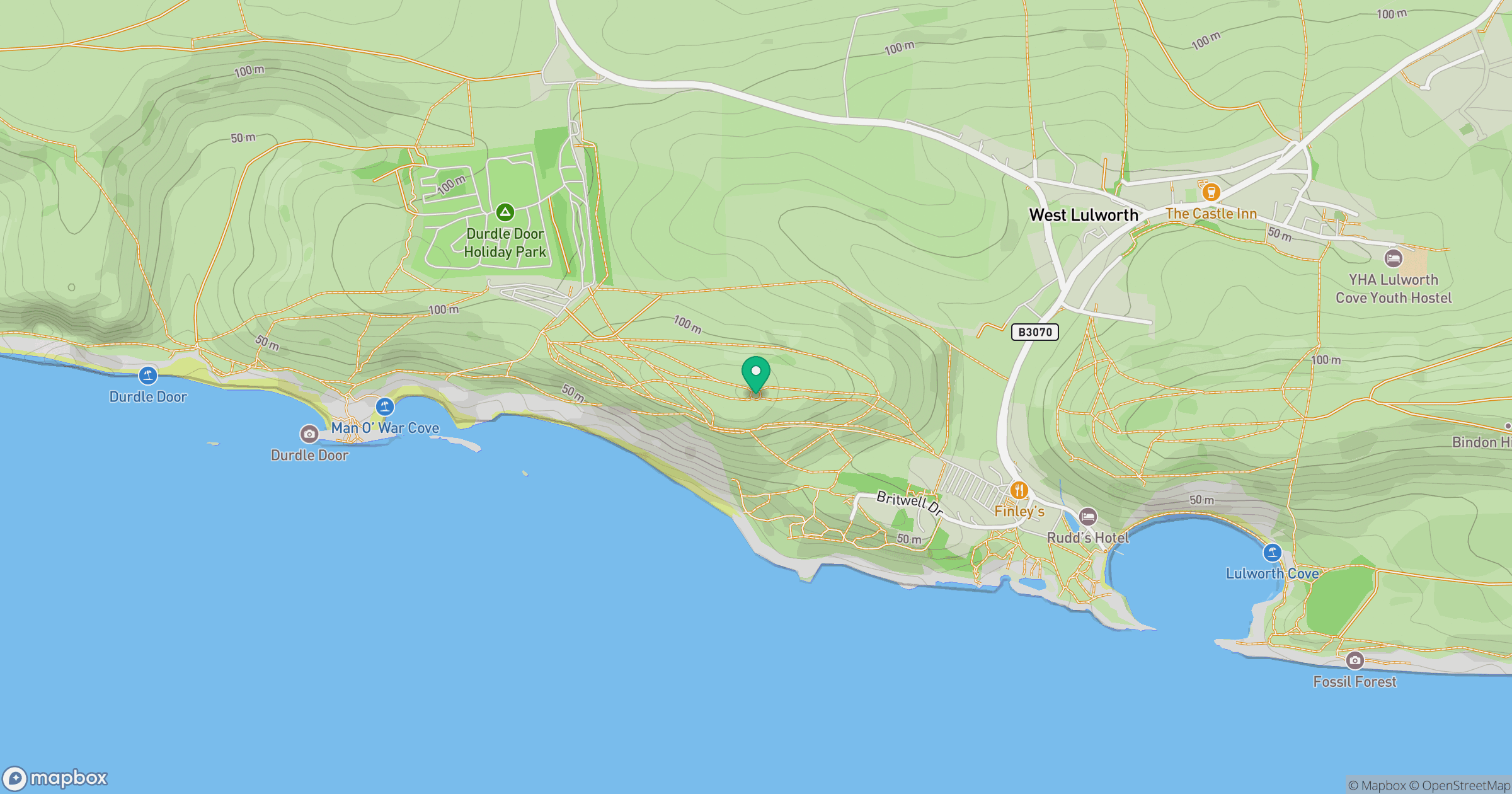
Grid reference: SY815802
View on OpenStreetMapOpens a map in a new tab, centred on the hill.


No comments yet. Be the first.