
Ham Hill
Good walks are even better shared.
Overview
Ham Hill: The Jewel of South Somerset
Nestled in the heart of South Somerset, Ham Hill is a delightful destination for hikers and outdoor enthusiasts alike. With its rich history, stunning views, and well-maintained paths, it's no wonder so many people flock to this lovely spot.
Geology
Ham Hill boasts fascinating geological features, primarily composed of green sandstone, which has been quarried extensively in the past. As you stroll through the park, take a moment to admire the layers of rock that reveal millions of years of sedimentary history.
Routes
One of the most popular routes is the Ham Hill Country Park Circuit, which spans about 4.2 kilometers. This gentle loop offers a fantastic way to experience the park, taking approximately 1.5 hours to complete. The trails are designed to cater to all abilities, making it a favourite for families and casual walkers alike.
Summit Features
Upon reaching the summit, visitors are greeted by a well-marked trig point and a collection of historical earthworks. Take a well-deserved break on the circular bench and soak in the breathtaking views that surround you.
Terrain Type
The terrain at Ham Hill is primarily grassy, with well-maintained paths that can be enjoyed by all. However, be cautious during wet weather, as muddy patches can appear, potentially turning your hike into an unintended mud wrestling match!
Views
Highlights
The summit provides stunning panoramas of the South Somerset countryside, including the impressive Glastonbury Tor. On a clear day, the vistas stretch far and wide, offering a delightful reward for your efforts.
Best Seasons
For the best visual feast, spring and early autumn are ideal times to visit. Spring brings a riot of colour with blooming wildflowers, while autumn showcases nature's beautiful palette.
Hazards
While the trails are safe for general hiking, keep an eye out for slippery sections, especially after rain. Uneven ground can also be found in some areas, so a good pair of hiking boots is recommended.
Nearby Summits
If you’re feeling adventurous, nearby Montacute Hill (elevation: 124 meters) is also worth a visit. It’s close enough for a cheeky additional walk!
Access
Nearest Parking
You'll find a convenient car park at Ham Hill Country Park, easily accessible and typically free of charge. This is the perfect launch point for your outdoor escapades.
Public Transport
For those relying on public transport, the nearest bus stop is in Stoke-sub-Hamdon, roughly one mile away. Be sure to check the bus schedule, as services can be a bit unpredictable.
Nearest Town
Stoke-sub-Hamdon is your closest town, providing a charming atmosphere and a lovely community feel.
Facilities
Ham Hill Country Park is equipped with public toilets and picnic areas, making it a great spot for a family outing. If you find yourself craving a snack, it’s best to bring your own unless you plan on visiting the local café!
History
Name Meaning
The name 'Ham Hill' has its roots in Old English, translating to 'home hill'—a nod to its long history of habitation.
Significance
This hill has been a significant site since prehistoric times, with evidence of Iron Age earthworks. It continues to provide a peaceful retreat for locals and visitors, steeped in rich history and culture.
In conclusion, Ham Hill offers a perfect combination of natural beauty, intriguing history, and accessibility. Whether you’re in for a leisurely walk or looking to soak in some impressive views, this hill is sure to not disappoint.
Happy hiking!
Explore routes near Ham Hill
Walks starting near this hill. Open a route to check its map, distance and full itinerary.
Wellington (Somerset) Walk with Men Walking & Talking
View route
Sampford Peverell to Whipcott Bridge: Grand Western Canal return
View route
Tiverton Grand Western Canal: Crownhill Bridge Return
View route
Taunton Walk with Men Walking & Talking
View route
Route planning notes
These notes describe possible approaches. Check a route's map and access information when planning your walk.
Ham Hill Country Park Circuit
A pleasant loop around the country park, offering easy access and scenic views.
Make a day of it, together
Find someone to share the walk with, or organise a day out along a route you like.
Hill facts and local notes
Classifications
Elevation
168m
551 ft
Prominence
31m
Coordinates
50.9909, -3.3408
ST059221
OS Map
181
Explorer: 128W
At the Summit
At the summit, you'll find a prominent trig point and a variety of historical earthworks, alongside a lovely circular bench for enjoying the views.
Terrain & Geology
Ham Hill is primarily composed of green sandstone, a rock type that has been extensively quarried in the past. The area's geology offers a fascinating glimpse into sedimentary processes, with exposed layers revealing millions of years of history.
Views & Scenery
From the summit, adventurers are treated to sweeping vistas across the South Somerset countryside, with views of the notable Glastonbury Tor and beyond.
History & Heritage
Name Origin
The name 'Ham Hill' is derived from Old English, meaning 'home hill', likely referring to its long-standing significance as a habitation location.
Historical Significance
The hill has been occupied since prehistoric times, with evidence of Iron Age earthworks. It is now a popular site for both locals and visitors, steeped in history.
Getting There & Facilities
Parking
There is a car park at Ham Hill Country Park, which is usually free. The car park is well signposted and provides a great starting point for your adventure.
Public Transport
The nearest bus stop is located in the village of Stoke-sub-Hamdon, a short walk away from the park's entrance. Buses are generally infrequent, so check schedules in advance.
Nearby Facilities
Ham Hill Country Park has public toilets and picnic areas, but be sure to bring your own snacks unless you're planning a visit to the local café.
Safety Information
Known Hazards
- While the trails are generally safe, it's worth noting that they can be slippery in wet conditions. Additionally, be wary of uneven ground in places.
General Safety Tips
- Check weather conditions before setting out
- Carry appropriate clothing and equipment
- Let someone know your planned route
- Take a map, compass, and GPS device
- Carry emergency supplies: food, water, first aid kit, torch
Hills
Some common questions about the hills answered
Are there group walks up Ham Hill?
Many walkers use Walkmates to join or organise walks with others. You can check for group walks around Ham Hill through the maps
Are there other walkers around Ham Hill?
Activity varies by location and time, but Walkmates lets you see whether others have shared walks or shown interest in this area. Find other people through the walking friends search walking friends for Ham Hill search or of course create your own walk for Ham Hill
Can I organise a walk to Ham Hill?
Yes. If there aren’t any walks listed already, you can create a walk and make it available for others to join.
If you're signed up to Walkmates, you can create a walk to Ham Hill.
How do I find a walk up this hill?
There are often multiple ways to walk this hill, depending on experience and route preference. Walkmates helps you explore walks and routes that others have shared.
Can I suggest a new route up Ham Hill?
Yes. You can suggest or create routes to share with others. Walkmates focuses on the social side of walking, so routes are used to help people organise walks and explore areas together, rather than as detailed navigation tools or route libraries.
Other uses really appreciate knowledgeable walkers sharing their routes. Share your favourite route to Ham Hill here
The is an error or something incorrect about this hill. How do I let you know?
We always strive to keep the information on Walkmates as accurate as possible. If you find an error, please let us know through the contact form and we'll aim to correct it as quickly as possible
Community Discussion
Comments
Location
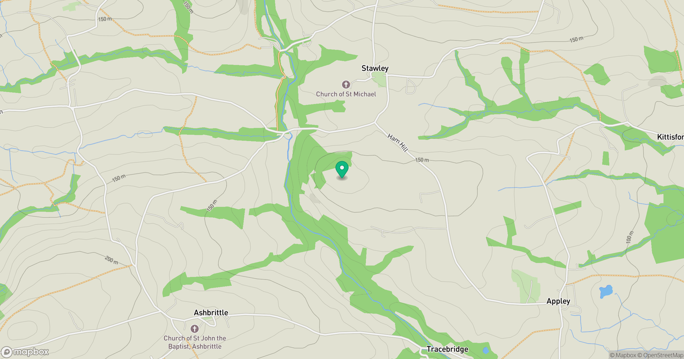
Grid reference: ST059221
View on OpenStreetMapOpens a map in a new tab, centred on the hill.



No comments yet. Be the first.