

Great Dodd
Good walks are even better shared.
NY3420 : Multiple 'mico-mounds' on slope of Great Dodd
Trevor Littlewood Photo source
Overview
Great Dodd
Great Dodd is a charming summit located in the beautiful Lake District, England. Standing tall at an impressive 856 meters, this Marilyn is a favourite amongst hikers for its accessibility and stunning panoramic views. Below, we dive into what makes this hill worth the trek!
Geology
Great Dodd’s geological story unfolds primarily through the presence of volcanic rock, specifically andesite and rhyolite. Formed during explosive volcanic activity millions of years ago, it is evidence of the tumultuous geological forces that shaped the Lake District we see today. The rocky outcrops you might encounter are not just mere stones; they’re relics of a very different time in the Earth’s history!
Routes
Peat Moss Route
This route is a relatively easy and scenic way to ascend Great Dodd. Starting from the small car park off the A66, you’ll traverse charming yet likely boggy terrain. The trek is about 7.5 km round trip and usually takes around 3 hours. Perfect for a leisurely hike on a sunny day!
Watson's Dodd Route
If you're feeling adventurous, combining Great Dodd with Watson’s Dodd provides a more challenging option at around 10 km. Expect some steep scrambles and the chance to feel like a mountain goat rather than merely a pedestrian. Allocate around 4 hours for this route.
Summit Features
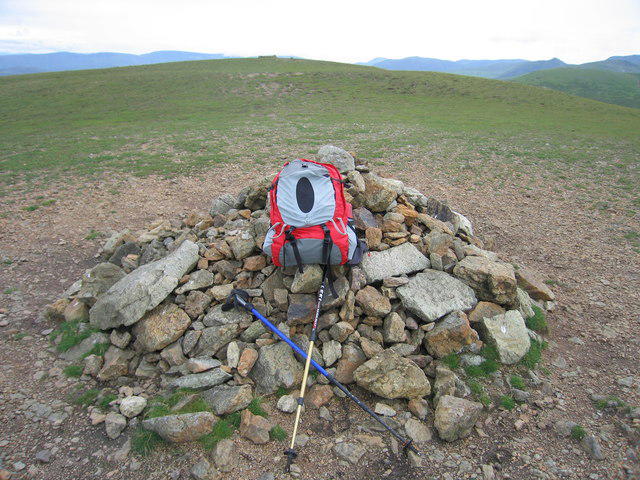
Upon reaching the summit, you’ll be greeted by a prominent stone cairn and a trig point that’s begging for a selfie. Just be careful of the winds, they can be a bit cheeky!
Terrain
Expect a delightful mix of grassy slopes, stunning rocky outcrops, and some boggy patches that might try to steal your boots. It’s best to wear sturdy footwear that you won't mind getting a bit muddy.
Views
From the top, the views are simply breathtaking. To the south, you'll see the stunning Helvellyn range, while the north reveals the tranquil waters of Thirlmere. Late spring to early autumn tends to offer the best viewpoints, but a clear winter day is nothing to scoff at either! Just dress for the occasion.
Hazards
Be aware that the terrain can be quite boggy, especially after rain. Visibility may change rapidly. A good map and compass won’t go amiss—this isn't a game of hide and seek with the mountain!
Access and Facilities
Parking is available in a small layby off the A66, with public transport links from Keswick and Penrith. Once you finish your hike, the town of Keswick is not only the nearest town, but also a delightful pit stop peppered with cafes and shops.
History
The name 'Dodd' hails from Norse origins, meaning hill or mound, which is fitting for this magnificent peak. As part of the Lake District National Park, Great Dodd is not just a mountain; it is a significant part of the cultural and historical tapestry of the region.
So, whether you're an avid hiker or just someone seeking a bit of fresh air, Great Dodd promises not just a hike, but a memorable adventure amidst some of England’s most stunning landscapes. Pack your boots, grab a map, and embark on the journey. Happy hiking!
Explore routes near Great Dodd
Walks starting near this hill. Open a route to check its map, distance and full itinerary.
Helvellyn via Striding Edge
View route
Striding Edge, Helvellyn and Catstye Cam
View route
Bannerdale Crags from Mungrisdale Wainwright
View route
Mungrisdale Common and Bowscale Fell from Mosedale Valley Wainwright
View route
Route planning notes
These notes describe possible approaches. Check a route's map and access information when planning your walk.
Peat Moss Route
Starting from the small car park at the base of the hill, the Peat Moss Route meanders steadily through charming, if boggy, terrain. This is a popular choice for hikers looking to soak in the beauty of the Lake District without feeling like they're doing battle with the mountain.
Watson's Dodd Route
This route connects Great Dodd and its neighbour Watson's Dodd, providing a scenic loop that showcases the best of the surrounding landscapes, with a few thrilling scrambles to keep your heart pumping.
Make a day of it, together
Find someone to share the walk with, or organise a day out along a route you like.
Photo Gallery
View all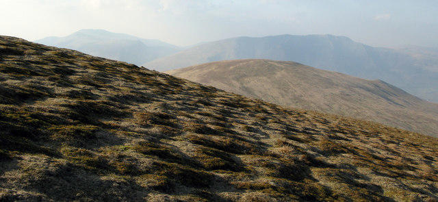 Photo could not load
NY3420 : Multiple 'mico-mounds' on slope of Great Dodd
Trevor Littlewood
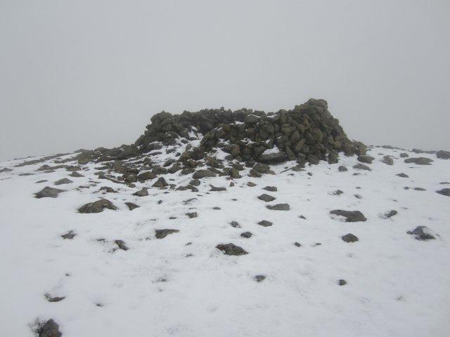 Photo could not load
NY3420 : Shelter Cairn on Great Dodd
Graham Robson
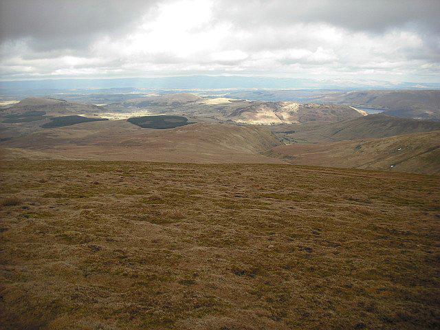 Photo could not load
NY3420 : From Great Dodd
Michael Graham
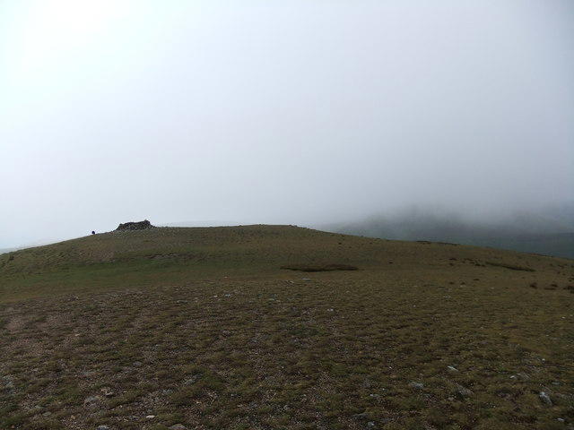 Photo could not load
NY3420 : Great Dodd
David Brown
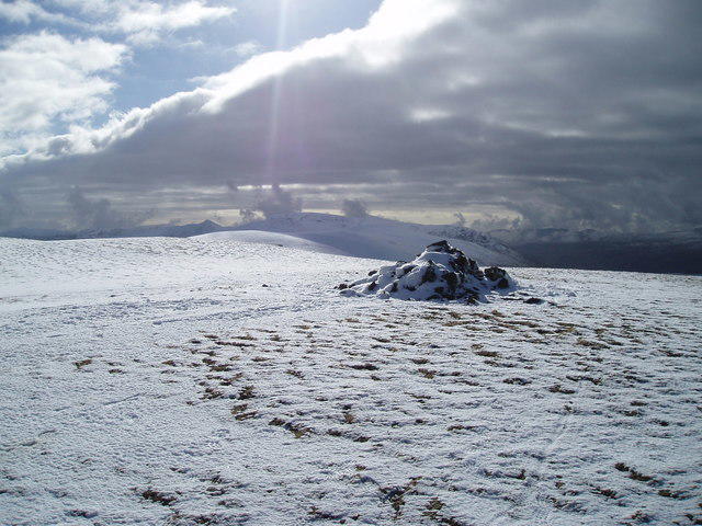 Photo could not load
NY3420 : Great Dodd summit
Matt Eastham
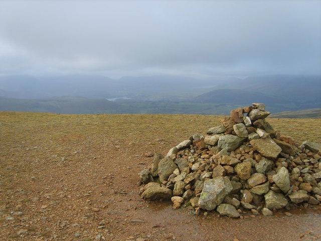 Photo could not load
NY3420 : Summit Cairn, Great Dodd
Michael Graham
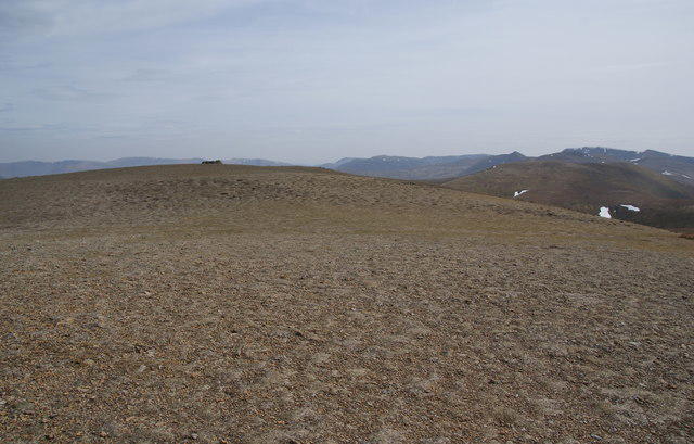 Photo could not load
NY3420 : The summit plateau of Great Dodd
Bill Boaden
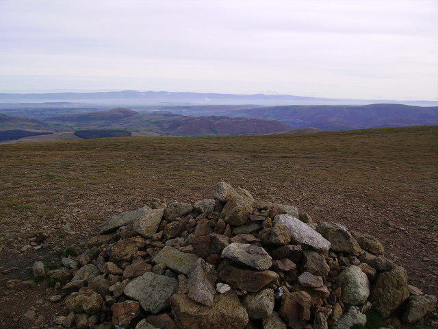 Photo could not load
NY3420 : Summit Cairn, Great Dodd
Michael Graham
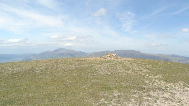 Photo could not load
NY3420 : On Great Dodd - view towards Skiddaw & Blencathra
Colin Park
NY3420 : Great Dodd
Rude Health
Hill facts and local notes
Classifications
Elevation
857m
2,812 ft
Prominence
109m
Coordinates
54.5757, -3.0194
NY342205
OS Map
90
Explorer: OL5S
At the Summit
The summit features a sturdy stone cairn and a trig point, which makes for a fantastic photo opportunity. Just watch out for the gusty winds—they're sometimes stronger than your best mate who insists they can do the 'Walk of Shame' uphill!
Terrain & Geology
Great Dodd is primarily composed of volcanic rock, specifically andesite and rhyolite formations, characteristic of its formation during the explosive volcanic activity that shaped the region millions of years ago.
Views & Scenery
From the summit, you'll marvel at views of the Helvellyn range to the south and the rolling fells of the surrounding countryside. On a clear day, you can even spot the shimmering waters of Thirlmere.
History & Heritage
Name Origin
The name 'Dodd' is derived from Norse and relates to the term for hill or mound. Great Dodd certainly lives up to its name, standing proud!
Historical Significance
As part of the Lake District National Park, Great Dodd holds historical importance not only as a natural landmark but also as part of the cultural heritage of the area, known for its extensive network of footpaths and trails.
Getting There & Facilities
Parking
There's a small layby on the A66 road near the foot of Great Dodd, suitable for cars. If you're lucky, you might even nab a space during peak times!
Public Transport
The nearest public transport is the bus service that runs between Keswick and Penrith, with a stop at the A66. From there, it’s a short walk to the trailhead.
Nearby Facilities
Keswick boasts numerous cafes, shops, and public toilets. A favourite stop is the Dog & Gun Inn, renowned for its local ales and hearty meals – a great reward after a long hike.
Safety Information
Known Hazards
- The terrain can be quite boggy, particularly after heavy rain, so be prepared for the possibility of wet feet. Visibility can change rapidly in the mountains, so keep an eye on the weather.
General Safety Tips
- Check weather conditions before setting out
- Carry appropriate clothing and equipment
- Let someone know your planned route
- Take a map, compass, and GPS device
- Carry emergency supplies: food, water, first aid kit, torch
Hills
Some common questions about the hills answered
Are there group walks up Great Dodd?
Many walkers use Walkmates to join or organise walks with others. You can check for group walks around Great Dodd through the maps
Are there other walkers around Great Dodd?
Activity varies by location and time, but Walkmates lets you see whether others have shared walks or shown interest in this area. Find other people through the walking friends search walking friends for Great Dodd search or of course create your own walk for Great Dodd
Can I organise a walk to Great Dodd?
Yes. If there aren’t any walks listed already, you can create a walk and make it available for others to join.
If you're signed up to Walkmates, you can create a walk to Great Dodd.
How do I find a walk up this hill?
There are often multiple ways to walk this hill, depending on experience and route preference. Walkmates helps you explore walks and routes that others have shared.
Can I suggest a new route up Great Dodd?
Yes. You can suggest or create routes to share with others. Walkmates focuses on the social side of walking, so routes are used to help people organise walks and explore areas together, rather than as detailed navigation tools or route libraries.
Other uses really appreciate knowledgeable walkers sharing their routes. Share your favourite route to Great Dodd here
The is an error or something incorrect about this hill. How do I let you know?
We always strive to keep the information on Walkmates as accurate as possible. If you find an error, please let us know through the contact form and we'll aim to correct it as quickly as possible
Community Discussion
Comments
Location
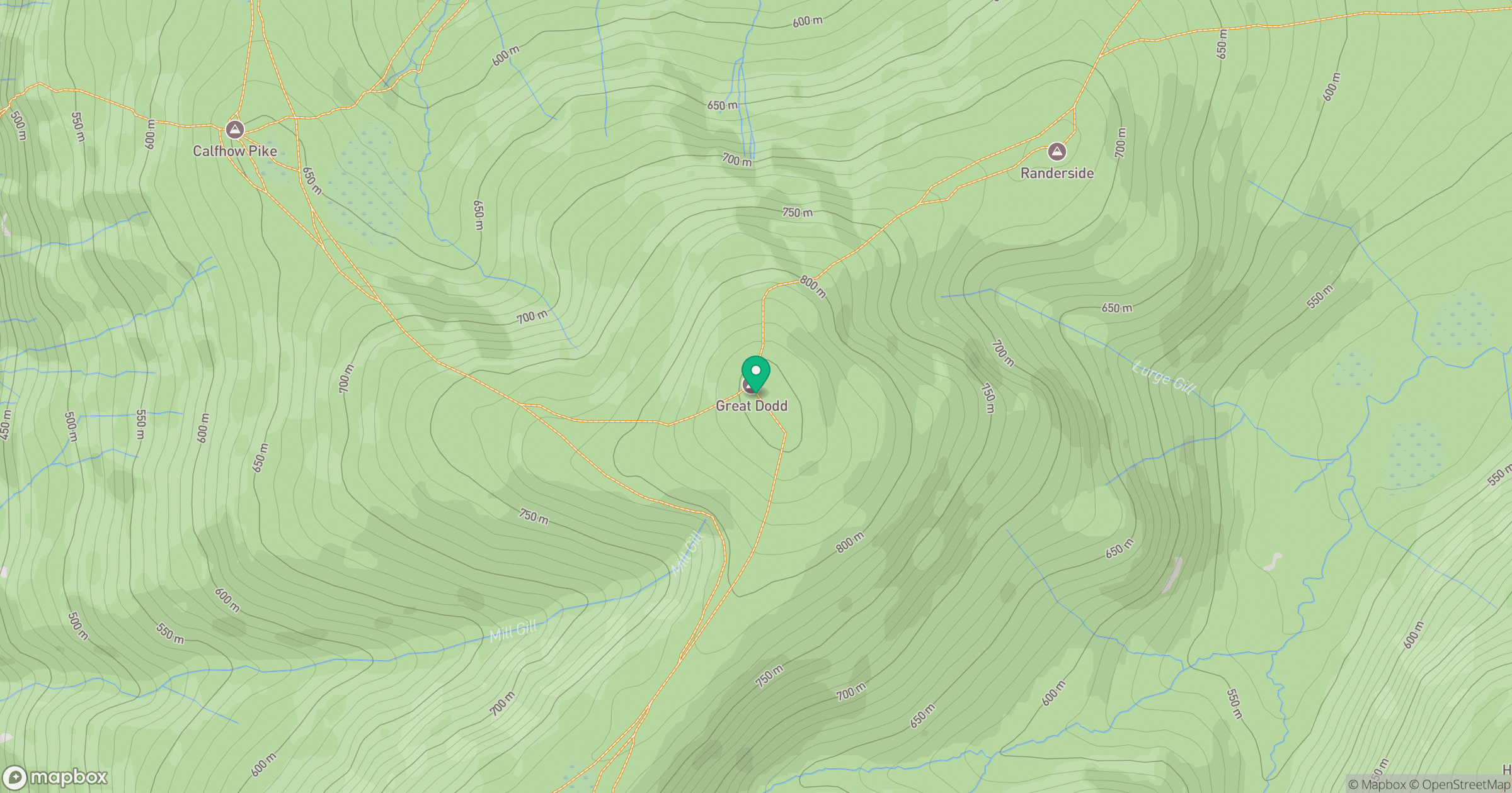
Grid reference: NY342205
View on OpenStreetMapOpens a map in a new tab, centred on the hill.


No comments yet. Be the first.