

Graig
Good walks are even better shared.
SO3023 : View from the crags of Y Graig above Cwmyoy
Jeremy Bolwell Photo source
Overview
Graig: A Hiker's Haven
Nestled in the Shropshire Hills, Graig stands as a proud Marilyn with scenic views and intriguing geological features. This charming hill draws hikers with both its accessible routes and splendid vistas.
Geology
Graig is predominantly composed of Old Red Sandstone, featuring rugged cliff faces that make for stunning photography—if only Mother Nature would cooperate!
Access
Parking
Visitors can find on-street parking in Upper Apley, allowing for easy access to trailheads. Just ensure you're not blocking anyone's driveway; we want you to enjoy your hike, not get a ticket!
Public Transport
Public transport options are available to Church Stretton, from where one might consider a short taxi ride or a pleasant stroll to Graig. Nature doesn’t rush, after all!
Nearest Town
Church Stretton is the closest town, buzzing with amenities and friendly locals who enjoy sharing tales of their adventures amid the hills.
Routes
Two notable routes provide splendid views and varied terrain. The "From Upper Apley" route offers a moderate challenge with lovely woodland views, while the "Apley Loop" is a gentler option complete with a mix of trails and lanes.
Summit Features
At the summit, a stone cairn stands tall; it’s your perfect backdrop for that all-important summit selfie. Just remember: it's not a competition, but it doesn't hurt to look good!
Terrain Type
Expect to encounter a delightful mix of grassy slopes and rocky paths. A keen eye is required post-rain for the muddy sections—your boots will certainly get a workout!
Views
The summit rewards your efforts with sweeping panoramas of the Shropshire Hills. On clear days, the landscape unfurls, revealing parts of Wales just beckoning for exploration. The best times for these views are during the spring and early autumn, when the countryside bursts with colour.
Hazards
While Graig is generally forgiving, do watch out for slippery spots after rain and the cheeky sheep that sometimes occupy the paths. And hold onto your hats—those brisk winds can surprise you!
In summary, Graig is not just a hill; it’s a journey filled with beauty, laughter, and that delightful feeling of having conquered yet another summit. Happy hiking!
Explore routes near Graig
Walks starting near this hill. Open a route to check its map, distance and full itinerary.
A Very Merry Winter Walk ending with Cake & a Hot Drink!
View route
Clytha Estate: River Usk, Chapel Ruins and Castle Woods
View route
Goytre Wharf to Pentre Bridge: Mon and Brec Canal Walk
View route
Brecon Basin to Brynich Aqueduct: Canal Towpath Walk
View route
Route planning notes
These notes describe possible approaches. Check a route's map and access information when planning your walk.
From Upper Apley
A scenic ascent starting from Upper Apley, taking you through delightful woodlands and open pastures.
The Apley Loop
A longer loop that combines trails and lanes, perfect for a leisurely day hike.
Make a day of it, together
Find someone to share the walk with, or organise a day out along a route you like.
Photo Gallery
View all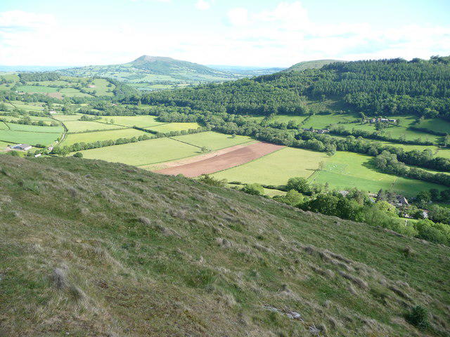 Photo could not load
SO3023 : View from the crags of Y Graig above Cwmyoy
Jeremy Bolwell
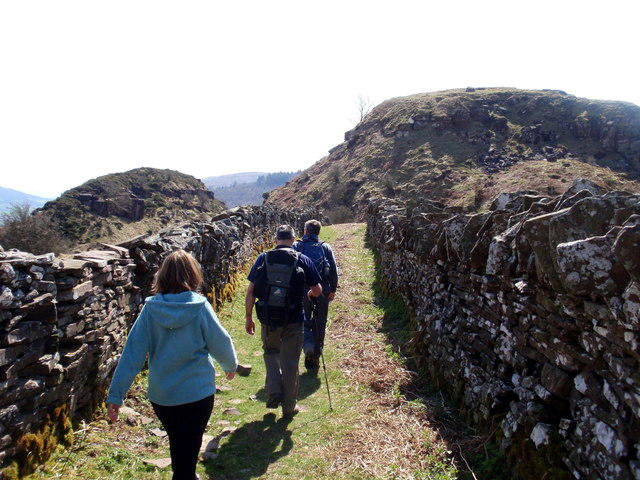 Photo could not load
SO3023 : Y Graig
Alan Richards
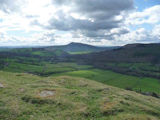 Photo could not load
SO2923 : View off the Graig above Cwmyoy
Jeremy Bolwell
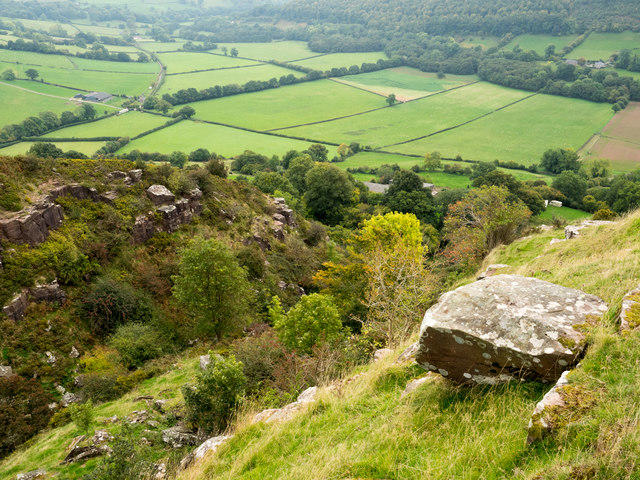 Photo could not load
SO3023 : Trees in cleft on Graig
Trevor Littlewood
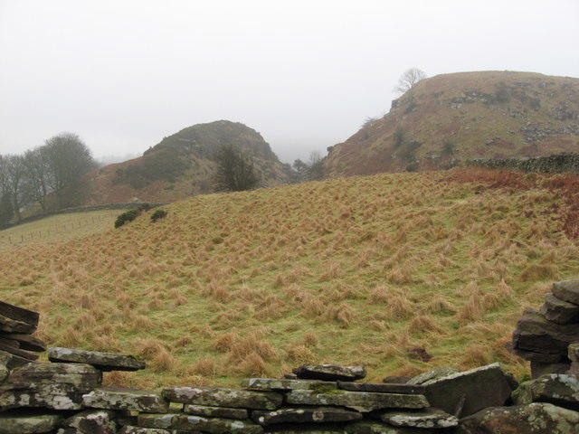 Photo could not load
SO3023 : Mind the gap!
Gareth James
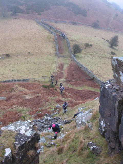 Photo could not load
SO3023 : Looking back from the knoll
Gareth James
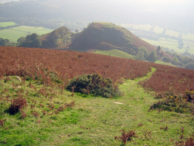 Photo could not load
SO3023 : Landslip at Cwmyoy
Trevor Rickard
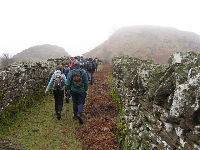 Photo could not load
SO3023 : Heading towards the knoll near Cwmyoy
Gareth James
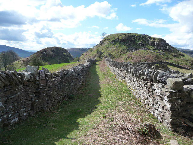 Photo could not load
SO3023 : The Graig above Cwmyoy
Jeremy Bolwell
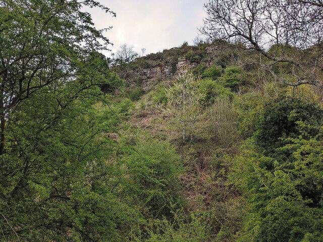
SO3023 : Y Graig (Cwmyoy)
Fabian Musto
Hill facts and local notes
Classifications
Elevation
348m
1,143 ft
Prominence
30m
Coordinates
51.9074, -3.0192
SO299237
OS Map
161
Explorer: OL13N OL13S
At the Summit
The summit is marked by a stone cairn, providing an excellent photo opportunity just in case clouds decide to lift for a moment.
Terrain & Geology
Graig is predominantly formed from Old Red Sandstone, resulting in a rugged and striking landscape with steep outcrops.
Views & Scenery
From the summit, enjoy sweeping views of the Shropshire Hills, the Long Mynd, and parts of Wales on a clear day.
History & Heritage
Name Origin
The name Graig translates to 'rocky place' in Welsh, which is quite fitting given its formidable presence!
Historical Significance
The area has connections to local folklore and historical events, with ancient trails used by traders and soldiers alike.
Getting There & Facilities
Parking
There's on-street parking available in Upper Apley, just be mindful of local residents who may want spaces too.
Public Transport
Buses run to nearby towns such as Church Stretton, with a short taxi ride or about an hour's walk from there.
Nearby Facilities
The nearest facilities are in Church Stretton, where you can find several cafes, shops, and public toilets for those necessary pit stops.
Safety Information
Known Hazards
- Slippery terrain after rain, sheep on path causing potential slowdowns, and the occasional sudden gust of wind that may steal your hat.
General Safety Tips
- Check weather conditions before setting out
- Carry appropriate clothing and equipment
- Let someone know your planned route
- Take a map, compass, and GPS device
- Carry emergency supplies: food, water, first aid kit, torch
Hills
Some common questions about the hills answered
Are there group walks up Graig?
Many walkers use Walkmates to join or organise walks with others. You can check for group walks around Graig through the maps
Are there other walkers around Graig?
Activity varies by location and time, but Walkmates lets you see whether others have shared walks or shown interest in this area. Find other people through the walking friends search walking friends for Graig search or of course create your own walk for Graig
Can I organise a walk to Graig?
Yes. If there aren’t any walks listed already, you can create a walk and make it available for others to join.
If you're signed up to Walkmates, you can create a walk to Graig.
How do I find a walk up this hill?
There are often multiple ways to walk this hill, depending on experience and route preference. Walkmates helps you explore walks and routes that others have shared.
Can I suggest a new route up Graig?
Yes. You can suggest or create routes to share with others. Walkmates focuses on the social side of walking, so routes are used to help people organise walks and explore areas together, rather than as detailed navigation tools or route libraries.
Other uses really appreciate knowledgeable walkers sharing their routes. Share your favourite route to Graig here
The is an error or something incorrect about this hill. How do I let you know?
We always strive to keep the information on Walkmates as accurate as possible. If you find an error, please let us know through the contact form and we'll aim to correct it as quickly as possible
Community Discussion
Comments
Location
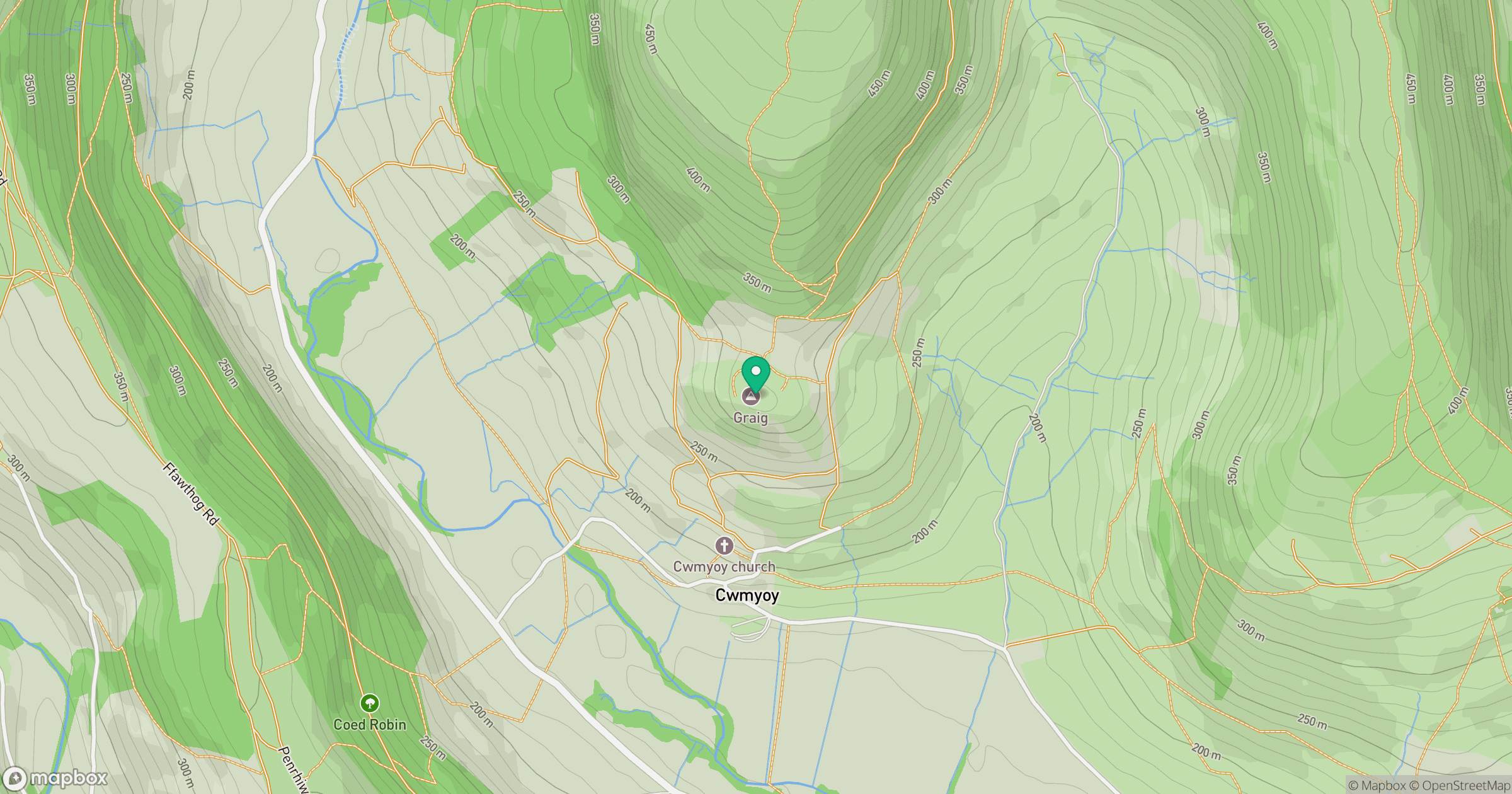
Grid reference: SO299237
View on OpenStreetMapOpens a map in a new tab, centred on the hill.

No comments yet. Be the first.