

Glenalla Fell - Fore Fell
Good walks are even better shared.
Overview
Glenalla Fell - Fore Fell
Introduction
Glenalla Fell, often referred to as Fore Fell, is a charming Marilyn nestled in the Southern Uplands of Scotland. Standing at an elevation of 601 meters, this relatively low summit packs a punch with its stunning views and diverse terrain. Perfect for those looking to stretch their legs and enjoy the great outdoors, it’s not just a hill, it’s an experience!
Geology
The geological composition of Glenalla Fell is primarily sedimentary rock, with layers of sandstone and shale that have shaped the landscape over countless years. This not only gives the fell its unique character but also provides an excellent opportunity for geology enthusiasts to marvel at nature’s handiwork.
Routes
There are a couple of notable routes you can take:
- Glenalla Circular Route: This route spans about 8.5 km, taking approximately 3.5 hours. It leads hikers through picturesque farmland before ascending the southern slopes of Fore Fell, where you can’t help but feel at one with nature.
- Straight Up the Front Route: For those who prefer the direct approach, this challenging 2.5 km hike will get your heart racing as you climb straight to the summit in just about an hour. Perfect for those seeking a bit of a workout!
Summit Features
When you finally reach the summit, you’ll find a trig point and a charming stone cairn. It’s a great spot to take a breather, snack on your provisions, and contemplate life’s mysteries—or at least the mysteries of footpath maintenance.
Terrain
The terrain here is predominantly grassy moorland with some rocky outcrops, making it a relatively easy walk for seasoned hikers, but challenging enough to keep things interesting for newcomers. Just watch your step in the boggy areas—it’s a bit like walking through treacle!
Views
From the top, the views are nothing short of spectacular. You’ll be greeted with panoramas of the Southern Uplands, shimmering Loch Doon, and, if you’re lucky, a clear day will reveal the Galloway Hills in the distance. The best times to visit for those postcard-perfect views are during spring and early summer when the landscape awakens in vibrant colours.
Hazards
As with any hike, be wary of the weather—it can turn quicker than a cat can lick its ear. Prepare for brisk winds and potential rain, and be sure to avoid the squelchy bogs unless you have a penchant for mud!
Access
Getting to Glenalla Fell is relatively straightforward:
- Nearest Parking: Glenalla Farm offers parking for a small fee. Just be courteous and don’t park in your neighbour’s potato patch.
- Public Transport: Buses from Dalmellington are available, albeit not at all hours, so check ahead to avoid being stranded.
- Nearest Town: Dalmellington is the closest town, with a small selection of shops and cafes for your post-hike refuelling needs.
Facilities
While there are no facilities on the mountain, Dalmellington is your go-to place for food and restrooms. A well-deserved treat after a day in the fresh air!
History
The name 'Glenalla' is rooted in Gaelic, meaning 'valley of the wood', which is rather poetic, don’t you think? The area is steeped in local lore, adding an extra layer of intrigue to your hike.
So pack your bags, lace those boots, and prepare for an adventure on Glenalla Fell - Fore Fell, where the wild meets the wonderful. Happy hiking!
Explore routes near Glenalla Fell - Fore Fell
Public walks starting within 80 km of this hill. Nearby does not mean a route reaches the summit; check its map and access before setting out.
Carrick Forest Drive: Stinchar Bridge to Loch Doon
View route
Loch Trool: Full Loch and Oak Woodland Circuit
View route
Glentrool Water of Trool and Spout Head Trail
View route
Wood of Cree Waterfalls and Scrubland Circuit
View route
Route planning notes
These notes describe possible approaches, not verified navigable routes or permission to cross land. Check current paths, local access rules and conditions before setting out.
Glenalla Circular Route
A scenic loop starting from the Glenalla Farm car park, taking you through lush farmland and ascending the southern slopes of Fore Fell.
Straight Up the Front Route
For those who enjoy a good sweat, this direct path leads straight from the base to the summit.
Make a day of it, together
Find someone to share the walk with, or organise a day out along a route you like.
Photo Gallery
View all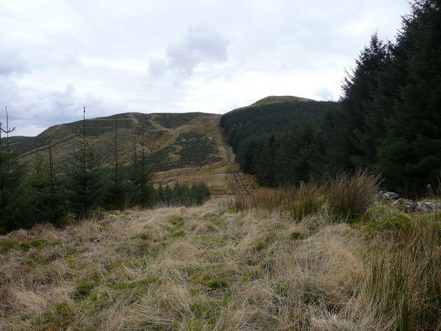 Photo could not load
NS3501 : Back Fell
david johnston
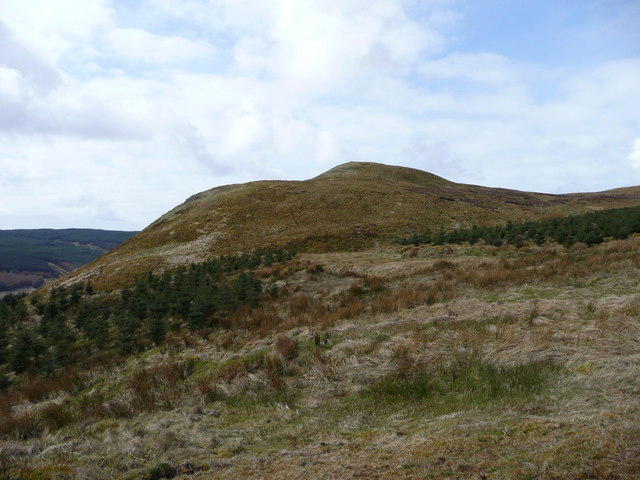 Photo could not load
NS3500 : Glenalla Fell
david johnston
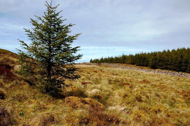 Photo could not load
NS3500 : On Glenalla Moor
Mary and Angus Hogg
Hill facts and local notes
Classifications
Elevation
428m
1,404 ft
Prominence
126m
Coordinates
55.2749, -4.5908
NS355009
OS Map
77
Explorer: 326S
At the Summit
The summit features a prominent trig point and a small stone cairn, which may be a fine spot for a celebratory snack—just don’t spill crumbs on the GPS!
Terrain & Geology
Glenalla Fell is primarily composed of sedimentary rock formations, with prominent sandstones and shales that have weathered over millennia to form the rolling hills characteristic of this region.
Views & Scenery
From the summit, you can see the rolling hills of the Southern Uplands, the shimmering waters of Loch Doon, and the distant peaks of the Galloway Hills beyond.
History & Heritage
Name Origin
The name 'Glenalla' is thought to derive from the Gaelic 'Glen-a-Choille', meaning 'valley of the wood', a nod to the verdant greenery that still blankets the area.
Historical Significance
This area has roots in numerous local myths and tales, and it remains a cherished spot for hiking and nature lovers alike.
Getting There & Facilities
Check current local access restrictions, parking rules and transport timetables before travelling. These notes do not confirm public access to the summit.
Parking
Glenalla Farm, where parking is available for a reasonable fee. Please don’t park in the farmer's field unless you want an unscheduled lesson in agricultural management.
Public Transport
Accessible by bus services from nearby towns, although routes may be limited on weekends. A good excuse to get some fresh air while waiting!
Nearby Facilities
There are no facilities on the mountain itself, but nearby Dalmellington offers cafes, and public toilets.
Safety Information
Known Hazards
- Watch out for sudden changes in weather; conditions can shift quickly in the hills. Also, be mindful of the occasional boggy patches—keep your feet dry if you can!
General Safety Tips
- Check weather conditions before setting out
- Carry appropriate clothing and equipment
- Let someone know your planned route
- Take a map, compass, and GPS device
- Carry emergency supplies: food, water, first aid kit, torch
Hills
Some common questions about the hills answered
Are there group walks up Glenalla Fell - Fore Fell?
Many walkers use Walkmates to join or organise walks with others. You can check for group walks around Glenalla Fell - Fore Fell through the maps
Are there other walkers around Glenalla Fell - Fore Fell?
Activity varies by location and time, but Walkmates lets you see whether others have shared walks or shown interest in this area. Find other people through the walking friends search walking friends for Glenalla Fell - Fore Fell search or of course create your own walk for Glenalla Fell - Fore Fell
Can I organise a walk to Glenalla Fell - Fore Fell?
Yes. If there aren’t any walks listed already, you can create a walk and make it available for others to join.
If you're signed up to Walkmates, you can create a walk to Glenalla Fell - Fore Fell.
How do I find a walk up this hill?
There are often multiple ways to walk this hill, depending on experience and route preference. Walkmates helps you explore walks and routes that others have shared.
Can I suggest a new route up Glenalla Fell - Fore Fell?
Yes. You can suggest or create routes to share with others. Walkmates focuses on the social side of walking, so routes are used to help people organise walks and explore areas together, rather than as detailed navigation tools or route libraries.
Other uses really appreciate knowledgeable walkers sharing their routes. Share your favourite route to Glenalla Fell - Fore Fell here
The is an error or something incorrect about this hill. How do I let you know?
We always strive to keep the information on Walkmates as accurate as possible. If you find an error, please let us know through the contact form and we'll aim to correct it as quickly as possible
Community Discussion
Comments
Location
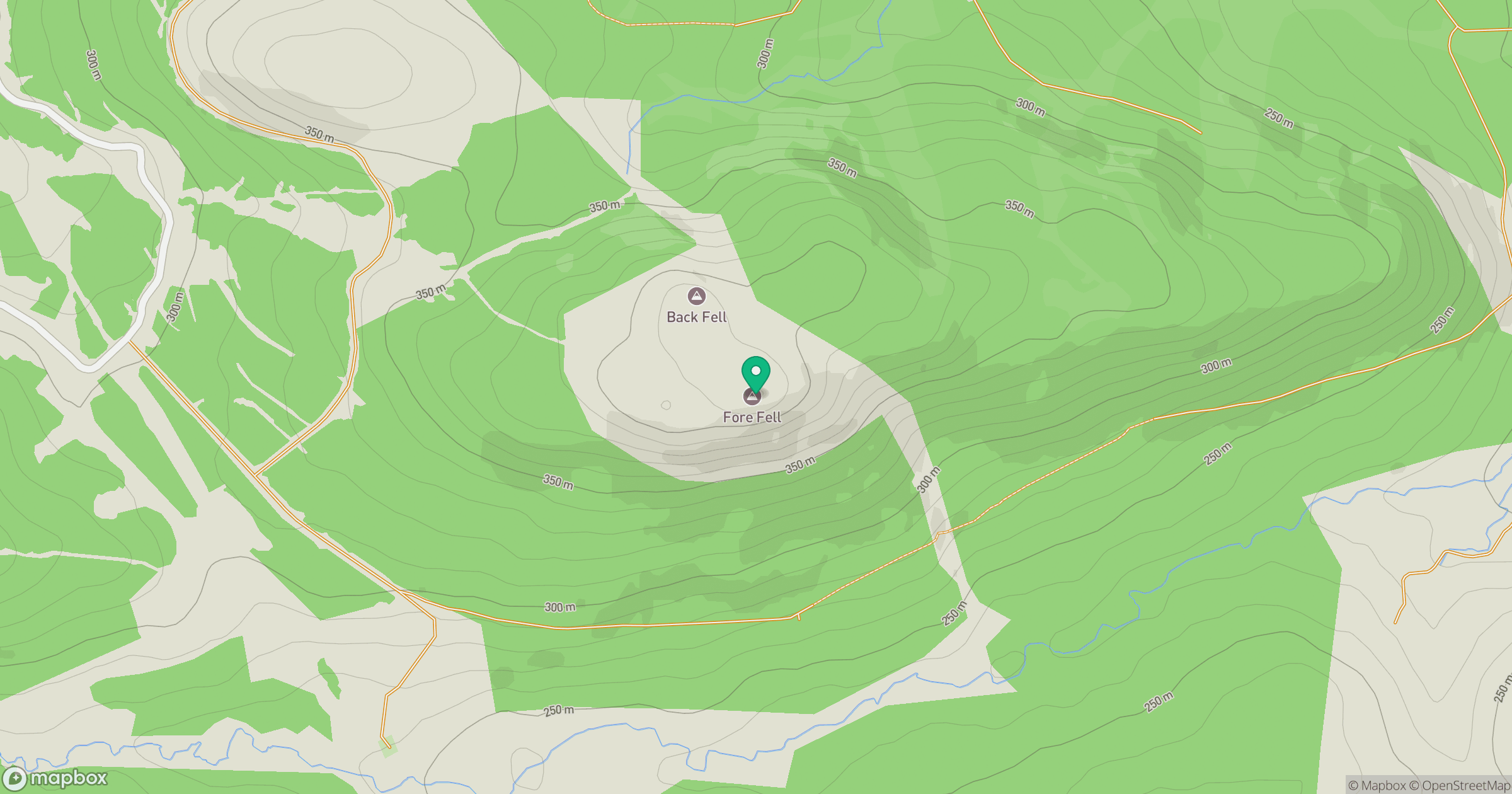
Grid reference: NS355009
View on OpenStreetMapOpens a map in a new tab, centred on the hill.
Hills within 30 km
Straight-line distance, not a walking route or confirmation of access.
No comments yet. Be the first.