
Giur-bheinn
Good walks are even better shared.
Overview
Giur-bheinn: The Hill of Thorns
Nestled in the heart of the Scottish Highlands, Giur-bheinn stands at a proud 767 meters tall. Known for its striking granite faces and series of delightful ridges, this Munro is a favourite among those seeking a moderate trek in a stunning environment.
Geology
Giur-bheinn presents a geological marvel with its schist and quartzite formation. These resilient rocks have been shaped by millennia of erosive forces, resulting in a dramatic landscape rife with crags. It's as if the mountain rolled out the red carpet—except it's a bit more rocky!
Ascent Routes
One popular route starts from Dalness, following the West Highland Way into unspoilt nature. This moderate 12.5 km trek takes around 5 hours, perfect for those who wish to savour their surroundings without racing the clock. Don't forget your snack; the views are so good you might just lose track of time!
Terrain and Conditions
Expect a rocky ascent where the ground can be uneven; sturdy boots are a must. The upper slopes transition into grass, allowing for a gentle finish to the climb—even if you feel like you’ve been up there for ages!
Summit Features
At the summit, you're greeted by a small cairn and panoramic views that will have you reaching for your camera. With clear skies, Loch Etive unfolds below, flanked by the towering Beinn Starav. It’s a sight worth the effort!
Best Views and Seasons
The scenery at Giur-bheinn is particularly breathtaking during the spring and early autumn, when the air is crisp, and the skies are blue—ideal conditions for capturing the majesty of the Highlands.
Hazards
While the ascent is manageable, be cautious of the rocky pathways, especially when wet. A tumble can take you on a not-so-great slide, and nobody enjoys an unexpected adventure!
Nearby Attractions
Giur-bheinn is flanked by other notable summits like Beinn Starav and Meall nan Creag, which provide additional hiking opportunities for the keen explorer.
Access and Facilities
To access Giur-bheinn, there’s parking at Dalness—best to arrive early as spaces are limited! If you're relying on public transport, a bus from Oban can get you relatively close. After your hike, pop into Taynuilt for some coffee and a bit of well-earned relaxation.
A Closer Look at the History
The mountain's Gaelic name, meaning 'the hill of the thorns,' hints at both its formidable presence and the striking landscape. With its historic significance, Giur-bheinn has long been a calling for adventurers keen to enjoy its hospitality.
In conclusion, whether you're a seasoned climber or a casual hiker, Giur-bheinn offers a rewarding adventure suited to a full day out. Just remember to take those shoe laces seriously—these highlands can be temperamental!
Explore routes near Giur-bheinn
Public walks starting within 80 km of this hill. Nearby does not mean a route reaches the summit; check its map and access before setting out.
Crinan Canal: Bellanoch and Dunardry towpath return
View route
Goatfell from Cladach
View route
Portballintrae to Giant's Causeway: railway path and Blue Trail return
View route
Glen Kin group walk
View route
Route planning notes
These notes describe possible approaches, not verified navigable routes or permission to cross land. Check current paths, local access rules and conditions before setting out.
West Highland Way Approach
Starting from Dalness, this route ascends through a mix of wooded sections before leading into open moorland that showcases the stunning landscapes of the Highlands.
Make a day of it, together
Find someone to share the walk with, or organise a day out along a route you like.
Photo Gallery
View all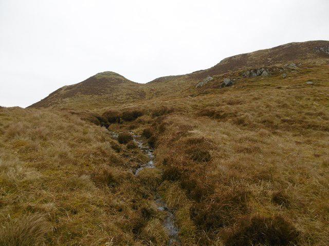 Photo could not load
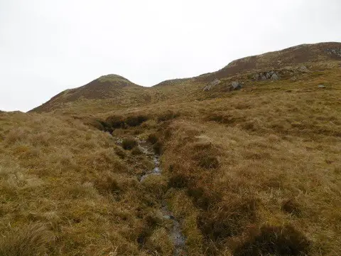
NR3772 : Slopes of Giùr-bheinn
Richard Webb
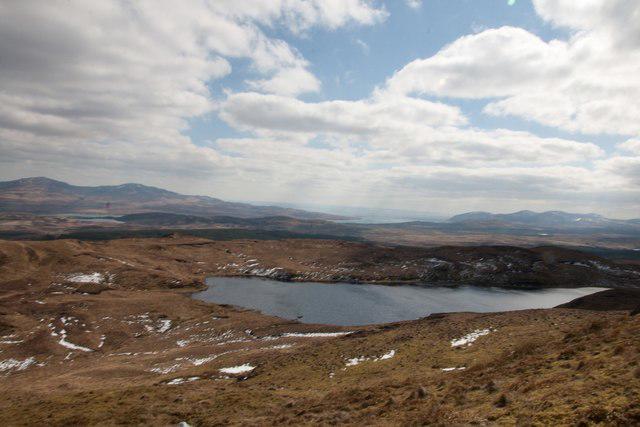 Photo could not load
NR3872 : Loch Giùr-bheinn, Islay
Becky Williamson
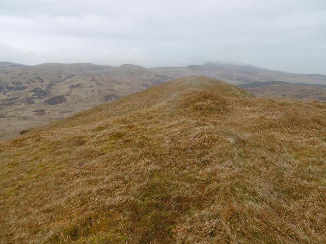 Photo could not load
NR3872 : Summit ridge, Giùr-bheinn
Richard Webb
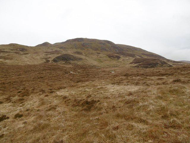 Photo could not load
NR3872 : Giùr-bheinn
Richard Webb
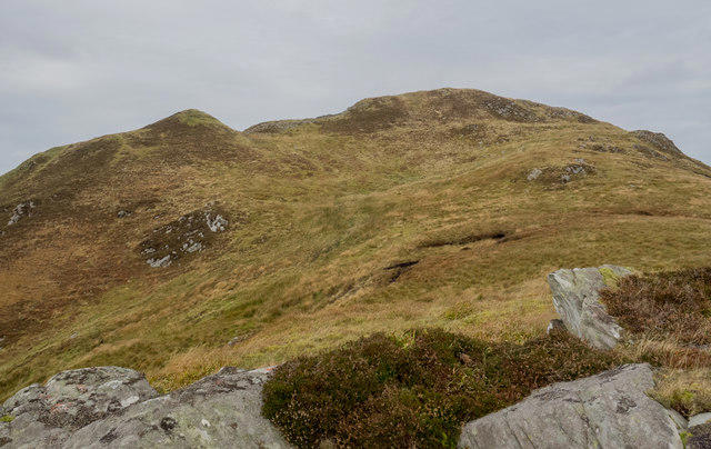 Photo could not load
NR3772 : Ridge rising towards summit of Giùr-bheinn
Trevor Littlewood
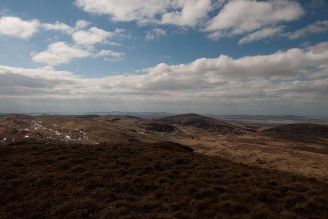 Photo could not load
NR3772 : Looking north-west from Giùr-bheinn, Islay
Becky Williamson
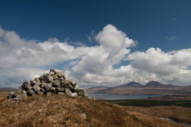 Photo could not load
NR3772 : Summit of Giùr-bheinn, Islay
Becky Williamson
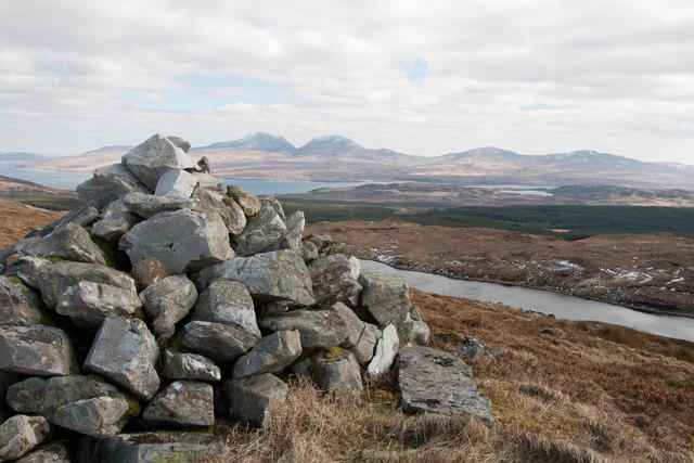 Photo could not load
NR3772 : Summit of Giùr-bheinn, Islay
Becky Williamson
Hill facts and local notes
Classifications
Elevation
317m
1,041 ft
Prominence
149m
Coordinates
55.8774, -6.1907
NR379728
OS Map
60 61
Explorer: 353E
At the Summit
The summit of Giur-bheinn features a prominent rocky outcrop, often adorned with a modest cairn and offering panoramic views over the surrounding landscape.
Terrain & Geology
Giur-bheinn is primarily composed of schist and quartzite, which provides a dramatic contrast to the softer, more fertile valleys below. This kind of rock can create spectacular crags where you might just want to show your climbing skills—unless you're like me and prefer to stick to the paths!
Views & Scenery
From the summit, you can enjoy breathtaking views of Loch Etive, Beinn Starav, and the wider landscape of the Scottish Highlands.
History & Heritage
Name Origin
The name Giur-bheinn derives from Gaelic, meaning 'the hill of the thorns,' possibly referencing the rugged landscape or the brambles that may accompany you on the ascent.
Historical Significance
Giur-bheinn has served as a waypoint for adventurers throughout history, presenting a natural challenge and an iconic view that has inspired many to take to the hills.
Getting There & Facilities
Check current local access restrictions, parking rules and transport timetables before travelling. These notes do not confirm public access to the summit.
Parking
There is a small parking area available at Dalness, accommodating about 6-8 vehicles. Arrive early to secure a spot, or you might be 'parking' down the road!
Public Transport
There are limited bus services from Oban to Dalness, which make for a scenic trip coupled with a lovely walk.
Nearby Facilities
You’ll find some quaint cafes in Taynuilt for a hearty feed post-hike, along with public toilets.
Safety Information
Known Hazards
- Steep descents on rocky terrain can be slippery, particularly in wet conditions; take care to avoid any tumble down the crags!
General Safety Tips
- Check weather conditions before setting out
- Carry appropriate clothing and equipment
- Let someone know your planned route
- Take a map, compass, and GPS device
- Carry emergency supplies: food, water, first aid kit, torch
Hills
Some common questions about the hills answered
Are there group walks up Giur-bheinn?
Many walkers use Walkmates to join or organise walks with others. You can check for group walks around Giur-bheinn through the maps
Are there other walkers around Giur-bheinn?
Activity varies by location and time, but Walkmates lets you see whether others have shared walks or shown interest in this area. Find other people through the walking friends search walking friends for Giur-bheinn search or of course create your own walk for Giur-bheinn
Can I organise a walk to Giur-bheinn?
Yes. If there aren’t any walks listed already, you can create a walk and make it available for others to join.
If you're signed up to Walkmates, you can create a walk to Giur-bheinn.
How do I find a walk up this hill?
There are often multiple ways to walk this hill, depending on experience and route preference. Walkmates helps you explore walks and routes that others have shared.
Can I suggest a new route up Giur-bheinn?
Yes. You can suggest or create routes to share with others. Walkmates focuses on the social side of walking, so routes are used to help people organise walks and explore areas together, rather than as detailed navigation tools or route libraries.
Other uses really appreciate knowledgeable walkers sharing their routes. Share your favourite route to Giur-bheinn here
The is an error or something incorrect about this hill. How do I let you know?
We always strive to keep the information on Walkmates as accurate as possible. If you find an error, please let us know through the contact form and we'll aim to correct it as quickly as possible
Community Discussion
Comments
Location
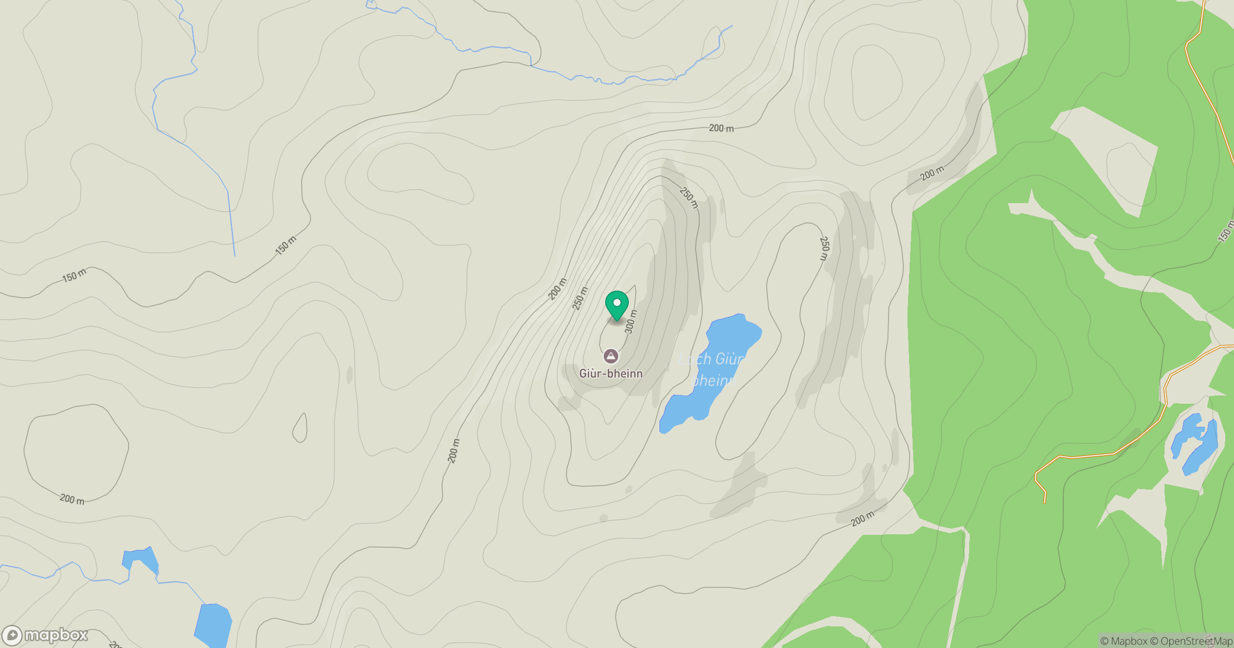
Grid reference: NR379728
View on OpenStreetMapOpens a map in a new tab, centred on the hill.
Hills within 30 km
Straight-line distance, not a walking route or confirmation of access.
No comments yet. Be the first.