

Geal-charn Mor
Good walks are even better shared.
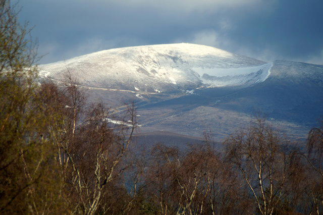
NH8312 : On the summit of Geal charn Mor
John G Burns Photo source
Overview
Geal-charn Mor: A Majestic Munro in the Scottish Highlands
Geal-charn Mor stands proudly at 1,029 meters, making it a revered Munro for hikers looking to tick off peaks in the Scottish Highlands. Whether you're a seasoned climber or a Sunday stroller, this hill offers paths that can challenge and please in equal measure.
Geology
The geological makeup of Geal-charn Mor is predominantly schist and granite, a testament to the ancient processes that have sculpted the Highlands over aeons. The vibrant lichens and mosses on the rocks add a splash of colour, making the ascent even more memorable.
Routes
The main trail from Balgowan is the most popular and accessible route to the summit. It's about 10.5 km round trip, generally taking around 4 hours to complete. Just remember, it's not a race unless you're running from the midges!
Summit Features
Upon reaching the summit, hikers are greeted by an impressive stone cairn that offers a perfect backdrop for photographs and a great spot to catch your breath. The site is occasionally visited by weather stations that add a hint of scientific intrigue to your ascension.
Terrain
Expect a combination of grassy slopes that lead you up to rocky ridges with the occasional boggy challenge thrown in for good measure. Waterproof footwear is a must; a wet foot is never a happy foot!
Views
The panoramic views from the top are simply breathtaking, with Loch Ness shimmering in the distance, and the soft ridges of the Monadhliath mountains outlining the horizon. Spring and autumn are the best times to visit, offering perfectly clear views and less chance of the unpredictable Highland rain turning your journey into an adventure through a cloud.
Hazards
Every hiker should be wary of the fickle Scottish weather. Prepare for sudden changes, and always carry a map and compass. Be mindful of livestock sharing these hills and walk carefully, especially on steeper sections.
Nearby Summits
Don't miss the chance to explore surrounding peaks like Geal-charn (1,030 m) and Carn na Leitire (1,009 m), which offer additional challenges and incredible views amidst your hiking adventure.
Access
Parking is available at Balgowan, just a short drive from Newtonmore, which has the nearest amenities. Make sure to check public transport schedules, as services are not frequent, and you'll want to avoid stranding yourself in the Highlands!
Facilities
Newtonmore has some lovely little cafés and shops to stock up on trail snacks. After all, no hike is complete without a hearty supply of energy bars!
History
The name Geal-charn, meaning 'white cairn', hints at its majestic snow-capped allure during winter months. Additionally, this peak is woven into the rich tapestry of Highland folklore and clan tales, making it not just a hike but a journey through history.
Enjoy your adventure up Geal-charn Mor and don’t forget to breathe in that crisp Highland air—it's better than any oxygen tank!
Explore routes near Geal-charn Mor
Walks starting near this hill. Open a route to check its map, distance and full itinerary.
Aviemore: Loch an Eilein and the Croft Track from Rothiemurchus
View route
Rothiemurchus: Beaver Trail and Lochan Mor
View route
Fort Augustus to Kytra Lock: Caledonian Canal Towpath
View route
Culbin Forest: Hill 99, Gravel Pit Ponds and Dragonfly Pool
View route
Route planning notes
These notes describe possible approaches. Check a route's map and access information when planning your walk.
Balgowan to Geal-charn Mor Trail
This route takes you from Balgowan up through dense forestry and open moorland before culminating in a steep ascent to the summit of Geal-charn Mor. Expect a mix of well-trodden paths and occasional rough terrain.
Make a day of it, together
Find someone to share the walk with, or organise a day out along a route you like.
Photo Gallery
View all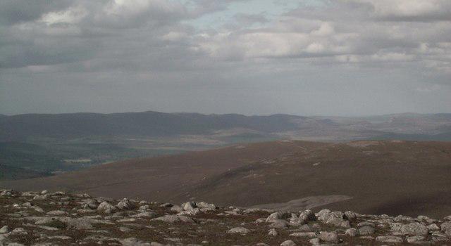 Photo could not load
NH8312 : On the summit of Geal charn Mor
John G Burns
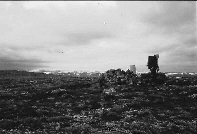 Photo could not load
NH8312 : Summit, Geal-charn Mòr
Richard Webb
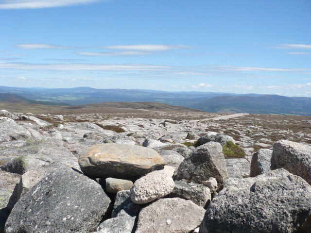 Photo could not load
NH8312 : At the summit of Geal-charn Mòr
Alan O'Dowd
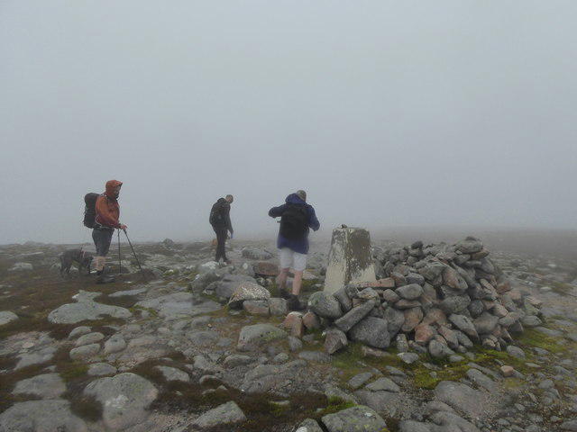 Photo could not load
NH8312 : Trig point, Geal-charn Mòr
Alpin Stewart
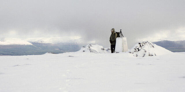 Photo could not load
NH8312 : Summit of Geal-charn Mòr under snow
Trevor Littlewood
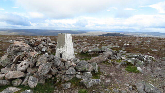 Photo could not load
NH8312 : Trig Point on Geal-charn Mor
Colin Park
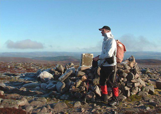 Photo could not load
NH8312 : Geall-charn Mor
Raibeart MacAoidh
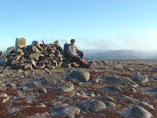 Photo could not load
NH8312 : Geall-charn Mor
Raibeart MacAoidh
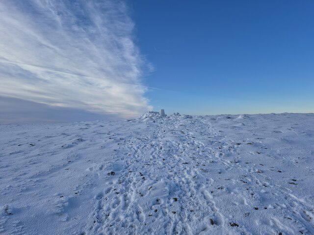 Photo could not load
NH8312 : Summit of Geal-charn Mòr
Steven Brown
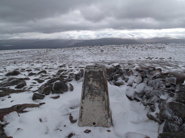 Photo could not load
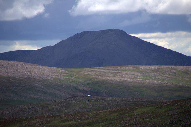
NH8312 : Geal-charn Mòr
David Brown
Hill facts and local notes
Classifications
Elevation
824m
2,703 ft
Prominence
227m
Coordinates
57.1869, -3.9269
NH836123
OS Map
35
Explorer: 417
At the Summit
The summit is marked by a stone cairn, providing a perfect spot for a well-deserved rest and for snapping the obligatory summit selfie. Look closely, and you may also find a small weather station among the rocks.
Terrain & Geology
Geal-charn Mor is predominantly composed of ancient schist and granite, providing a classic example of the geological processes that shaped the Highlands millions of years ago. The rocks are often adorned with patches of moss and lichen, giving the hill a timeless, rugged beauty.
Views & Scenery
On a clear day, you can see across the vast expanse of Loch Ness to the north, the diagonal ridges of the Monadhliath mountains, and even a glimpse of the towering Ben Nevis to the south.
History & Heritage
Name Origin
The name Geal-charn translates to 'white cairn' in Gaelic, hinting at the summit's often snow-capped peak.
Historical Significance
Like many Munros, Geal-charn Mor is steeped in the cultural heritage of the Highlands, featuring in local folklore and tales of the clans.
Getting There & Facilities
Parking
There is a small parking area at Balgowan, which can accommodate around 5-6 cars. Be sure to arrive early to snag a spot, especially on sunny weekends!
Public Transport
Public transport options are limited, but services run to nearby villages like Laggan and Newtonmore. It’s advisable to check schedules in advance.
Nearby Facilities
Facilities in Newtonmore include a couple of cafes, a small grocery store, and public toilets. Just remember to stock up on snacks; nobody wants to be stuck on a mountain without their favourite chocolate bar!
Safety Information
Known Hazards
- Regularly changing weather conditions mean that visibility can drop quickly; be prepared for sudden storms. The terrain can be tricky, with rocky sections and bogs that may test your balance.
- As with any Highland hike, it's wise to keep an eye on livestock and wildlife, particularly sheep and deer.
General Safety Tips
- Check weather conditions before setting out
- Carry appropriate clothing and equipment
- Let someone know your planned route
- Take a map, compass, and GPS device
- Carry emergency supplies: food, water, first aid kit, torch
Hills
Some common questions about the hills answered
Are there group walks up Geal-charn Mor?
Many walkers use Walkmates to join or organise walks with others. You can check for group walks around Geal-charn Mor through the maps
Are there other walkers around Geal-charn Mor?
Activity varies by location and time, but Walkmates lets you see whether others have shared walks or shown interest in this area. Find other people through the walking friends search walking friends for Geal-charn Mor search or of course create your own walk for Geal-charn Mor
Can I organise a walk to Geal-charn Mor?
Yes. If there aren’t any walks listed already, you can create a walk and make it available for others to join.
If you're signed up to Walkmates, you can create a walk to Geal-charn Mor.
How do I find a walk up this hill?
There are often multiple ways to walk this hill, depending on experience and route preference. Walkmates helps you explore walks and routes that others have shared.
Can I suggest a new route up Geal-charn Mor?
Yes. You can suggest or create routes to share with others. Walkmates focuses on the social side of walking, so routes are used to help people organise walks and explore areas together, rather than as detailed navigation tools or route libraries.
Other uses really appreciate knowledgeable walkers sharing their routes. Share your favourite route to Geal-charn Mor here
The is an error or something incorrect about this hill. How do I let you know?
We always strive to keep the information on Walkmates as accurate as possible. If you find an error, please let us know through the contact form and we'll aim to correct it as quickly as possible
Community Discussion
Comments
Location
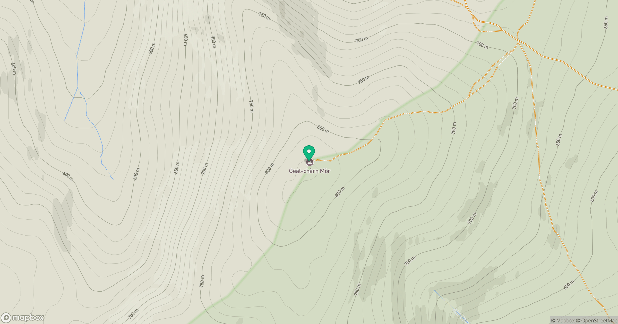
Grid reference: NH836123
View on OpenStreetMapOpens a map in a new tab, centred on the hill.
![Ben Macdui [Beinn Macduibh]](https://cdn.walkmates.com/gallery-images/e60cf32aeb394c3282fcdd14a63368f0.jpg)
No comments yet. Be the first.