

Cnoc Fraing
Good walks are even better shared.
Overview
Cnoc Fraing
Cnoc Fraing, standing at an impressive 661 meters, is a Marilyn located in the heart of the Scottish Highlands. This charming hill isn't just another bump on the map; it offers hikers a fantastic blend of stunning vistas, geological wonders, and an ideal spot for a picnic.
Geology
The bedrock of Cnoc Fraing is primarily composed of granite, which has been shaped by glaciers over countless ages. The rough terrain includes weathered stones and boulders, a true testament to the power of nature. The geological formations are not just fascinating to look at; they also tell the story of the Earth's history.
Routes
The most popular route begins from the A9 and meanders about 5.5 km to the summit. This path is a favourite among locals who often walk it for a quick escape into nature. Expect a moderate level of difficulty, making it accessible for most hikers. Keep your eyes peeled – you might spot some unique wildlife along the way!
Summit Features
Upon reaching the summit, you'll find a rocky outcrop topped with a small stone cairn. This prominent feature not only marks the peak but also serves as the perfect vantage point for enjoying the views. You'll want to grab a snack and take a moment to soak it all in. And yes, don’t forget your camera!
Terrain
Cnoc Fraing offers a delightful mix of grassy slopes and rocky outcrops, with a few boggy patches scattered about. It's essential to choose your footsteps wisely—don’t say we didn’t warn you about the Scottish bogs!
Views
The views from the top are nothing short of spectacular. On a clear day, the Cairngorms stretch majestically to the northeast, while the gentle hills of Strathspey lay to the south. The scenery is sure to take your breath away—just like a wee hill sprint!
Hazards
As with most Highland walks, be prepared for rapid weather changes. It’s not unusual to experience sunshine, rain, and possibly hail all in one day! Staying aware of the ground conditions and avoiding sheep-related distractions can keep your trek safe and enjoyable.
Nearby Summits
For those wanting to extend their adventure, Cnoc Fraing is surrounded by several other notable peaks such as Meall a'Bhuiridh (933 meters) and Carn na Caim (1049 meters). Each offers their own unique experience and views.
Access
Access to Cnoc Fraing is straightforward, with a small car park along the A9 providing suitable stops for cars. Buses run from nearby towns like Aviemore, making it easy for those relying on public transport to visit this gem. Aviemore, the nearest town, is stocked with cafés and shops, perfect for a pre-hike refuel!
Facilities
While there aren’t facilities on the mountain itself, nearby Aviemore is rich with amenities, including cafés, shops, and public toilets. Make sure to swing by and grab a treat or two!
History
The name 'Cnoc Fraing' derives from Gaelic, meaning 'Hill of the Freckled One', likely referencing its interesting rock patterns or a local legend that's been passed down through generations. Historically, this hill has provided invaluable lookout points for shepherds and hikers alike, who have navigated the stunning Highlands for centuries.
So, whether you’re looking to tackle Cnoc Fraing for its stunning views or simply enjoy a pleasant walk through the Scottish countryside, this charming hill is sure to leave a lasting impression on your outdoor adventures.
Explore routes near Cnoc Fraing
Public walks starting within 80 km of this hill. Nearby does not mean a route reaches the summit; check its map and access before setting out.
Aviemore: Loch an Eilein and the Croft Track from Rothiemurchus
View route
Rothiemurchus: Beaver Trail and Lochan Mor
View route
Inverness: River Ness and Caledonian Canal circuit
View route
Coire Ardair lochan from Aberarder and back
View route
Route planning notes
These notes describe possible approaches, not verified navigable routes or permission to cross land. Check current paths, local access rules and conditions before setting out.
Cnoc Fraing Walk from the A9
A well-trodden path starting from the A9, leading you through beautiful glens and up towards the summit. It’s popular among locals for an afternoon jaunt and offers scenic views.
Make a day of it, together
Find someone to share the walk with, or organise a day out along a route you like.
Photo Gallery
View all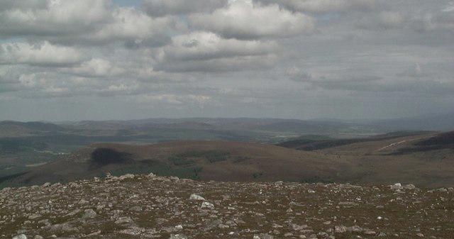 Photo could not load
NH8014 : On the summit of Cnoc Fraing
John G Burns
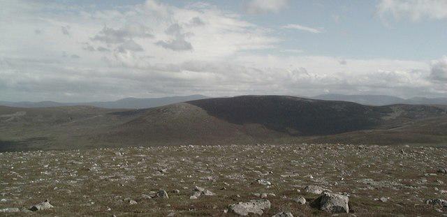 Photo could not load
NH8014 : On the summit of Cnoc Fraing
John G Burns
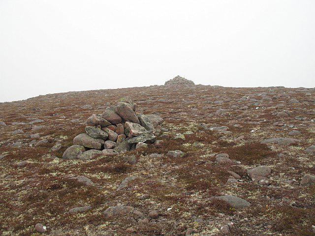 Photo could not load
NH8014 : Cnoc Fraing, the summit
Richard Webb
Hill facts and local notes
Classifications
Elevation
745m
2,444 ft
Prominence
142m
Coordinates
57.2039, -3.9781
NH806143
OS Map
35
Explorer: 417
At the Summit
The summit features a prominent rocky outcrop with a small stone cairn that provides a perfect spot for a celebratory snack. On a clear day, the summit offers panoramic views of the surrounding glens.
Terrain & Geology
Cnoc Fraing is primarily composed of granite, which is common in the Scottish Highlands. The rugged terrain and boulders offer a fascinating look at weathered rock formations, shaped by millennia of glacial activity.
Views & Scenery
From the top, you can see the stunning expanse of the Cairngorms to the northeast and the rolling hills of Strathspey to the south. Don't forget to wave at the passing deer!
History & Heritage
Name Origin
The name 'Cnoc Fraing' translates to 'Hill of the Freckled One', possibly referencing the unique patterns of the granite rock or perhaps an elusive local legend.
Historical Significance
Historically, Cnoc Fraing has been essential for local shepherds and hikers who rely on its surveying vantage points to better understand the land.
Getting There & Facilities
Check current local access restrictions, parking rules and transport timetables before travelling. These notes do not confirm public access to the summit.
Parking
There is a small car park at the side of the A9 near the starting point of the walk, providing ample space for a handful of cars.
Public Transport
Buses regularly run from nearby towns like Aviemore and Newtonmore, dropping you conveniently near the A9.
Nearby Facilities
While there are no facilities directly on the mountain, Aviemore offers cafes, shops, and public toilets for your convenience before or after your walk.
Safety Information
Known Hazards
- Be cautious of sudden weather changes; the Scottish Highlands can be unpredictable. Variations in ground conditions, especially in wet seasons, can be tricky. Also, watch out for the occasional overenthusiastic sheep!
General Safety Tips
- Check weather conditions before setting out
- Carry appropriate clothing and equipment
- Let someone know your planned route
- Take a map, compass, and GPS device
- Carry emergency supplies: food, water, first aid kit, torch
Hills
Some common questions about the hills answered
Are there group walks up Cnoc Fraing?
Many walkers use Walkmates to join or organise walks with others. You can check for group walks around Cnoc Fraing through the maps
Are there other walkers around Cnoc Fraing?
Activity varies by location and time, but Walkmates lets you see whether others have shared walks or shown interest in this area. Find other people through the walking friends search walking friends for Cnoc Fraing search or of course create your own walk for Cnoc Fraing
Can I organise a walk to Cnoc Fraing?
Yes. If there aren’t any walks listed already, you can create a walk and make it available for others to join.
If you're signed up to Walkmates, you can create a walk to Cnoc Fraing.
How do I find a walk up this hill?
There are often multiple ways to walk this hill, depending on experience and route preference. Walkmates helps you explore walks and routes that others have shared.
Can I suggest a new route up Cnoc Fraing?
Yes. You can suggest or create routes to share with others. Walkmates focuses on the social side of walking, so routes are used to help people organise walks and explore areas together, rather than as detailed navigation tools or route libraries.
Other uses really appreciate knowledgeable walkers sharing their routes. Share your favourite route to Cnoc Fraing here
The is an error or something incorrect about this hill. How do I let you know?
We always strive to keep the information on Walkmates as accurate as possible. If you find an error, please let us know through the contact form and we'll aim to correct it as quickly as possible
Community Discussion
Comments
Location
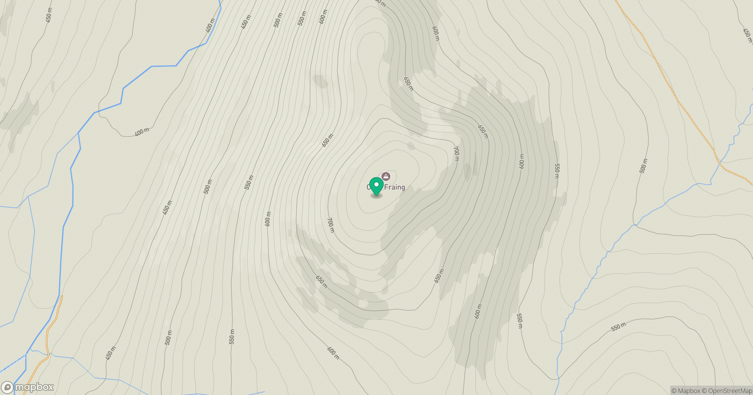
Grid reference: NH806143
View on OpenStreetMapOpens a map in a new tab, centred on the hill.
Hills within 30 km
Straight-line distance, not a walking route or confirmation of access.
Sgor Gaoith
1,116m
Braeriach
1,296m
Binnein Mor
550m
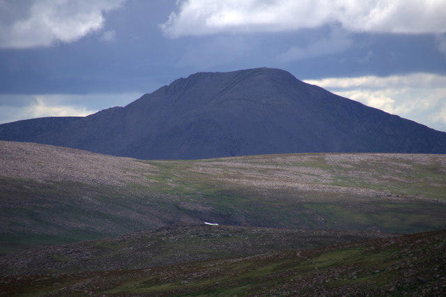
Cairn Toul
1,292m
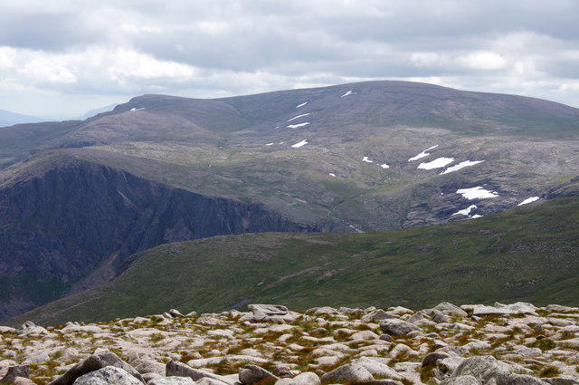
Ben Macdui [Beinn Macduibh]
1,309m
No comments yet. Be the first.