
Geal-charn
Good walks are even better shared.
Overview
Geal-charn: The White Cairn
Introduction
Nestled in the wild beauty of the Scottish Highlands, Geal-charn invites adventurers to experience its heights and breathtaking vistas. Whether you're a seasoned Munro bagger or a casual hiker looking for your next challenge, Geal-charn offers something for everyone.
Geology
Geal-charn is primarily composed of granite and schist – geological formations that have weathered the test of time. You can find fascinating rocky outcrops along the paths, showcasing nature's artistry and perhaps some peculiar shapes worthy of a laugh or two.
Routes
For those keen to conquer this Munro, the route from the A86 is a well-trodden path offering manageable inclines. It covers approximately 12 km and takes around 4.5 hours to summit, depending on how many selfies you decide to take along the way!
Terrain Type
Expect a mix of rocky terrain and grassy patches, along with the occasional boggy area. The ground may be uneven, so sturdy footwear is advisable. Unless you're a fan of mud, that is!
Summit Features
Upon reaching the summit, you'll be greeted by a magnificent cairn – a perfect spot to rest your legs and collect your thoughts or simply breathe in the fresh Highland air. Don’t forget your camera; the views will take your breath away!
Views
From Geal-charn’s peak, you’re met with extensive views of the surrounding landscapes, including the iconic Ben Nevis and the rugged Aonach Eagach ridge. Visit during late spring or autumn for the best visibility.
Hazards
While hiking is a joyous pursuit, be mindful of potentially abrupt weather changes. Conditions can shift fast in the Highlands, sending visibility plummeting. Ensure you have a map and know your route before heading out.
Access
Geal-charn is easily accessible from the A86. Parking is available just a short distance from the trail. Public transport options are somewhat limited, so consider planning for that.
Facilities
Once you've conquered Geal-charn, treat yourself to a bite at a nearby café— a perfect stop-off to share tales of your adventure!
Conclusion
With its splendid climbs and beautiful surroundings, Geal-charn exemplifies why the Scottish Highlands remain a top destination for outdoor enthusiasts. Pack your gear, enjoy the hike, and perhaps leave a bit of room for cake afterward!
Explore routes near Geal-charn
Walks starting near this hill. Open a route to check its map, distance and full itinerary.
Kenmore: Drummond Hill Black Rock Trail above Loch Tay
View route
Fort Augustus to Kytra Lock: Caledonian Canal Towpath
View route
Aberfeldy: Glassie Woodland and River Tay Circular
View route
Rothiemurchus: Beaver Trail and Lochan Mor
View route
Route planning notes
These notes describe possible approaches. Check a route's map and access information when planning your walk.
From the A86
A straightforward ascent from the A86 road, providing excellent views along the way.
Make a day of it, together
Find someone to share the walk with, or organise a day out along a route you like.
Hill facts and local notes
Classifications
Elevation
917m
3,009 ft
Prominence
178m
Coordinates
56.8744, -4.3045
NN596782
OS Map
42
Explorer: OL50 393
At the Summit
The summit is marked by a large, rugged cairn and offers a splendid panoramic view, just in case you fancy whipping out your camera.
Terrain & Geology
Geal-charn is primarily composed of granite and schist, typical of the rugged Highlands. The rocky outcrops present fascinating geological formations, offering a glimpse into the Earth's past.
Views & Scenery
You can spot famed peaks such as Ben Nevis and the Aonach Eagach ridge among many others; it's a veritable feast for the eyes!
History & Heritage
Name Origin
Geal-charn translates to 'white cairn' in Gaelic, perhaps a nod to the rocky summit covered in lichen and alpine plants.
Historical Significance
As a Munro, Geal-charn attracts hikers and climbers from all over, becoming a part of their personal challenges and achievements.
Getting There & Facilities
Parking
There is parking available at the start of the A86, close to the 'Dulnain' layby. Remember to leave your car no more than half a mile away from the trailhead.
Public Transport
The nearest bus route operates from Newtonmore to Spean Bridge, with limited service, so plan accordingly.
Nearby Facilities
A few miles down the road, you'll find a lovely café offering hearty meals and restrooms. Perfect for a post-hike treat!
Safety Information
Known Hazards
- Be wary of sudden weather changes common in the Highlands. Visibility can drop and paths may become slippery.
General Safety Tips
- Check weather conditions before setting out
- Carry appropriate clothing and equipment
- Let someone know your planned route
- Take a map, compass, and GPS device
- Carry emergency supplies: food, water, first aid kit, torch
Hills
Some common questions about the hills answered
Are there group walks up Geal-charn?
Many walkers use Walkmates to join or organise walks with others. You can check for group walks around Geal-charn through the maps
Are there other walkers around Geal-charn?
Activity varies by location and time, but Walkmates lets you see whether others have shared walks or shown interest in this area. Find other people through the walking friends search walking friends for Geal-charn search or of course create your own walk for Geal-charn
Can I organise a walk to Geal-charn?
Yes. If there aren’t any walks listed already, you can create a walk and make it available for others to join.
If you're signed up to Walkmates, you can create a walk to Geal-charn.
How do I find a walk up this hill?
There are often multiple ways to walk this hill, depending on experience and route preference. Walkmates helps you explore walks and routes that others have shared.
Can I suggest a new route up Geal-charn?
Yes. You can suggest or create routes to share with others. Walkmates focuses on the social side of walking, so routes are used to help people organise walks and explore areas together, rather than as detailed navigation tools or route libraries.
Other uses really appreciate knowledgeable walkers sharing their routes. Share your favourite route to Geal-charn here
The is an error or something incorrect about this hill. How do I let you know?
We always strive to keep the information on Walkmates as accurate as possible. If you find an error, please let us know through the contact form and we'll aim to correct it as quickly as possible
Community Discussion
Comments
Location
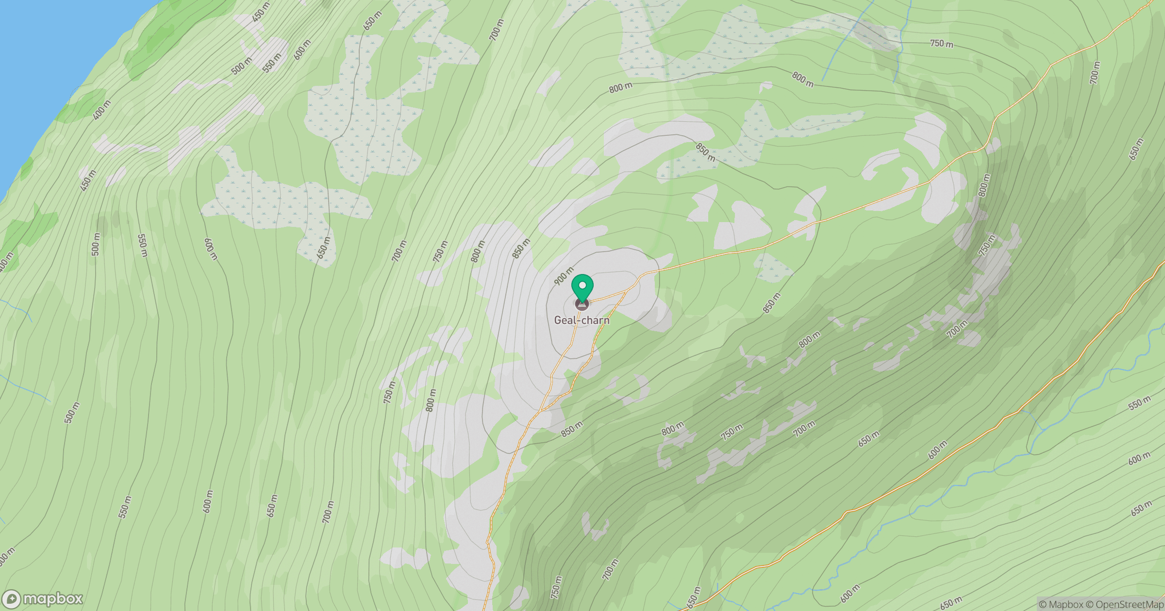
Grid reference: NN596782
View on OpenStreetMapOpens a map in a new tab, centred on the hill.
No comments yet. Be the first.